A good grouse?
Are we too grumpy? Maybe we all need to get out more.
Last summer, when we could (get out more), we spent some time walking in the Derbyshire side of the Peak District. I hasten to add that these were legitimate walks, although we did keep a sharp lookout for the Derbyshire Constabulary and for lagoons which had turned a suspicious shade of black. Little did we know that carrying a takeaway coffee would later become an icon of Derbyshire lockdown bad temper and an extreme interpretation of recreational rules.
What is it about Derbyshire which puts people out of sorts? We are certain that the Derbyshire community, as a whole, is not to blame. We know for sure, however, that areas of beautiful, dramatic and inspiring landscape such as the Peak District or the Lake District create intense human passions – often about protection, conservation, access, management and policing - which may polarise views and create adversarial situations.
The 1932 mass trespass on Kinder Scout, which drew support from both sides of the Pennines, is a classic case in point. The fact that it took a further 80 years to pass legislation which allowed any form of open access to landscapes such as these, is enough to make anybody irritable. We refer, of course to the Countryside and Rights of Way Act 2000 (the CROW Act). Even the National Parks and Access to the Countryside Act 1949, which recognised the significance of these landscapes, if not of universal access, had to wait 17 years to reach the statute book, after a gestation period which included WWII. The Peak District was the first National Park to be designated, and this year sees its 70th birthday. But not even this anniversary seems sufficient to create universal joy and good will to all.
As an example of some of the issues which make landscape management so ‘interesting’, and defusing conflict so important, we will take a look at some of the walks which we enjoyed so much last summer. There was considerable debate between the three of us who took part but not, I am pleased to report, a single cross word. Do I hear laughter in the background?

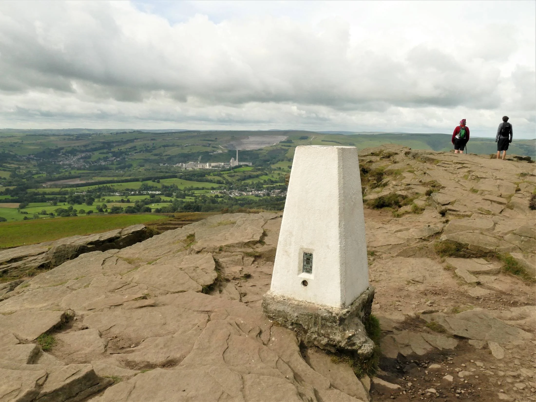
Ladybower Reservoir and Win Hill
Let’s start off by being petty: nice bit of traditional waymarking but the plethora of roundels makes a bit of a nonsense of the ‘Public Footpath’ message!
More seriously, did they really need to mow the down stream slope of the reservoir dam in the monocultural, English garden style? It seems possible to accept a more diverse and sustainable ground flora beneath the scrub and bushes on the left of the photo, and around the photographer’s feet.
We’ll pick up the non native coniferous planting later.
Ladybower Reservoir was constructed between 1935 and 1943 to quench the thirst of the expanding industrial towns surrounding the Peak District. The long, deep valleys of the rivers Ashop and Derwent, the high rainfall and low popuation, made the area seem ideal for water storage. The population was not non-existant, however, and two villages, Ashopton and Derwent, were flooded and their population moved to an estate downstream of the dam. They must have found it galling to discover that ‘Derwent's packhorse bridge, spanning the River Derwent … was removed stone by stone to be rebuilt elsewhere as it was designated a monument of national importance’. And that, ‘The church spir' was left intact to form a memorial to Derwent. However, it was dynamited on 15 December 1947, on the rationale of safety concern’. https://en.wikipedia.org/wiki/Ladybower_Reservoir
Of course, after WWII, the attitude to planning and infrastructure changed significantly. In the 1950s and 60s, the plans for the Llyn Celyn reservoir in Gwynedd caused deep controversy. Despite the degree of protest, the village of Capel Celyn and its valley, located in a stronghold area of Welsh culture and language, was flooded to provide water for the - English - city of Liverpool.


Do people grouse about Ladybower today? It is a large of expanse of open water, beloved by thousands of tourists. But - parking and traffic creates a management nightmare. It provides drinking water, but access to the reservoir is controlled with limited recreational uses including no swimming (potentially hazardous). Architecturally, it is imposing and technologically, interesting. It looks wonderful when full of water, much less so in a drought, and probably a potential nightmare to manage access when the water level is so low that you see the remnant village.
Let’s move on to the top of Win Hill and look at the view.

Oh look - lots of issues here! On the plus side, there is no one else around, so those of us who love getting away from it all are very happy. But we did get up early to achieve this. We don’t see this as a problem, however. Self-managing the timing of our access to potentially busy areas is part of the challenge.
But obviously, lots of other people have been here and the photo hints at the erosion that all those walkers have caused. In the early days of the Pennine Way this was a serious problem, and much of the route has been paved to overcome the ‘sea of mud’ crisis. This is a sensible solution, which increases access but does diminish the wilderness feel. I was worried during our recent wet winter that the ‘sea of mud’ look created by a lockdown population desperate to get out and keep sane, would bring out the worst in our open space managers. What a swell of pride when the response was basically, ‘don’t worry, keep coming, we’ll sort it out later’.
And the view? What’s that lurking in the distance, sporting a high chimney and a massive quarry? It’s the Bredon Hope Cement Works, with the village of Hope nestling in the Valley below. The up side? It all started in the late 1920s, long before planning legislation and the designation of the National Park, but environmental control is much stricter now.

Lots of the finished product goes out by rail (left), so minimal impact on road transport.
Provision of local employment - Bredon says the company is ‘the area’s largest employers with the majority of the 200-strong workforce at Hope living in the Peak District’ and that they employ a ‘diverse range of people’. https://www.hopecementworks.co.uk/about/
Down side? Big energy user and lots of CO2 goes up the chimney. Damage to visual amenity? You decide. At this distance, we thought it rather interesting and a demonstration of geography in the raw (the plant is here because the required limestone is here). Living next to it, may produce a different answer, however.
Don’t like it? One of the great 21st century challenges is finding alternatives to, in this case, building materials, to reduce negative impacts. On delving deeper, alternatives can often be worse than the existing situation. Ingenuity essential.
Thanks to Wikipedia for some help with the above. https://en.wikipedia.org/wiki/Hope_Cement_Works

Strines Moor and the real grouse.
Grouse moors: where to start. So many issues, so many points of view.
Shooting and grouse moors were a big part of the original Right to Roam debate. The few owned vast acreages of moorland and denied access to the many. It was still an issue in the CROW Act which does allow for short term closures of open access land to allow for shooting.
You could devote a whole blog to intensive grouse shooting and grouse moor management and indeed Terroir was planning to do this until we came across Guy Shrubsole’s blog post on ‘Who Owns England?’ https://whoownsengland.org/ Do read his January post, entitled ‘The Climate Sceptics Grouse Moor’ which, although a diatribe against one particular moorland owner, gives an overview of some of the issues. Read all his links too, to get a view of both sides of the argument. Both the hunting and shooting orgnisations and the environmental press argue lucidly for and against intensive grouse shooting.
Here is a quick round up of the main issues. We have already mentioned access, so we will move onto the management debate. Rotational cutting, burning and draining of grouse moors is standard practice. If cut back, heather re-grows until it becomes ‘over mature’ - tall and leggy - when, if cut back again, it will restart the growth cycle. Each part of the cycle has its ecological advantages and so it is not uncommon, on any form of heathland, to cut areas on a rotational basis and try to mimic former and traditional management via grazing and burning.


Above - classic pictures of rotational cutting of upland moorland for grouse shooting. The patterns are wonderful and I would happily upholster my sofa in something based on this, but the ecological implications are less appealing.
Grazing and burning of lowland heaths, often in urban areas, is not really attempted any more for reasons of livestock welfare and control and, for burning, for reasons of pollution, and burn control, particularly in areas heavily used for recreation. On upland moorland, the substrate is often peat, which puts a whole different perspective on the matter. Peat is regarded as an excellent carbon store and burning and drainage is seriously damaging to peat. Strines Moor is classified as Upland Heath (https://magic.defra.gov.uk/MagicMap.aspx) which means peat depth may be limited to ‘only’ 50 cms deep, but there is plenty of blanket bog in the area, and the name is an excellent description.
Of course, species conservation and biodiversity is also part of the debate with game keeper and ecologist fighting it out on who can best conserve and manage heath and bog vegetation, ground nesting birds, raptors, butterflies and … . You get the picture.

Tree planting is the other ‘Big One’, which must be discussed.
Deciduous woodland beside Ladybower Reservoir
One of the big upland debates centres on trees. Visitors love the windswept uplands, with their stunning views, ‘wilderness’ experiences and complete contrast to an urban and often industrial home environment. The Forestry Commission loved the open uplands for their unobstructed tree planting options. Don’t forget that the Commission was set up in 1919 after the terrible experiences of WWI, to provide a strategic resource of timber, should such a conflict ever re-occur. Of course, it did re-occur but by 1939 the new plantations were at best only twenty years old and even the fast growing, non native conifers were not of a size or condition to deliver.
Post war, support for planting non-native and non-local timber conifers continued with a mix of enticing tax breaks for those owning large estates, and a range of grant funding. In my view the economics never stacked up, but the promise of jam today more than compensated for the lack of jam/income at maturity and felling. Criticism of the visual impact of the sitka spruce farms and of damage to biodiversity and native habitat became increasingly vocal. To encapsulate over half a century of grumpiness into one sentence, changes were made in planting design, management and species choice, and the governmental approach shifted to include access and nature conservation as prime objectives along with timber production. The grant forms became harder and harder to understand/complete, so just about everyone had something to moan about.


With increased understanding and awareness of climate change, the whole tree planting thing shifted gear once again. Here is a flavour of some of the issues (it’s extraordinarily complex, so please don’t expect a comprehensive run down, details, or academic verification). Trees absorb carbon as they grow, but they grow very slowly. Alternative carbon sinks are available. Managing woodland to create a continuous supply of fuel might be close to carbon neutral, but wood smoke contributes to air pollution and we are already banned from burning ‘wet wood’ (more than 20% moisture content), please note if you own a wood burning stove. Mass tree planting can do more harm than good and this is a serious issue. We were incandescent over an episode of BBC’s Countryfile, which appeared to be supporting mass planting of a single non-native conifer, in Northumberland. I thought we got over that approach last century.
Tree planting will be and should be one of the pieces in the carbon control jigsaw but, as with peat, it’s not as easy as it looks. Tree planting must use appropriate, preferably native - and locally native - species and mixes, or our wildlife and ecology will be sunk. It must also take into account other landuses and habitats, which may actually be more valuable than new tree planting - yes, really - otherwise our ability to sustain, diversify and also feed ourselves will be significantly damaged. It must be in an appropriate place in the landscape, taking into account our love of the hills, views, access, and the needs of human beings, or our history and society will go down too.
To do all of this, we must have appropriate leadership, support and guidance from our government and its advisers. We must learn lessons from the Corona epidemic. And we must do it on a global scale.
End of rant, but it is rather important.