Camberwell Beauty
Burgess Park in Camberwell (London SE5) rose slowly, like a self-assembly phoenix, from the ashes of the Blitz. It is a remarkable open space which touches on many facets of London’s history, but its story is as diverse, fragmented and as quirky as the Park itself. Let’s see if we can build a compelling narrative out of the Burgess box of bits.

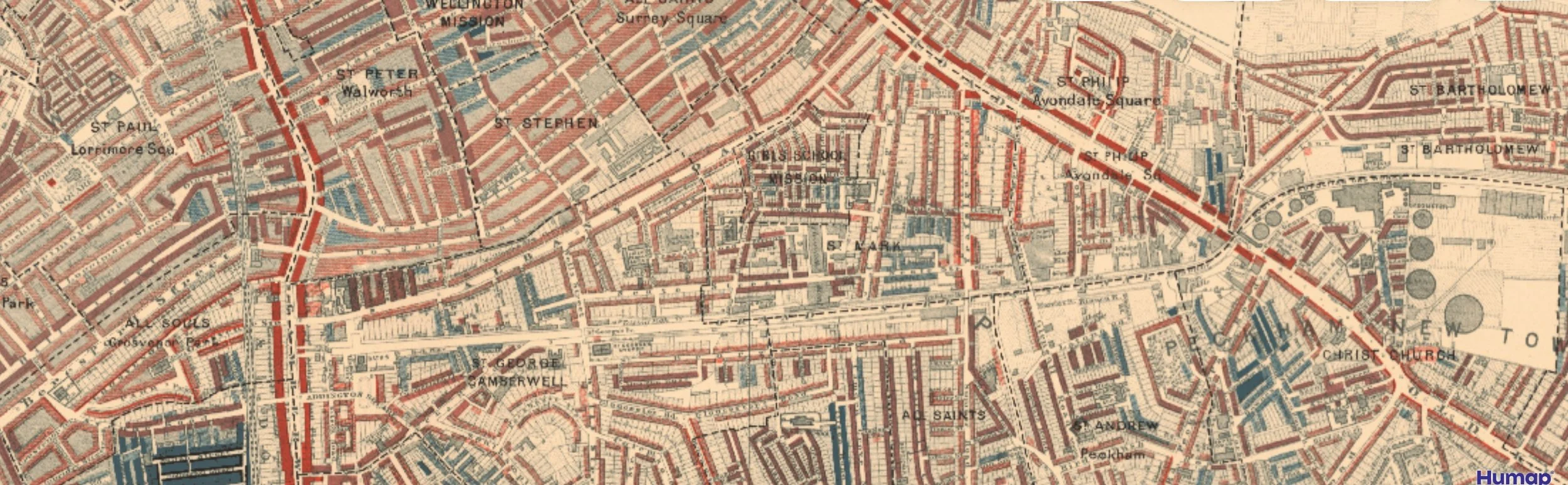
Burgess Park - thanks to https://www.layersoflondon.org
Some visitors might think that Burgess Park in winter is somewhat unexciting, akin perhaps to a quilt of green in the early stages of embroidery, hemmed in by Albany Road, Old Kent Road, St Georges Way, and Camberwell Road. Key features such as the lime kiln, the Bridge to Nowhere and the Lake have been added to the bedspread but there are large areas of short green grass which seem to stretch in unbroken swathes to the urban-edged park horizon.


Above: OK, so these images aren’t of the exact spots mentioned above, but you get a rough idea of what we are talking about.

The Bridge to Nowhere (image right) was once an important crossing point over the now infilled Surrey Canal. This waterway once ran east/west right across what is now the park. The route is unmarked, save for an anonymous, grey/black tarmac path, looking like a stick of liquorice laid from one end of the park to the other.
Only in an underpass (where the canal would have passed under Wells Way) is a hint of the former canal culture.
Images below: underpass wall decorations hinting at the cargoes which the canal carried.


To be fair, there are some gems within the park, but they do seem strangely isolated in the expanses of the Burgess prairie lands. The more peripheral gardens - Glengall Wharf Community Garden, the Chumleigh Gardens and Addington Square are terrific and offer wonderful facilities including cafes and saunas!


Just because some of Burgess Park history is invisible, doesn’t make it unimportant or insignificant, however. Unlike many London Parks, Burgess does not have a continuous history of open space, although the Layers of London website mentions that the area was once part of Walworth Common, noted for footpads.

Roque’s mid 18th century map of London (left) shows an agricultural area, but hints of urban sprawl encroaching from the north and west, suggesting that already this area is urban fringe rather than rural idyll.
images left and below: the National Library of Scotland https://maps.nls.uk/

By the mid 19th century the area is clearly urban…
Image left: the National Library of Scotland https://maps.nls.uk/
… and by the latter part of the 19th century, Charles Booth’s poverty maps show that the area of what is now the park was largely the greys and reds which depicted the less well-off.
image right: https://booth.lse.ac.uk/map
The Second World War was to be a tipping point. By May/June 1940 Britain was evacuating troops from Dunkirk. On the 18th of June, Churchill announced that “the Battle of France is over. I expect that the Battle of Britain is about to begin…”. France signed an armistice with Germany on the 22nd June and, according to Britannica (https://www.britannica.com/event/Battle-of-Britain-European-history-1940) the German army pretty much went on holiday, while waiting for Churchill to capitulate. He didn’t of course, so Luftwaffe leave was cancelled, German bombing raids on the UK started and the RAF got stuck into Churchill’s Battle of Britain. By October 1940, Britain was felt to be victorious. But - enter the shock and awe tactics of the Blitzkrieg.
The blitz lasted from September 1940 to May 1941 and had a huge impact on the social and physical geography of the UK. The bomb count for the Burgess Park and sourrounding area is illustrated below.

Around 30,000 bombs dropped on London as a whole with enormous impact on many aspects of life. The centre of London suffered particularly badly. But the far-sighted realised that this offered potential as well destruction. “London was presented with an opportunity to amend the perceived failings of unplanned and haphazard development that had occurred as a result of rapid industrialisation in the nineteenth century.” (https://en.wikipedia.org/wiki/Greater_London_Plan#cite_note-2)

Consequently, Professor Patrick Abercrombie and London County Council architect John Forshaw were, in 1942, commissioned to write the County of London Plan which aimed to direct the reconstruction of inner London. This was presented to the London County Council in 1943 and subsequently Abercrombie with Forshaw developed the Greater London Plan, completed in 1944.
The Abercrombie Plan, as it is usually called (Forshaw seems to have been a rather shadowy figure, seldom in the limelight), is seen as a seminal document in post war planning. It covers, amongst other things, industry, communications, housing, land classification and agriculture, community planning and public services. There are 28 appendices and is worth browsing for its (now historic) photographs of London and the south east alone.
For our purposes, the key section relates to Chapter 7 - Outdoor Recreation: Open Spaces, for it is this section which gave rise to the development of Burgess Park. Abercrombie (and, I hope, Forshaw) realised the huge benefits of accessible open space in the crowded communities of places like Camberwell and recommended 4 acres of open space per 1,000 people. Rather than rebuild or attempt to repair the shattered housing, dying canal and battered industry, it was agreed to demolish the majority of the buildings (including perfectly serviceable dwellings, churches and community buildings), and translate the area into an open space, in line with Abercrombie’s (not forgetting Forshaw’s) recommendations. This was to become a green lung for the new developments round the area, many of which (ironically, with hindsight) were high rise accommodation.


The open space was called Burgess Park in honour of Jessie Burgess, labour councillor for Camberwell Metropolitan Borough from 1934 to 1951 and the Council’s first female mayor (1945 to 1947).
Obviously this is a rather simplistic account of a very large and very significant open space. We will return to the Park in the summer to see what difference that makes to our perhaps rather low key response on a chilly day in February. Locals will also note that we have said little of the Surrey Canal but we will also return to that piece of heritage on another occasion.

What we would compliment is the width and depth of digital history and interpretation available to the inquisitive. We would particularly reccommend the Friends of Burgess Park website (www.friendsofburgesspark.org.uk). If you prefer a more traditional format, then a trip to Dulwich Library to read “The Story of Burgess Park” (sadly out of print) is definitely for you.
At 56ha, Burgess Park is bigger that either St James Park or Green Park. But who needs bedding plants, rose gardens, fountains and pelicans, when you have the entire history of a south London community buried beneath your feet?