Final Offa
I wouldn’t blame you if you are thinking, ‘when will this walk along Offa’s Dyke end?’ We were thinking much the same as 2021 dawned and, five years after we started, there were still three days walking left to do!
This final section of the walk is formed by the Clwydian Hills which stretch from the village of Llandegla in the south to the resort town of Prestatyn – our final destination - in the north. It’s a continuous stretch of about 22 miles (35 km) by raven, but nearer 33 miles by the Trail (54 km).

This strip of sedimentary rocks (laid down in a warm sea over 400 million years ago), create a joyous, green, looping barrier between the industrial landscapes of north east Wales and the exhilarating geography of the rural Vale of Clwyd to the west. The range leaps from hill fort to hill fort and I’m reminded of an irregular pile of giant green cushions, trimmed with craggy lace and green chenille woodlands.
No doubt hill fort builders appreciated the more strategic and defensible attributes of the range, while trail walkers tend to concentrate on the inexorable challenge of a steep haul up (albeit rewarded by an outstanding view), followed by a knee crippling descent. Again and again and again.
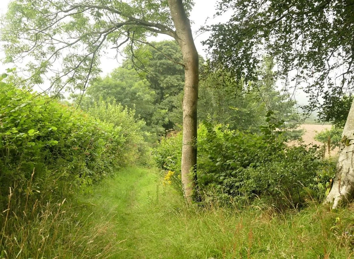
Llandegla, at the southern end of all these ups and downs, was once a thriving community on one of the main drove roads connecting north west Wales to Wrexham and the English cattle markets. According to a village information board, the drovers once brought enough business to support 16 village pubs but, unsurprisingly, only two now remain in business. In many villages, one pub seems a miracle of survival, but perhaps walkers and tourists to this attractive area, and undoubtedly pretty village, are in sufficient numbers to enable a choice of hostelry.
Below: the church, cottages and Old Smithy are symptomatic of this attractive and historic village, but don’t believe the sign post.


Walking out of the village is deceptively easy, traversing well-watered pastures before commencing an easy climb towards the reality of the Clwydian Range.


We are spared from climbing Moel yr Accre and Moel y Waun - babies at just over 400 m (1,312 ft) - which lie to our south and east respectively, but soon begin the serious climb to Moel y Plas. Moel means a round headed hill and these high-ish but unaggressive, beckoning hill tops must have been a blessing for prehistoric peoples: the maps are pockmarked with cairns, tumuli and the afore mentioned hill forts.
The Trail continues in friendly mood and does not require a summit expedition for Moel y Plas, Moel Llanfair or Moel Gwy, the latter reaching 467 m (1,530 ft). We continue on at a gentle, undulating tramp around the 400m contour, until we drop down to cross the main road at Clwyd Gate. Our first day of the Clwydian Range has been leg stretching but thoroughly enjoyable.


By the time we return for the final push, it is early October 2021. Picking up from Clwyd Gate, our first round-headed hill of the day is Moel Eithinen, which we skirt, before a concerted attack on Foel Fenlli which we conquer with fresh-legged enthusiasm, scorning the bypass route, clambering over the hill fort ramparts, and striking a pose on the 511 m (1,676 ft) top height. The view of the fort ramparts, and the wider landscape is spectacular.
Above right: the rounded summit of Foel Fenlli, the slopes a patchwork of heather cutting to encourage grouse. Do grouse object to softer shapes, more in keeping with the curves of the landscape?
Below: the gentler environment of Moel Eithinen and (lower row, 2nd from right) the steeper slopes of Foel Fenlli; the path ahead of the hiker is about to cross the hill fort ramparts before climbing up to the very modern cairn on the summit. Lower row, far right: the view from the top.


Plunging down the far side of Foel Fenlli, we settle in for the tramp to Moel Famau, possibly the most famous Moel of them all and certainly one which we have both climbed before.
As the ‘top of the range’ (554 m or 1,818 ft), Moel Famau has, of course, become the honey pot of the Clwydian Hills. Car parking is reasonably generous, information signs abound (spot those right-angle loving grouse) and the access track is wide and smooth, making it a very accessible, biggish hill.


It’s a Saturday and a lot of people are enjoying themselves, trekking to the Jubilee Tower on the summit. Some slow significantly on the final assent and appreciate the occasional bench or pass on tips about a contouring alternative route!


The Jubilee Tower isn’t much of a reward for the climb and has had a cyclical history of refurbishment and neglect. The Jubilee in question marks the 50th year of the reign of George III, so the structure has been around since 1810. Inevitably location makes restoration expensive.
By now, the clouds have descended and although the children are enjoying hide and seek in the misty atmosphere around the Tower, the view from the top has vanished. Time to press on.


The trail now dips down a little and takes us through a long stretch of undulating uplands. We traverse Moel Dywyll, and look back to the Jubilee Tower (right). But our target for the day is Moel Llys y Coed which, at 465 m (1525), stands guardian over the mystical sounding Moel Arthur (a smidge lower and finally a name that one of us doesn’t struggle to pronounce).
It seems that ‘one of us’ has never before visited either of these majestic hills and, on breasting nearly-the-top of Moel Llys y Coed, the view of Moel Arthur takes one of us’s breath away. There, across the valley, lies a perfectly circular, fort-crowned dome of green and brown magic; the Glastonbury of North Wales, complete with bewitched rowan. It is possible to climb Moel Arthur, of course, but the Trail elects to go round and, as it’s started to rain, we elect to go with it and postpone the Arthurian experience to another time.


We are nearly through the big Clywdians now although we still have a long stretch of commercial conifer forestry to negotiate (Coed Llangwyfan), another hill fort to inspect (on Pen y Cloddiau) and a distant view of Moel y Parc to enjoy, before we descend down into the valley of the River Wheeler (Afon Chwiler), and cross over to the village of Bodfari. By now our numbers have swelled to four individuals, as part of Terroir North has joined us, although the most important member of the expanded team is Pixie the dog.
Ten Terroir legs are now walking up through Coed Llangwyfan and scaling the heathery slopes of Pen y Cloddiau. Pixie adds a new dimension to the expedition; her view is distinctly lower level and enhanced by her olfactory skills, while her companions are on constant alert for livestock and the need to reel back the extending dog lead.


Before we descend to Bodfari, we are treated to a memerising view: a distant glimpse of our final destination. There in the haze lies the Irish sea, complete with windfarm and, ornamenting its edge, the seaside town of Prestatyn.

Beyond Bodfari, which sounds more Italian than Welsh, the Clwydian Range subsides into a lower ridge of undulating, agricultural and rural domesticity but with some high points, literally as well as figuratively. These hills will lead us all the way to Prestatyn. Slopes are steep but the climbs are short with top heights generally less than 250 m (820 ft) but hill tops still abound in tumuli and the occasional hill fort.
Left: bench in the bizarrely named village of Sodom


Once a fishing village on the edge of the Irish Sea, between the Dee Estuary and Colwyn Bay, Prestatyn - our final destination - was transformed into a seaside resort with the coming of the railway in the late 1840s. As the town grew, the urban area spread inland until it was finally halted by the Clwydian Hills - a surprisingly steep finale, about a mile from the sea.
After 177 miles of inland, rural walking, the descent into a seaside town comes as an enormous shock. We feel totally incongruous, marching down the High Street in walking boots and anoraks, rucksacks bumping on our backs. Buckets and spade shops, cafes, pleasure gardens, convenience stores, pubs, holiday chalets and bungalows, feel totally divorced from, and lacking connection to, the hills and vales, orchards, meadows and upland pastures, bridges, earthworks, rivers and canals, villages and towns through, over and up which we have intermittently plodded for the last 6 years.


Strangely, the beach seems less bizarre. Unsurprisingly it is deserted, late on an October afternoon, and the wide, windswept, damp sands, the promenade seats, and the seaside sculptures create a surreal effect which suits our mood. And it is our mood which catches us unawares. We are ridiculously elated. One of us stands in the sea with boots in one hand and walking pole in the other, raising them in salute to the border lands through which we have travelled.


There is really only one way to celebrate our arrival. It’s 6pm but the ice cream café is still open and dogs are allowed. We purchase one vanilla and two cones of rhubarb and custard ice cream. Pixie is not impressed.