A Good Offa?
Political walls and fences have been in the news with surprising frequency over the last sixty years or so. Just as the Berlin wall comes down, so we see the erection of Trump’s USA/Mexico wall and the Israeli West Bank Barrier. One can only assume that the reactions created by these modern walls - anger, fear, rebellion, frustration and misery to suggest just a few - echo the feelings of those who lived on the ‘wrong side’ of the Great Wall of China or Offa’s Dyke.


In blog 2 (about the Klondike lead mill in North Wales) I asked, ‘How long does it take for an abandoned industrial site to become a piece of archaeology, a piece of heritage and a tourist asset, rather than a blemish or an intrusion?’ The same question applies here. When does a divisive, defensive and thoroughly unpleasant barrier become valuable heritage with a useful story to tell? For once we have recent evidence, thanks to the demolition of the Berlin Wall, initiated on the night of 9th of November 1989. The wall instantly became a very different and very positive symbol and siteseers flocked to its remnants. Destruction, rather than time is, obviously, the key here. With King Offa’s mighty dyke we have both time and, sadly for modern archaeologists, partial demolition on our side.
So what was Offa’s Dyke all about? The story seems to start when the Celts rocked up on British shores (around three thousand years ago), apparently intermixing with the British who were moving from a bronze to iron based technology. The identification of the Celts with the western extremities of the British Isles appears to have been initiated by the Roman invasions, with both sides building forts in the battle for supremacy. What did the Roman’s ever do for us? Well, the foundations for three National Trails, at the very least.
Post the Roman Empire, King Offa of Mercia (an ambitious sounding monarch whose definition of Mercia seems to have included most of southern England at one time or another) is thought to have ordered the construction of a dyke, sometime in the second half of the 8th century. A chap called Wat also constructed a border dyke, but Offa’s is thought to have been bigger and longer. That’s certainly how it looks on the ground today. Poor Wat!
At the time, it seems highly probable that Offa’s Dyke was a very good example of the nasty, political and power based type of construction, in this case built to protect the Angles from their British (aka Welsh) rivals. Of course, geology and geography took a hand in delineating the actual route; uplands and rivers, for example, were probably key factors in creating feasible and defensible boundaries. One can speculate that this worked both ways, and, ironically, may have helped in the attempt to create a defensible principality for Celtic peoples, who were looking at things from the ‘other’ side.


Whatever the original circumstances, Offa’s Dyke seems to have started a trend which was taken up enthusiastically by the Normans, who established a frontier zone under the ‘control’ of the newly created Marcher Lords. In the early 1400s, Owain Glyndŵr had a good go at Henry IV but was, eventually, defeated. At least Glyndŵr had a National Trail named after him. This frontier zone became known as the Welsh Marches. One never hears of the English Marches, of course; the Marcher lords were on the English side but, as fairly frequent border adjustments may illustrate, never quite seemed to pull off full control.
So is the modern National Trail based purely on a political construction project, bits of which are still visible in the landscape? No, of course not! The history, myth and romance of the trail which now bears Offa’s name (sorry Wat…) is down to the social concept of borderlands: power struggles, heroes, containment, independence, subjugation, freedom, Welsh identity and the fight for English supremacy. Thankfully, the dyke also passes through remarkable and extraordinarily varied landscape, thus reinforcing its claim as ideal National Trail material! Definitely a good offer.


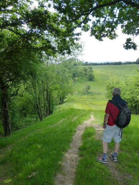
Terroir has been walking the Offa’s Dyke National Trail for 6 years. No, ha ha, we aren’t excessively slow walkers. We belong to that group of ramblers known as section walkers. We’ll walk for a week, then come back the following year and do another section. But many would regard us as ‘not quite the thing’. We keep stopping to look at the view, butterflies, birds or plants. We have days off to explore local towns, or visit gardens. We aren’t booked into B & Bs so don’t have to anywhere at any particular time. Shocking behaviour!
So how does one describe a journey along the narrow corridor of a long distance footpath? Offa’s Dyke is particularly idiosyncratic, as it passes through some distinctive but very different landscapes. But to the trail walker, it is the essentially a linear ‘terroir’, specific to the path and its history, which is the essential Offa’s Dyke experience.
The photographs below can only describe our own high lights, assessed through the filters of our own experience and interests, the camera lens, the weather and the people who we meet. But here goes.
From the River Severn to the lower reaches of the River Wye We decided to walk from south to north. Technically, the Trail starts on the top of Sedbury Cliffs, above the Severn estuary, but if seemed churlish not to walk from the estuary itself before heading up the Wye. It is varyingly bleak (the Severn), charming (what a loaded word) (Chepstow), flat, wet, engineered and managed (the lower Wye).


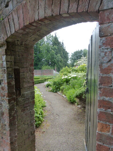


The Wye Valley from Tintern to Monmouth and on towards the Black Mountains Part I We start with the intense delights of green rolls of hills, the steep sided Wye valley, Tintern Abbey, midsummer road verges, lush meadows, relaxation, satisfaction, extensive productivity, small woodlands, small farms, small scale, huge feeling of well being


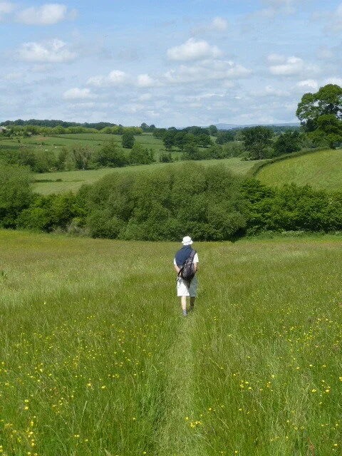


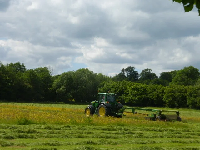
On towards the Black Mountains Part II Down to the Monmouthshire lowlands, the calm before the uplands; still green, still lush, but no more fairy tales; flatter, occasional meadows already buzzing with the silage cutter, elsewhere things are more intensive, with agricultural monocultures, orchards in scorched earth, less colourful hedgerows and a foretelling of the hills to come


The Black Mountains What a contrast, what a surprise and how typical of the Offa’s Dyke Path - this is by no means the last such landscape volte face which we will discover; the red marls, brown sandstones and conglomerates of the Black Mountains rise with abrupt steepness from the plains below; the Way shows evidence of heavy use in a fragile environment (note the erosion and use of paving to keep us going); a bracing and inspring walk on a good day, an exercise in survival on a bad one


I think this is what novelists call a cliff hanger. As we slither down the northern slopes of the Black Mountains, we will leave you. In our next instalment we will visit Hay on Wye, the Radnorshire Hills and on to the Clun Hills to revisit the Severn.
*Tony Webster: https://www.flickr.com/photos/diversey/16025367585/in/photolist-qq7ct8-5yEX1i-7Tx3yN-kYh1oZ-5uNnm8-kYhUGh-kYgt7H-2dpgogX-5wpW8m-8oRDxV-ouC6x-nxmJUF-8pA9AS-2hYi2ts-2hYi2ro-3GrkV-QTH5Ue-5TKhRm-482uwf-kYgrG8-2bqXuFk-2bmzfXY-2bmzf67-2bmzfpd-z87sX-Ket8uH-kYhWwQ-kYguqK-ebDWxQ-ebyhA2-kYhWah-kYgshg-kYgCQR-kYih7w-kYh2wv-kYh18P-kYgvQi-kYh1ng-kYhWVA-kYh4FF-kYh36g-kYgvCV-kYgv3r-kYgrRr-kYi6kS-kYi6Y5-eLAUFX-8oUQWQ-kYhWjW-b7mecg
**Jonas Witt https://www.flickr.com/photos/jonaswitt/3830661294/in/photolist-6Qv99o-49thm1-7z332x-4SFSsc-49e5b6-4SL4wu-5WvQbo-4SFTx4-4SFRX6-5Wry2K-5WryVV-5WvQos-49patT-5WvQBj-4SFRt4-4SFQWH-nJEqLH-5YvJaJ-4SFK7P-4SFNRn-49p8Hv-4SL2YS-81JzLb-49p9Pk-81JzpW-49tgio-6kLrMu-21fVJoK-81JAH3-81EsMc-21cVaTX-49p9iT-5YvHXj-a84vB6-49tfAf-D1wQhR-CypMjb-7MP8je-7AgjGD-7MT7iU-7Ak6LL-7MT7Pj-K9wHxw-7BJKqo-7AgjEa-7MT7tj-81JCL1-8367w1-YkNMy4-81FtLe