Imberbus
Way back in the 70s, I can recall a geography field course in Dorset. Our lecturer stood on the edge of a muddy track (it was probably in the Lulworth Ranges), reading out excerpts from Thomas Hardy. Behind him, on the MOD equivalent of a field course, rumbled assorted tanks. None of us was listening to Hardy; all of us were glued to the tank manoeuvres and the sheer incongruity of the situation. I have harboured an ambivalence to both Hardy and the MOD ever since.
Around that time there was a tendency to diss the MOD for negative impacts on its huge estate, particularly with regard to access, nature conservation and heritage. I was not overly surprised, therefore, to find that a committee had been set up in 1971, chaired by Lord Nugent of Guildford, ’to carry out a review of land in the United Kingdom held by the Armed Forces for training areas, airfields and ranges wherever situation [sic], and land used for any purpose in national parks and areas of outstanding beauty and along the coastline, except for dockyards and port installations’. https://api.parliament.uk/historic-hansard/commons/1975/jan/17/defence-lands-and-national-parks
The Nugent Report was published in 1973, and is credited with a recommendation to appoint a MOD conservation officer. I suspect they also appointed a conservation savvy PR officer as, from memory, it was soon after, that we became increasingly aware of the extraordinary biodiversity which the MOD’s restricted access requirements was harbouring - although it was not until 2017 that the BBC’s Springwatch gave it the final seal of public awareness and approval by filming at Porton Down! https://www.gov.uk/guidance/defence-infrastructure-organisation-estate-and-sustainable-development#history
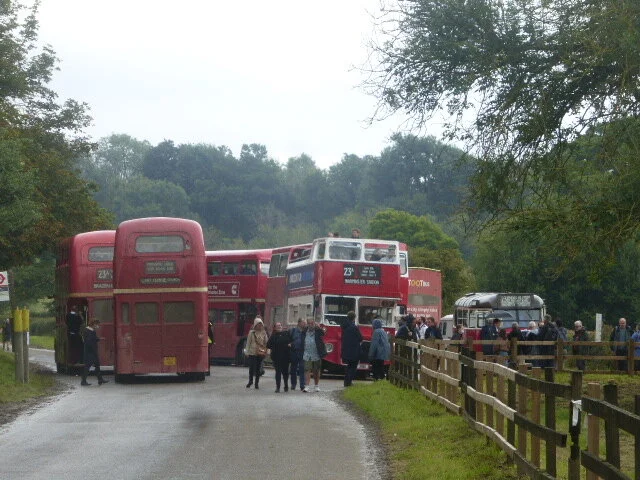
I was pondering this history while travelling on bus route 23A. The 23A used to connect various parts of east London with various parts of central London, but now has a much reduced timetable. Currently operated by the Bath Bus Company, the 23A runs a very frequent service but only on one day of the year. Welcome to the IMBERBUS.
This extraordinary day out is a bizarre partnership between transport fanatics and the MOD, who own the deserted village of Imber, in Wiltshire. According to the excellent Imberbus website – do take a look, particularly if you like history and/or buses (https://imberbus.org/introduction/) – the idea was concocted ‘On a cold winter’s evening back in 2009, over a few pints in a Bath pub, [when] four transport professionals discussed where the most unlikely place would be to run a bus service. The answer was a place that the public were not normally allowed access to and so the idea of running a bus service to the village of Imber on Salisbury Plain was born’.


Imber was once an isolated, rural village on Salisbury Plain, dependent on agriculture and supporting trades. Recorded in Domesday Book, by the latter part of the 19th century (see extract from 1899 Ordnance Survey below) it included various farms, a windmill, a school, an inn, a smithy, a Manor House (Imber Court), the parish church of St Giles with substantial vicarage, a Baptist Church and a shop. The ordnance survey map of 1922 records remarkably little change over the previous decades apart from, sadly, the inevitable addition of a war memorial, plus a wind pump and allotments. A rich store of old Imber photographs can be found at http://www.imbervillage.co.uk/imber-then.html

Reproduced with the permission of the National Library of Scotland' https://maps.nls.uk/index.html
Significant changes were afoot, however. The War Office had been buying land to the east of Imber, for military training manoeuvres, since the late 19th century and physical damage to the village was recorded as a result of expanding activity prior to the First World War. By the late 1920s, the War Office was purchasing a number of farms around Imber, and bought most of the village, finding ready sellers at a time of agricultural depression.
The shadow of WWII caused another significant hike in training activity in the area, with a similar increase in damage to the village. On the 1st November, 1943, at a crucial point in the war itself, Imber’s landlords held a meeting in the village schoolroom and gave the villagers 47 days’ notice to quit, prior to using the village itself to train troops for street fighting. An interesting exhibition in the Church records that villagers assumed, or were told, that they would be allowed to return after hostilities ended, but no written records of such a promise could be found.
Today, Imber is a very different place. The church remains as a haven for wet visitors on open days and opens every year to celebrate St Giles’ day. Some other original buildings still remain and many others have been added to provide training facilities for warfare in built environments. The Baptist church was demolished in the late 1970s, but the grave yard with its yew trees remains.


Other original buidings are identifiable by their brick construction. The pub, below left, and the blocks known as the ‘Council Houses’, below right, are obvious, if now very sad, examples.


The original Manor House, Imber Court, still retains some of its grandeur, despite a few interesting additions (below right) but must look very different on military training days. We felt that the list of instructions had been followed meticulously.


Other former village buildings now mingle with the more recent MOD structures (below).


The village-scape has changed drastically too. The annual bus invasion is a delight but other signs are a constant reminder of the new Imber ‘inhabitants’.


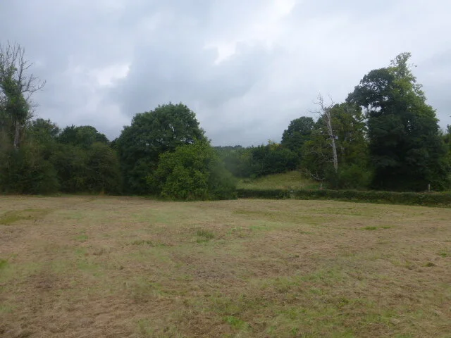
And the village setting must also be very different. Gone are the open views, the occasional orchards, and the village gardens. Some grassland (one could hardly call it pasture or meadow) and hederows remain, but trees and shrubs have taken root in other areas and the village stream, known as the Imber Dock, is invisible, in summer at any rate.


It could be said that the MOD has destroyed one Salisbury Plain heritage and replaced it with another. Bus enthusiasts flock to Warminster to travel on the buses of their youth or, to a lesser extent, their parents’ youth. Many also come ‘for the ride’ and to take advantage of one of the few days per year when Imber village is open. It is also a rare occasion to take a trip across areas of the Plain usually closed to civilian traffic, and to partake of the glorious tea-and-cake-fest provided by the villages such as Market Lavington and Chitterne which lie beyond the Military ‘Danger Area’. So, perhaps one could construe this to be a very, very modest nod to providing some public access and, if not Salisbury Plain heritage conservation, at least military heritage interest and interpretation.
But please don’t come on Imberbus day if you want to find out about, or rate, the MOD’s contribution to nature conservation! The view from a rain swept London RT bus window is extremely limited; we spotted a great deal of ragwort and common yarrow (at least I think that is what it was) and some road side disturbance and enrichment (giveaway patches of stinging nettles), presumably resulting from tank tracks kicking up the dirt. The acres of Salisbury Plain’s ancient chalk grassland or juniper scrub were safely tucked away, out of reach of the likes of us.
We did however, take a quick look at the digital records for the Salisbury Plain Site of Special Scientific Interest (SSSI) units. Please note that we did NOT check the ownership records. We will merely report that no units were classified as being in unfavourable condition and about 60% were classified as in favourable condition. That left around 40% classified as ‘unfavourable recovering’. So perhaps a way to go yet, Salisbury Plain?
We leave you with two iconic images from Imberbus Day.

