Sand Pit
What do you do with a hole in the ground?
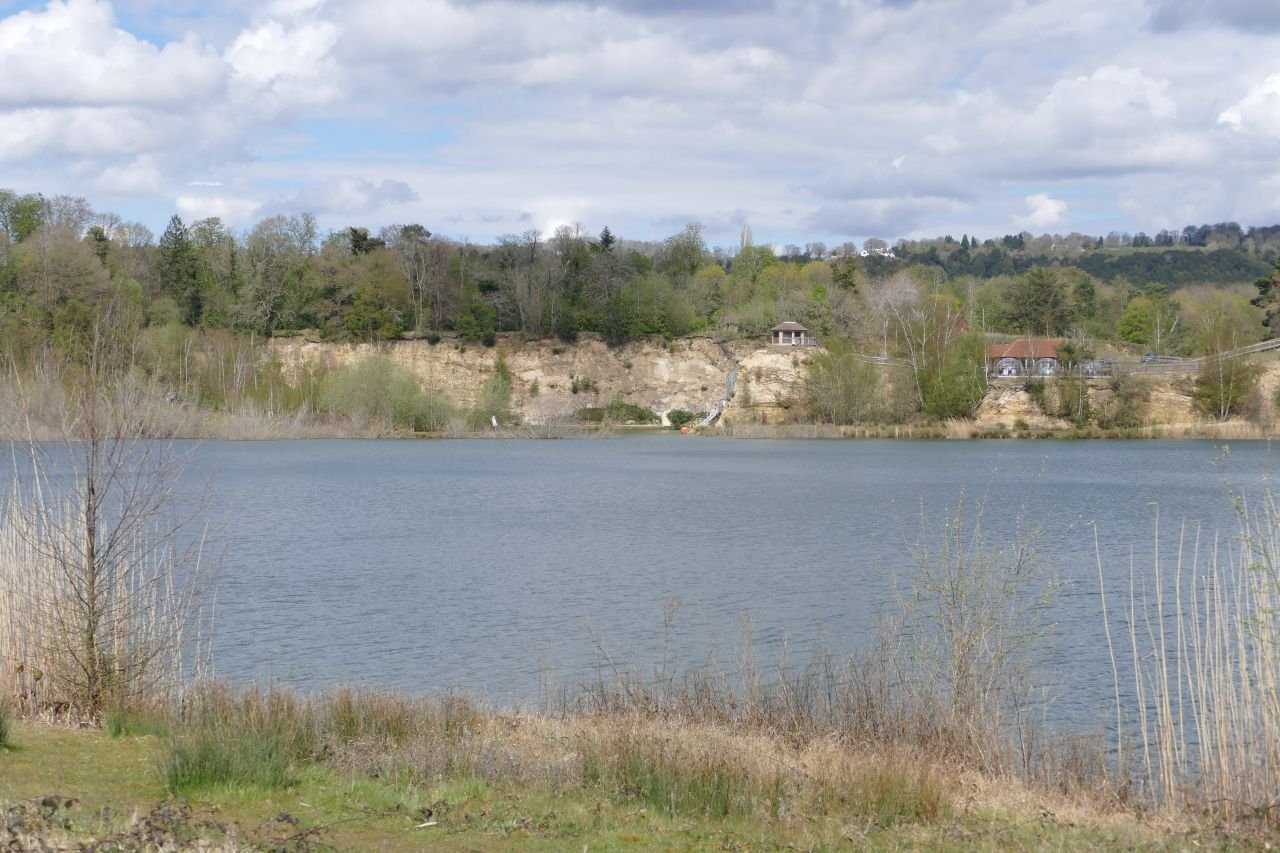
Surface mineral extraction can be a landscape blight as well as an industrial resource. Clay, sand, aggregate, granite, limestone, slate – all can make huge impacts on their environments as well as, more positively, on their local economies. All create holes with very differing characteristics and potential. Clay holes are often filled with waste, and have gone on to expand upwards, creating hills where none existed before. Slate and granite are good at new vertical landscapes with scars and screes. Once the pumps are turned off, sand and gravel pits usually fill with water, creating widespreading horizontal changes to the local landscape character.
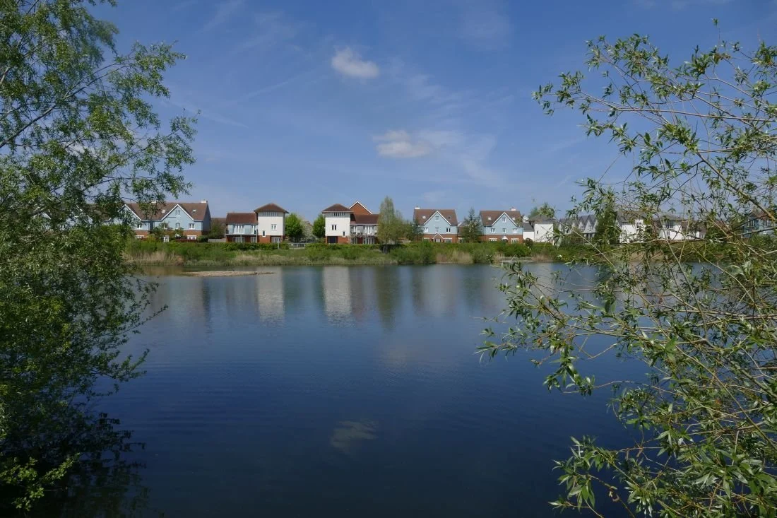
Recently Terroir visited a sand pit, once impenetrable behind its industrial security fencing, ‘keep out’ signs and all the paraphernalia of extraction health and safety requirements. Eventually, however, new mineral extraction planning permissions were no longer forthcoming and the pit was allowed to flood.
Nothing unusual there, you may say. ‘Soft’ restoration schemes are very common, with management for nature conservation and visual amenity, and frequently including some sort of revenue earning, water-based recreation facilities, such as sailing, kayaking, fishing, but with plenty of public access. Last week’s blog featured The Moors, a mixed development with new housing adjacent to flooded lagoons and seasonal water bodies. Here, existing public access has been extended and linked into the National Cycle Network which takes you onwards to two older flooded sand pits, one managed for water based recreation at one end (with fishing and nature conservation at the other), and the second purely as a nature reserve.
Buckland Park Lake, however, is trying a different model. With no pre-existing public rights of way, the whole, post-industrial, lake-and-landscape combination, is concealed behind a pay-wall. Well more of a pay-woodland, actually, with a wooden shed located half way down the old mineral access road, to sell you entrance tickets; £7 a pop for adults during the High Season or £99 for the year. Various concessions are available.

Once inside this ‘new and unique recreation space’ (https://bucklandparklake.co.uk/) access to the whole park and the paddling pool is free but ‘open water swimming, water sports and bushcraft should be booked directly with The Surrey Hills Adventure Company’. There’s also a restaurant and a variety of tracks and trails suitable for strolling or running. No dogs are allowed.
It sounds, and one day may feel, like an inland resort. But this is not a word used by the website:
‘Our 100-acre site blends tranquillity with breath-taking views over one of Surrey’s largest lakes. We have around 50 acres of mature mixed woodland, abundant bird life, walking trails and a small sandy beach.’
Terroir went to take a look.
First of all, it is still very new. As the landscape matures and the facilities bed, one hopes that many of the raw edges will be softened.


Above: The water sports area
Below: theview from the restaurant (the pods get very hot during the day) and the less formal recreational areas


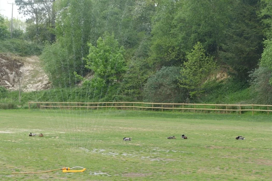
Surprisingly, drainage appears to be an issue. A cut off ditch edges the car park and supports a lush, linear wetland habitat which we hadn’t expected, but were delighted to see. Yet the car park itself presented a bizarre contradiction: its outer edge blending with the ditch habitats - dominated by juncus rush and other indicators of wetland and poor drainage - while a few feet away the sprinklers were working hard (the car park had taken a hammering the day before) and the local ducks were in irrigation heaven. One feels, perhaps, that a rethink of car park surfacing is urgently required.


Above: the stream/ditch/drain
Below: left - car park ‘outfield’, full of rushes; right - the actual parking areas, full of ducks

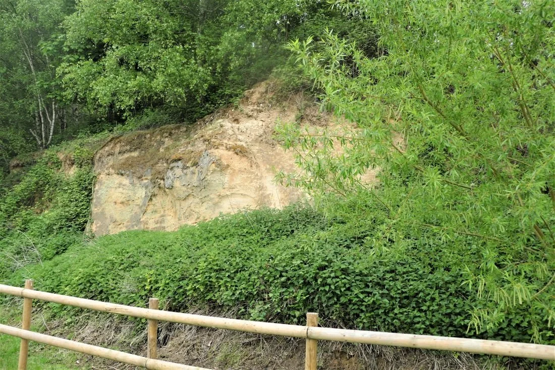
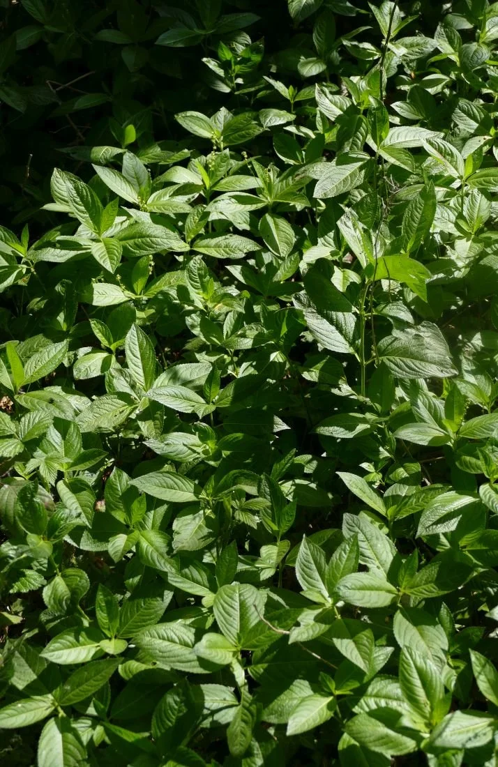
Elsewhere the sand cliffs are a delightful mix of dry and acid loving species including gorse, broom and birch, with sheets of nettles where the richer overburden or spoil was probably stored or subsequently buildozed.


The woodland walk sounds inviting. The current offer is a mixed bag of developing ‘secondary’ woodland on areas no longer used for sand extraction, and older stands of exotic conifers. Terroir has no problem with that - indeed it’s fascinating evidence of the sand pit’s history - but the information signs fail to take advantage of the story. Why not explain why there is such a mix of local species (including birch, sweet chestnut, sallow, sycamore, English oak, evergreen oak and field maple), in some areas and single species stands of Scots Pine or the non-native western red cedar, in others?

A number of Scot’s pines ‘interspersed in the woodland’. It sounds so romantic but what the viewer is actually looking at is a 1950s commercial, single species, conifer plantation surrounded by a delapidated fence. Why not tell the story of why these planations were planted and what is (or more likely isn’t) happening to them now. And possibly remove that fence.
The story of the local sand extraction is told on - just one - interpretation board (below left). There is scope for a lot more and one hopes that this will follow. The retention of the processing plant (below right) is also a plus, adding welcome historical links.


The bird life mentioned on the web site is certainly developing and the multistorey sand marten nesting wall seems to be well used. Sensitive management should increase the lake’s attraction for bird watchers, but currently the hide looks rather lonely.


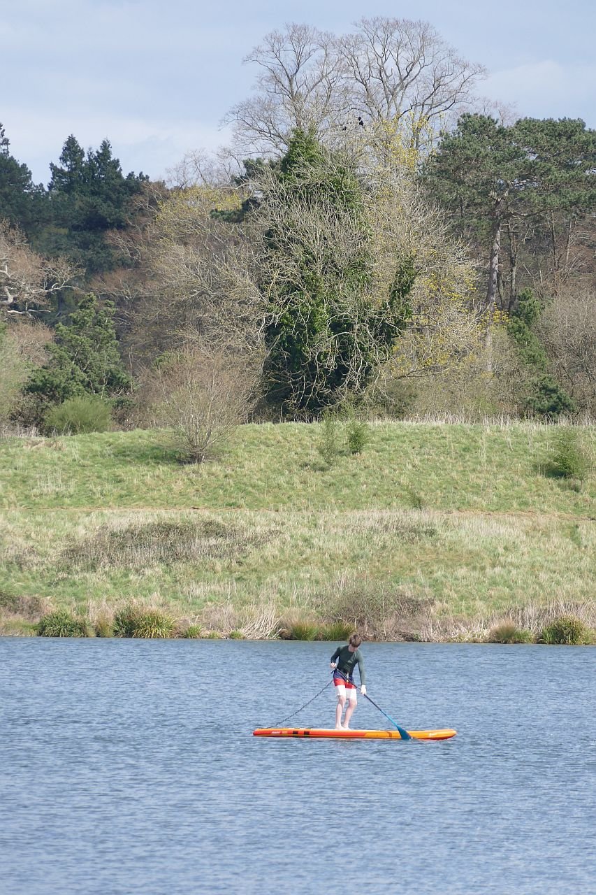
We have no knowledge of whether the bookable, water based activities, and the fishing, are providing the income required to make this into a going concern, but even on a chilly day in early May, there was at least some activity on the lake.


But surely the big question is, will the punters pay the site entry charge? Will they cross the pay wall? With so many free countryside, wetland and greenspace facilities nearby, not to mention the Surrey Hills Area of Outstanding Natural Beauty, the North Downs Way and the Greensand Way, is their any incentive for the casual user to pay up? Curiosity there certainly is. This year, the Annual Buckland May Fayre was held in the Buckland Park Lake. Numbers attending were hugely underestimated, traffic queued to get in, food supplies ran out, the bottle tombla wiped clean and stories of chaos were legion. The entry fee was reduced to £2 and it was reported that many turned up out of sheer curiousity to see what Buckland Lake was all about. £7 a time is definitely offputting, but a village fete at £2 is worth a go.
But maybe that is exactly the point. Maybe the business plan for Buckland Park Lake is based on creating an exclusive environment for those willing to pay for it.

Change of Management
With an ever growing image library, this blog was meant to be a comparison of spring 2020, 2021 and 2022, based on Terroir’s photographs of our favourite urban landscape, The Moors, near Redhill in Surrey. Those new to Terroir can catch up on the back story in Blogs 1, 11, 16, 31, and 54.
We discovered - the hard way - that unless you can indulge in fixed point photography and keep excellent records of camera settings, view points etc, taking and comparing before and after images can be at best frustrating and at worst, useless. Take a look at the disastrous attempt below!

Above: ‘before’ on the left (2020), and ‘after’ on the right (2022). Well, maybe that islet has moved, but as the photographer’s location and camera settings are different, it is impossible to verify!
The changes which were most obvious, however, were not those necessarily linked to seasonal variation. It was the changes which had occurred to this post industrial landscape over the (nearly) three year time span of the pandemic.
Here is what we found.
A hugely expanded clump of dogs mercury: usually regarded as an indicator species for ancient woodland; so good to see it not just hanging on, but now thriving.
During the pandemic, there has been little active maintenance and management at the Moors. This isn’t necessarily bad - just different. At the moment the wild flowers which thrive on the edge of hedgerows are blooming, providing a range of colour and form. The summer grassland flowers, however, may not be so copious this year as the scrub is slowly extending over the grassy verges, alongside the paths and cycle way. But already a healthy growth of young willowherb, and some spikes of common agrimony, pressage a blaze of pink and mauve, with yellow highlights, later on in the year.


From left to right - top row: common sorrel, common forget-me-not, and a young teasel
Middle row: red campion, bugle and white dead nettle
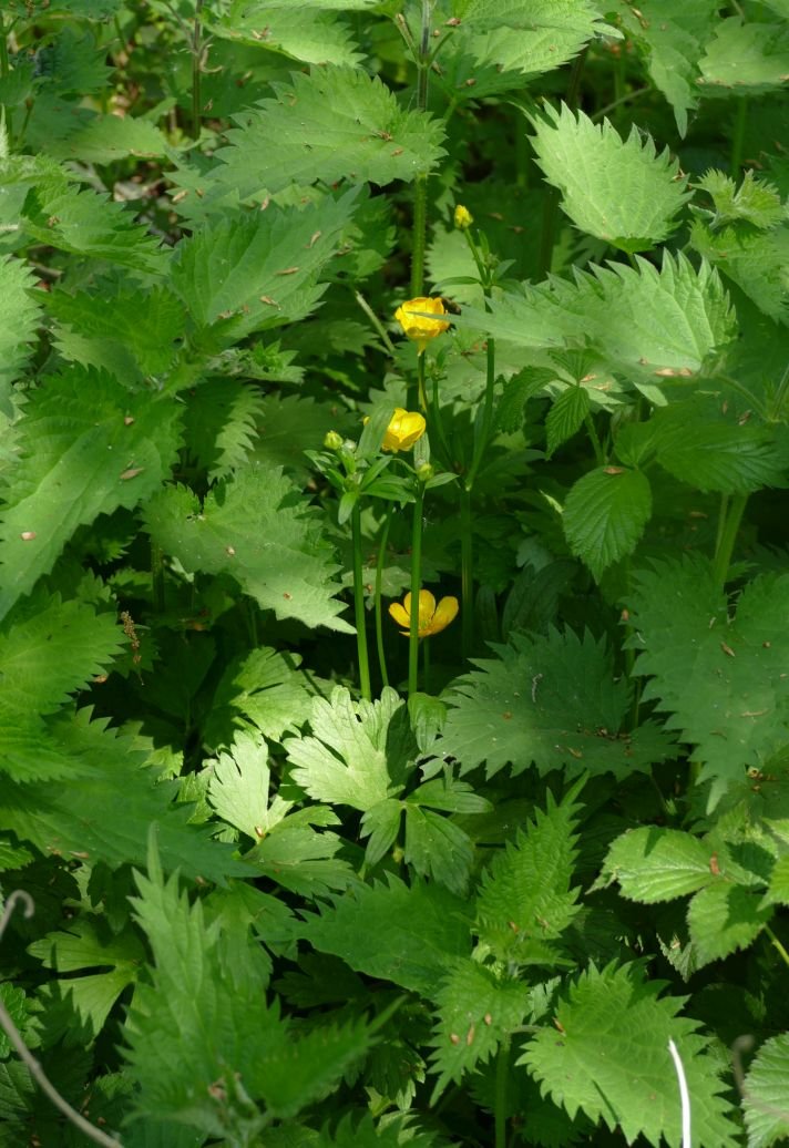
Bottom row: garlic mustard (the tangy leaves are delicious at this time of year), meadow buttercup and cuckoo flower/ladies smock, a lover of ditch sides and damp rough grassland.
Thankfully, the encroaching scrub is not without interest either: flowers, fresh foliage and tinges of red on some newly opened leaves are all welcome accessories to a late spring walk.


From left to right - top row: holly in flower, a sycamore sapling and an alder - the latter another wetland lover.
Bottom row: a wild rose, buddleia (a naturalising garden escape) and the soft, glossy leaves of young brambles
The blackthorn is over but other shrubs and trees are adding to the spring time vibe. And, as is usual these days, the May (hawthorn) is fully out in April.


From left to right - top row: hawthorn hedge in flower, elderflower and gean or wild cherry: with its straight branches, awkwardly angled from the trunk, the gean flowers always make me think of handkerchiefs on a washing line or stars on a Christmas tree.
Bottom row: willows, and a rogue horse chestnut complete with candle
Sadly, the ash dieback is very obvious (below).


Despite the lack of rain, water levels are still high, the main footpath/cycle way is still partly flooded and the seasonal wetlands are inundated. This excess of water is possibly why the swan pair have moved their nest; still close to the path but further to the west of last year’s location. A beady-eyed heron stands very close. We’ve not heard of herons taking eggs but they certainly eat ducklings and cygnets.


The brook itself has also changed. Some of the mature trees have been felled or partly felled, presumably for safety reasons, and more light is reaching sections of the water course. The partly felled ‘totem’ trees look bizarre but the organisms which will inhabit the slowly rotting wood will be a welcome addition to the area’s biodiversity.


The ‘offline’ balancing pond has turned a rusty brown colour - an algal bloom? - and there are traces of it along the edge of the shadier, slower flowing, sections of the stream (image below left). Some green waterweed still remains, however (below right), but the areas of yellow flag (centre) have extended enormously and will be spectacular later in the month.


We have given up on fixed point photography, but we will report back later in the year on how the Moors post-pandemic (is that tempting fate?) summer of 2022, compares with its lock down predecessors.
Changes to Terroir
Terroir blog had a long gestation period but eventually went live in October 2020. It was the perfect lockdown project and a weekly post seemed ideal. Thankfully, our life styles have changed and now that we are ‘learning to live with Covid’ we will be travelling more often and more extensively than we were able to, in the previous two summers. For the next six months at least, therefore, the Terroir blog will be appearing on a fortnightly basis. Blog 81 will appear as normal on Thursday 12th May but blog 82 will not be posted until Thursday 26th May. Further postings will follow at two week intervals.