
An Autumnal Jumble

Two days ago, I received this photograph from the North Wales section of Team Terroir. The accompanying message read “Very late foxglove … maybe another blog on late flowering plants?”
Three journeys were precipitated by this idea. The first was a visit to The Moors (English Team Terroir’s local green-escape, and frequently featured in this blog). The second and third journeys circumnavigated Terroir’s gardens (one in north Wales and one in southern England). Like our modern climate, the results were confusing.
Let’s start with the gardens. Both had been frost free until the start of November. Both are fairly sheltered. Both have fairly similar elevations (the Welsh garden at 80 m and the English at 100m). Of course the Welsh garden is further north than the English garden, but also considerably further west, and only 20 miles from the sea. You also need to know that the Welsh team are the better gardeners!
Here is a sample of the late flowers in the Gardd Gymreig.


You may say that it is hardly surprising to have nerines or fuchsias flowering in the autumn, but in this garden, all the above have been an unexpected, if welcome addition, to the November display.
The English garden is less floriferous but the message is the same: we are surprised to see you.


The hydrangea heads are normally well coloured until after Christmas, but it is unusual to get a fresh bloom in November. The Salvia Hot Lips is technically a cheat, as it is cheering up the front garden of a neighbour, but the element of surprise is the same, although the profusion of flowers has probably been helped by the prodigious quantities of rain which have fallen recently.
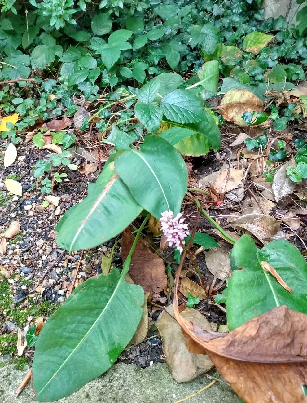
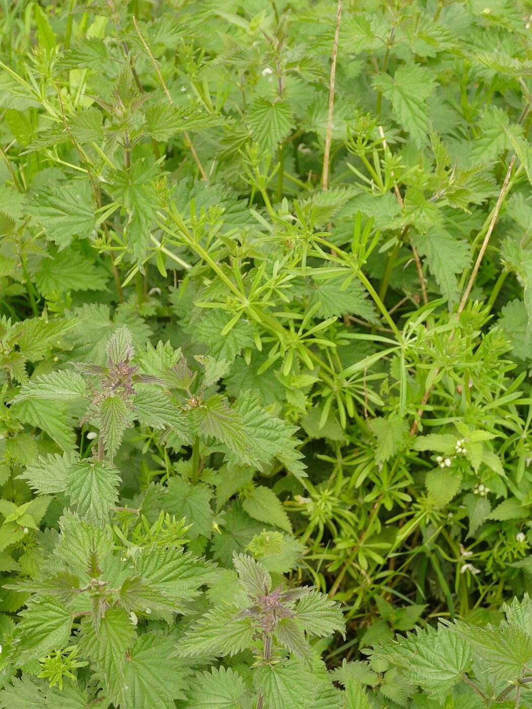
Assuming that there would be an equally surprising range of flowers in bloom along the path through The Moors, Terroir set off in anticipation of a stimulating stroll. Unfortunately this assumption was utterly erroneous, and the herbaceous colour palette was based almost entirely on an array of green/brown leaves and seed heads. After some searching, a few late flowers were spotted lurking in the undergrowth (see below), and there may have been others even better hidden. Indeed, on turning back to take a better photograph of the single red campion flower, I was totally unable to find it again. Why this contrast with the exotics of the garden? We would appreciate comments and suggestions in the box at the end of this blog. If you can’t find it, click on ‘read more’ and scroll back down to fill in your thoughts.


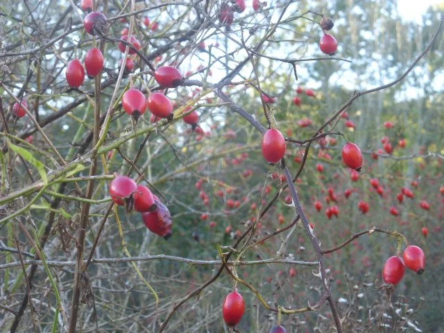
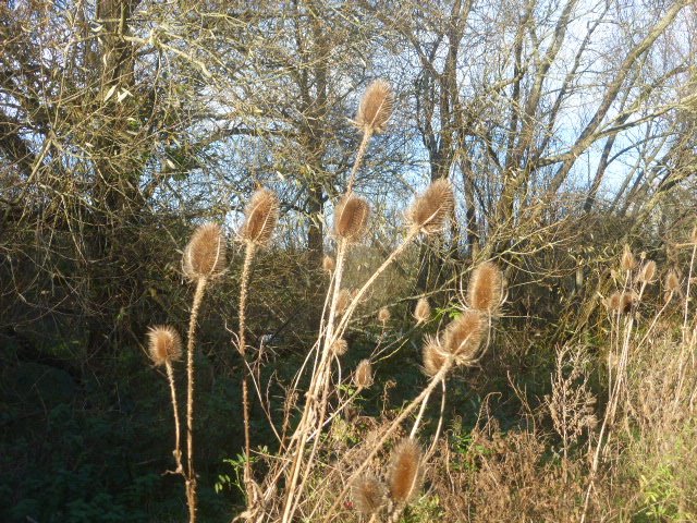
The walk was not without interest, however. The variety of seed heads and berries provided a varied and sculptural and/or colourful display.


But it was the trees which were most varied and unpredictable. Considering that it is already early November, many seem slow to lose their leaves.
The English oaks were still in full leaf with plenty of late summer greens and only a few turning to autumnal yellow.


The American oaks which someone has planted here (probably Red oaks, see below left), were anything but red, having already lost many leaves whilst of a pleasant but unspectacular yellow/brown colour. The equally non-native Norway maple (second from right), which usually puts on a spectacular show of brilliant yellow at a bend in the path, is still green; the native field maple (below right) has gone totally autumnal.


The willows and poplars are a mixed bunch. The poplars (see below, upper row, left and centre) are either bare or have retained their upper most leaves. The sallows (upper row right) are still late summer green but their long leaved, weeping, cousins (lower row and immortalised in William Morris’ willow bough design) seem to have lost the plot completely .


The self-seeded forest of alders is largely denuded of leaves, but those with space to expand (below left) still retain their summer leafy glory. The dogwoods just seem to be confused.


Down by the laid hedge, the hazel has regrown vigorously and retained the enormous leaves which the wet weather seems to have encouraged. A neighbouring blackthorn , also in full leaf (below right), is clinging to a last remaining sloe. As with the holly, this year’s cornucopia of fruit has already been eaten.


Sadly, the chaos which is autumn 2021 feels like a metaphor for COP 26 in Glasgow. Already we have lost our ash trees (below left and centre: a dying ash and the lesion caused by ash die back disease). Is it too late to retain the stately beech (below right)?


The Darling Buds
This time last year, the ‘darling buds of May’ were unshaken by rough winds and were sunning themselves in our much appreciated parks and gardens. Terroir’s plot was full of weeds, of course, but also colour, butterflies and bees.
Mid May 2020


This year the garden is a wonderful fresh green, a delight to behold but distinctly monochrome and very damp. The aquilegias are providing spikes of red, blue and purple, the bluebells are hanging on, but the apple trees are so behind that one is still in flower and none have set fruit yet. Otherwise, it is a mosaic of verdant foliage. I have never seen such a gigantic crop of cleavers (Galium aparine). The bees are making the best of a bad job but the butterflies are few and far between. Too cold, too wet, too windy and garden development is seriously delayed. The photographs (above and below) make an interesting comparison - same plants but different years.
Late May 2021


This weather has also been a big factor in our (lack of) outdoor exercise, but now the rain has ceased and the wind dropped, it is time for another visit to the Moors (see 29/10/20 , 7/1/21 and 11/2/21 for the back catalogue of Moorish blogs). How has the weather impacted on our local wetland nature reserve?
The walk reminds us a little of those horticultural shows where size matters. Here we have the biggest shoals of cow parsley (seen below peeking over a railway bridge, almost as tall as Terroir), the tallest stands of dock spears and the widest ‘spades’ of burdock leaves that I can remember. The cleavers are pretty upstanding too but I still think that chez Terroir will win the cup for longest and fattest sticky willy (aka goosegrass, catchweed, stickyweed, sticky bob, stickybud and many, many more highly descriptive names).


On a smaller scale of leaf but larger scale of structure, the freshness of the tree foliage still allows the sculptural quality of the trees’ wooden skeletons to be admired. It will be a while yet before the ‘spring greens’ pass to the heavy, stately, dark greens of high summer.
Underneath the branches, the bluebells are overblown and fading but still manage a hint of that blue miasma which brings magic to every spring bluebell wood. Bedraggled forget-me-nots and self heal add to the blues, but there are just a few stands of red - or perhaps startled pink would be a better description - campion that suddenly pounce on you from behind a clump of grasses. The willow herb has a way to go yet in terms of height, let alone flower and last years dead stems (bottom row, left) indicate just what it has yet to do to match last summer’s blaze of colour. The garlic mustard and buttercups are irrepressible, of course, but the biggest surprise is a clump of daisies, raising their faces to the light and smiling like cheeky children at the shock they are creating by their presence.


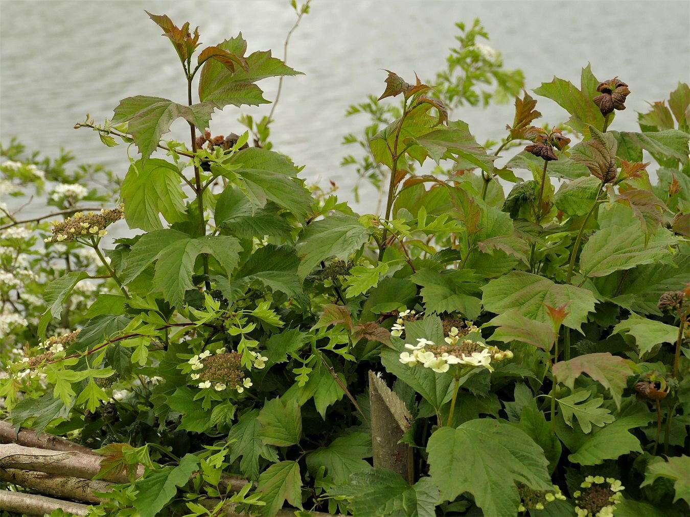
The blackthorn has finished flowering of course but the guelder rose is holding up its lace cap flower heads like doilies on a tea tray (below, left). The hawthorn has also managed to bloom within its eponymous month of May. Did the ‘darling buds of May’ refer to the month or the hawthorn flower, and did Shakespeare consider May time to be summer? The answers to these questions are probably irrelevant as I’m pretty sure that a good rhyme was more important to Shakespeare than consideration of phenology or calendar. You try finding a decent rhyme for ‘June’.


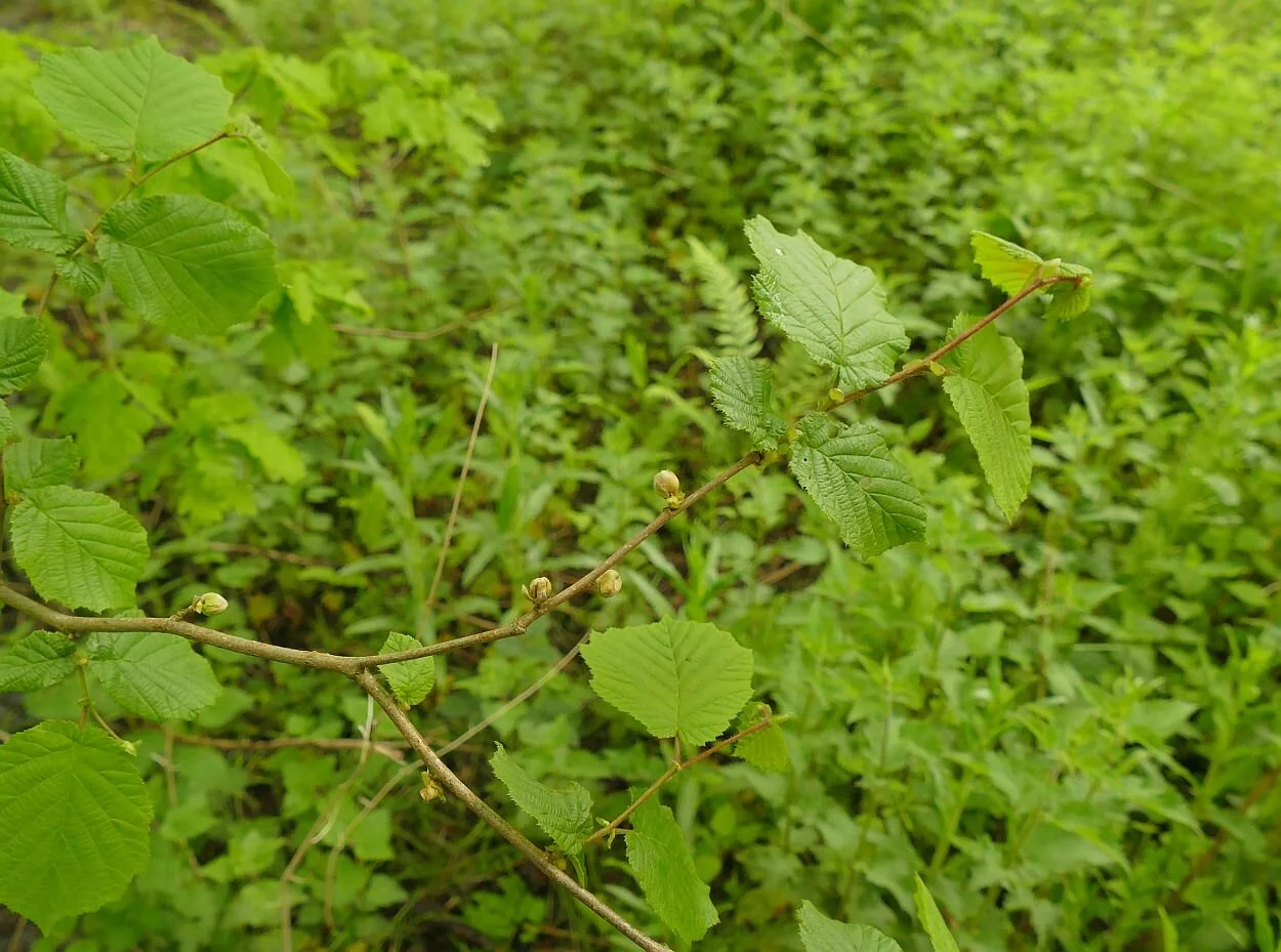
There are still some willow catkins but the alder and hazel have moved on and are quietly presenting the next generation of cones and nuts for whatever super-spreader (wind or animal) will be required to complete their lifecycles. There is excitement at the site of a young oak sporting what appear to be red berries, but which we assume are a type of gall. Does anyone know which sort they are?


The horse chestnut candles are bedraggled but finally blooming bravely. It’s at this time of year that the non-natives become obvious, in this case with a red blossomed horse chestnut tree. The American oaks, which also adorn the Moors, become distinctive in the autumn with their dramatic red fall colours.
As with the rest of Surrey, the ash is late and very hesitant. Whoever penned ‘ash before oak – we’re in for a soak; oak before ash - we’re in for a splash’ needs to define their time frames. We had a pretty thorough soaking this spring before the ash appeared, but if it refers to summer weather, then there is still time for the old saying to ring true. Ambiguity is so good for successful weather forecasting.


But, as usual, it is water which steals the show on the Moors. For those who are new to the blog, the Moors is a local, Surrey Wildlife Trust, nature reserve sandwiched between a railway line and a landfill site, and exploiting an exsiting brook and former sand and fullers earth excavations. It’s hard to read the former landscape in the riot of habitats which now abound here.

Inevitably the water level in the seasonal lakes and ponds is high, but the floods have retreated and the footpaths and cycleways are passable if muddy.
It’s easy to see the regular users here - walkers, dogs and cyclists - although the burdock is doing its best to obscure the prints and narrow the path.
The wetland vegetation is growing fast, although only the yellow flags have started to flower. On the lake edges there is space for the water mint to take hold and flourish before the reeds shade it from view.


The swans on the upper lake are watchful but there are no cygnets and their nest is now hidden in the reeds. A great crested grebe and a mallard (both males) are both showing off but there is no sign of their respective mates. We just can’t get a picture of the grebe with its ruff extended in full Elizabethan splendour, but the mallard is happy to give us a ‘daffy duck’ shot. The tufted ducks are absent but a couple of coots are on the water. All in all, though, it’s quiet on the duck front today. On the other hand, two juvenile cormorants are drying their wings, perched on the old fence posts which cross the upper lake, while a heron stalks the shadows.


Further upstream, a sodden meadow currently bears more than a passing resemblance to an 18th century English landscape park, in miniature. Not bad for an old mineral extraction landscape and a wet and windy spring!
.
Slow Ways
Maybe Terroir should adopt this as a slogan, as we have been rather slow-moving in picking up on the Slow Ways project. In case that goes for you, too, I’ll tell you what we know about it so far.
If you go to the project website https://beta.slowways.org/ you may be somewhat phased by the Home Page which hits you between the eyes with a nodal and very purple matrix which looks more like a protein network than an invitation to amble across Britain! Each node is a city, town or village and the aim is to connect them by creating a unique network of walking routes. Wheels are allowed, but only if they belong to a wheel chair or children’s buggy.

‘Using existing paths, ways, trails and roads, people can use Slow Ways routes to walk or wheel between neighbouring settlements, and combine them to create longer distance trips. It’s designed to make it easier for people to imagine, plan and go on walking journeys.’
As far as we can see, it is the brain child of Dan Raven-Ellison, self-styled ‘Guerrilla Geographer and Creative Explorer’. He is also keen on ‘wild cities’ and creating a London National Park. Neither of these concepts are new, of course, but if DR-E can raise the profile, speed things up, change attitudes – and find the funding – then we are all for it.
Raven-Ellison writes that, in February 2020 lockdown, a group of 70 people were mobilised to test the Slow Ways idea, followed by 700 to plot a first draft of the network. We assume this was a desk study, based on mapping provided by one of the project supporters, the Ordnance Survey (OS). By the winter of 2020, ‘80,000 people [had] registered to help walk and review routes’. That number continues to grow and, by May 2021, included Team Terroir.
Why did we join up? At first glance it seems like a tremendous idea: mobilising a huge army of volunteers to identify routes which will connect communities and encourage walking over driving, just as we were encouraged to do during Covid: roads were empty whereas green space and countryside honeypots were heaving. We desperately needed to encourage people to explore footpaths, spread the visitor impact more widely and enjoy it at the same time!


But Terroir wonders if there may be downsides. This is from the BBC, on the subject of the Slow Ways project (https://www.bbc.co.uk/news/uk-54562137), last October:
“Would you know the best way to walk from Leeds to Manchester? From Tring to Milton Keynes, or Carlisle to Inverness? If not, then you're not alone.
We live in a time when our phones will show us the quickest route to almost anywhere - if we are driving, that is. Walking? Well, that's a different matter.”
As a point of accuracy, BBC, any decent mobile phone App will tell you how to walk from T to MK, but what it won’t show you is a pleasant route via footpaths and countryside, which is what Slow Ways is all about.
On the other hand, why would you want to walk from Tring to Milton Keynes (a 7 hour, 20 mile walk) when you can walk from Tring to a pretty part of the Chilterns? Or, if you want a long walk, what’s wrong with the 134 mile long, circular Chilterns Way? Wouldn’t an app or map which showed you the best walking route from Tring to the nearest bit of a Chilterns waymarked footpath, be more popular?
After a career in landscape, I am no longer surprised by the number of people who struggle to interpret maps. Most of us learn to read words and many read music, but how many of us are comfortable with plans and cartography? Will replacing an OS map with a purple Slow Way map make walking any more accessible? Those of us who love and already use maps can plot our own routes, whether from community to community, or to/though an attractive piece of countryside.
I hope I will be proved wrong and any comments from Slow Ways will be very welcome at the bottom of this blog. If no comment box is visible, click on ‘read more’, scroll down the blog again (sorry) and put me right.
Earlier this week, Terroir set out to walk our first Slow Way. It is called Redgod One, and links Godstone and Redhill, in Surrey. Both ends can easily be accessed by bus, and the Redhill end has a decent train service. We’re not born techies, however, and we found the website clunky and the route map download difficult, so we worked with a combination of mobile phone data and – guess what – a comforting paper copy of the relevant 1:25,000 Ordnance Survey Map.
We thought we were out for a general, Slow Way experience, but soon discovered that the project is still very much at the pioneering stage. By signing up for the Slow Ways website, you can take on a number of roles, including ‘review’, ‘verify’, ‘survey’ and ‘add a new route’. In retrospect, I think our five mile walk will trigger all these activities. We also now know that Redgod One’s theme is the Surrey sand extraction industry. Perhaps it should be renamed Redsand, or Greensand, or RedsandGod. Please see Terroir’s first ever blog if you want to know more about Surrey and sand.

We started in Godstone. In good times, Godstone is blessed with an extraordinary number of pubs and cafes, some interesting architecture, at least two ponds and a well-used village green. Even in bad times, it boasts public toilets, although so poorly lit that an in depth review of the facility is not possible. Our walk commenced by traversing the aforementioned village green. There followed Redgod One’s first and only encounter with a busy main road, which immediately threw up a route amendment: the footway on the northern side of the A25 offers a marginally improved experience, with a slightly safer road crossing, compared with the one suggested by the Slow Way route. Good: our morning is already providing some positive feedback. Oh, and somewhere on our right is our first sand quarry, hidden behind a strategic tree/shrub belt.


Redgod One - the Godstone end. Left: our personal starting point - bus stop, public conveniences and one of the pubs Centre: another pub! Right: village green and pond


Cricket has been played in Godstone since 1749 and is memorialised by this poignant sculpture: from one view (left) you see a cricketer, from another view (right) a first world war soldier.


Left: our Slow Way took us diagonally across the Green from the pond at one corner (out of shot to the right) to (Right): the A25, just as the road leaves the village and heads off westwards towards Redhill


From left to right: here is the southern side of the RedGod route along the A25; although it has a fine crop of Arum lilies, it is sigificantly less pleasant than the elevated northern foot way, which leads us to our escape route to rural byeways
After a bearable 250 m we are off the A road and enjoying a sandy footpath.


Left: the quarry is relatively unobtrusive, behind its boundary fencing while Right: at our next path junction, the sand wagons are substantial and rather obvious! At this point, Redgod One, takes us left, away from these juggernauts. But please read on!
Not long, though, to the first major shock of the day: Redgod One’s purple line ignores the public right of way, clearly shown on the OS map, and careers into inaccessible sand-quarry-land (below left). We skirt decorously round on the bridleway (below right), screened from quarries and a golf course by massive hedges both new and old. It’s like walking down an ornamental allée in an English garden.


Emerging from hedge-dom, we glimpse a sheep strewn restored quarry and pass into the world of Brewer Street – a hamlet of varied but interesting architecture, much now re-imagined as residential property, small business units and wedding venues. To our right is a sandy plain, as yet unexcavated, a scatter of farmsteads and some seriously big houses. Sandy Lane, Water Lane, Lake Farm, Place Farm offer insights into former features, wet and dry.


Through undulating farmland and substantial mansions we approach the M23, where an enormous underpass allows access for the likes of us, but also for the likes of combine harvesters, removal pantechnicons, quarry lorries and every other sort of large vehicle which a road engineer could possibly imagine.


A hundred metres later and we have found the edge of the known universe. All maps indicate a footpath cross roads, but we are stymied at a new T junction, with a healthy grain crop ahead of us and a suspiciously new finger post with no onward option. The flat land ahead of us is now a quarry margin and we must skirt round the field, cross a new quarry access road, and follow a new (although perfectly pleasant) path to meet Cycle Way 21, as it winds its way between new quarries, old quarries, landfilled quarries and restored quarries. It’s all much nicer than it sounds, with a popular inn, cricket ground, a country park with a sailing/fishing/wildlife lake - and many more farm buildings converted into residential use.


Left: a diversion with new quarry buldings just visible in the middle distance. Right: the new peripheral path, neatly machined into the field edge.


The new bits of infrastructure…


… are stitched to the old
Round one more corner and we are all on familiar territory as Redgod One lurches into Redhill via the Moors (please see blogs 1, 11 and 16 for details). No route changes are required here, although the landfill to the east of the path rises inexorably towards the sky.


So now ‘all’ that is left is to start working on our route review, verification, survey (with photographs) and ‘add a new route’ form. I can see why walking and map loving volunteers flock to do this sort of work. We’ll let you know how we get on.