Bute-ified
Serendipity flourishes in a downpour, these days. Our impulse trip to the Dyfi Osprey Project was, literally, a shoo-in as we dodged rain showers, ran into the visitor centre and bought tickets without a thought to advance booking.

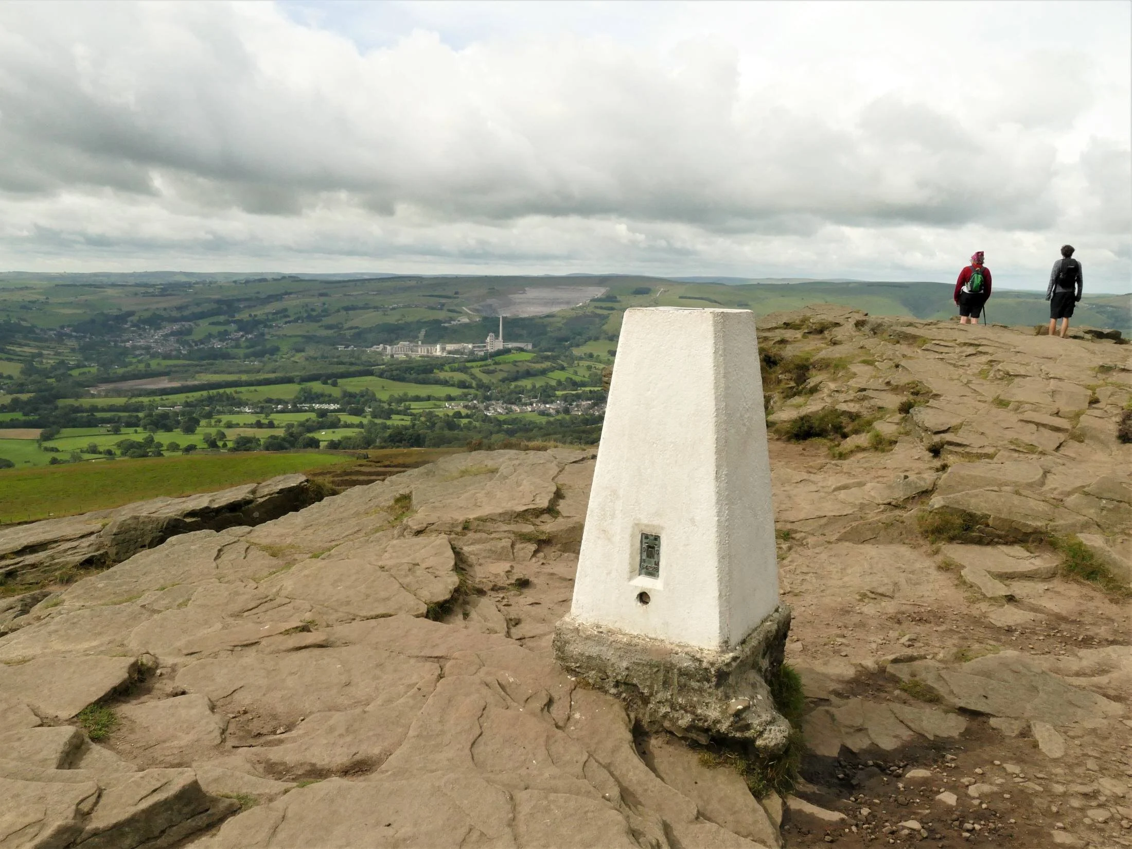
A day later, the sun shone and the situation was very different. No matter how earnestly the Cadw staff at Caerphilly Castle studied their daily booking list, whichever way they looked at it, they were fully booked. We were pleased for them and not really disappointed for us, as a do-it-yourself tour around the outside also looked like a very attractive option.
There are plenty of websites detailing the history, construction and development of Caerphilly Castle. It’s an interesting read, but for now we will just record a few key facts selected according to the Terroir view of the world. The castle is of course a significant player in Welsh/English border history, built in the 13th century by Marcher lord Gilbert de Clare (a good Norman name) to protect his domain from Llywelyn ap Gruffudd (a good Welsh name, and self-proclaimed Prince of Wales) who was marching steadily southwards from his North Wales stronghold.
According to various histories, including https://en.wikipedia.org/wiki/Llywelyn_ap_Gruffudd and John Davies’ ‘A History of Wales’ Llywelyn routed Roger Mortimer’s army in 1266, took control of a largish chunk of South Wales, opened negotiations with Henry III and, via the Treaty of Montgomery, became formally recognised as Prince of Wales, for a cost of 25,000 marks (5,000 marks extra if he wanted the homage of Maredudd ap Rhys of Deheubarth) in 1267.
Understandably, de Clare was somewhat rattled by developments and started building Caerphilly Castle in 1268. Davies comments, ‘one of the most remarkable buildings of the Middle Ages was constructed in order to frustrate [Llywelyn’s ambition]. That building was Caerphilly Castle, a symbol of the pride of the house of Clare and an abiding reminder of the strength of Llywelyn’s appeal to the Welsh of northern Glamorgan.’ Negotiations and armed attack on the castle failed, however, both with de Clare at Caerphilly and elsewhere in south Wales. Llywelyn had peaked and his tide of success was on the ebb. He defaulted on his annual tribute payments, his family turned on him, and, after a messy decade of fighting and feuding, Llywelyn finally met his end in December 1277. Caerphilly Castle was promptly transformed into a massive mansion with hunting lodge.
In 2021, it is still outstanding (literally) for both its size and its waterscapes, and skirting all of this pleasurably extends our walk. In terms of size, it is one of the largest castles in Britain, second only to Windsor Castle. Sorry Wales! There is a cunning little Cadw CGI video (https://www.youtube.com/watch?v=sNIvZl_K45M) which gives a curious raven’s eye view of the castle’s construction. The number of gates, portcullises and draw bridges is positively dizzying, presumably a reaction which was shared by the 13th century Welsh.


Caerphilly Castle doesn’t just have a moat, it has massive ‘water defences’, which seem to have been extended in peace time with the addition of a northern lake. Mown grass and large bodies of water are goose heaven, of course, and a huge flock of Canada geese mingles with a smaller gathering of greylags. There is a great gaggle of adolescent goslings piled up on a grassy slope like a teenage duvet which has come loose from its covering.


Follow the goose footprints around the castle and over a bridge (why swim when you can walk?) and you come to Canada goose suburbia, on the edge of the northern lake. Not a greylag in site but some of those fanciful Indian runner duck/mallard crosses are sprinting up a nearby slope. Should we be calling them delta runner ducks, these days…?


You can see why geese become so unpopular in many parks. Lush and varied grass/wildflower areas can go from this (below left) to this (below centre), when a hungry colony of Canada geese move in. With few predators, control can be tricky and unpopular with the human community. An integrated management system is often used including licensed control of adult numbers and eggs, fencing of banks and grazing areas (below right), and bank barrier planting. We assume this is what is happening here.


Turning a corner, a public walk opened up before us, sandwiched between walls of disproportionate heights - one to keep us out (on our left) and one to keep us in, or rather on, dry land (to our right). The view of the Castle was spectacular and duly appreciated, but the real eye catcher was the wall-and-mortar habitat which accompanied us all the way down our stony promenade.


This apparently inhospitable environment is home to an array of tenacious plants which can thrive in man-made structures like stone and brick walls. Drought resistence, a love of lime (mortar is lime based, of course) and a natural habitat in rocky areas are, understandably, an advantage, writes Terroir’s botanist. At this time of year, ivy-leaved toadflax (Cymbalaria muralis) is a real scene stealer (left) but the clumps of Pellitory of the Wall (Parietaria judaica), with their spikes of tiny flowers (right), are also putting on a brave show. For audacity, however, it’s hard to beat maidenhair spleenwort (Asplenium trichomanes) (centre). It was years before one member of Team Terroir realised this was a real fern, after receiving a sprig of it attached to a childhood Easter egg. Looking back, we hope it was a clever imitation but, regretably, we doubt it.


My favourite, navelwort (Umbilicus rupestris) aka pennywort, penny-pies or wall pennywort for obvious reasons, grows prolifically on the tall, shady, castle wall to our left.
Many of the other plants we encounter are less obviously linked with rocky or wall habitats, but are well known for their invasive qualities, able to gain a foothold at the base of the wall, where something akin to soil is starting to accumulate, and away from the destructive pressure of passing feet.


From left to right: a generous growth of ragwort (potentially poisonous to live stock which is not an issue in this location)
herb robert (Geranium robertianum), hunkered down with a dock and some pellitory of the wall
spear leaved willow herb (Epilobium lanceolatum)
and a sow thistle (Sonchus sp)

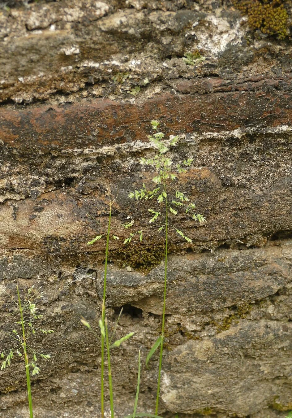

Grasses include, from left to right:
Yorkshire fog grass (Holcus lanatus), Smooth Meadow Grass (Filipendula ulmaria) and a rather blurry picture of sweet vernal grass (anthoxanthum odoratum), an important contributor to the equally sweet scent of hay
Llywelyn didn’t manage to do much damage to Caerphilly Castle but anno domini did. Enter the Marquesses of Bute: Marquess 1 bought the ruins in 1776, complete with leaning tower and, no doubt, plenty of dodgy masonry. Marquesses 3 and 4 were passionate about architecture and heritage and had also acquired an immense fortune from the south Wales coalfield. No. 3 set about clearing the urban sprawl which was encroaching on the site (Terroir has yet to find out what the inhabitants thought of this) but No. 4 may have become Caerphhilly’s hero with a massive restoration project from 1928 (Great Depression time) to the start of WWII, employing significant numbers of locals in both skilled and labouring activities. The perceived wisdom at the time was ‘keep as found’, but that was a mantra which the Butes had no intention of following! Finally, Marquess No. 5 gave the Castle to the State and further conservation work was carried out by the public purse in the 1950s and 60s. Now, Cadw has stepped into the shoes of some pretty impressive former owners. Thanks to Wikipedia and Cadw for help with this section. (https://en.wikipedia.org/wiki/Caerphilly_Castle and https://cadw.gov.wales/more-about-caerphilly-castle)
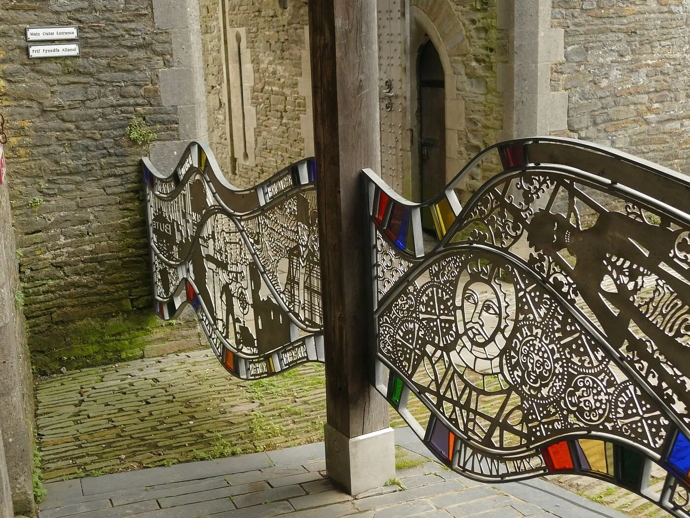
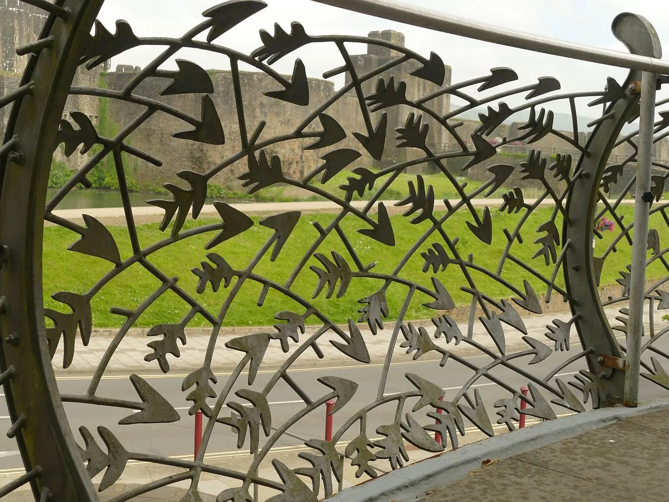
Finally, we are pleased to report that Cadw and Caerphilly have a sense of style, and a sense of humour. Here are:
Artist Rubin Eynon’s story telling gates (we were allowed to sneak in to get a better view of these functional, flowing, metal and glass structures)


Sculptor John Merrill’s figure of the fourth Marquess of Bute, propping up the leaning tower
and medieval fire power - as street furniture and as a rather dark health warning - and an easily recognisable local hero.


Tan y tro nesaf/Until next time.
A Flying Visit
Live streaming wildlife webcams have never dominated Terroir’s leisure time. We’ve always enjoyed, indeed marvelled at, BBC’s Spring and Autumn Watch and many other programmes and websites which use them, but we’ve never been hooked. All that changed last week.
On a characteristically damp and misty journey through Wales, we passed the Dyfi Osprey Project located off the A487 near Machynlleth. ‘Not the day for a visit’ we cried, ‘terrible visibility’ we exclaimed, as we slammed on the brakes, turned the car and headed for the car park.


Thankfully the project’s new visitor centre is welcoming, light, airy and, on a wet June day, warm and dry. The seating features recycled church pews and the staircase is enclosed by curved, polished timbers, reminiscent of a whale’s rib cage.


But the big question is, are we going to see any ospreys? On one side of the visitor centre, partially hidden but still very eye catching, are four enormous screens showing the intimate details of ‘Idris’ and ‘Telyn’’s family life, perched high on a nesting platform, somewhere out in the mist. We’re hooked immediately. The quality is excellent, the action live, the volunteer on duty informative, cheerful and enthusiastic. To hell with the weather! The view is much better inside.
The male, Idris, has already swung past with a fish, and the two chicks have been fed and have hunkered down. We are told that ‘Telyn is doing her umbrella imitation’, and has spread herself over her sleepy offspring to protect them from the rain. It doesn’t matter that we’ve missed the male, that the chicks are invisible, that the nesting platform is artificial and that we are far away in the warm and dry. It is nature in the raw and is utterly compelling.

Osprey’s have long been a conservation icon. I can remember as a child, having an RSPB jigsaw puzzle featuring an osprey (Pandion haliaetus) speeding across a watery surface, a fish firmly clamped in its claws. Today, Wikipedia and most wildlife conservation organisations have website pages devoted to these raptors, although amounts of detail vary.
As with many raptors, their extinction from the UK was probably complex. The Victorian hunting/fishing/collecting fixation must have taken a huge toll, including egg collecting, shooting for taxidermy (not just antlered stag heads on castle walls) and probably to prevent osprey predation on sport fishing.
The Wikipedia article (https://en.wikipedia.org/wiki/Ospreys_in_Britain) suggests extinction as a breeding bird in England by 1840, and absence from Scotland from 1916 to 1954, when a Scandinavian breeding pair rocked up at Loch Garten, in the Cairngorms, north east of Aviemore. The RSPB’s Operation Osprey opened to public viewing in 1959, and ten years later the Scottish Wildlife Trust reserve at Loch of Lowes (further south, near Dunkeld) was also supporting breeding pairs.
Other conservation projects have followed. The ground breaking project at Rutland Water (Leicester and Rutland Wildlife Trust) produced Terroir’s first off-jigsaw viewing of an English osprey. Pairs have been successfully breeding here since 2001. Other Wildlife Trusts’ osprey havens include Kielder Forest in Northumberland, (first breeding pair in 2009), the Dyfi project in Montgomeryshire (a breeding pair since 2011), the Lake District (Foulshaw Moss – first breeding pair in 2014) and Llyn Brenig (North Wales Wildlife Trust, first breeding pair 2018).
Life is still tough for opsreys however and it’s not just about rain and wind. The Llyn Brenig centre suffered a horrific act of vandalism in May this year when their nest platform was felled with a chainsaw. Other threats include contamination of birds with mercury and organochlorine pesticides, entanglement in fishing line and being shot while migrating across southern Europe – the birds winter in Senegal.

Which brings us neatly back to Dyfi and the need to debunk the romantic myth that these birds mate for ‘life’. The birds live independently through their Senegalese winters; if one doesn’t make it back to Northern Europe, then the pair bond is broken and another mate has to be found; this may happen quite frequently in any one bird’s lifetime.
When Nora failed to return in 2013 (see time line above, right), the Dyfi website (https://www.dyfiospreyproject.com/) tells extraordinary stories of violent, aerial, all female, ‘cat’ fights taking place over the lonely Monty. The winning ‘gal’, christened Glesni, had to fight again, the following year, to retain her pair bond. Would Monty have accepted a new mate, if Glesni had lost the battle? It all sounds so Thorn Birds, so Foresyte Saga.
As it had stopped raining we ventured out to tackle the board walk from the osprey visitor centre through the Cors Dyfi nature reserve, to the viewing tower. No ospreys visible of course, but plenty of surprises. The centre is located in the lush, damp, Dyfi valley, formerly a peat bog, then planted with conifers and now being returned to bog again. There is plenty of open water to provide provender for a nest of hungry osprey chicks, but wet scrubland, rushes, and water loving wildflowers also abound.
Wet scrub


Wild flowers, left to right: ragged robin, yellow flag, water dropwort and cotton grass


As we climbed the viewing tower steps we were caught by a tangible buzz of excitement and joined the - socially distanced – row of assorted bird enthusiasts watching a couple of young long-eared owls perched in the willows below. ‘That’s a real ‘tick’ for round here’, one said. The Reserve’s dense scrub seems to suit them well.
The other, big, surprise for us were the beavers. The reserve has started a - licensed and heavily fenced - beaver colony to help manage all that willow scrub which is holding back re-conversion to peat bog. Two beavers – father and son - arrived in March and recently the mother was added to complete their domestic bliss. We gathered that, as the colony grows, it is hoped to create further enclosures to spread the impact of these ‘ecosystem engineers’.
Beavers have been extinct in Britain for around 400 years, thanks to the fashion for beaver fur hats, for beaver meat, for a secretion they produce called castoreum and probably because they were also regarded as pests. The recent re-introductions of beavers have not been universally popular. As far as Terroir is aware, there are no intentional, free-roaming beaver trials in England and Wales (please correct us if we are wrong) although the River Otter beavers in Devon have, we understand, been given leave to stay after the results of a five year montoring period (again, updates appreciated).
We didn’t see the Dyfi beavers (obviously - see below, right), but we did discuss project security with one of the duty volunteers. It is important that they don’t escape and the Dyfi beaver fence is, we gathered, inspected very regularly. We were particularly intrigued by a complicated device which seems to involve apples and carrots and a web cam (Dyfi Project, please forgive us if we haven’t got this quite right!); apparently the beavers can be relied on to visit this free food source daily, thus providing an easy head count on a very regular basis!


The beavers deserve a blog in their own right. And, in comparison, it sounds as though ospreys have had it relatively easy.
Now, back to that webcam….

© Montgomeryshire Wildlife Trust, reproduced with permission Image captured 16/6/21
The Brylcreem Girls
‘Last chance to see herd of elephants in Chelsea’ read the headline on the Southwest Londoner webpage (https://www.swlondoner.co.uk/news/04062021-last-chance-to-see-herd-of-elephants-in-chelsea/). We had been watching the progress of this particular migration with curiosity and, as we had missed the elephants' crossing of the Mall, we decided to try our luck in London’s latest wildlife park on the Cadogan Estate, in Duke of York Square.

The great Mall migration © CoExistence
You have probably guessed by now that this Band of Mothers (elephants are strongly matriarchal) is not a trumpeting, earth-stomping, tree-rubbing, flesh and blood herd. But neither are they purely an artistic venture; they are part of an educational and ecological endeavour to raise awareness of wildlife conservation and problems of co-habitation between elephants and humans, all courtesy of ‘Coexistence’ (https://coexistence.org/about-coexistence/):
‘As the herd make their way around the globe, they will tell the story of our over-populated planet, the effect of human encroachment on wild spaces and the inspiring ways we can coexist with all the other living beings that make our world magical – from tigers and orangutans to nightingales and elephants.’
These elephants are made from a plant called Lantana camara, a native of Central and South America. It’s a member of the Verbena family, has numerous local names, including yellow sage, and is offered to British gardeners by a number of well-known commercial nurseries. It is highly toxic and has spread, not just to UK patios and conservatories, but throughout the world, where it
‘can outcompete native species, leading to a reduction in biodiversity. It can also cause problems if it invades agricultural areas as a result of its toxicity to livestock, as well as its ability to form dense thickets which, if left unchecked, can greatly reduce the productivity of farmland’. https://en.wikipedia.org/wiki/Lantana_camara So this not just about elephants, it is about habitat and humans, as well.
Below: the deceptively pretty flowers of Lantana camara


We had puzzled over the construction of these full size sculptures. In their press photos they look sleek, polished, and reminiscent of the wooden carvings which used to adorn so many side tables and mantelpieces. Close to, you immediately understand how verbena can create a tusker: basically they are just a herd of enormous wicker chairs. And, from the middle distance, the strands of plant material, stretched over a metal skeleton create an impression of carefully slicked back hair, held in place by vast quantities of gel – like elephantine Brylcreem Boys.


This is not to demean the elephants’ impact, however, and the sight of a full herd marching across Duke of York Square, or small groups loitering in corners of pedestrianised Chelsea shopping precincts, is certainly arresting and memorable.


On the other hand, their basket case construction and their location adjacent to high end market stalls and restaurants, renders them friendly, endearing and almost cute. Their press team may not have helped either: ‘experience them in all their glory and bask in the ambiance of Xerjoff perfumes made with ingredients taken from the jungles of India’. The air of Chelsea was warm and pleasant but, thankfully, we could detect not a sniff of either elephant dung or jungle perfume.

In their natural habitat, however, elephants are seldom described as ‘cute’. They are large, loud, and scary, and it is not surprising that the problem of integrating human and elephant needs is one of the big issues which Coexistence seeks to address. But ‘these majectic cratures’ are much more fragile that they look.
So, is this the best way to highlight the plight of these wild beasts?
London has already hosted a herd of Bronze elephant orphans, and there are other elephant focussed campaigns such as the Elephant Collective (https://www.therealelephant.com/) or the Elephant Family (http://elephant-family.org/). This blog has, however, already touched on the difficulties associated with single specie conservation, and the need for holistic habitat management to sustainably improve biodiversity (Blog 19, Walking the Line, 4th March 2021, butterflies as conservation emblems). Using large, furry or cute wildlife as figure heads for wider conversation initiatives may be very effective in the short term. Let’s hope it can also deliver on a long term and habitat wide basis.
In the meantime, however, if you fancy a gentle afternoon out with a herd of benign and creative elephants, then these Indian pachyderms are for you - enjoyable, soothing and a lot easier to get on with than the originals. If you decide to buy one, of course, it could be very painful on the wallet, but let’s hope, it will be in a thoroughly good cause.
And, by the way, the Chelsea pensioners seem to get younger everyday.
I Spy
Pre Covid, Terroir defined four criteria for determining where we wanted to live. These criteria were, in no particular order:
· Good transport links to make leaving (and coming back) easy! Tick
· Access to a lively city with plenty going on. Tick (in fact 2 cities within easy reach)
· Great countryside. Tick (lovely, long linear belts of the stuff)
· Near the sea – it takes about an hour to reach the coast from the current chez Terroir, so seaside is technically null points but not an impossibility.
Three out of four suits us pretty well for the time being.
With regard to our local countryside, familiarity has not bred contempt. A couple of days ago, we trialled anther local Slow Way (see Blog 29, on 13th May) and were embarrassed but also delighted to find that here was another walk which we had never tried before. We climbed the scarp face of the North Downs, turned round and admired the view.
Here are a couple of samples, the distant haze showing just how hot a day it was turning out to be.


As we contemplated the panorama, we started that conversation which is usually spawned by looking down on a familiar landscape from an unfamiliar view point. It went something like this: ‘Oh look, there is St John’s Church tower. Can you see that tower block? Where is the new school? Why can’t we see the railway?’
Here is a list of all the things we spotted. Can you find them?
13th century church tower, Victorian church tower
A Capability Brown landscape
Two motorways and a lot of railway,
Telecomms tower
Sand quarry and a landfill site
A high pressure gas pipeline (trick question)
1930s housing
1960s block of flats
21st century housing estate on former minerals site
20th century industrial estate, 20th century commercial ‘sheds’
21st century primary school
Answers below!
It is amazing what you can hide in a summer landscape. We will go back in the winter to see just how much a visual impact assessment is influenced by seasonality.
So here are the ‘answers’. This second set of photographs has zoomed in on sections of the view, panning from east to west. Terroir is standing on the crest of the North Downs chalk ridge, looking south across the gault clay below, to the Greensand ridge on the other side of the valley.

This is, pretty obiously, one of the two mortorways, in this case the M23 heading towards Gatwick Airport. For once we were unable to see the airport buildings from our viewoint and, as the aiport is pretty much closed, there was no flight traffic to indicate its whereabouts.

Next up is the sand quarry, tucked in at the foot of the greensand ridge. A hint of the 1930s housing can be seen at the western extent of the picture.

Picking up again on the tile roofs of the 1930s housing estate, we have moved west to the landfill site. At gound level, this seems like a veritable mountain, especially as it is so obvious now, in its white shroud, waiting for final restoration. From our viewpoint above it looks more like a water body. The fields rising behind the white mound are older reclamation works, from the area’s long history of Fullers’ earth excavation.

Now we move on the to the industrial estate - the collection of light coloured roofs to the right of the image - which is a suprisingly extensive affair of light engineering, car show rooms, vehicle repairs, interior and exterior building trades etc - bounded by one of the railway lines (so hard to see). The 21st century housing estate, just off picture, comes snugly up to its boundary.

Moving ever westward into increasing haze, we can just pick out the spire of the Victorian church on its wooded knoll, just under the skyline to the left of the picture. Here is also the paraphnelia of the local town looking, from this height, as though it lies in a woodland clearing. The block of flats (right of photo) looses its dominance when seen against the wooded hillside, but the 20th century commercial ‘sheds’ are very visible below. These latter lie adjacent to the main railway line, which is entirely hidden by the early summer foliage.

Moving form the 20th century sheds, you can just make out the blocky shape of the 21st century primary school just to the left of centre of the photo. The wedge of green sace to the right is an outlier of the Capability Brown landscape!

The North Downs are back in the picture now. Another railway line runs parallel to the chalk escarpement, but is impossible to see. Once renowned for its views of the Downs, the trackside scrub and tree growth is rapidly expanding, reducing vistas of the Downs to just quick glimpses - and hiding the railway itself from the views above.

And there is the telecomms tower, exploiting the North Downs ridge to provide signals to north and south. Less obvious, but there if you look carefully, is the spire of the 13th century church; a dark grey cone piercing the tree canopy, just right of centre on the photgraph.

Finally, we have swung full semi-circle to watch (and sadly listen to) the M25 carving its way up the North Downs escarpment to its highest point at 213 m above sea level.

And the gas pipeline? Well it goes under the view somewhere. When we had finished admiring the vista, we turned round to continue our walk and spotted the tell tale red topped marker over to our left.
The Darling Buds
This time last year, the ‘darling buds of May’ were unshaken by rough winds and were sunning themselves in our much appreciated parks and gardens. Terroir’s plot was full of weeds, of course, but also colour, butterflies and bees.
Mid May 2020


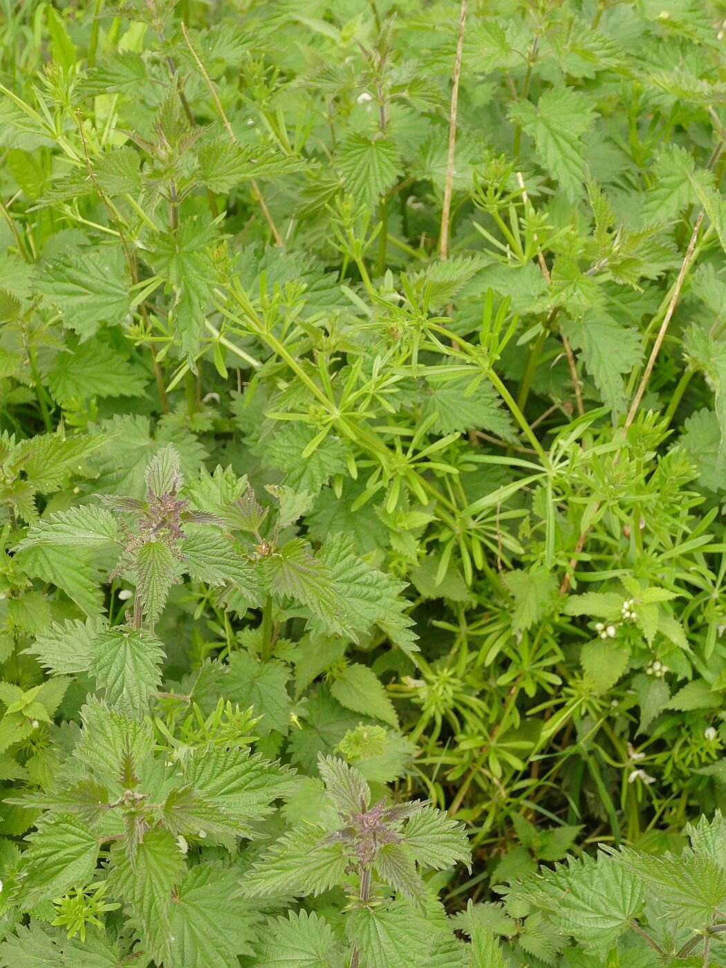
This year the garden is a wonderful fresh green, a delight to behold but distinctly monochrome and very damp. The aquilegias are providing spikes of red, blue and purple, the bluebells are hanging on, but the apple trees are so behind that one is still in flower and none have set fruit yet. Otherwise, it is a mosaic of verdant foliage. I have never seen such a gigantic crop of cleavers (Galium aparine). The bees are making the best of a bad job but the butterflies are few and far between. Too cold, too wet, too windy and garden development is seriously delayed. The photographs (above and below) make an interesting comparison - same plants but different years.
Late May 2021


This weather has also been a big factor in our (lack of) outdoor exercise, but now the rain has ceased and the wind dropped, it is time for another visit to the Moors (see 29/10/20 , 7/1/21 and 11/2/21 for the back catalogue of Moorish blogs). How has the weather impacted on our local wetland nature reserve?
The walk reminds us a little of those horticultural shows where size matters. Here we have the biggest shoals of cow parsley (seen below peeking over a railway bridge, almost as tall as Terroir), the tallest stands of dock spears and the widest ‘spades’ of burdock leaves that I can remember. The cleavers are pretty upstanding too but I still think that chez Terroir will win the cup for longest and fattest sticky willy (aka goosegrass, catchweed, stickyweed, sticky bob, stickybud and many, many more highly descriptive names).


On a smaller scale of leaf but larger scale of structure, the freshness of the tree foliage still allows the sculptural quality of the trees’ wooden skeletons to be admired. It will be a while yet before the ‘spring greens’ pass to the heavy, stately, dark greens of high summer.
Underneath the branches, the bluebells are overblown and fading but still manage a hint of that blue miasma which brings magic to every spring bluebell wood. Bedraggled forget-me-nots and self heal add to the blues, but there are just a few stands of red - or perhaps startled pink would be a better description - campion that suddenly pounce on you from behind a clump of grasses. The willow herb has a way to go yet in terms of height, let alone flower and last years dead stems (bottom row, left) indicate just what it has yet to do to match last summer’s blaze of colour. The garlic mustard and buttercups are irrepressible, of course, but the biggest surprise is a clump of daisies, raising their faces to the light and smiling like cheeky children at the shock they are creating by their presence.


The blackthorn has finished flowering of course but the guelder rose is holding up its lace cap flower heads like doilies on a tea tray (below, left). The hawthorn has also managed to bloom within its eponymous month of May. Did the ‘darling buds of May’ refer to the month or the hawthorn flower, and did Shakespeare consider May time to be summer? The answers to these questions are probably irrelevant as I’m pretty sure that a good rhyme was more important to Shakespeare than consideration of phenology or calendar. You try finding a decent rhyme for ‘June’.


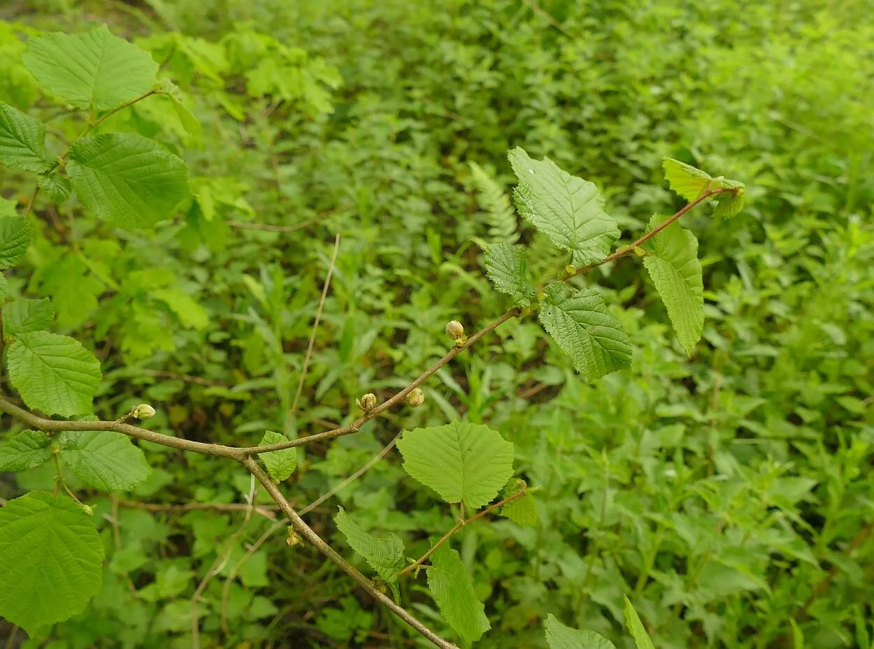
There are still some willow catkins but the alder and hazel have moved on and are quietly presenting the next generation of cones and nuts for whatever super-spreader (wind or animal) will be required to complete their lifecycles. There is excitement at the site of a young oak sporting what appear to be red berries, but which we assume are a type of gall. Does anyone know which sort they are?


The horse chestnut candles are bedraggled but finally blooming bravely. It’s at this time of year that the non-natives become obvious, in this case with a red blossomed horse chestnut tree. The American oaks, which also adorn the Moors, become distinctive in the autumn with their dramatic red fall colours.
As with the rest of Surrey, the ash is late and very hesitant. Whoever penned ‘ash before oak – we’re in for a soak; oak before ash - we’re in for a splash’ needs to define their time frames. We had a pretty thorough soaking this spring before the ash appeared, but if it refers to summer weather, then there is still time for the old saying to ring true. Ambiguity is so good for successful weather forecasting.


But, as usual, it is water which steals the show on the Moors. For those who are new to the blog, the Moors is a local, Surrey Wildlife Trust, nature reserve sandwiched between a railway line and a landfill site, and exploiting an exsiting brook and former sand and fullers earth excavations. It’s hard to read the former landscape in the riot of habitats which now abound here.

Inevitably the water level in the seasonal lakes and ponds is high, but the floods have retreated and the footpaths and cycleways are passable if muddy.
It’s easy to see the regular users here - walkers, dogs and cyclists - although the burdock is doing its best to obscure the prints and narrow the path.
The wetland vegetation is growing fast, although only the yellow flags have started to flower. On the lake edges there is space for the water mint to take hold and flourish before the reeds shade it from view.


The swans on the upper lake are watchful but there are no cygnets and their nest is now hidden in the reeds. A great crested grebe and a mallard (both males) are both showing off but there is no sign of their respective mates. We just can’t get a picture of the grebe with its ruff extended in full Elizabethan splendour, but the mallard is happy to give us a ‘daffy duck’ shot. The tufted ducks are absent but a couple of coots are on the water. All in all, though, it’s quiet on the duck front today. On the other hand, two juvenile cormorants are drying their wings, perched on the old fence posts which cross the upper lake, while a heron stalks the shadows.


Further upstream, a sodden meadow currently bears more than a passing resemblance to an 18th century English landscape park, in miniature. Not bad for an old mineral extraction landscape and a wet and windy spring!
.
Isabella Slade
There are times when only a walk in the Park will do.
And there are times when only a Royal Park will cut the mustard.
An ebbing lockdown is just one of those times and Richmond Park is just one of those open spaces. We started early, took our dog – no, no, wrong poem. We started early to find a parking space; already that adventurous idyll is fading, but at least our companion of choice arrived by bicycle.
Dodging speeding cyclists as we crossed Queens Road, we stepped out across the deer strewn grassland, under trees high-pruned to the exact stretch of a red deer’s neck, and skirted massive chunks of felled or fallen timber, which provide sculptural, dead wood habitats for what we hoped was a spectacularly diverse array of invertebrates. The cynic in me wondered if anybody had ever complained about the dead wood ‘scatter’, on the basis of it making the Park look untidy.


After an hour in a car, it was revitalising to re-orientate ourselves in parkland which extends over 2,500 acres (I checked this on the website and, yes, they do measure this enormous, 800 year old Royal Park in old money), located within 12 miles of St Paul’s Cathedral. Or, if you prefer, over 1,000 hectares of parkland within 20 km of the City of London. https://www.royalparks.org.uk/parks/richmond-park/
It’s the place to be in a pandemic. Charles I removed his court to Richmond Palace in 1625, to escape the plague, and enjoyed it so much that he enclosed the Park in 1637. As ever with enclosures, this move proved unpopular with the locals but pedestrians were allowed a right of access. It was this right, as well as our legs, which we were exercising during the current pandemic.
It’s still a heavily protected landscape although these days by legislation rather than the walls. It’s a National Nature Reserve, London’s largest Site of Special Scientific Interest and a Special Area of Conservation. This last is a European designation, which has been transferred across the Brexit enclosures to operate in England and Wales. But hey, this is supposed to be a rejuvenating walk in the park, not a history and politics lesson.
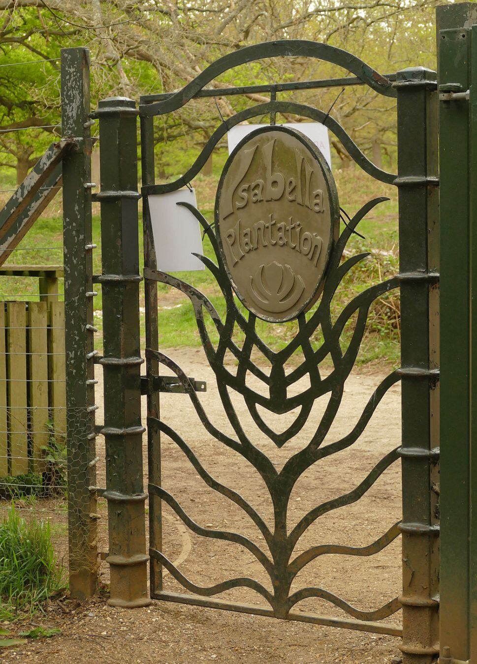
Today’s destination is the Isabella Plantation, a more recent ‘enclosure’ which, at this time of year, promises colourful therapy to senses jaded by lockdown and ‘stay local’ limitations. I suppose the additional plastic signs, on the back of the gate, are an inevitable part of Covid ‘road map’ life.
As a part of a Royal Park, I was imagining the eponymous Isabella to have royal connections, if only in the sense of a Nell Gwyn or a Lily Langtry. In fact, Isabella Slade comes from humble and geographical origins. At best, suggests the website, Isabella might have been a staff member’s wife or daughter, but the author obviously favours the corruption theory: ‘it is more likely to be a corruption of the word isabel, which was used as far back as the 15th century to mean dingy or greyish yellow - the colour of the soil in this part of the park‘. This is a definition new to Terroir but corroborated by Wikipedia (https://en.wikipedia.org/wiki/Isabelline_(colour)). And Slade? Apparently this part of the Park was known as ‘The Sleyt’ in the 17th century, a name used for ‘boggy ground or an open space between woods or banks. By 1771, it is shown on maps as Isabella Slade.’

By 1831, 17 ha (42 acres) had been fenced off, planted for timber with oak, beech and sweet chestnut, and renamed Isabella Plantation. A second makeover started in the 1950s, to create a damp, woodland garden. Large quantities of Rhododendron ponticum (that weedy thug of many British landscapes) were removed, and replaced with azaleas, more interesting and less invasive rhododendrons and a good range of other exotic trees and shrubs.
There are lots of interesting things to say about Isabella. She/it contains the National Collection of Kurume Azaleas, brought back from Japan by plant hunter Ernest Henry ‘Chinese’ Wilson in the 1920s. We also have to note that E H Wilson was born in Chipping Camden, on the other side of the hill to Ilmington, the subject of Blog 22, on March 25th.

Biodiversity is taken pretty seriously, it seems, and plantings of native flowering and berry bearing trees and shrubs grow alongside the exotic vegetation, to enhance the habitat for birds, bats and insects.

A Heritage Lottery Fund/SITA funded access project seems to have done wonders for paths, vegetation management and the wetland environment. All these aspects were delivered to a very high standard on the day of our visit. Even the rain held off.
Apparently there are some very eco-friendly toilets, but Terroir is not in a position to comment on these.
The plantation is regularly infested with Oak Processionary Moth (OPM), the hairs of which, IF TOUCHED, can trigger skin rashes and respiratory problems. Control is carried out by spraying with insecticide (the Plantation may be closed during spraying operations). We could spend quite a lot of time discussing the pros and cons of OPM control.
But
This blog is meant to be about spiritual refreshment, colour therapy, relaxation, an antidote to lockdown, tranquillity, a shared experience with nature and a friend.
Let’s go for walk.
The colour therapy:


The wetland - those skunk cabbages are just lapping it up:


And the Japanese Kurume Azaleas:

Feeling better?
Slow Ways
Maybe Terroir should adopt this as a slogan, as we have been rather slow-moving in picking up on the Slow Ways project. In case that goes for you, too, I’ll tell you what we know about it so far.
If you go to the project website https://beta.slowways.org/ you may be somewhat phased by the Home Page which hits you between the eyes with a nodal and very purple matrix which looks more like a protein network than an invitation to amble across Britain! Each node is a city, town or village and the aim is to connect them by creating a unique network of walking routes. Wheels are allowed, but only if they belong to a wheel chair or children’s buggy.

‘Using existing paths, ways, trails and roads, people can use Slow Ways routes to walk or wheel between neighbouring settlements, and combine them to create longer distance trips. It’s designed to make it easier for people to imagine, plan and go on walking journeys.’
As far as we can see, it is the brain child of Dan Raven-Ellison, self-styled ‘Guerrilla Geographer and Creative Explorer’. He is also keen on ‘wild cities’ and creating a London National Park. Neither of these concepts are new, of course, but if DR-E can raise the profile, speed things up, change attitudes – and find the funding – then we are all for it.
Raven-Ellison writes that, in February 2020 lockdown, a group of 70 people were mobilised to test the Slow Ways idea, followed by 700 to plot a first draft of the network. We assume this was a desk study, based on mapping provided by one of the project supporters, the Ordnance Survey (OS). By the winter of 2020, ‘80,000 people [had] registered to help walk and review routes’. That number continues to grow and, by May 2021, included Team Terroir.
Why did we join up? At first glance it seems like a tremendous idea: mobilising a huge army of volunteers to identify routes which will connect communities and encourage walking over driving, just as we were encouraged to do during Covid: roads were empty whereas green space and countryside honeypots were heaving. We desperately needed to encourage people to explore footpaths, spread the visitor impact more widely and enjoy it at the same time!


But Terroir wonders if there may be downsides. This is from the BBC, on the subject of the Slow Ways project (https://www.bbc.co.uk/news/uk-54562137), last October:
“Would you know the best way to walk from Leeds to Manchester? From Tring to Milton Keynes, or Carlisle to Inverness? If not, then you're not alone.
We live in a time when our phones will show us the quickest route to almost anywhere - if we are driving, that is. Walking? Well, that's a different matter.”
As a point of accuracy, BBC, any decent mobile phone App will tell you how to walk from T to MK, but what it won’t show you is a pleasant route via footpaths and countryside, which is what Slow Ways is all about.
On the other hand, why would you want to walk from Tring to Milton Keynes (a 7 hour, 20 mile walk) when you can walk from Tring to a pretty part of the Chilterns? Or, if you want a long walk, what’s wrong with the 134 mile long, circular Chilterns Way? Wouldn’t an app or map which showed you the best walking route from Tring to the nearest bit of a Chilterns waymarked footpath, be more popular?
After a career in landscape, I am no longer surprised by the number of people who struggle to interpret maps. Most of us learn to read words and many read music, but how many of us are comfortable with plans and cartography? Will replacing an OS map with a purple Slow Way map make walking any more accessible? Those of us who love and already use maps can plot our own routes, whether from community to community, or to/though an attractive piece of countryside.
I hope I will be proved wrong and any comments from Slow Ways will be very welcome at the bottom of this blog. If no comment box is visible, click on ‘read more’, scroll down the blog again (sorry) and put me right.
Earlier this week, Terroir set out to walk our first Slow Way. It is called Redgod One, and links Godstone and Redhill, in Surrey. Both ends can easily be accessed by bus, and the Redhill end has a decent train service. We’re not born techies, however, and we found the website clunky and the route map download difficult, so we worked with a combination of mobile phone data and – guess what – a comforting paper copy of the relevant 1:25,000 Ordnance Survey Map.
We thought we were out for a general, Slow Way experience, but soon discovered that the project is still very much at the pioneering stage. By signing up for the Slow Ways website, you can take on a number of roles, including ‘review’, ‘verify’, ‘survey’ and ‘add a new route’. In retrospect, I think our five mile walk will trigger all these activities. We also now know that Redgod One’s theme is the Surrey sand extraction industry. Perhaps it should be renamed Redsand, or Greensand, or RedsandGod. Please see Terroir’s first ever blog if you want to know more about Surrey and sand.

We started in Godstone. In good times, Godstone is blessed with an extraordinary number of pubs and cafes, some interesting architecture, at least two ponds and a well-used village green. Even in bad times, it boasts public toilets, although so poorly lit that an in depth review of the facility is not possible. Our walk commenced by traversing the aforementioned village green. There followed Redgod One’s first and only encounter with a busy main road, which immediately threw up a route amendment: the footway on the northern side of the A25 offers a marginally improved experience, with a slightly safer road crossing, compared with the one suggested by the Slow Way route. Good: our morning is already providing some positive feedback. Oh, and somewhere on our right is our first sand quarry, hidden behind a strategic tree/shrub belt.


Redgod One - the Godstone end. Left: our personal starting point - bus stop, public conveniences and one of the pubs Centre: another pub! Right: village green and pond


Cricket has been played in Godstone since 1749 and is memorialised by this poignant sculpture: from one view (left) you see a cricketer, from another view (right) a first world war soldier.


Left: our Slow Way took us diagonally across the Green from the pond at one corner (out of shot to the right) to (Right): the A25, just as the road leaves the village and heads off westwards towards Redhill


From left to right: here is the southern side of the RedGod route along the A25; although it has a fine crop of Arum lilies, it is sigificantly less pleasant than the elevated northern foot way, which leads us to our escape route to rural byeways
After a bearable 250 m we are off the A road and enjoying a sandy footpath.


Left: the quarry is relatively unobtrusive, behind its boundary fencing while Right: at our next path junction, the sand wagons are substantial and rather obvious! At this point, Redgod One, takes us left, away from these juggernauts. But please read on!
Not long, though, to the first major shock of the day: Redgod One’s purple line ignores the public right of way, clearly shown on the OS map, and careers into inaccessible sand-quarry-land (below left). We skirt decorously round on the bridleway (below right), screened from quarries and a golf course by massive hedges both new and old. It’s like walking down an ornamental allée in an English garden.


Emerging from hedge-dom, we glimpse a sheep strewn restored quarry and pass into the world of Brewer Street – a hamlet of varied but interesting architecture, much now re-imagined as residential property, small business units and wedding venues. To our right is a sandy plain, as yet unexcavated, a scatter of farmsteads and some seriously big houses. Sandy Lane, Water Lane, Lake Farm, Place Farm offer insights into former features, wet and dry.


Through undulating farmland and substantial mansions we approach the M23, where an enormous underpass allows access for the likes of us, but also for the likes of combine harvesters, removal pantechnicons, quarry lorries and every other sort of large vehicle which a road engineer could possibly imagine.


A hundred metres later and we have found the edge of the known universe. All maps indicate a footpath cross roads, but we are stymied at a new T junction, with a healthy grain crop ahead of us and a suspiciously new finger post with no onward option. The flat land ahead of us is now a quarry margin and we must skirt round the field, cross a new quarry access road, and follow a new (although perfectly pleasant) path to meet Cycle Way 21, as it winds its way between new quarries, old quarries, landfilled quarries and restored quarries. It’s all much nicer than it sounds, with a popular inn, cricket ground, a country park with a sailing/fishing/wildlife lake - and many more farm buildings converted into residential use.


Left: a diversion with new quarry buldings just visible in the middle distance. Right: the new peripheral path, neatly machined into the field edge.


The new bits of infrastructure…


… are stitched to the old
Round one more corner and we are all on familiar territory as Redgod One lurches into Redhill via the Moors (please see blogs 1, 11 and 16 for details). No route changes are required here, although the landfill to the east of the path rises inexorably towards the sky.


So now ‘all’ that is left is to start working on our route review, verification, survey (with photographs) and ‘add a new route’ form. I can see why walking and map loving volunteers flock to do this sort of work. We’ll let you know how we get on.
A good grouse?
Are we too grumpy? Maybe we all need to get out more.
Last summer, when we could (get out more), we spent some time walking in the Derbyshire side of the Peak District. I hasten to add that these were legitimate walks, although we did keep a sharp lookout for the Derbyshire Constabulary and for lagoons which had turned a suspicious shade of black. Little did we know that carrying a takeaway coffee would later become an icon of Derbyshire lockdown bad temper and an extreme interpretation of recreational rules.
What is it about Derbyshire which puts people out of sorts? We are certain that the Derbyshire community, as a whole, is not to blame. We know for sure, however, that areas of beautiful, dramatic and inspiring landscape such as the Peak District or the Lake District create intense human passions – often about protection, conservation, access, management and policing - which may polarise views and create adversarial situations.
The 1932 mass trespass on Kinder Scout, which drew support from both sides of the Pennines, is a classic case in point. The fact that it took a further 80 years to pass legislation which allowed any form of open access to landscapes such as these, is enough to make anybody irritable. We refer, of course to the Countryside and Rights of Way Act 2000 (the CROW Act). Even the National Parks and Access to the Countryside Act 1949, which recognised the significance of these landscapes, if not of universal access, had to wait 17 years to reach the statute book, after a gestation period which included WWII. The Peak District was the first National Park to be designated, and this year sees its 70th birthday. But not even this anniversary seems sufficient to create universal joy and good will to all.
As an example of some of the issues which make landscape management so ‘interesting’, and defusing conflict so important, we will take a look at some of the walks which we enjoyed so much last summer. There was considerable debate between the three of us who took part but not, I am pleased to report, a single cross word. Do I hear laughter in the background?

Ladybower Reservoir and Win Hill
Let’s start off by being petty: nice bit of traditional waymarking but the plethora of roundels makes a bit of a nonsense of the ‘Public Footpath’ message!
More seriously, did they really need to mow the down stream slope of the reservoir dam in the monocultural, English garden style? It seems possible to accept a more diverse and sustainable ground flora beneath the scrub and bushes on the left of the photo, and around the photographer’s feet.
We’ll pick up the non native coniferous planting later.
Ladybower Reservoir was constructed between 1935 and 1943 to quench the thirst of the expanding industrial towns surrounding the Peak District. The long, deep valleys of the rivers Ashop and Derwent, the high rainfall and low popuation, made the area seem ideal for water storage. The population was not non-existant, however, and two villages, Ashopton and Derwent, were flooded and their population moved to an estate downstream of the dam. They must have found it galling to discover that ‘Derwent's packhorse bridge, spanning the River Derwent … was removed stone by stone to be rebuilt elsewhere as it was designated a monument of national importance’. And that, ‘The church spir' was left intact to form a memorial to Derwent. However, it was dynamited on 15 December 1947, on the rationale of safety concern’. https://en.wikipedia.org/wiki/Ladybower_Reservoir
Of course, after WWII, the attitude to planning and infrastructure changed significantly. In the 1950s and 60s, the plans for the Llyn Celyn reservoir in Gwynedd caused deep controversy. Despite the degree of protest, the village of Capel Celyn and its valley, located in a stronghold area of Welsh culture and language, was flooded to provide water for the - English - city of Liverpool.


Do people grouse about Ladybower today? It is a large of expanse of open water, beloved by thousands of tourists. But - parking and traffic creates a management nightmare. It provides drinking water, but access to the reservoir is controlled with limited recreational uses including no swimming (potentially hazardous). Architecturally, it is imposing and technologically, interesting. It looks wonderful when full of water, much less so in a drought, and probably a potential nightmare to manage access when the water level is so low that you see the remnant village.
Let’s move on to the top of Win Hill and look at the view.

Oh look - lots of issues here! On the plus side, there is no one else around, so those of us who love getting away from it all are very happy. But we did get up early to achieve this. We don’t see this as a problem, however. Self-managing the timing of our access to potentially busy areas is part of the challenge.
But obviously, lots of other people have been here and the photo hints at the erosion that all those walkers have caused. In the early days of the Pennine Way this was a serious problem, and much of the route has been paved to overcome the ‘sea of mud’ crisis. This is a sensible solution, which increases access but does diminish the wilderness feel. I was worried during our recent wet winter that the ‘sea of mud’ look created by a lockdown population desperate to get out and keep sane, would bring out the worst in our open space managers. What a swell of pride when the response was basically, ‘don’t worry, keep coming, we’ll sort it out later’.
And the view? What’s that lurking in the distance, sporting a high chimney and a massive quarry? It’s the Bredon Hope Cement Works, with the village of Hope nestling in the Valley below. The up side? It all started in the late 1920s, long before planning legislation and the designation of the National Park, but environmental control is much stricter now.

Lots of the finished product goes out by rail (left), so minimal impact on road transport.
Provision of local employment - Bredon says the company is ‘the area’s largest employers with the majority of the 200-strong workforce at Hope living in the Peak District’ and that they employ a ‘diverse range of people’. https://www.hopecementworks.co.uk/about/
Down side? Big energy user and lots of CO2 goes up the chimney. Damage to visual amenity? You decide. At this distance, we thought it rather interesting and a demonstration of geography in the raw (the plant is here because the required limestone is here). Living next to it, may produce a different answer, however.
Don’t like it? One of the great 21st century challenges is finding alternatives to, in this case, building materials, to reduce negative impacts. On delving deeper, alternatives can often be worse than the existing situation. Ingenuity essential.
Thanks to Wikipedia for some help with the above. https://en.wikipedia.org/wiki/Hope_Cement_Works

Strines Moor and the real grouse.
Grouse moors: where to start. So many issues, so many points of view.
Shooting and grouse moors were a big part of the original Right to Roam debate. The few owned vast acreages of moorland and denied access to the many. It was still an issue in the CROW Act which does allow for short term closures of open access land to allow for shooting.
You could devote a whole blog to intensive grouse shooting and grouse moor management and indeed Terroir was planning to do this until we came across Guy Shrubsole’s blog post on ‘Who Owns England?’ https://whoownsengland.org/ Do read his January post, entitled ‘The Climate Sceptics Grouse Moor’ which, although a diatribe against one particular moorland owner, gives an overview of some of the issues. Read all his links too, to get a view of both sides of the argument. Both the hunting and shooting orgnisations and the environmental press argue lucidly for and against intensive grouse shooting.
Here is a quick round up of the main issues. We have already mentioned access, so we will move onto the management debate. Rotational cutting, burning and draining of grouse moors is standard practice. If cut back, heather re-grows until it becomes ‘over mature’ - tall and leggy - when, if cut back again, it will restart the growth cycle. Each part of the cycle has its ecological advantages and so it is not uncommon, on any form of heathland, to cut areas on a rotational basis and try to mimic former and traditional management via grazing and burning.


Above - classic pictures of rotational cutting of upland moorland for grouse shooting. The patterns are wonderful and I would happily upholster my sofa in something based on this, but the ecological implications are less appealing.
Grazing and burning of lowland heaths, often in urban areas, is not really attempted any more for reasons of livestock welfare and control and, for burning, for reasons of pollution, and burn control, particularly in areas heavily used for recreation. On upland moorland, the substrate is often peat, which puts a whole different perspective on the matter. Peat is regarded as an excellent carbon store and burning and drainage is seriously damaging to peat. Strines Moor is classified as Upland Heath (https://magic.defra.gov.uk/MagicMap.aspx) which means peat depth may be limited to ‘only’ 50 cms deep, but there is plenty of blanket bog in the area, and the name is an excellent description.
Of course, species conservation and biodiversity is also part of the debate with game keeper and ecologist fighting it out on who can best conserve and manage heath and bog vegetation, ground nesting birds, raptors, butterflies and … . You get the picture.

Tree planting is the other ‘Big One’, which must be discussed.
Deciduous woodland beside Ladybower Reservoir
One of the big upland debates centres on trees. Visitors love the windswept uplands, with their stunning views, ‘wilderness’ experiences and complete contrast to an urban and often industrial home environment. The Forestry Commission loved the open uplands for their unobstructed tree planting options. Don’t forget that the Commission was set up in 1919 after the terrible experiences of WWI, to provide a strategic resource of timber, should such a conflict ever re-occur. Of course, it did re-occur but by 1939 the new plantations were at best only twenty years old and even the fast growing, non native conifers were not of a size or condition to deliver.
Post war, support for planting non-native and non-local timber conifers continued with a mix of enticing tax breaks for those owning large estates, and a range of grant funding. In my view the economics never stacked up, but the promise of jam today more than compensated for the lack of jam/income at maturity and felling. Criticism of the visual impact of the sitka spruce farms and of damage to biodiversity and native habitat became increasingly vocal. To encapsulate over half a century of grumpiness into one sentence, changes were made in planting design, management and species choice, and the governmental approach shifted to include access and nature conservation as prime objectives along with timber production. The grant forms became harder and harder to understand/complete, so just about everyone had something to moan about.


With increased understanding and awareness of climate change, the whole tree planting thing shifted gear once again. Here is a flavour of some of the issues (it’s extraordinarily complex, so please don’t expect a comprehensive run down, details, or academic verification). Trees absorb carbon as they grow, but they grow very slowly. Alternative carbon sinks are available. Managing woodland to create a continuous supply of fuel might be close to carbon neutral, but wood smoke contributes to air pollution and we are already banned from burning ‘wet wood’ (more than 20% moisture content), please note if you own a wood burning stove. Mass tree planting can do more harm than good and this is a serious issue. We were incandescent over an episode of BBC’s Countryfile, which appeared to be supporting mass planting of a single non-native conifer, in Northumberland. I thought we got over that approach last century.
Tree planting will be and should be one of the pieces in the carbon control jigsaw but, as with peat, it’s not as easy as it looks. Tree planting must use appropriate, preferably native - and locally native - species and mixes, or our wildlife and ecology will be sunk. It must also take into account other landuses and habitats, which may actually be more valuable than new tree planting - yes, really - otherwise our ability to sustain, diversify and also feed ourselves will be significantly damaged. It must be in an appropriate place in the landscape, taking into account our love of the hills, views, access, and the needs of human beings, or our history and society will go down too.
To do all of this, we must have appropriate leadership, support and guidance from our government and its advisers. We must learn lessons from the Corona epidemic. And we must do it on a global scale.
End of rant, but it is rather important.
Pond Life
If last week’s blog discussed the environment of Thornton Heath’s present day fishy experiences, then this week’s sequel will focus on a historically watery habitat. We are going from Thornton Heath’s fish shops to Thornton Heath Pond. We will return, via a new open space opposite the station, to complete our circuit.
The maps included in last week’s post clearly show that, in the 19th century, the heart of Thornton Heath lurched eastwards, from the original hamlet around the Pond to the station, and then beyond again to the newly-created, semi-circular High Street. The pulling power of the Victorian railway system was, in all senses of the word, vastly superior to the speed, comfort and carrying capacity of the Victorian road system. Today, of course, road transport is favoured, but it also delivers a significant, negative environmental impact. Thornton Heath High Street, originally a product of train travel, appears to have responded well to regeneration works but what has happened to the road transport dominated ‘Pond’?
It is a good mile from the High Street to the Pond so, after our exploration of Thornton east, we save our legs and take a bus to go west to the Pond. To be honest we got the wrong bus so come upon Thornton Heath Pond from the south rather than from the east.

Approaching Thornton Heath Pond along the old London to Brighton Road you cannot but believe that this vast gyratory will be a polluted, noisy, dusty, litter-strewn, cracked paving, broken tarmac-ed, and unpleasant experience.
© Google Maps 2021

To reach the centre you have, by necessity, to cross busy roads. Threading your way over a traffic ‘skerry’ (island is too comforting and romantic a word) with an untidy growth of poles supporting traffic lights, signposts and cameras, it is at best uninspiring and at worst confusing and downright depressing. The only nod to local identity – a kind of low, urban, metal hurdle adorned with golden baubles and announcing ‘ornton Heath Pond’ - has already been adapted to carry the modern equivalent of fly posting.
Emerging on the other side, there is another scatter of vertical elements and lumpy skerries but the impact is both surprising and altogether more pleasing. Dimensions, materials, spacing and sight lines have created a sense of arrival and of calm. Who would have thought that the centre of a roundabout could become a destination, a place to sit in the sun, a place to watch the shadows etching patterns on the ground, a place to admire the daffodils, tulips, new leaves and blossom. One of the boulders even turns out to be a Croydon Stone.


The remnant of the pond lies at the other end of this almost-bean-shaped traffic island. A path, delineated by low brick walls, offers a pleasant promenade down into the grassy bottom, which is itself edged by further walls or vegetated banks. It doesn’t take much to imagine it full of water. Considerable efforts have been made to decorate the walls, and the perimeter trees on the ‘banks’ provide structure, shade, interest and significantly dilute the impact of the circling traffic (although I might not be saying that during a wet and non-Covid rush hour).


Some would say that the perimeter banks, the planting areas and even the grassed area within the ‘pond’ itself are neglected and weedy, but in spring time we find them totally inoffensive, indeed a real bonus for a heavily urbanised area of south London located in the centre of a roundabout. The impact of a wide selection of native wild flowers, all blooming, all self-generating in their rough grassy matrix, gave enormous pleasure. We logged red dead nettle (Lamium purpureum), groundsel (Senecio vulgaris), dandelion (Taraxacum officinale), shepherds purse (Capsella bursa-pastores) chickweed (Stellaria media), daisy (Bellis perennis), forget-me-knot (Myosotis arvensis or similar garden escape!), yarrow (Achillea millefolium), buttercup (Ranunculus acris) and an umbel which the photographer slipped in without identifying…).
We will revisit later in the year to see how this landscape copes with other seasons.


Also on the plus side, I did find subtle evidence of maintenance. The path edges had been cleared, trees maintained, and there was precious little litter. An extraordinary range of people were either walking though or sitting and enjoying the sunshine and the delights of such an unusual open space. Even the noisy bunch of young men who turned up to sit on the walls were soon relaxing, quietening down and generally merging into the magic of the environment.


Perhaps the lonely, off-centre, tree-less, commemorative planter fails to make the grade. Perhaps the place is a nightmare in the dark, perhaps …. But on that day, in that weather, at that time of year it was an extraordinary, surprising and pleasant experience.
But there is another open space we need to visit before we take the train home.
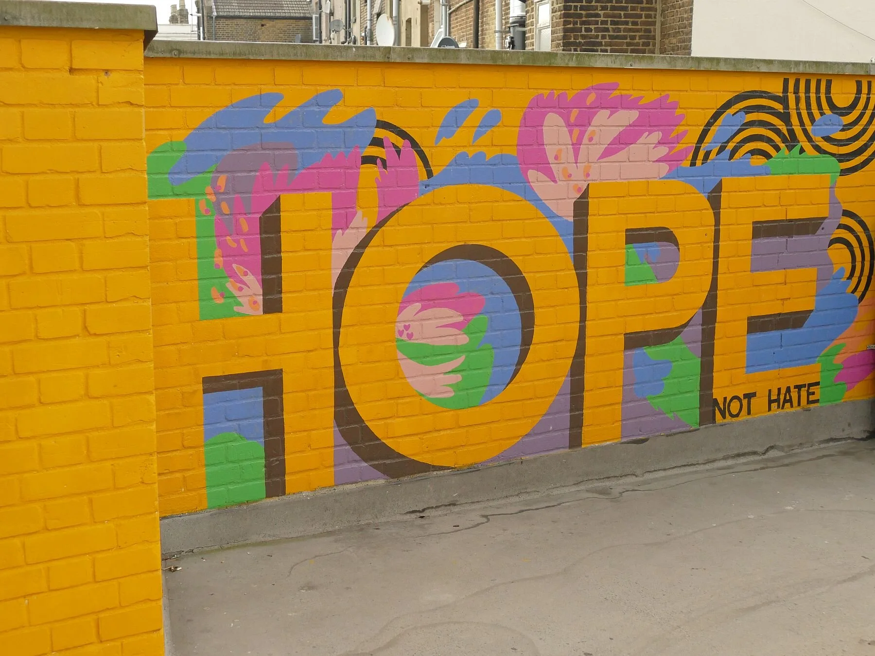
Walking up Brigstock Road from Pond to Station we pass more street murals which do exactly what they are meant to do and reinforce our upbeat mood.


Opposite the station, we come to Ambassador House. We will let the Thornton Heath Chronicle (online edition, 28/10/18) make the introductions:
‘The iconic Thornton Heath eyesore Ambassador House is being squatted by a collective of artists, The Chronicle can exclusively reveal.
The group of five have taken over the vacant building which has been empty since it was bought at auction in October 2012 by Red Wing Property Holdings Ltd … .
The group wants to open up the redundant office space to the community and has begun putting in place precautions to meet health and safety requirements as well as setting up an account to pay for the utilities.
Ambassador House was was[sic] once a busy hub, with offices used by CALAT, the Met Police, and Croydon council.’
How interesting. But back to the Thornton Heath Chronicle online (6/12/19):
‘Last year the council launched a competition to transform the Ambassador House forecourt.
A year later this is the result – a mural and and an unfinished garden. …
Following the announcement of the winners, a collective of architects, public consultations were held resulting in a grand design. A mural was painted and then months spent creating a garden by the bus stop which is full of weeds …
Then out of no where the forecourt was back in the spotlight. The council had done a deal with Timberland as part of its Nature Needs Heroes campaign with Croydon rapper Loyle Carner declaring plans to green up the area. The forecourt was cordoned off and transformed in to a trendy venue with marquee and a concert stage and the public hurriedly invited on a week day to look at the plans, though to the untrained eye looked much the same plans. …
The latest date to install and launch the square is April 2020. Watch this space!’
So we did watch this space and this is what we found.


It’s bright, it’s fun, it’s brash and in your face. It’s so much better than a weedy bus stop. It’s also lunchtime. Where are the people? It’s pretty much empty. It’s long and thin, and feels tight, small. To us, back from the sunshine over Thornton Heath Pond, it feels drafty, lacking focus and depth. We are probably being very unfair; It’s probably heaving in the sunshine, on a weekday, when there is an event on, when the shops are open. But today? It lacks the spontaneity, the people, the nooks and crannies of the Pond. It feels more like a thoroughfare than a place to linger. The Pond was obviously used as an access - it’s in the middle of four major roads for goodness sake, and walking through is a far pleasanter experience than walking around - but it also felt like a place where you could ‘dwell’ for a moment or for a while.
So, sorry Ambassador House. We want to pick up a wrap or a samosa from one of those exciting shops in the High Street but its too far in the wrong direction, so we’ll find something in equally multi-cultural Broad Green on our way to East Croydon Station. This space is too well-tailored, too sterile for our current needs. Espeially when the station building, wrapped in scaffolding, can’t contribute anything to the street scene either!
So we will bid you farewll with a taste of some of Thornton Heath’s best banners.


An uproar of amazingness
Fish for supper? Fancy a surprising south London suburban stroll? Welcome to Thornton Heath.
The reason we went to Thornton Heath was to look at some art work at the station, of which more later, but having arrived by train it seemed churlish, and unlike Terroir, to go home after just viewing that mosaic on platform 1. So we climbed up to the High Street and spent a few hours exploring the wider suburban landscape. It’s quite an eyeful.

St Alban the Martyr’s Church
Building started in 1889 but contined in stages until 1939. It is listed grade II
Architects: William Bucknall & Sir Ninian Comper
But let’s start by going back a bit. In case you don’t know, and that may be quite a lot of you, Thornton Heath is in south London, just to the north of Croydon. One of the better known local landmarks is Thornton Heath Pond, not because you can picnic or feed the ducks there (you can’t) but because of the adjacent bus depot and the number of red London buses which carry ‘Thornton Heath Pond’ as their final destination. But it does sound delightfully rural, atmospheric and a worthy - if somewhat mythic - destination, just like the Purley Fountain, to the south of Croydon. And, just like the Purley Fountain, Thornton Heath Pond, is now the centre of a very busy roundabout.


In August 2018, the Croydon Advertiser asked the inevitable question, ‘Why is there no water at Thornton Heath Pond?’ (https://www.croydonadvertiser.co.uk/news/croydon-news/no-water-thornton-heath-pond-1939675). Part of the answer went as follows:
‘Centuries ago, before the busy roads were built, Thornton Heath actually was a heath. Acres of common land stretched across the area, and the ancient grazing land was used by Medieval farmers to feed their animals.
Their livestock could also take a drink at the watering-hole at the heart of the heath which would later become the eponymous Pond.
The area – now part of London's most populous borough – was once a rural and isolated spot.’
The London to Sussex Road (now the A23 London to Brighton road) also passed by the pond and is probably the reason the area became famous for highwaymen. An interesting Wikipedia article (https://en.wikipedia.org/wiki/History_of_Thornton_Heath) suggests that Dick Turpin was associated with the area (via a local aunt - families, eh?) and that a ‘plot of land at the Pond became known as Hangman's Acre. Immense gallows loomed on John Ogilby's Britannia maps of 1675, and were still present in a later edition in 1731.’ The account goes on to suggest that in the 17th and 18th centuries Thornton Heath was ‘a desolate valley with lonely farmsteads sheltering desperate outlaws, with the hangman's noose the only recognised authority.’
The other local activity of note is commemorated by Colliers Water Lane, a local street name which still exists, and whose origins were linked to the romantic sounding Great North Wood. Remember, however, that this area is culturally both the south of England and ‘south-of-the-river’, so that the Great North Wood didn’t even get to Watford, but stopped abruptly on the south bank of the River Thames. The Colliers were charcoal burners who, according to the Wikipedia article, burnt timber from the Norwood Hills, using cooling water from the adjacent Norbury Brook. The concept of ‘north’ must have had a deep psychological impact on Croydon and the south. Wikipedia continues, ‘Smoke and high prices made the Thornton Heath colliers unpopular. With their dark [presumably in the sense of grimy?] complexions, they were often portrayed in the popular imagination as the devil incarnate.’
Back to the Croydon Advertiser: ‘In the early 19 century the well-to-do started to build their grand houses along the London Road [or, as William Cobbett described them less politely, ‘stock-jobbers’ houses’] , and the village surrounding the pond began to attract tradesmen.
New tastes and wealthier citizens led to the one-time watering-hole being given an upgrade – formal railings were installed to circle the water-feature, which became the decorative heart of the area.’
What the Croydon Advertiser forgot to mention is that, prior to the 19th century ribbon development, the land surrounding Thornton Heath had been enclosed (in the 1790s), and had become a landscape of small fields, farms, woodlands and the occasional orchard; no doubt very bucolic but enclosure meant that the control of the land would now have been in the hands of a very small number of people.
With the development of the Surrey Iron Railway (Croydon to Wandsworth section) in 1803, and the Croydon Canal (Croydon to New Cross via Forest Hill), in 1809, both passing close to the south of Thornton Heath Pond, plus the existing importance of the London to Sussex road, probably made investment in the Thornton Heath Pond settlement an attractive proposition. Instead of agricultural improvements to his newly enclosed fields, a beneficiary of the enclosures, one Thomas Farley, ‘converted allotments of land and sold them as freehold property. As a result, by 1818, the hamlet around the Pond had become a considerable village containing 68 houses’ (Wikipedia). One suspects that it was not quite the windswept heath which the newspaper report implied.

The sign of the Thomas Farley Public House, High Street, Thornton Heath
The pub has closed but, perhaps appropriately, has been converted into residential accommodation.
But it was the Victorian railway boom which initiated the major conversion of Thornton Heath from urban fringe to full on south London suburbia. Where railway lines had not been routed through existing settlements, stations such as Thornton Heath (constructed in 1862) were built in the middle of farmland. Again, those who had done so well out of the enclosures, recognised that they were sitting on prime real estate and, within ten years, the area of housing around the station was larger and more significant than the road hub, almost a mile away, around the Pond.
The maps below tell their own story, with the railway stimulating residential development far more rapidly around the station than around the pond/village/highway combination.

Ordnance Survey 1894/95 Revision, showing both pond and railway station
Pond - blue circle Station - red circle


All map images 'Reproduced with the permission of the National Library of Scotland' https://maps.nls.uk/index.html
21st century Thornton Heath has a far more diverse demographic than the community which formed around the station in the late 18th century. But times are tough and, in 2010, most of the area between and around the station and the pond was recorded as lying in the more deprived end of the multiple deprivation spectrum. By 2015, the situation worsened but some improvement is shown in the 2019 statistics. Indeed Croydon Council has been working on the regeneration and improvement of the Thornton Heath environment since 2016 and around £3 million pounds has been invested, on shop and building front improvements, on artworks and on open space. The methodology behind this work deserves a blog in its own right but, for now, Terroir will take you on a tour of the delights of Thornton Heath and try to demonstrate why we so enjoyed our morning of sight seeing.
If you arrive by train, look out for two things.

The first, left, delivers a bit of a mixed message.
We are happy to be welcomed to Thornton Heath, but are wary of the anti-climbing device on the top of the wall!

This, right, is what we have actually come to see.
It is one of 14 such roundels currently adorning 11 stations around London.
The roundels are the work of Artyface, founded by Maud Milton in 1999, ‘to provide high quality, legacy public art’ with community involvement at its core. Her website is a delight (https://artyface.co.uk/wp/) and if you ever need cheering up, just take a browse.
The Station roundels project was developed out of a partnership with Arriva. Maud and team worked with 3,000 members of the relevant local communities to create the designs for the first 13 roundels which are all noth-of-the-river, mainly on the London Overground.
The most recent roundel has been devloped for Govia Trains and the Thornton Heath community. The detail is phenomonal and tells its own story.


Leaving the station for our ‘well we might as well take a look while we’re here’ expedition, we turn to the left to head east - away from the Pond. Turning around to take a photograph of the 1860s station building, we are gutted to find that it is encased in the warm embrace of extensive scaffolding. A bad start for the photographer.
Our next discovery was the clock tower and the Croydon stones. The clock tower, which also seems to feature as an iconic bus stop, in a similar manner to the Pond, was erected in 1900 to celebrate the new century. According to the Thornton Heath Chronicle, it suffered a minor arson attack last year but appeared, to Terroir, to be in good condition last Saturday. Neither were there any signs of the ‘street drinkers’ who the Chronical reported to have been plaguing the area.
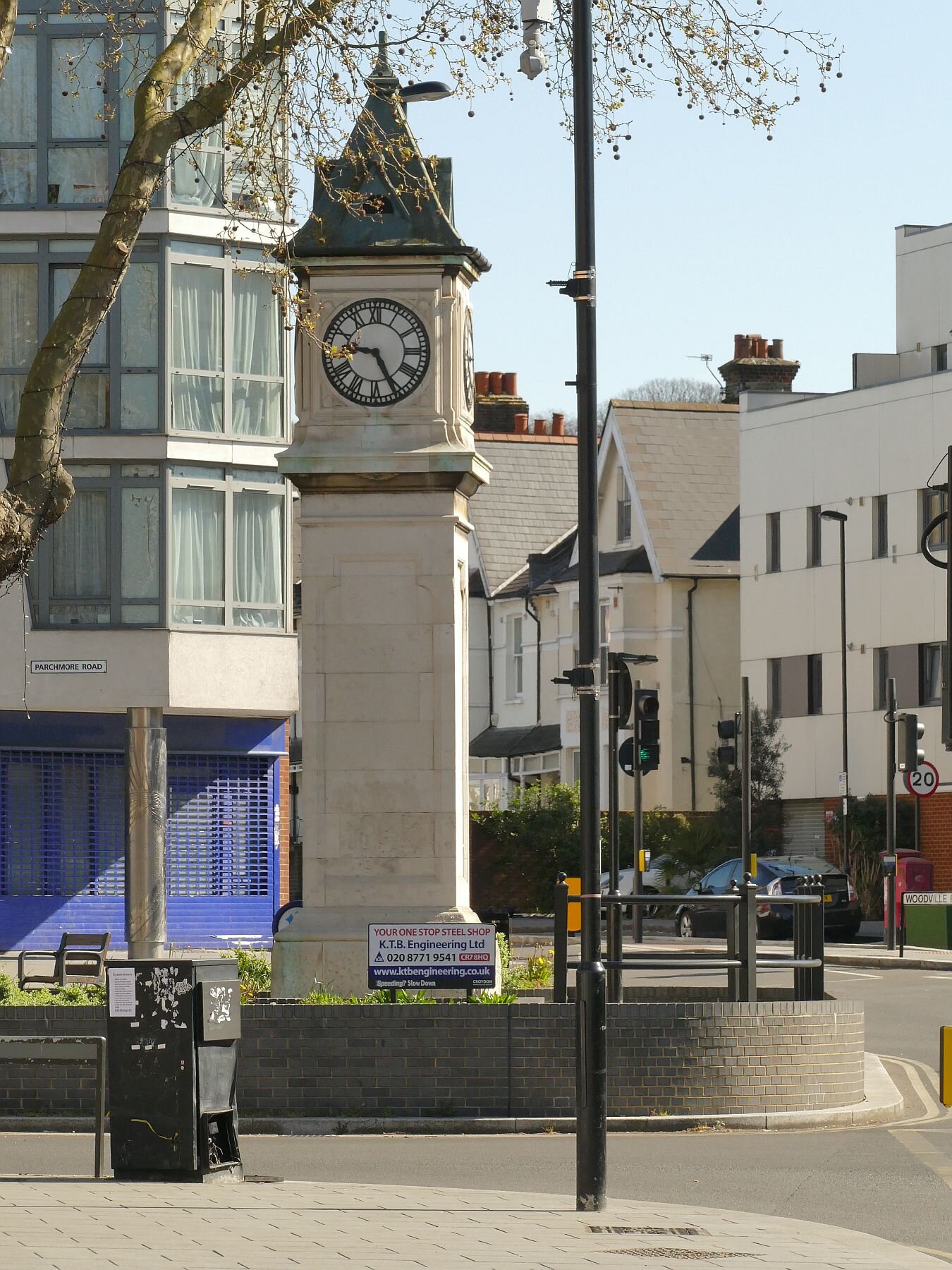
Left: the Thorton Heath Clock Tower
Below: one of the Croydon Stones


After this sedate history lesson, things really began to hot up as we rounded the corner and moved onto the High Street. It was a blast - first the murals, then the building facades, and then the shops themsleves.


We turned off up a side road, to see what went on behind the behind the High Street and were taken aback - again - by the extraordinary contrast offered by the suburban streets. How could anywhere so close to that vibrant, brightly coloured and noisy high street be so quiet and so calm. We could hear the birds singing and we couldn’t hear the traffic. How is it done?
We walked up hill, discussing how we would like to live here, as long as there was a park or open space nearby. As if by magic, we came across the entrance to Grangewood Park. As we entered, the magic did rub off a little, however, as the steep gradient put paid to our day-dreams of spending our twilight years here. If any octogenarians were to make it their daily walk, they would certainly be very fit. Grangewood Park is a relic of a much older estate which was originally part of, guess what? the Great North Wood (https://www.thorntonheathchronicle.co.uk/wp-content/uploads/2020/04/Grangewood-Booklet-v6.pdf). Today the southern lodge is boarded up, the scattered trees look tired (and what is that tent doing in the second picture from the left?), the ground flora is trampled down and the soil looks heavily compacted. Spring seems a little far away, although a Monkey Puzzle tree and some sparkling new gym equipment do lift the spirits.


We zig-zagged back through more amazingly peaceful - and clean - streets, spotting our favourite bits of suburban architecture.


Back on the High Street, we had to face up to the big question. Why were there so many fish shops? We don’t mean fish and chip shops or fish restaurants, we mean wet fish shops, fishmongers, shops that sell fresh fish. Some just sold fish, some sold fish and a variety of groceries or vegetables. We wouldn’t have been surprised if the newsagents had had a fish counter. Why is Thornton Heath fish heaven? If you know please put a comment at the bottom of this blog.
Talking of which, we will postpone the rest of our voyage through Thornton Heath until next week, as there are one or two suprises still to come. But we will leave you with an image of that evening’s supper. It was by far the best fish we have had in ages.

Home Ground
An Englishwoman, an Irishwoman, a Welshman and a ‘British’ woman were all sitting around their respective dinner tables having a Zoom meal. It was the time of the Rugby Six Nations tournament and the conversation between the Welsh and Irish contingent was animated, emotional, patriotic, fervent and loud. Suddenly Irish turned to English and asked why we didn’t exhibit the same degree of loyalty to England. There was quite a long, deep pause as we marshalled our thoughts.
While we are waiting, I will just mention that the ‘Briton’ present is so-called because she is linked by birth, domicile, emotional connections and genetics, not only to Surrey, but also to the Isle of Wight, Yorkshire and Ayrshire. In the interests of balance she is often pigeonholed as the token Scot, but on this occasion she adopted an English perspective (current domicile and birthright). As another aside, we are all white and British or Irish born.
Much of what came out of the pregnant pause will be picked up again in future blogs. I’m referring to things like never thinking we were the underdog, not having to fight for (in this case) Celtic identity, culture, language or independence; things like guilt over the empire (so often identified with the English if not, actually, factually correct); things like the adoption of the cross of St George by football fans; things like being economic migrants within our own country and having lost our roots or strong feelings of identity for a particular region.
The final question, from Ireland, was, ‘Well, where is home for you, and with what area do you identify?’ It was a sudden, light bulb moment for England. The answer is Kent. It is the land of my fathers (most of my mothers came to London from the Midlands). Kent is not known for its prowess in rugby, but it is where I instantly feel at home and is the only county where I don’t have to spell my surname.


As a child I visited deepest Kent regularly. We were allowed free range of the local countryside as long as we rocked up at our grandparents’ cottage in time for meals. Somehow, I absorbed an innate emotional, ecological, botanical, geographical, historical, architectural, cultural, literary, agricultural and (being Kent) horticultural afinity, and a deep appreciation of Kentish landscape and community. Many, many years later, on a visit to Hughenden Manor (which is in Buckinghamshire), we walked down an avenue of beautiful coppiced hazels. I instantly felt a warm rush of comfort and nostalgia for Kent. I instinctively knew their shape and form and what they stood for in the history of the Kentish landscape. You may think this is bizarre, but it was a wonderful feeling of coming home. Snowdonia does it for the other half of Terroir. So it’s not romantic tosh after all?

Coppiced hazels used as an ornamental avenue along the drive to Hughenden Manor
The hazel coppice, backed by the brick and flint wall, could easily be taken for a Kentish ensemble, rather than the entrance to Benjamin Disraeli’s home near High Wycombe in Buckinghamshire
This feeling was revived, when we went for a walk in a National Trust Woodland on the Surrey side of the Kentish border. No, we’re not purists; English Terroir feels pretty comfortable in Sussex and the Kent/Sussex/Surrey borderlands too, despite greater difficulties in surname spelling.
Walking into Hornecourt Wood feels like slipping on a favourite old glove and, in landscape terms, you instantly recognise every aspect of the history and ecology of the space around you. But you don’t have to be a local or an ecologist to appreciate the delicate beauty of a deciduous wood in spring. The wood anemones were at their best, low-lying but proud, massed but not in your face, stunning but delicate. The beefier bluebells were doing their best to catch them up and already a blue miasma was creeping over the ground, but the bridal wind flowers (Anemone nemorosa) were the stars of the show.
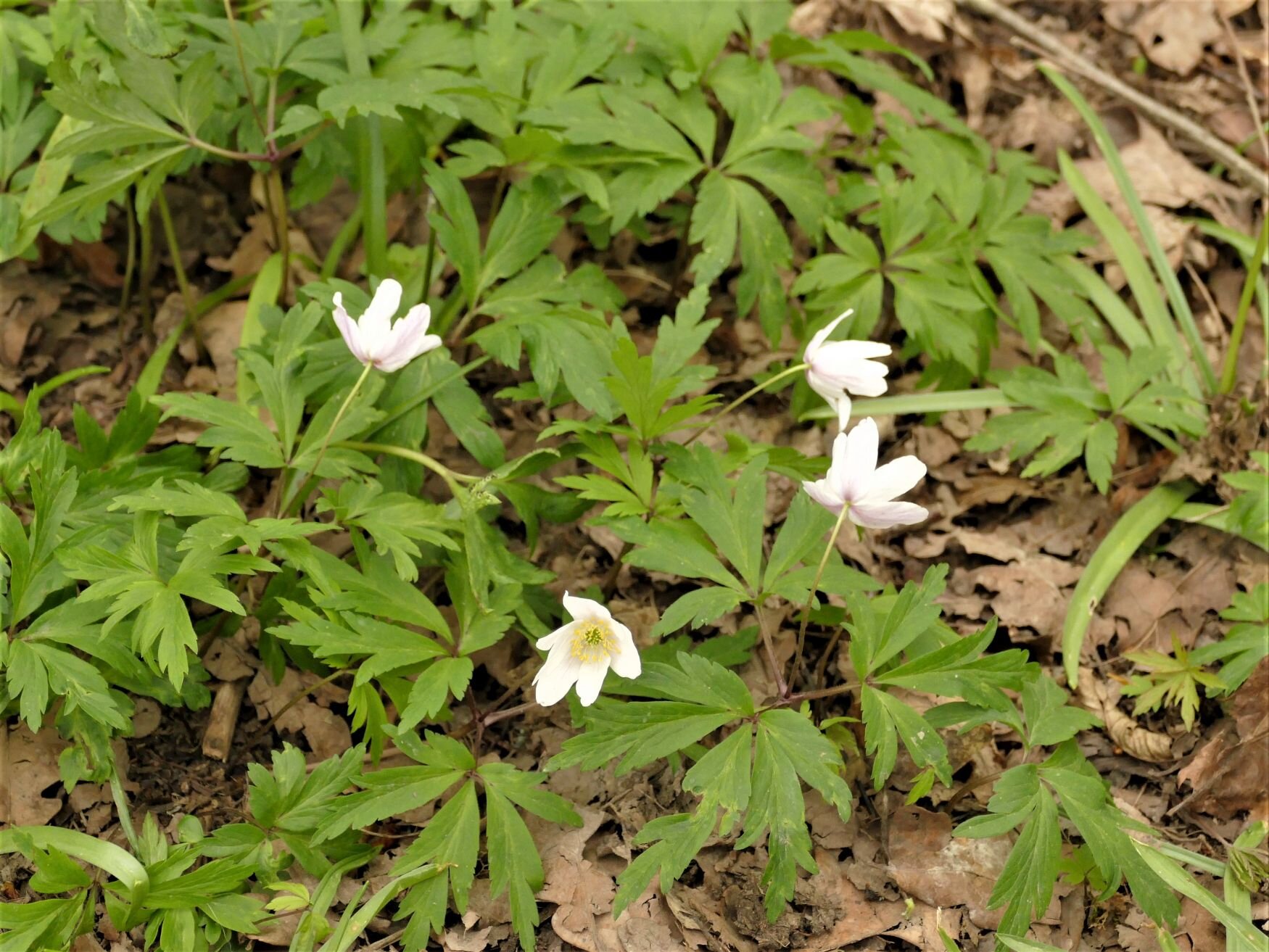

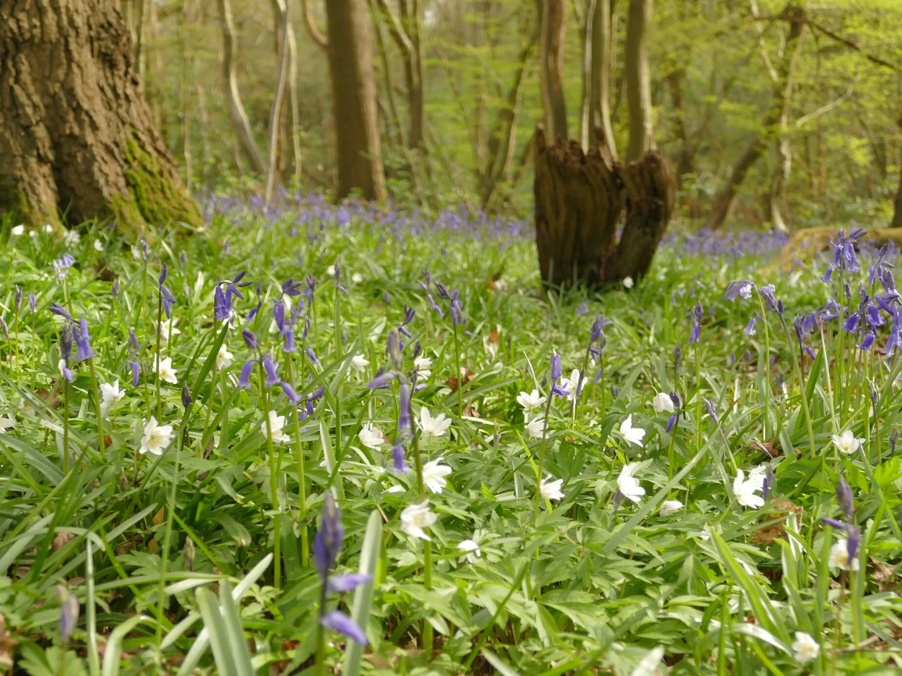
This is ancient semi-natural woodland, defined by being consistently shown as woodland from the earliest maps to the present day (1600 is taken as the starting point). At Hornecourt, it’s a southern classic: a mix of hornbeam which is easily coppiced to provide small ‘round wood’ for poles, fencing, hurdles and so on, and, at a lower density, oak ‘standards’ which grow up as single massive stems to provide construction timber. It’s been a while since that management system has been in operation in Hornecourt, and the hornbeams are growing bigger while the oaks are falling, creating a horizontal sculpture park, studded with their star-like roots. Even the occasional hornbeam has toppled over.


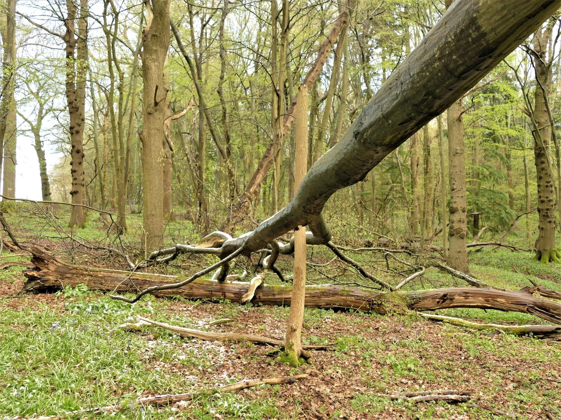
The sculpture park effect is also turned to vertical effect by many of the standing oaks displaying a spectacular range of burrs which are outstandingly visible in springtime.


The hornbeam is as delicate as the wood anemones at this time of year and their opening buds are hanging down like tiny, lax, cocktail umbrellas, while their catkins fatten, lengthen and release their pollen, to the disquiet of Terroir’s hay fever sensitive receptors.


Hornbeam bark is smooth to the touch, a simple garment, elegantly worn.
Hornecourt Wood isn’t all fairy glades, catkins and picturesque burr oak, however, and its topography hides some interesting and alternative evidence of former times. As background, you should know that the wood is just a small part of a large agricultural estate, donated to the National Trust around the middle of the last century; there are five main farms spread over three parishes. To a public which is used to the Handbook listings of heritage buildings and spectacular countryside, this is a side of the National Trust which is less well known. The estate is located in the farmlands of the Low Weald and the wood tumbles down a low escarpment to the sticky clays of the Weald below. A classic Wealden gill also tumbles through a steep-sided valley within the wood, and low-key plank bridges provide pedestrian access.


But there are warning signs of alternative or additional uses. It’s like stubbing your toe on a stone which shouldn’t be there. A rhododendron clump and a few cherry laurels are out of character; stands of birch regeneration, standing out like sore thumbs, have probably taken root in an area cleared but not restocked; there is the shock of an inner core of conifers, including what looks to me like western red cedar, a native of the Pacific coast of north America; new plantings of native hardwoods stand in regimented rows, even-aged and as yet un-thinned – the tell-tale tree shelters still lurking in the light-loving bramble undergrowth.


A quick chat with the National Trust confirms these findings. Apparently the wood was once managed for pheasant rearing – no doubt as an additional source of income at a time when local biodiversity was not sufficient justification in a working landscape. Pheasants are not lovers of draughty copses and the laurel may have been encouraged to provide cover and shelter.
The Trust experimented with ‘commercial’ plantings of conifers again, no doubt, following the practice of the time and chasing the available grants. Thankfully, they were limited to the interior of the woodland and the gill valley, no doubt to conserve the visual amenity of the ancient wood within the landscape.
Again, management aspirations and grant funding changed and much of the coniferous timber appears to have been felled to be replaced by native hardwood species, with the pioneer birch trees leaping in to colonise peripheral open spaces. No doubt the pandemic has entirely destroyed the timetable and budget for any plans to manage these young trees, such that they can integrate into the classic habitat which gives the rest of the wood its richness and beauty.
The National Trust has Terroir’s every sympathy. Woodland management is wonderfully rewarding on all fronts except financial. Until we can adopt a Natural Capital approach, whereby the ‘stocks’ and flows’ of natural resources and services can be assessed in monetary terms, and accounted for on a par with traditional evaluations of goods and services, mangement of magical places such as Hornecourt Wood will be an uphill (pun intended) struggle.
Terroir will leave you with two thoughts. The Zoom dining quartet (particularly the Celts) wish it to be known how much they appreciate living in England, despite their apparent fierce attachment to their mother lands!
Meanwhile those with a fierce attachment to their English forefathers delight in the sculptural impact of the historic remnants of a neglected, south east English, hornbeam-and-hawthorn hedge.


The Art of Lockdown
One of the inspiring experiences of lockdown has been the artistic endeavours of friends, family and colleagues, and it is with great pleasure that I have ‘curated’ (how posh) an exhibition of their works completed during the last 12 months. Some of the contributors have been creating artwork for many years, some only started in lockdown. All have been working within the confines of a pandemic. Many have sold their art at open studio or similar events, but the majority would probably classify themselves as producing art for the sheer pleasure of creativity and, for some, for the adventure of exploring their own artistry as a response to Covid-19.
The experience of curating turned out to be terrifying. I looked up the definition of the expression ‘to curate’ something, to see what it was that I was trying to do. Words such as select, organise, look after, present, interpret and display came up again and again.
Selection has been easy and involved emails to friends and colleagues who I knew were painters or artists. My brief asked for ‘something that you might have created over the last year which has some relationship to landscape, environment or society, however tenuous’. Thus the process of selection of the potential artists was down to me. The selection of the artworks, was (largely) down to the artists. I have accepted everything which was sent me. I was aware that some I contacted had been involved in portraiture but, knowing my background, they felt that the link to ‘landscape and society’ was just too tenuous; thankfully I managed to convince one artist that portraits are important too.
It was the requirement to organize, look after, present, interpret, and display which was so stressful. My own creative experience relates to working with actual, live landscapes. This can be onerous: the responsibility of creation must be taken seriously, and comes with responsibility to client, user and environment. But the curating or management of that landscape is also, in my experience, a joy which brings immense satisfaction. So why the tears and fears connected to this blog’s endeavours? One dictionary defintion continued: ‘typically using professional or expert knowledge’. Ah. So obvious. I am trained to handle landscapes which are alive in a biological sense and are physically anchored into our external environment (I can even handle the occasional house plant) but am a total amateur in curating artistic representations of and refections on ‘landscapes, environment and society’.
So, forgive me if I have made a poor job of exhibiting my friends’ and colleagues’ work. Not only am I inexperienced in presenting and displaying artistic output, but am constrained by the technlogy of a blog platform, on which my grip is tenuous to say the least. If admiration and enthusiasm were enough, then this would be a superb ‘exhibition’, but I know that in the curating sense this is not true! Please enjoy as best you can. My contibutors deserve better but I also know that, despite my ineptitude, their art will speak out for them.
Elizabeth Ellison
Regular walks started last year, usually walking up and over/under the A264, and the railway line, towards the farmland, and Rusper. I took photographs, (too cold to sit about) and resolved to paint small and fast, so no dithering or overworking. Found it helped to prepare sketches, mix all the paint first, and allow myself no more than 40 mins. Nothing too challenging or long term, but as they say, you have to put the paint on!!
Oil paint on board, palette knife
Size 24x18cms
Prepared throughout 2020

March
April

May

June

July

August
Carole
Instagram: @calligraphysurrey
I belong to a calligraphy group and last year the theme for our summer project was ‘CELEBRATE' and the format was a folded book made of a single sheet of paper. I wanted to use the letters of the word ‘celebrate’ but also wanted to specify what I wanted to celebrate. As lockdown happened about the time I started thinking about the project, I chose to celebrate trees, as they became my close companions during lockdown walks.
The large colourful letters spell tree names starting with the letters C E L E B R A T E and although I tried to use mainly native trees, a eucalyptus managed to sneak in.
The tree names were written first with a chisel brush and gouache paint. Then I folded the sheet of paper into its book shape and on each page I carefully wrote a different tree quote in pencil.


Gwilym Owen
I signed up to a lockdown art class, to do something, to motivate myself to attempt some art, and maybe to learn some new skills. I painted from photographs.

Fly Agaric Toadstool
Watercolour on paper

Starling
Water colour on paper

Stanage Edge, Peak Distict
Pen and ink on paper
Maureen Ford
Instagram: @maureen_ford22
Redhill redevelopment during lockdown. Charcoal drawing on paper.

The building site was a mass of linear, vertical, horizontal and diagonal lines and structures with contrasting tones. Having sketched the demolition of the Co Op store decades ago I couldn't resist taking multiple photos and sketching this view.

The painted version is executed using acrylic paint on paper emphasising the contrast of cold greys with the warm colours of the plant.
These are two of the portraits made during lockdown when Clive Myrie and Lesley Garrett engaged in fascinating conversations while sitting for Skye’s ‘Portrait Artist of the Week’ on Sunday lunchtimes. The portraits were fascinating, challenging and demonstrated a wealth of talent by participating artists who shared their work online. portrait artist of the week skye arts

Lesley Garrett, Pastel pencil on paper
[A Yorkshire phenomenon, ed]

Clive Myrie, watercolour on paper
Born on the ‘other side’ of the Pennines [ed]
Walking the footpaths and fields during lockdown and watching the seasonal changes to the fields brings a stability to the everchanging scenario of lockdown.
The sheep are moved to different fields when the foraging becomes scarce. Each sheep has a character of its own, be it curiosity or resignation.

Sheep in a turnip field.
Pastel pencil on paper.
Locked in or locked out?!

Reminders of a bright hot summer
Acrylic paint on paper
Zosia Mellor
I retired from practice as a Chartered landscape architect and have thoroughly enjoyed having time for pastimes. I really enjoy painting …! Before lockdown we travelled a great deal, however last year I did enjoy exploring different corners of England.
Landscape:

Darenth Valley in Kent
Fresh Food in Lockdown

Blackheath Farmers Market
: the market ran throughout both lockdowns and it was a wonderful outlet on a Sunday morning. I was struck by the vibrancy of the colours of this vegetable stall and the jumble of shapes and textures.
This painting is acrylic on board measuring 30 x 20 cms.

Field Mushrooms
: during lockdown walks for exercise I collected these field mushrooms. I enjoy painting seasonal subjects and lockdown has definitely heightened my awareness of the changing seasons.
I used acrylic paint on acid free card measuring 30 x 20 cms.
Rob Thompson
I wasn’t sure if I should include more of Rob’s work (see Blog 18 Cynefin), not because I was worried about over exposure (!) but because in my view he sells enough of his work to make him a professional. Rob thinks this is very funny. So Terroir has compromised and we are pleased to include some paintings he produced to support Snowdonia Donkeys, a charity dedicated to promoting human and equine health and well-being, through working and walking with donkeys. https://www.snowdoniadonkeys.com The two images below were created for, and donated to, a secret post card raffle. If you were generous enough to donate to the raffle and received either of the donkeys shown below, please let us know!


Before you go… thank you so much to all our contributors. When we started working on this blog post, Terroir had no idea just how rewarding, stimulating and throughly enjoyable this curating business was going to be. I hope you - our readers - are able to enjoy this lockdown art as much as we have.
… don’t forget to visit the gift shop! Most of the art shown above is for sale and, if you like their style, the artists also have a store of other treasures. If you are interested, contact Terroir at blogterroir.net@gmail.com and we will pass your details on to the relevant artist or atists. This aspect of producing art was never mentioned in the definitions of curating, and Terroir certainly didn’t embark on this project with this in mind. But, if any of our artists are starving in a draughty garret, we are very pleased to help!!
‘Chilly Finger’d Spring’
Spring - such an obvious name! So delightful that the English language settled on a word so simultaneously descriptive, self-evident and cheering. But there are other names, of course. Here are a few: vernal equinox, emergence, daylight saving, the start of British Summer Time, clocks spring forward, seed time, spring fever, primaveral, vernalagnia, frondescentia, repullulate, Chelidonian winds. No, Terroir’s vocabulary is not that extensive and we owe a debt of gratitude to a wonderful page on the BBC website: https://www.bbc.co.uk/programmes/articles/rMcWv9V1wWWNXxmbLkQW5P/12-spring-words-to-celebrate-the-new-season
Spring is also a time of religious celebration: Easter, Pacque, Ostern, Πάσχα, Pasg, A 'Chàisg, Cásca, Easter Tide, paschal festival, Pesach, Nowruz (Iran), Holi (Hindu), Vaisakhi (Hindu/Sikh).


Some aspects of spring are best avoided, however: gowk-storm (snow fall or gale which coincides with arrival of gowk or cuckoo - Scottish dialect), lamb-storm (spring thunderstorm at lambing time), blackberry winter (American spring cold snap). Again, thank you BBC.
More secular celebrations tend to get less exciting names: Easter holidays, spring break.
Terroir has spent many late winters watching for the signs of spring. We are not very good at phenology - the study of biological cycles and how they are influenced by seasonal variations - because we never keep proper notes. The only key information we can remember from year to year is whether the garden daffodils are out for St David’s day. 2021 qualified for an ‘only just’; one miniature bloom was sacrificially plucked for the Welsh lapel.
For some time now the old-fashioned enjoyment of a warm spell bringing an early clump of snow drops, or the traditional agony of a cold snap delaying the first pussy willow buds, has been tainted by the spectre of climate change. Phenology has become witness to a sad confusion of seasons and global influences. Watching the quickening of the local landscape from dormancy to a riot of activity is no longer the simple pleasure of our childhoods.
Lockdown, however, has changed our attitudes to spring even more thoroughly than climate change. And, so, this year we kept a pictorial record of our journey from winter to spring, from Christmas to Easter, from winter solstice to vernal equinox.
Our pictorial voyage is exhibited below, in fairly strict chronological order. We have broken it into three sections in accordance with our crazy, traditional calendar which does it’s best to ignore the lunar cycle, although the relationship between the moon and the earth is perhaps the most steadying influence in our currently topsy world.
January: a revealing month, showing details and patterns which are either hidden or overshadowed by the riots of spring growth, the ripening of summer or autumnal reveries. We found natural sculptures, spots of colour, fungus and seed heads, the loss of an old hedgerow tree veteran, extremes of weather and, yes, new life.


February: a month which started well but rapidly became the victim of strong meterological contrasts. The days continued to lengthen, but none of us in Terrior-land really noticed as the snow fell to a mixed reception. We - adult humans and nascent nature - bided our time until, finally, the sun came out again.


March: sunshine, cold and long. The gardens did their best to cheer us up, but the countryside held its breath, drab khaki beneath the yew, juniper and pine. Farmers and schools started work again, and finally, finally the rest of us were rewarded with green shoots, early blossom, thoughts of eggs and spring flowers aplenty. At the end of the month the sun came out and so did we.


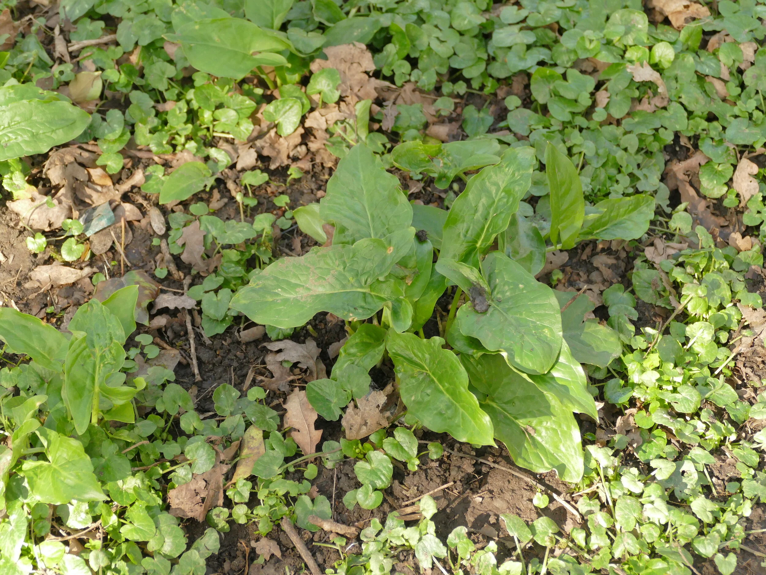


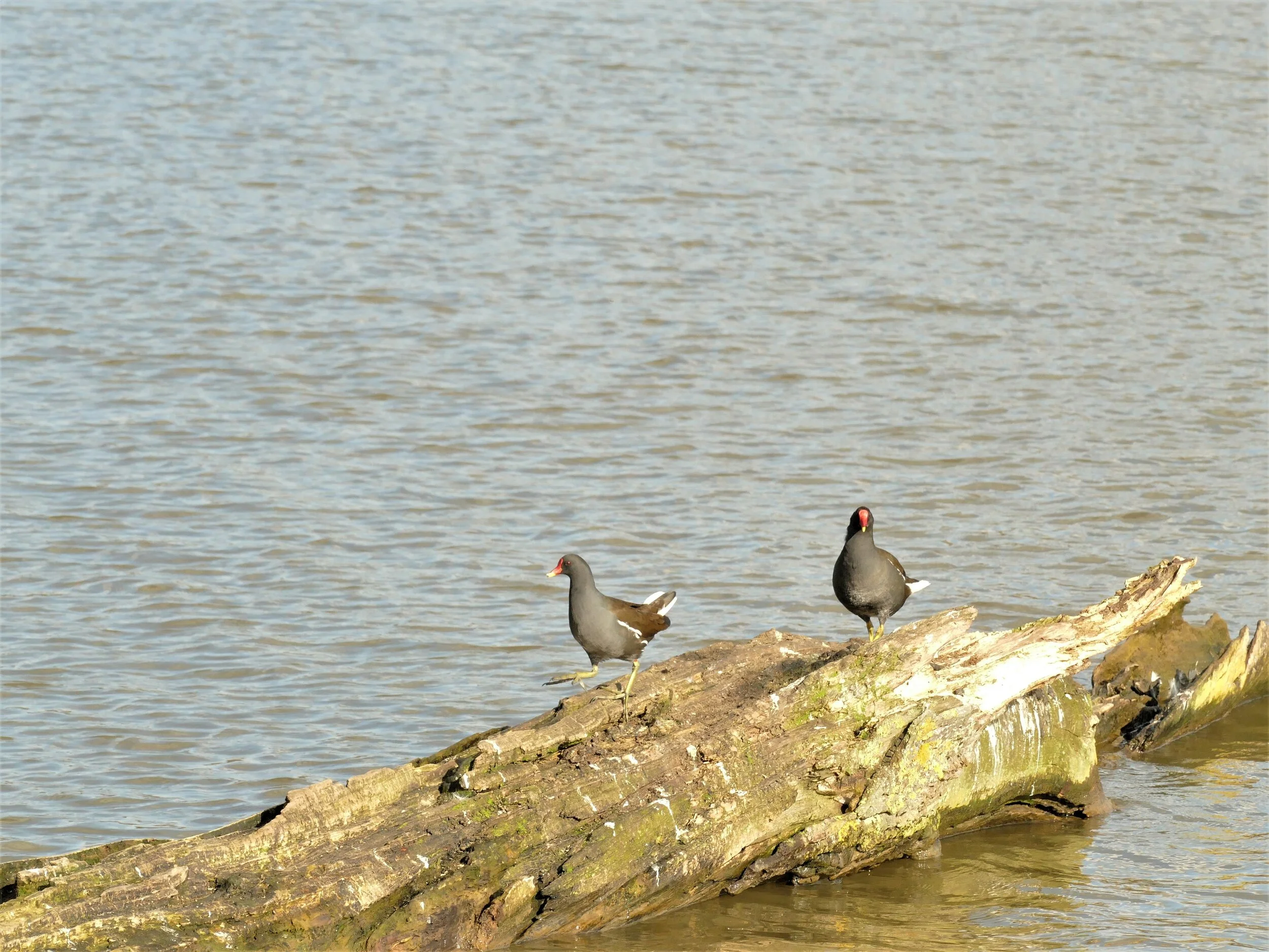


“… for the choir
Of Cynthia he heard not, though rough briar
Nor muffling thicket interpos’d to dull
The vesper hymn, far swollen, soft and full,
Through the dark pillars of those sylvan aisles.
He saw not the two maidens, nor their smiles,
Wan as primroses gather’d at midnight
By chilly finger’d spring.”
John Keats Endymion Book IV
I think Keats would have hated climate change…
Happy Easter/Spring Break to you all. May the English and Northern Irish ‘Rule of Six’, the Welsh freedom to roam, and staying local in Scotland bring health and happiness.
Life and Death on the Fringe
The concept of the favourite aunt or uncle has always seemed a tad too sentimental for the likes of Terroir. We had no shortage of appropriate relatives. Between us we can muster seven uncles (of which four share our DNA) and twelve aunts (of which a mere five are genetically connected). The arithmetic is interesting, I agree, but multiple marriages (in sequence, we are not aware of any bigamy), plus an extra family lurking in the shadows, make for the usual complicated familial links. Some we never met, or even knew about as children. The known uncles and aunts were loved and appreciated but never promoted to ‘favourite’ status.
One set of relatives, however, has always generated an irresistible magic (one of Scary Great Granny’s daughters married into the clan – see Booth map blogs) and some years ago, I promoted a first-cousin-once-removed clan member to Favourite Cousin. No one could accuse Meg of being saccharine or a cliché. I first consciously met her when I was maybe six or seven years old, she in her early 30s, a tall figure in a beautiful summer dress. She knew how to engage with children - and also how to buy them presents. I still have that wooden jigsaw puzzle of the United States of America. I rated her as special from then on and was never disappointed. I hope she will forgive me for promoting her to ‘favoured’ status.
Last month, Meg died at the age of 92. I was uncharacteristically upset. The funeral was a Covid 19 limited edition, but with space for Terroir amongst the congregation of 30 max. The location was the Cotswold village of Ilmington, where Meg had previously lived for many years.
Why had Meg chosen Ilmington as her favoured terroir? It turned out that Ilmington had chosen her. A cousin (obviously not on the Terroir side, to whom such things do not happen) had left Meg a house in the village (a joint inheritance with someone else). Possibly scenting internecine warfare, the house was put up for sale, but the transaction later fell through. Realising the house was rather special, Meg and husband upped sticks, left the south east and moved in. They were right about the house and, fortunately, right about the village too.

Ilmington depicted on an Ordnance Survey map of 1897
The contours to the south west of the village rise inexorable up Campden Hill to the top of Ebrington Hill (731 feet above sea level). The gardens of Hidcote and Kiftsgate lie on the lower, western slopes of the hill.
Reproduced with the permission of the National Library of Scotland' https://maps.nls.uk/index.html
Ilmington is described as a Cotswold Fringe Village. This seems to be an established typology, relating partly to geography (Ilmington is on the very northern fringes of the Cotswolds) rather than a derogatory comment on village character. It is also noted as the highest village in the Cotswolds and lies at the base of Ebrington Hill, the highest point in Warwickshire. I can bear witness to a certain draughtiness which becomes apparent when the sun goes in on an otherwise fine March morning.
Apart from its immediate attraction as a honey-coloured Cotswold village (however fringe), two specific things strike me about Ilmington. One is related to food and drink, and the other to architecture and buildings, both an integral part of any discourse on terroir.
Farmers have probably been cultivating the Cotswolds since the Neolithic period (from about 6,000 years ago) but Terroir’s sources of information stem from a slightly more recent era. Go to http://www.fabulous-50s.com/memories/oral-histories.html and you will find a rich seam of oral history called ‘Ilmington Remembers the 1950s’, inspired by celebrations for the Queen’s Diamond Jubilee in 1977. The stories are captivating, and revealing about post-war Ilmington life, which very much revolved around agriculture and its supporting trades and activities.
Two things stand out. During a time of continued food rationing, when other communities were still struggling to find a sufficiency and variety of nourishment, it appears that the village had plenty to eat. Gardens and allotments were the norm, obviously well tended and productive, even to the level of providing a suplus for sale (there is a mention of one family producing over a ton of potatoes in a year). Blackberries were foraged for eating or selling on. Meat was avalable - often in the form of rabbit, but a more traditonal Sunday roast did not seem uncommon and there was a butcher in the village as well as a grocer. Local farmers had dairy herds and there is mention of milk available as well as fruit for making puddings. No one seems to mention hunger, and many comment on having enough to eat.
The other recurring theme relates to orchards. Lots of orchards. There is mention of plums grown locally, but the product of the apple orchards seems to have made the biggest impact, with many farm workers reported as receiving considerable quantities of cider as part remuneration for their daily labours!
The maps below show that orchards were significant thoughout the late 19C and though to the interwar years of the 20C. Both oral history and mapping confirm the importance of the orchards in the early 1950s, but by the end of that decade, surveys show the bginning of reduction in area. The orchards today are sad remnants of their former glory, more so perhaps than even in Kent or Herefordhire. Some of Ilmington’s orchards are extant but derelict, others converted to alternative uses including housing.
Terroir has, however, just ordered some refreshment from a renewed interest in the apple harvest resulting from remaining trees, and we will report back on the apple brandy and dry gin in due course.


All map images reproduced with the permission of the National Library of Scotland' https://maps.nls.uk/index.html

Satelite image of Ilmington today.
A new tree-scape now characterises Ilmington but it is still possible to pick out where the orchards used to be.
© Google Maps 2021
Railway gricer alert: check out the route of the Morton-in-Marsh to Stratford Tramway, a horse drawn system authorised in 1821 to supplement the canal system, and visible on both maps of eastern Ilmington and on the satellite image.

Terroir is in possession of another document relating to food, this time a substantial cookery book, produced in 1982 to raise funds for the Ilmington Church Roof Fund. I can still remember Meg flogging us a copy in a determined effort to do her bit.
We can’t find a single recipe with her name on it, but it is obvious that diets have changed a lot since the Cider with Rosie era of the 1950s. Bacon Jack, Back-bone Pie and Soldiers Cake are now heavily outnumbered by Tonille aux Pêches, Bermudian Banana Fritters and Sole à L’Indienne. I leave you to draw your own conclusions on the changes in lifestyle and demographic.
But I also mentioned architecture and housing, and those honey-coloured, marlstone Cotswold buildings. Unsurprisingly, Ilmington is a very attractive village (excepting the draughts). Unsurprisingly it is also heavily regulated. The Cotswolds were designated an Area of Outstanding Natural Beauty (AONB) (aka be innovative and outstanding before you even think about trying to build a house) in 1966. It was the 14th AONB to be designated and I’ve not begun to work out why it took them so long.


In 1969, nearly the entire village was designated a Conservation Area (apply for permission before you do nearly anything). When this designation was reviewed in 1995, there were 41 listed buildings or structures in the village (check your bank balance before contemplating modifications). Today, there are no less than 61 such listings!
An analysis of these buildings offers a fascinating insight into the agricultural heritage of ilmington and also to the extraordinary level of change which has occurred in the village since the 1950s. Out of the 61 listings, 58 are Grade II. Of these, I would suggest that over a third relate to the village’s agricultural heritage. No less than ten are described as ‘Farmhouse’ and the remainder are barns, outbuildings or cart sheds. Structures related to the religious life of the parish mop up another 10 listings, leaving less than 50% for other forms of residential buildings (which seem to range from cottage to Dower House) and the Chalybeate well head (see below). What a heritage. And, in case you are wondering, Wikipedia tells me that ‘Chalybeate means mineral spring waters containing salts of iron’.


As an aside, it is no surprise that this area comes very low in the England deprivation indices, with the main exception of ‘physical and financial accessibility of housing and local services’ (http://dclgapps.communities.gov.uk). Even in the 1950s, the oral history accounts often mention the wait for council housing, although it also records that such did exist in village. Today, private house prices in Ilmington are only slightly below typical prices in the south east commuter belt.
Only two buildings manage grade II*: the grandiose early 18C Manor House (think Doric Columns and a pediment on top to attic height) and the earlier 16C ‘Ilmington Manor with attached Barn’. The latter is much more to my taste, particularly because of the down-to-earth and very functional attachment.
Which leaves us with a single grade I listing, the Norman parish church of St Mary. This deserves a blog in its own right, but a mention of the embroidered apple map is essential. Created by resident June Hobson, the map is a copy of a 1922 plan which identified the locations of all the orchards in the village (https://www.cotswolds.info/places/ilmington.shtml). The church is also famous for its wood carvings by Robert Thompson (no known relation to Rob Thompson, the artist/architect, featured in the Cynefin blog, last month). Not only did he create the pulpit and pews, but carved his signature mice in eleven places throughout the church (https://en.wikipedia.org/wiki/Ilmington)
I sat in one of Robert Thompson’s pews last week, saying goodby to favourite-cousin Meg. Although she had temporarily left Ilmington (a decade in a life of 92 years counts as temporary in my book) to live closer to essential amenities in Stratford upon Avon, she had chosen to return to Ilmington for her final farewells and for her ashes to be interred next to her husband, in the church yard. It has been a great privilege, not only to have known Meg, but to have actually been related to her. A Grade I human being resting beside a Grade I Norman Church.


Privet Land
Although privet was an integral part of a Terroir childhood, it was many years before I realised the stuff had pyramidal spikes of white blossom, or experienced that heady, heavy, almost sickly perfume which emanates from the flowers. I suspect I caught up with the follow-on black berries even later. How come I was so ignorant of such basic aspects of this native shrub (Ligustrum vulgare)?


Flower image: © David Birch Privet flowers DSCF5484 https://www.flickr.com/photos/hedgerowmobile/328836044
Berries image: © versageek European Privet (Ligustrum vulgare) https://www.flickr.com/photos/versageek/1563369131
Like so many of us, I was a suburban child. The only privet I knew was the privet hedge which formed the boundary to so many semi-detached front gardens. In our area, Ligustrum ovalifoilum vied with Golden Privet (Ligustrum ovalifolium ‘Aureum’) for most-favoured hedge status. A 1950s and 60s summer did not hum with the sound of an electric lawn mower, but rattled with the sound of a push mower, and a pair of shears chopping the privet hedges into perfect vegetable rhomboids. No flower was ever allowed to appear on these hedges, so no whiff of potent perfume or tell-tale berries.
As a nearly-teenager I spent more time at the overgrown, more distant, end of the back garden. Here a neighbouring privet had been forgotten and run wild. Here I discovered the privet secrets of flower and scent. Such was the universality and uniformity of the sterile front garden privet hedge, that the shock of the fecund floral discovery was akin to finding out how babies were made!
My childhood privet landscape was one of inter-war, speculative, private housing development.
The urgent need for housing following WW1 created vast acreages of suburbia. The ‘Addison Act’ of 1919 and subsequent Housing Acts in the 1920s and 30s, ensured the construction of over a million local authority houses.
In 1923, the speculative builders of private houses joined in, adding a further 2.8 million ‘middle class’ homes. This was my domestic inheritance landscape: a ‘Tudoresque’, three bedroomed semi-detached, of brick cavity wall construction, with pebble dash and tiled roof, small front garden and bigger back garden. The house was fitted with electricity, gas, tiny kitchen, bay windows at the front, topped with a gable, French doors at the back, an inside bathroom and separate toilet. Two designs were often offered: ours had a curved bay and arched storm porch while Granny and Aunt J (Scary Great Granny’s daughter and grand-daughter - see the Booth Blogs) had a rectangular bay and matching storm porch. Subtle. Garages were an optional extra and ours had been built of asbestos but with the classic wooden double doors. Looking back, and looking at pictures of ‘typical’ spec-built estates, I realise that chez Terroir was at the smaller end of the size range; indeed my bedroom was not much more than 6 foot by 6 foot square.
From memory, the classic front garden featured a low brick wall, topped off with either looped chains or backed by the aforementioned privet hedge. By the 1950s, the uniformity was already being eroded. The low brick walls lasted well, but I have only faint memories of the looped chains and the privet hedges were definitely on the decline.
The images below are a classic selection of inter-war speculative private housing, in this instance as found in Terroir’s current home town. These all have the classic gable, over the two stories of bay windows, something which was missing form Terroir’s childhood estate. On the other hand, these tend to have a single, shared access to garages behind the houses. The density was often lower in the childhood estate, offering space for a garage beside the house, sometimes with a side passageway through to the backgarden, as well. Obviously, there have been significant changes to the front gardens, although low walls and hedges are not completely absent.


Since achieving some sort of adult status, Terroir had not given the suburban privet hedge much thought. Interest was revived recently, however, by the discovery that some of Sheffield’s allotments are surrounded by privet. We don’t mean neat, waist high hedges around the external site boundary. We mean that every two allotment plots are corralled within massive privet ramparts, at least 4 metres high and a couple of metres wide. Thankfully the plot sizes are generous, as nothing grows within the shade of these evergreen barbarians.

Now on constant hedge alert, we soon saw that the remains of privet hedges are alive and well. Not just in Sheffield but throughout the towns and cities of England and Wales.


Finding information on the history of the privet hedge has been tricky, however. Histories of modest 20th century domestic architecture are not difficult to find. But details of standard garden finishes, are much harder to track down. Were the looped chains a figment of my imagination? What sort of fencing was used to divide the residential plots? Was that front garden privet hedge a hangover from the 19th century or was it a purely inter-war feature? Why did Sheffield plant them around their allotments?
Some references we have found. Ian Waites, in his evocative book ‘Middlefield – A post war cou ncil estate in time’, talks of cut-throughs – ‘narrow channels of privet, wall and fence’ - where children would disappear and reappear as they crossed this Lincolnshire estate. The Municipal Dreams website (https://municipaldreams.wordpress.com) remarks that ‘The privet hedges remain a characteristic feature of Nottingham’s interwar council housing’ (Nottingham’s Council Housing by Bus and Tram Tuesday 19 June 2018) and ‘Some original privet hedges survive to mark the plot boundaries’ (Lincoln’s Early Council Housing 16 June 2015).
We will continue to research the history of the privet hedge but we would be grateful for any further information, whether circumstantial, anecdotal, or academic, which readers can contribute. If the comment box below is not visible, please click on ‘read more’, scroll down to the bottom again (sigh), and share your knowledge. We look forward to hearing from you.
Heavenly Bodies

What makes you choose one block of flats over another?
Location, obviously. And as an aside, the famous phrase ‘Location, Location, Location’ was not invented by Kirstie Allsopp and Phil Spencer, presenters of the eponymous TV programme, but by one Harold Samuel, property developer, in 1944. But then I expect you knew that.
Before lockdown, a good urban location might have been defined as a town centre, close to railway station/transport hub, shops, cinema, cafes and restaurants, for that authentic city experience; no car needed.
After lockdown, a flat may be the last place you want to live, the train station may no longer be relevant, parking may suddenly be more important and access to green space top of the agenda.
So how does a pre-Covid development of ‘luxury apartments’ sell itself? The one Terroir has in mind must have seemed a sure fire thing when it was planned in the 20 teens. It is literally opposite a good commuter railway station, right at the edge of the town centre, and with a cinema/restaurant complex, aimed at boosting the evening/night time economy, going up just across the road. Oh, and an international airport 20 minutes away (flight path not an issue). What more does the pre-pandemic, go-getting singleton or couple desire? The outdated sales blurb talks of good transport connections (well you will certainly get a seat on the train these days), retail therapy (currently closed), pubs and restaurants (if they ever re-open), and wonderful local countryside (true but car - and thus parking space – essential).


Terroir visited a two-bedroom show flat last summer. Considering this seems to be the most expensive apartment block in town, we were surprised to find: no separate kitchen (washing up in full view from living space); en-suite to master bedroom seriously reducing wardrobe space, no cat-swinging room in either bedroom, and a tiny balcony overlooking either a main road or the railway line (great for railway gricers, I suppose - see last week’s blog). Oh and we forgot to mention, and I quote, the
· Porcelanosa wall tiles in bathroom and en-suite
· Integrated Bosch appliances in the kitchen
· TV/FM Sky Q points to living room and master bedroom
· Stylish bathrooms with Roca bath and chrome Hansgrohe taps and fittings
Call us old-fashioned but we don’t understand a word of that.

So, lets go outside and take a look at the greenspace. On three sides the block is bordered by a main road, a sizeable but inaccessible railway embankment, and a second block of flats, still under construction. Out front? The building is separated from another main road (on the other side of which lies the under-construction-cinema site and the town centre) by an irregular space which has just been ‘landscaped’. We have to say, it did make us smile. And brought out the worst in us, too.
Let’s try to be positive, to begin with, at any rate. Topiary seems to be the order of the day, creating a green passage between the building and the main road. I love the way the cypress seem to flicker and dance like flames in the sunshine while the bay laurel ‘guard of honour’ keeps pedestrains on the straight and narrow.
But is it really going to work? I give it one summer to impress potential purchasers of the remaining flats (let’s stop calling them ‘apartments’) and by next year the maintenance regime will have started to ‘level down’ the whole thing.
Let’s take it apart.


The Cypress snake: these things grow fast and furiously. Keeping them in shape (literally) will take consistent and sympathetic trimming. Neither adjective is in common usage with the average commercial residential grounds maintenance team or, perhaps more accurately, the budget of the contract manager. The image to the right of the snake depicts a hedge of Cypress ‘Green Hedger’ which is cut back twice a year just to keep it in this simple form.
The conical bay trees (laurus nobilis): their natural shape is neither conical nor noble and they will need ongoing care and attention to keep them to this shape and size. The bay illustrated to the right of the newly-planted specimen grows in a garden about 500 m from our conical friends.
The yew bomb, cannon ball or heavenly body: so heavily clipped that we could not even begin to identify its species, so let’s assume Taxus baccata. Again, they don’t grow naturally like this. The Taxus baccata specimen on the right of the newly planted yew ball is neighbour to the non-conical and expansive bay tree, shown above.
The Euonymus (Euonymus japonica ‘Bravo’): no we are not expert Euonymus growers, that is what it says on the label. Already reaching for the sky, this shrub can, according to the Royal Horticultural Society, grow to 4 m high (yes, really) and spread to 2 m wide. And there are smaller varieties, so why use this one? The right hand image is a different variety but shows the same enthusiasm for vigorous growth.
The Mexican Orange Blossom (Choisya ternata) is no slouch and can quickly grow to well over a metre. It’ll be fun watching it fight for space with the canonball yew. And, oh horror, ‘they’ have included a Photinia fraseri (Little Red Robin). See Blog 3 (12th November) for why I dislike this plant so much.
I actually like the inclusion of Nandina domestica aka Heavenly Bamboo (it isn’t a bamboo, it’s in the Barbary family, most of which are types of Berberis). I’d like it even better if the contract supervisor had spotted the condition of some of the plants. Maybe they just haven’t done the snagging meeting yet… .
There are even a few trees, their trunks making a pleasant contrast to the other vertical elements which include flag poles and ‘for sale’ signs. At least these uprights will probably be removed in the fullness of time.
The choice of location did make us laugh, however. Some branches are already wrapped lovingly around a couple of lamp fittings and one tree is so close to the building that its juvenile boughs are making a concerted effort to climb through an adjacent window.
But there are good bits. A few cheerful daffodils (more would have been nice, of course), a herd of Bergenia (Elephants’ Ears), tough critters with cheerful flowers; they can also spread with alarming rapidity but only require brute force to get them back under control again.
I imagine, by now, that you are getting my drift: if left under-maintained, this formal and sculptual luxury apartment-selling landscape will quickly become a spectacular, if unsophisticated, jungle. Terroir has no problem with landscapes and gardens developing, and this particular landscape may well need changing, thinning, and/or restructuring to create a long term setting for the building. It needs to be both appropiate to the site (narrow, linear space, close to two main roads, plus heavy footfall between station and town centre etc) and to the management company’s budget. The problem will be if no-one manages the residents’ expectations, for when their cypress snakes and soldier bay trees, develop into common or garden trees and shrubs.


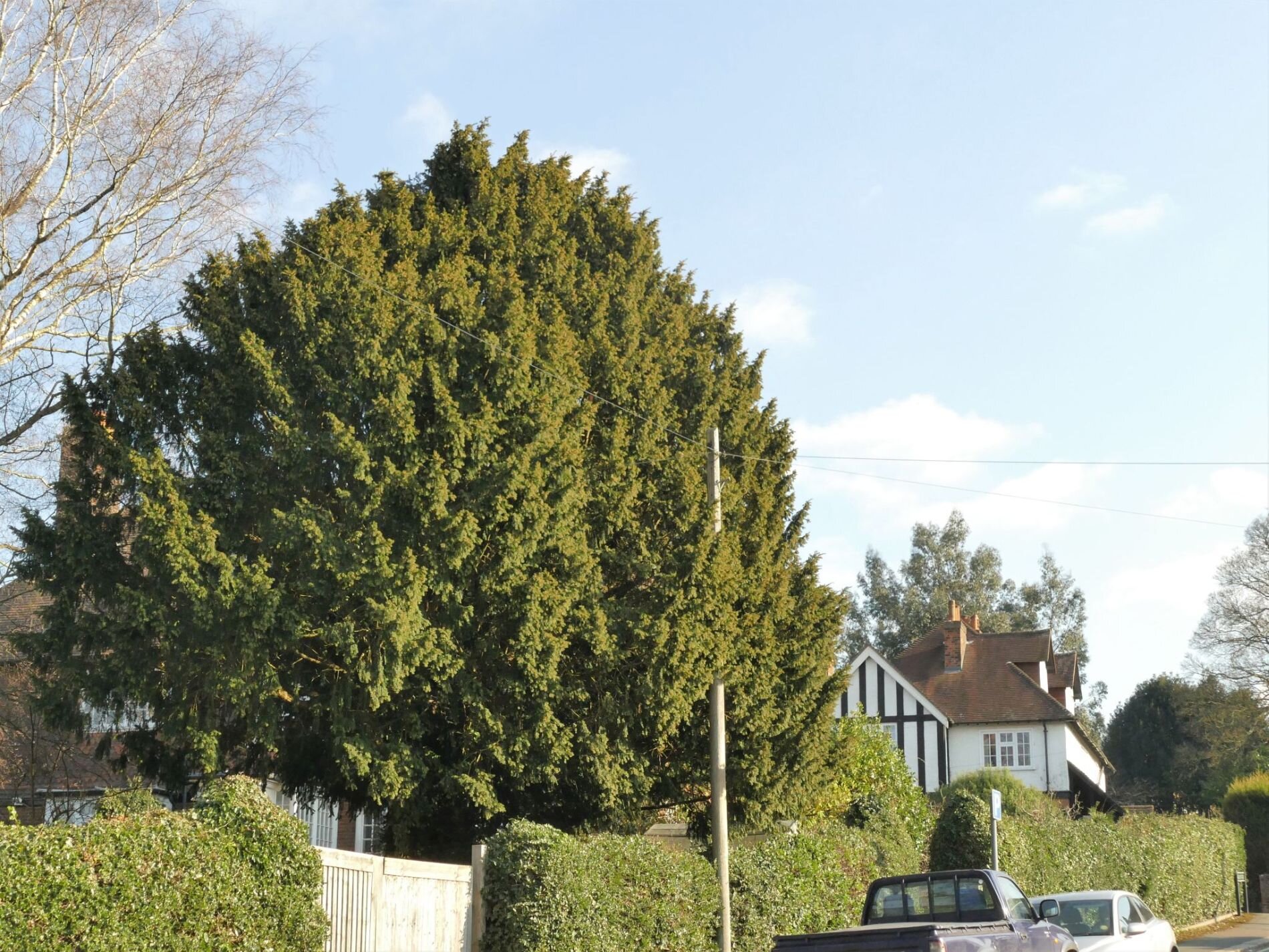


Walking the Line
As Chris Baines (environmentalist author and campaigner) once said, “Whoever heard of the Society for the Protection of Slugs”?

We are suckers for the eye catching and the beautiful. Take birds: in the UK, the largest nature conservation membership organisation is the RSPB, with over a million members, all prepared to stump up an annual membership fee to protect and enjoy just one small segment of the biosphere. On a global level, we also have the example of the WWF, which started life in 1961 as the World Wildlife Fund, campaigning with huge success under its delightful image of a panda. Although WWF was always committed to ‘protect places and species that were threatened by human development’ (https://www.worldwildlife.org/about/history), it was the panda that caught my attention and imagination, and I am sure I was not alone in that.


Why is this? Why do these appealing species create so much enthusiasm, loyalty and support? Why is there so much less attention given to the world of say amphibians or even wildflowers and so little attention to say, spiders or worms. What follows is purely anecdotal, based on observation, and has no scientific backing, but it seems to me that there are a number of factors.
The first is the teddy bear factor: pandas are cuddly and cute. We fall for them every time. The second is the human perception of wild beauty: I doubt the female blackbird will ever top a bird beauty contest, but there are many other British avian species which take our breath away, an obvious example being the kingfisher. [Stop press: regular followers will be pleased to hear that there is at least one on The Moors, flashing its feathers in fine style].
Thirdly, there is the human perception of wildlife repulsiveness, into which category fall the aforementioned slugs, spiders and worms and may also include close encounters with snakes or ants.
Fourth, and thanks to lockdown, we all know that being outside makes us feel good, and watching something alive and cuddly or beautiful makes us feel even better.


Picture credits, left to right: Kingfisher - Vine House Farm; Wasp spider - © Nigel Jackman 2021; Ant - Maciej; Blackbird - Wildlife Terry
And fifthly, there is the human love of the chase. Call it hunting or list ticking, human beings have been doing this for a very long time: train spotters (gricers), bird watchers (twitchers), butterfly or egg collectors (dodgy), trophy hunters (controversial), sporting hunters (commercial?), wildlife managers (cullers). Much of this love of the hunt has now been channelled into benign pursuits and scientific study but, whether peaceable or more destructive, it has been around a long time - and is a key factor in the growth of the conservation movement. I hesitate to say that it may also be a largely male pursuit, but observation suggests that, in the past, this might be so.


Ironically, the RSPB started, in 1889, as an organisation to stop the trade in feathers and plumes which late Victorians used in lavish quantities to adorn ladies’ hats. The Society consisted entirely of women, and cost tuppence to join. The rules were:
“That members shall discourage the wanton destruction of birds and interest themselves generally in their protection [good to see this first in the list]
That lady-members shall refrain from wearing the feathers of any bird not killed for purposes of food, the ostrich only excepted.” https://www.rspb.org.uk/about-the-rspb/about-us/our-history/
I’m not sure what happened to the ostriches, but some influential ornithologists (men) joined in, the Society grew rapidly, got its Royal Charter and, in 1921, the Importation of Plumage (Prohibition) Act was passed, forbidding the import of plumage to Britain. Result!


But conservation focused on a single species, no matter how attractive or repulsive, was never going to be really effective. The importance of the ecosystem approach, which aims to manage the whole habitat for the good of an appropriate range of species, became increasingly recognised as the way forward. The more habitat-based ‘Society for the Promotion of Nature Reserves’ was set up by Charles Rothschild in 1912, but it wasn’t until after WWII that this style of conservation really got going, with the expansion of county Wildlife Trusts, in the 1940s and 50s. This was reinforced by significant legislation, starting with the ground breaking National Parks & Access to the Countryside Act in 1949.
It took until the 1970s, however, before the WWF began to look seriously at holistic habitat protection as well as species specific work, (it kept the Panda logo though) and it was 2010 before the RSPB started its ‘landscape scale’ conservation programme, and 2013 before ‘Birds’ magazine became ‘Nature’s Home’. Oh, and another black and white cuddly image (of a badger) became the Wildlife Trusts poster animal from 2002.
Conservation organisations which concentrate on single species or species groups still thrive however, including The Bat Conservation Trust, Buglife, The Mammal Society, and Plantlife (wild flowers, plants and fungi) to name a few. Typically memberships are in the thousands or tens of thousand, however, and the RSPB still leads the way in terms of sheer size.
How do these organisations cope with habitat wide issues? Let’s take a look at Butterfly Conservation, a classic in terms of life-affirming study of beautiful creatures, with the added bonus that those creatures tend to grace our landscapes in the warmer months and during daylight hours. In addition, there are only 59 butterfly species in the UK (depending on how you count) compared to 3,000 or so moth species, which makes the annual challenge of seeing them all much more achievable. Happy hunting.

Adons Blue Butterfly
© Richard Stephens 2021
Butterfly Conservation (BC) has four very laudable aspirations and I hope they will forgive me for my ‘holistic habitat approach’ comments:
Conservation - including the recent Brilliant Butterflies Project, a partnership between BC, London Wildlife Trust, Natural History Museum and funded by a Dream Fund Award (Post Code Recovery Fund/Lottery). Sounds good: specialist knowledge teamed with area based knowledge.
Reserves – BC owns over 30 reserves around the UK ranging from Devon to Norfolk and the Scottish Highlands, all managed for the benefit of the butterfly/moth home team. Terroir needs to know more on the management issues before commenting.
Recording – including some seriously useful Citizen Science (see below).
Education – many, many field visits for BC’s local membership groups (this is serious butterflying with, in Terroir’s experience, only a smattering of wider habitat input!) (and yes, a few women attend!). Also initiatives such as a ‘Munching Caterpillars’ programme for Primary schools; I assume this is more along the lines of Eric Carle’s ‘The Very Hungry Caterpillar’ than an Australian bush craft diet for the stranded human.
Why would you not want to come out and look at these beauties? Their names are as picturesque as their wing formations. But their context is important too: why are they there, what do they feed on, what do their caterpillars feed on, do they cohabit with equally important but less beautiful plants and animals which are also deserving of conservation?


Terroir’s favourite Butterfly Conservation activity centres on the citizen science end of things - knowing what is going on is key to understanding just about anything. BC has set up a series of transects – fixed lines through all types of habitat - which are walked weekly by enthusiastic members, between April and September. Whoever is walking the line, records butterfly sightings (species and numbers) according to a standard set of rules. The data is then uploaded onto The UK Butterfly Monitoring Scheme (UKBMS) website (https://www.ukbms.org/ ). It is then available to those who, one hopes, can interpret the trends and offer appropriate conservation management advice. There are over 3,000 monitored sites and transects across the UK with over 100 butterfly transects in the Surrey and South West London branch area, alone.
The Box Hill/Dukes transect in Surrey crosses chalk downland, and up to 33 butterfly species have been recorded there by the line walker. Thankfully, this site is owned and managed by the National Trust, who have the tricky job of trying to balance the needs of butterflies with the needs of the species rich chalk grasslands, of reptiles, of birds, of arachnids, of archaeology, of history and, not least, of the many human beings who exercise (pun alert) their ‘right to roam’ across these open access areas, to walk their dogs, improve their health and lift their spirits.
The images below show just a small selection of the butterflies recorded on the Box Hill/Dukes transect.


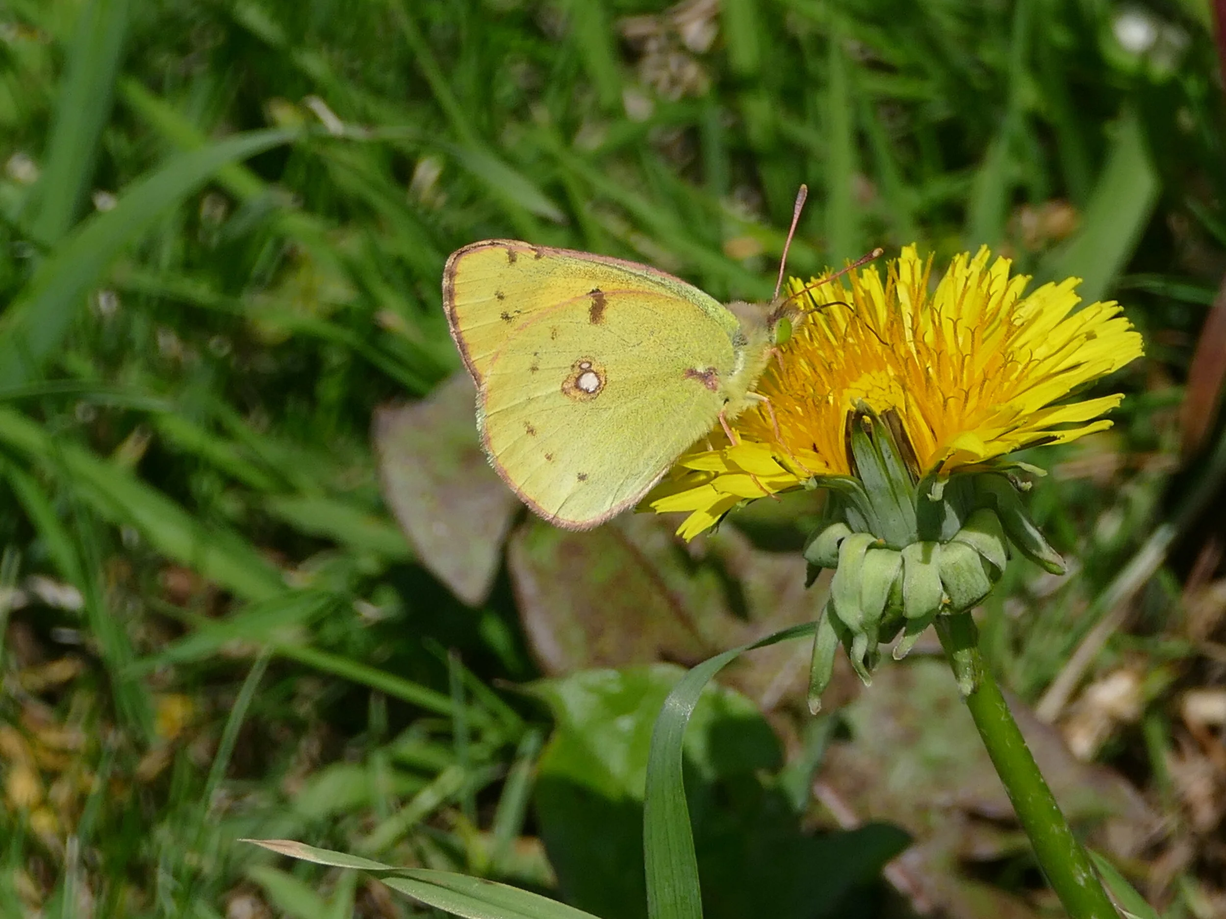

So, is there a role for all these different types of wildlife and conservation organisations? Of course there is, specialist knowledge is always valuable, but there is also a constant need to adapt to changing circumstances and to listen to the views of others, whether scientific or social. Just as the WWF and RSPB adapted their approach to conservation, so species experts like BC are having to adapt their approach to banging their particular butterfly, bug or bat drum.
At the moment partnership is vital, as exemplified by BC’s collaboration with holders of a different sort of specialist knowledge such as the London Wildlife Trust, the British Museum or the National Trust. No organisation is, or should try to be, an island.
Don’t forget to log your own wildlife sightings on iRecord (https://www.brc.ac.uk/irecord/ ), and yes, I know, yet another recording website.
And if you join Butterfly Conservation, and start transect walking, remember Johnny Cash’s immortal lines:
I keep a close watch on this heart of mine
I keep my eyes wide open all the time
I keep the ends out for the tie that binds
Because you're mine, I walk the line
He was referring to his wife, not to his passion for butterflies. The butterfly widow is not yet extinct.
Cynefyn
‘Terroir’ is very much a francophone concept of landscape and culture but other languages and nations have similar words to express this complex concept. The Welsh cynefin is as hard to define as terroir, but has strong links to ideas of place, of habitat, of belonging, of welcoming familiarity, of a location which feels like home. And it is an aspect of cynefin which occupies Terroir today.
As part of the research for a blog post on art in lockdown, we have been following a young Welsh artist and architectural designer who specialises in vernacular structures, particularly traditional Welsh buildings. Rob Thompson says,
“As an artist, my subject is the everyday. Although humble, [these buildings] seem to sit proudly in the landscape, and appear very comfortable in their habitat. The cottages, farmhouses and barns which are scattered across Wales’ western seaboard, offer a direct connection to those who shaped this land before us [and] are indelibly linked to the werin bobl (the rural people). Using locally sourced materials such as stone, slate, mud, timber and heather, they were relatively quick and cheap to build. By sketching and painting these buildings, I hope to record them before they disappear. Over the last few decades they have been vanishing at an alarming rate and when they do survive have often been so changed that they are barely recognisable.”
The paintings which have emerged from this understanding and appreciation of the west Wales cynefin have really caught Terroir’s attention.
One of Rob Thompson’s Instagram accounts (how many does a young man need?) started today’s journey across west Wales by introducing us to the ‘Crog Loft cottage’.


Rob writes:
“[the Crog Loft cottage is] essentially a single storey dwelling with a lofted space above for sleeping. Similarities exist in Ireland, Scotland and Brittany but the Crog Loft cottage version is uniquely Welsh. Its origins are linked to 19th century poverty and encroachment onto common land.” Those who were fortunate, would own a cottage with a tiny land holding [called Tyddynau] and could maybe keep a cow or other livestock, but the Ty Moel, or dwellings of the poorest members of society had no land and thus no additional resources to fall back on when times were hard. If, however, ‘you could successfully build your home overnight, and have smoke rising from the chimney by the morning, you could claim the land your house sat on.” These cottages were known as Ty Unnos, or overnight houses.
Single-room cottages such as these were divided by a dresser “placed half way across the space, thus separating the main cooking/living area from the bedroom. At some stage, planks of wood were placed over the box beds to create a sleeping platform and the Crog Loft cottage was born! Later, formal timber partitions, and in some cases stone walls, were built, creating a three-roomed space. The Crog Loft only sat above the bedroom, so the living and kitchen space was double height. There are many words for the Crog Loft. In Welsh it is called the taflod or in English, the cockloft. It is hard to know where it came from originally.”


Rob has been able to continue drawing and painting throughout lockdown, thanks to a library of photographs taken when travel across North Wales was still possible. But lockdown is also responsible for a new artistic venture, an exploration of lino cuts which has added a new dimension to his cynefin portfolio. Rob Thompson again:
“I have never done lino prints before. The notion of forming a negative on the lino was tricky to get my head around at first, and once you remove a piece with a cut you can't go back!
“I have a file of drawings of … vernacular cottages, farmhouses and barns around the coast of Wales which I would like to prepare [as lino prints], and which I think would bring the collection together, the aim being to produce a book one day. I like the way the process calls for a simplification of an image, yet the simplification is the difficult bit!”
Here is a Crog Loft cottage ‘simplified’ as a lino print.

Once again, Terroir discovered Thompson’s skill with lino and chisel through another Instagram post displaying a Welsh stick chair (below). I found it utterly compelling and symbolic; the very kernel, the quintessence of rural Wales, not in slate but in a piece of lino!

Lino print of three legged Welsh Stick Chair
The origins of this particular chair are equally compelling. Here is Rob’ story:
“I built the actual chair a few years ago while working on the construction of an oak framed visitor centre at the Felin Uchaf cultural and ecology centre in north west Wales. As well as building we were making welsh stick chairs, signposts, and all manner of rural craft objects. Before I left I was given some wood to make my own chair. The timber for the seat was elm from a fallen tree in Criccieth. The oak is from a forest behind Bodnant near Conwy, the peg joints for the arm are Yew from Llangernyw, and the joints for the seat are made from one thousand year old bog oak from mid Wales. The saddle of the seat is carved with an adze and chisel, the legs shaved with a draw knife on a shaving horse and the spindles for the back turned on a lathe, although not your traditional pole lathe but one powered by the engine and gear box from a Reliant Robin car! It took months to make all the parts and many a late night was spent in the workshop carving away. The assembling of the chair is similar to constructing a building. You have to understand the compression and tensions of the structure and how the different wood will react. It is like north west Wales in a chair! The chair now sits in my cottage. It has changed within it's now ten-year life: the arms and seat are worn, and some of the joints have risen a little from being in a heated room. It is in its own cynefin, and like the Welsh cottage of the past it is very fitting, as exactly like the home built furniture that would have existed then.
“The print came from a pen sketch done at the time when I first drew what I wanted to build. The three legs is a Welsh thing, three legs being more forgiving on wonky Welsh flagged stone floors. I translated it into a pencil sketch directly onto the lino rectangle. The tones are tricky to get right as you work as a negative. So whatever you scrape away becomes white and what is left is black or whatever colour ink you choose to use. If you remove too much then you can't go back so it is a bit nerve racking! You just have to go for it and a glass of a good ale (Welsh of course) helps along the way! The ink is rolled over the lino block and is then ready to print onto anything you like.
“The print is a very primitive design yet it took time to consider how best to put it together – a very similar process to the construction of the actual chair!”


Most of Robert’s paintings have stories attached. Terroir is now conversant with the grouted roof, another feature of the west Wales vernacular. Roof slates (often of poor quality) were bedded into lime mortar to prevent the wind driving through the gaps. Over the years, more lime mortar was applied to fill new gaps and to weather-proof the tiles, “so in some areas the roofs are white and appear like tents or cakes dotted across the landscape.”


“As for the farmhouse, a very different journey must be made to the uplands of Wales to find the most ancient Snowdonian houses, which is a building typology in its own right. These were homes of gentry hill farmers from when there was alot of wealth in the Welsh uplands - many go back five hundred years.”


Wales is famous for its terraces of quarry workers cottages, but a different quarry-related landscape developed on the slopes around Caernarfon. As a result of rural poverty on Anglesey and the Llŷn Peninsula, many moved to the Caernarfon area and built detached Tyddyn or Ty Moel houses, basing their livelihoods on a mix of quarry work and farming, creating a scatter of cottages and small farms across the local scrub land.


Rob’s work is important as a record of a vanishing landscape and architecture. He paints with the emotional understanding of a Welshman and the eye of the trained architect and craftsman. In Terroir’s view, it doesn’t seek to romanticise his environment, but to record his cynefin in the full meaning of the word.
Rob can be contacted via his infamous Instagram accounts @rob_thompson_artist @robthompson_architect @ty_bach_ and his website https://www.robthompsonart.co.uk/ (there is currently only one website but rumour has it that he is working on that too).
All images © Rob Thompson
Coal Porter
“Times have changed, And we've often rewound the clock …. Anything goes”
[Cole Porter, extract from lyrics of ‘Anything Goes’]
In 1934, when Cole Porter wrote ‘Anything Goes’ for his musical of the same name, Terroir doubts he realised just how prophetic his lines might be in 2020, when Cumbria County Council granted permission, for the third time, for the UK’s first new deep coal mine in 30 years. The development of yet another carbon based fuel supply has started a complex debate, revolving around steel production, world transport issues, economics, job creation, and carbon reduction. The government’s refusal to call in the plans, for an inquiry, has further inflamed the debate.
Coal (pun intended) has played a long and complex part in British history, a role which, due to the industrial revolution, has had repercussions around the world. Today, however, Terroir is focussing in on a very small coal-related area, but one which probably punched well above its weight in terms of economic and environmental impact. This is where the ‘porter’ bit comes in, as we will also be looking at the influence of the railways. Welcome to London’s Coal Drops Yard, welcome to Kings Cross.


A Kings Cross gas holder ‘from the back, By Robin Hall, CC BY-SA 2.0, https://commons.wikimedia.org/w/index.php?curid=9210813 Coal Drops Yard Central St Martin College of Art and Design, also ‘from the back’
In the early 18th century, Kings Cross wasn’t much of a destination. In Terroir’s mind the area only became famous for construction of the ‘New Road’ in 1756. This was a sort of early London North Circular by pass, and clearly delineated the edge of London, beyond which one threw one’s rubbush. To the north of the rubbish lay brick works, market gardens, open countryside and small hamlets such as Highgate and Hampstead. To the south, there was a rapid expansion of new housing, later joined by a Small Pox Hospital and later still, a Fever Hospital (classic infilling of the ‘city envelope’, to use modern planning parlance).
But the 19th century swept all this away: engineering, industry, transport, coal, a cycle which was to change Kings Cross - and the whole of Britain - forever. Canals started the revolution in the 1750s. With the completion of the Regent’s Canal in 1820, the canal system could deliver freight from the Midlands directly to north London, via Paddington, Regents Park, to Kings Cross, and then on around east London to Lime House and the Thames. By 1824, the Imperial Gas Light and Coke Company had opened the Pancras Gas Works immediately to the south of the Regent’s Canal at Kings Cross and the local landscape was well on the way to full industrialisation.
By the 1840s the Great Northern Railway Company was in town, looking for a depot and passenger station. Land was purchased to the south of the canal for the station (opened in its final position in 1852). The Great Northern Hotel followed in 1854 (at the posh, passenger-orientated southern end of the development) and extensive areas of housing (most on a very different scale of opulence and grandeur) were constructed for the now expanding workforce, in the north. Just to complete the picture, areas to the west of Kings Cross Station were redeveloped in the 1860s for the construction of the Midland Railway’s St Pancras station and goods yards.
This division between the north and the south extremeties of these two railway empires is significant. To use the modern parlance, the outward facing, passenger related elements of the Great Nothern and the Midland Railways were, literally, grand facades aimed at making the travelling public feel good. Unless you worked for the railways, I suspect that the great majority of the public, whether travelling or not, never guessed at the huge, grimy, commercial, ‘back of house’ yards through which passed thousands of wagons carrying thousands of tons of Yorkshire and Midland coal, as well as agricultural supplies such as grain and potatoes. Enclosed by high walls, these extensive land holdings were probably hidden from all except those, perhaps, on top of a double decker bus. The grime was due not just to the cargo but also to the exhaust of the steam locomotives which burnt some of that cargo in the course of their daily shunting duties. Kings Cross must have been a heavily polluted environment.
The maps below show the enormity of the industrial transport undertaking.


All map images 'Reproduced with the permission of the National Library of Scotland' https://maps.nls.uk/index.html
Top left: 1868-1873 survey: red circle - Kings Cross station and St Pancras station; black circle - Pancras Gas Works; green circle - Great Northern Railway yards; maroon circle - Great Midland Railway yards.
Top right: 1893 - 1894 survey Bottom left: 1913 - 1914 survey Bottom right: 1938 revision
Coal was King and where the profit lay. The ‘Coal Drops’ were built in the 1850s, to transfer coal from railway wagons to road carts. The Drops consisted of long linear structures, built of brick and iron, and roofed in slate, and carried high level railway tracks. Coal dropped from bottom doors in the wagon into hoppers beneath or down a shoot for filling bags. Kings Cross boasted two such Drops. There was also a Granary, a Train Assembly Shed, and Eastern and Western Transit Sheds.


Post WWII brought nationalisation of the railways and road transport started to make serious inroads into the railway freight operation. By the 1980s much of the goods yard rail insfraturure had been removed. Amazingly, the gas works continued, on a small scale, to the turn of the century but it was not until 1986 that four of the holders (No 8, and the three conjoined holders, Nos 10, 11, and 12) were listed Grade II ‘as a tangible reminder and physical manifestation of the St Pancras gasworks, which was at one time the largest gasworks in the country, and probably the world.’ https://historicengland.org.uk/listing/the-list/list-entry/1464325
By the 1970s Terroir had first-hand knowledge of the Kings Cross area and can attest to its need for regeneration. Using the trains was never an issue but ambling down the side of the station of an evening, waiting to board the sleeper to Aberdeen was always a bit of an adventure; worth it, though, to peer in the window of the model shop (as in railways and cars, I hasten to add) at No. 14 York Way. The shop always seemed such an anachronism in an area so obviously used for prostitution. There was never any evidence of the rave scene which made use of the deserted industrial buildings, but the overnight trains may well have left before that activity really got going. The nature park in Camley Street on the west side of the station, was a welcome addition, however, and painting the listed gas holder frames in black and red provided a cheering focal point, particularly when seen from the train. By the end of the century, however, the railway yards were derelict.
Regeneration of the area began in 2001 with the Channel Tunnel RailLlink and the restoration and expansion of St Pancras station, although the building works seemed never ending. Since then there has been significant investment in the area and the two hotels and Kings Cross Station have all been upgraded.
Which brings us to the regeneration of Coal Drops Yard. Pictures of the Yard at its most derelict are hard to find, but the two wikimedia photos below give a hint of the trnsformation.


Today, Coal Drops Yard is a very different place. It has, apparently, been turned into an ‘Experience’ offering plenty of retail, a culture hub and food outlets. An article in The Architectural Review started with these words: ‘The crowning jewel at King’s Cross Central, Heatherwick Studio’s Coal Drops Yard is yet another in a litany of cultural hubs cum shopping arenas that are carefully choreographed confections of disingenuous ‘authentic’ experiences.’ https://www.architectural-review.com/buildings/the-experience-is-everything-coal-drops-yard-london-by-heatherwick-studio For an awful moment I thought they liked it, but phrases such as, ‘The project is a kind of industrial-themed strip mall, poorly disguised as a bustling local marketplace’ made me feel better.
Here is Terroir’s critique. We visited Coal Drops Yard on a damp October afternoon before lockdown 2 started. It was a gloomy day and the site, although not crowded, was uncomfortably busy by lockdown standards, and the food and retail offer was limited. To us, it felt (indeed it was) wind swept, but also rather desolate. The boundary walls have gone, of course, making it accessible to all, but reduces its identity and sense of place. The granary and east and west transit sheds now house Central St Martin’s School of Art and Design as well as shops and offices. The buildings, however, seem stranded in a sea of paving, lacking any reference points or navigational aids to the rest of the site. We came across the entrance to Central St Martin’s almost by chance and were relieved to find something on a human scale to which we could relate. The two coal drops buildings, with their new, raised, flying roofs, like an enormous black moustache, are certainly eye-catching but we found the space below and between them uninviting. The cluster of gas holder frames are splendid and add height and structure. Their location, however, is very confusing until you understand that they were dismantled from their original positions, repaired, restored and re-erected on the opposite side of the canal, as part of the Coal Drops scene.
These photos were taken on a much better day (you can see how much we liked the gas holders) but not all members of Team Terroir were present.


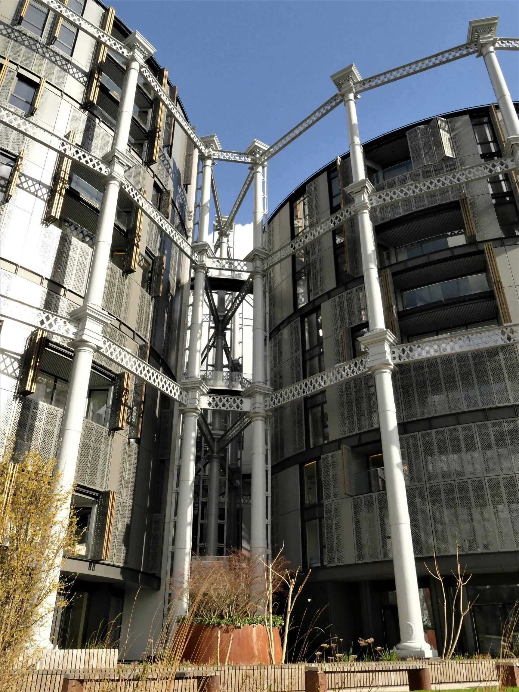


Finding it difficult to find a focus or haven within Coal Drops Yard itself, we attempted to find the canal. Again, the lack of reference points made it a longer search than it should have been, but oh, the relief when we finally located the tow path. Here was a landscape which we could read, understand, and navigate; from which we could appreciate the modernity of the new canalside buildings, and relish the juxtaposition of the old and the new.


When times are easier, the sun is out and the cafes are open, we will try another sortie to Coal Drops Yard. But I suspect that, along with the Architectural Review, we will not wowed by the ‘Experience’ and will once more seek sanctuary on the buzzing, linear highway of the Regent’s Canal.
‘And we shall have snow’
The north wind doth blow, And we shall have snow, And what will poor Robin do then? Poor thing
He’ll sit in a barn, And keep himself warm, And hide his head under his wing, Poor thing
Trad, Nursery Rhyme
The Oxford Dictionary of Nursery Rhymes, edited by those experts in children’s culture, Iona and Peter Opie, is silent on any possible ‘meaning’ of The Robin rhyme, although numerous websites suggest that it was used to ensure children associated home with security, as well as understanding how tough it was to be a robin. It is believed to be a British rhyme and may have dated back to the 16th century. The Opie’s earliest documentary reference is from Songs of the Nursery, 1805.

To be honest, Terroir is with the silence of the Opie’s on this one. Why would children need to be taught to associate home with security, or to pity the plight of the robin (or the blue tit or the thrush or any other fairly common and easily recognisable song bird)? Robins are, of course, especially obvious, and very sociable birds, particularly if anyone is turning over soil or dead leaves, which might reveal a few worms. Isn’t that reason enough to write a ditty about them? It’s a great song, very rythmic, majors on things we all understand such as cold winds, snow and keeping warm, and anthropomorphising a robin is a wonderful way to amuse children. Interestingly, the robin came eighth in the RSPB’s 2021 Big Garden Bird Watch’s top ten, but numbers are down by 32% since the Bird Watch began in 1979. So, please, pity the plight of the robin. And it’s habitat.
The point of quoting the rhyme was to introduce a blog entirely about snow, a topic which is current if not very original. We must replace the north wind with the Beast from the East, but there is plenty of other literature with which to celebrate a snow fall. Those who have recourse to shelter and warmth also have the resources to respond in verse to the extraordinary delight with which human beings respond to a white out. This exploration of literary snow will be based on a trip to The Moors, which regulars know is our local lockdown space. Terroir has reported on The Moors in summer and winter, but snow always reveals a new aspect to a familar landscape.


Brown skeletons of leaves that lag
My forest brook along;
When the ivy-tod is heavy with snow
And the owlet whoops to the wolf below …
From The Rime of the Ancient Mariner
Samuel Taylor Coleridge 1772-1834
No wolves on The Moors of course but plenty of ivy tods and leaf skeletons lagging the brook. ‘Tod’ is also an addition to the Terroir landscape lexicon. For those of us with a passing knowledge of Rhyming Slang, ‘tod’ means ‘alone’ or ‘on your own’ derived from Tod Sloan, the American jockey. To be ‘on your tod’ was (maybe still is?) a common phrase in any south London childhood. But in landscape terms, a tod refers to a mass or bush, or a measure for wool. Dictionary.com describes it as an ‘English unit of weight, chiefly for wool, commonly equal to 28 pounds (12.7 kilograms) but varying locally', and ‘a load’’, or ‘a bushy mass, especially of ivy’. Thank you Coleridge.


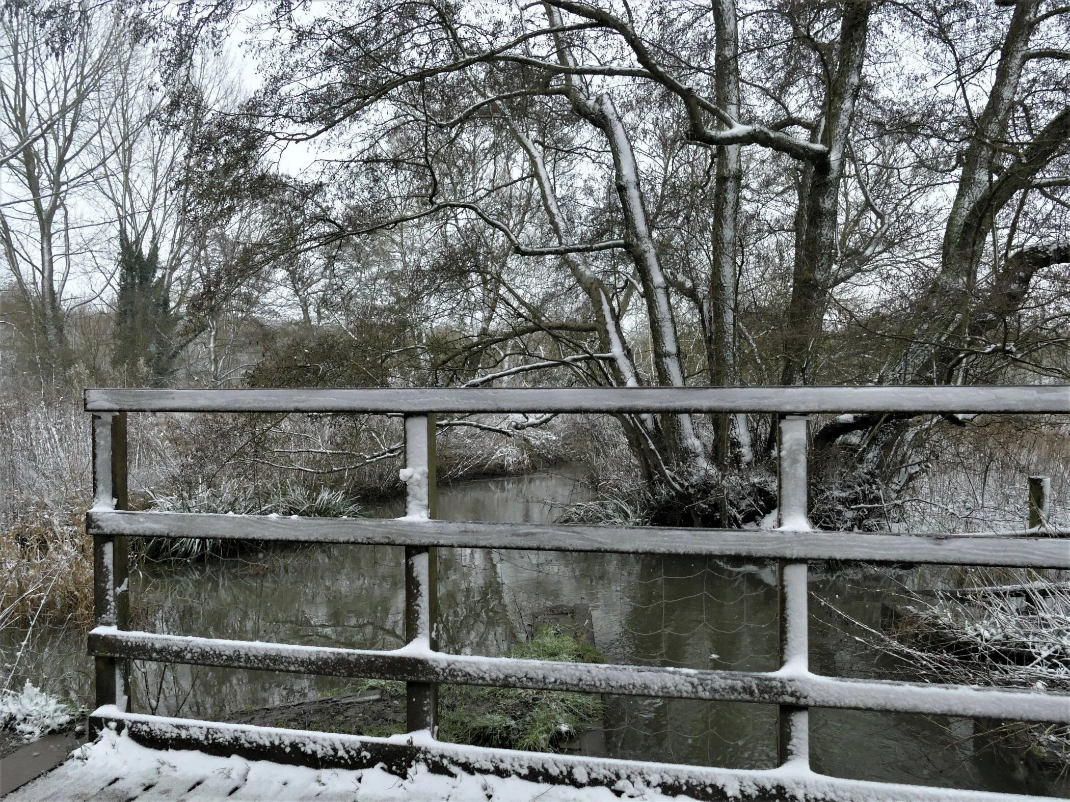


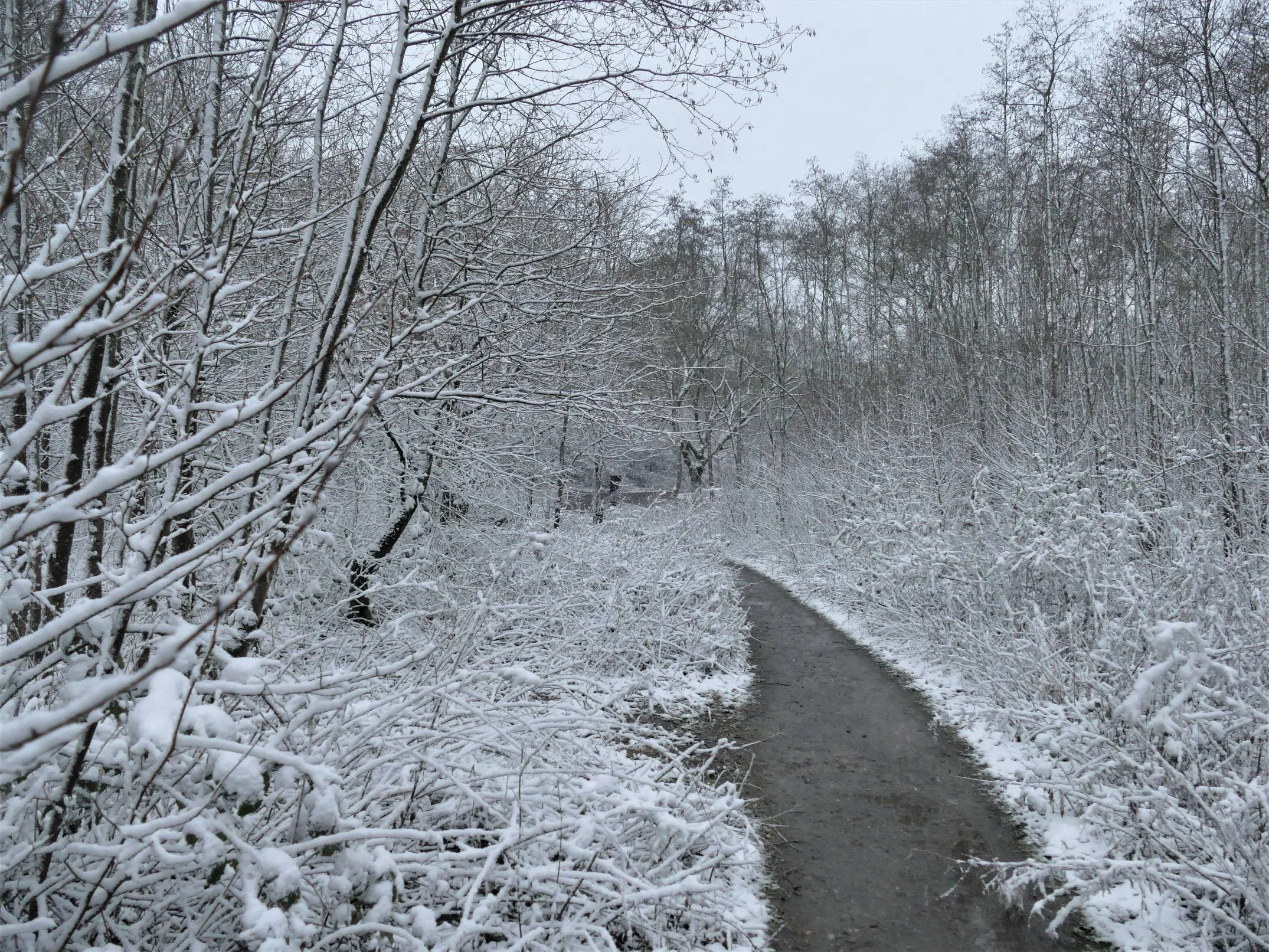
Hail, old patrician trees, so great and good!
Hail, ye plebeian underwood
Opening lines of Of Solitude [not a great advertisement for the ecologically essential scrub]
Abraham Cowley 1618 - 1687


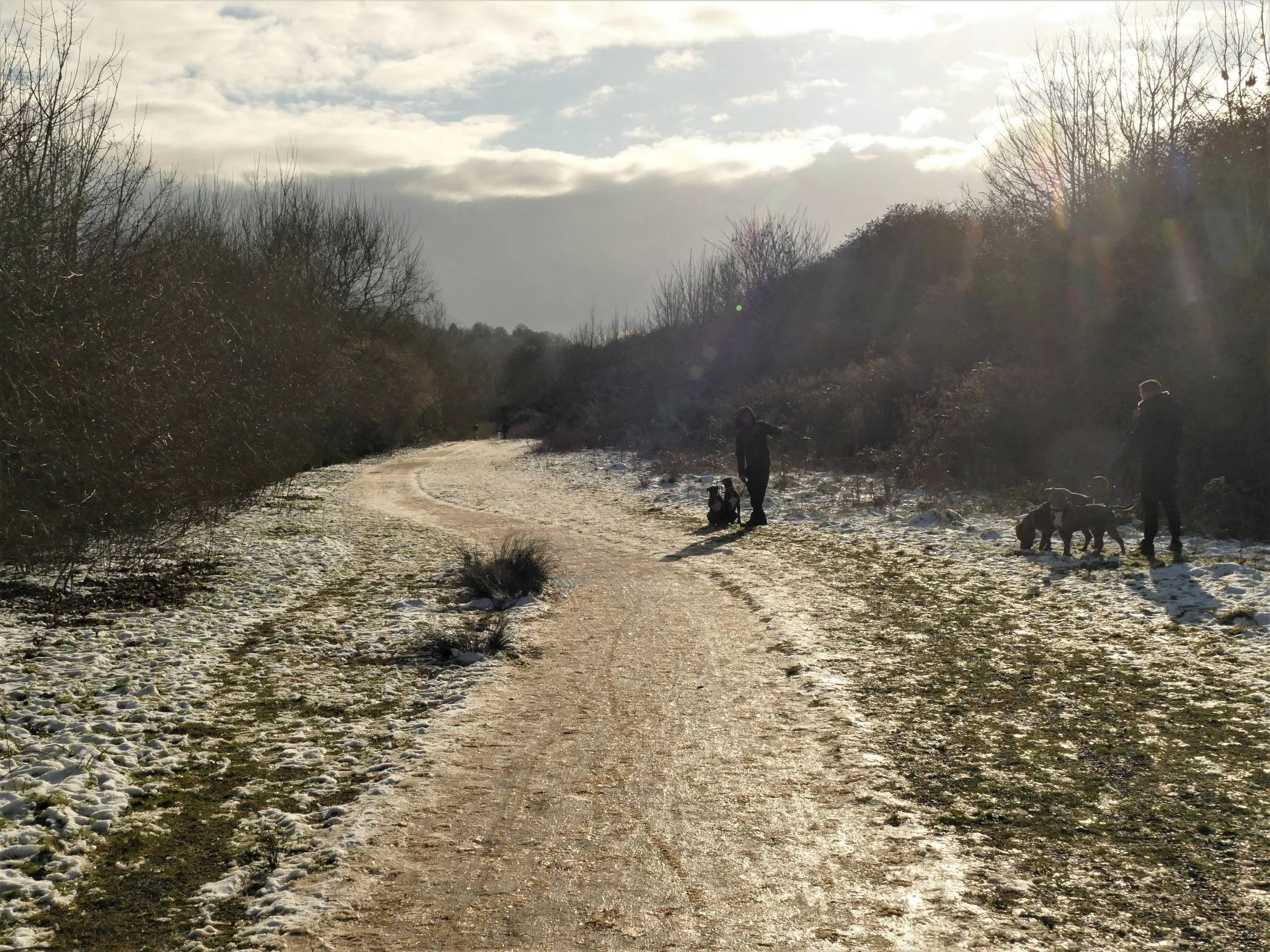
From troubles of the world
I turn to ducks,
Beautiful comical things….
… or paddling
-Left! right!-with fanlike feet
Which are for steady oars
When they (white galleys) float
Extracts from Ducks (written for F.M. who drew them in Holzminden Prison) [Ducks, both real and poetic, still provide tremendous therapy and enjoyment]
F W Harvey 1888 - 1957
Let Hercules himself do what he may
The cat will mew and dog will have his day
Hamlet, Act 5 scene 1 [or day-ly walk]
W Shakespeare 1564 - 1616


‘Oh look at the trees!’ they cried, ‘O look at the trees!’
London Snow [but still very appropriate to the Moors]
Robert Bridges 1844 - 1930


Every branch big with it,
Bent every twig with it;
Every fork like a white web-foot;
Every street and pavement mute:’
Snow in the Suburbs [spot on for the walk home from the Moors]
Thomas Hardy 1840 - 1928