
Season of Mists and Mellow Fruitfulness
Dispatches from the North West
“Season of Mists and Mellow Fruitfulness”: so goes the well known first line of John Keats’ poem ‘To Autumn’. A little over 200 years since that poem was written we still marvel at the wonders and beauty of the season. Here in the Vale of Clwyd in the far north of Wales mists are rarely seen – in fact Team Terroir Gogledd Cymru/North Wales find it difficult to recall the last time it was truly misty or foggy in the Vale. To the east over the mountain range where north east Wales meets the Cheshire Plain the towns, villages and countryside are frequently shrouded in mist at this time of year but the fresh winds blowing across the Vale from the moors and mountains to the west ensure that any would-be mists are rapidly dispersed.
But fruitfulness we have in abundance. And not just fruit but also seeds and berries in profusion. It can be said that the autumn of 2022 has been truly bountiful, more so than for many years. The hedgerows are filled with blackberries, sloes, bullace (the latter two excellent for fruit gin connoisseurs), hips and haws. The trees are laden with acorns, rowan berries, crabapples, beech mast and chestnuts. Similarly the trees in our orchard have produced most plentifully and the fruit harvest has kept this part of Team Terroir fully occupied throughout much of October.
Orchards are not a dominant feature of the landscape of north Wales (unlike the vast areas of fruit trees in some English counties) but they do, in a quiet and discrete way, occur frequently in association with many farms and smallholdings. Small is beautiful as they say. Typically an orchard here can range from just five or six trees up to maybe a dozen or more but rarely larger. The small vernacular cottages may only have the space for one tree but growing fruit for self-sufficiency rather than any commercial reason is very much the tradition here. This is reflected in the fairly frequent occurrence of the Welsh word Perllan, often mutated to Berllan, in local farm and other place names. Examples include Ty’n y Berllan (house in the orchard), Cae Berllan (orchard field) or even Berllan Surgery in Denbigh suggesting it’s on an old orchard site.
Sadly many of these orchards are in serious decline with numerous dead and dying trees. Their contribution to biodiversity has been recognised for some time and traditional orchards were given priority Biodiversity Action Plan (BAP) status in 2007. Much more information can be found in the Traditional Orchard Habitat Inventory of Wales produced by Natural Resources Wales (https://cdn.cyfoethnaturiol.cymru/media/685908/eng-report-018-traditional-orchard-habitat-inventory-of-wales-2014.pdf).


Our original orchard (see images above), which we think dates from around 1900, contained five apples, three pears and two plums. A typical mixture. What is of particular interest, of course, is the composition of types. Two of the apples are straight forward gnarled old Bramleys. One consistently crops heavily whilst it’s equally healthy immediate neighbour normally refuses to produce a single apple – this year being no exception. Very occasionally it concedes and yields maybe 10 or so fruits and then reverts to its intransigent state of fruitlessness. One apple tree succumbed to Armillaria (honey fungus) at an early stage and two of the remaining apples are of unknown varieties. Very productive they are too but we can only guess at their origin. With that in mind and aware of the need to conserve heritage varieties we have taken cuttings and grafted them onto rootstock. The other trees are a couple of pear varieties, a yellow plum which died recently and a Denbigh plum which is slowly disintegrating with each successive storm. The latter is of great interest though as it is the only plum variety native to Wales and now enjoys Protected Designation of Origin (PDO) status. It therefore stands alongside such wonders as Cornish Clotted Cream, Jersey Royal Potatoes and West Wales Coracle-caught Salmon! (https://businesswales.gov.wales/foodanddrink/how-we-can-help/new-uk-geographical-indication-gi-schemes-0/vale-clwyd-denbigh-plum-pdo). There are now a number of projects the length and breadth of Wales aimed at identifying and propagating heritage varieties of all fruit trees and encouraging the establishment and restoration of orchards.


To these trees we have added a couple of damsons and two more Denbigh plums as our original tree is in rapid decline. Anxious to ensure long term continuity we found a small area in the old paddock to plant more fruit trees.So the ‘new orchard’ was born (images above). Starting in 2008 with around 15 trees, mainly apple (including Worcester Permain, Cox, Red Falstaff, Russetts, and James Grieve) but also a plum and three Morello cherries (the latter having been disappointingly unsuccessful) the growth rate was phenomenal and most started to yield within a couple of years.


Above left and centre: Red Falstaff - small tree but consistently big crop Above right: Russett - all round versatile favourite
Two trees are of special note being North Wales heritage varieties. The first is the Enlli or Bardsey apple originating from a single tree on Ynys Enlli/Bardsey Island off the extreme North West tip of the Welsh mainland. More on this at www.bardsey.org which describes how the apple came to be ‘found’ as well as lots about this fascinating but remote island. The other tree of note is the Anglesey Pig’s Snout/Trwyn Mochyn Ynys Mon. So called because of its tapered and angular shape broadly reminiscent of a pig’s snout albeit rather greener! There is more on this at https://treborth.bangor.ac.uk/welsh-orchard.php.en along with descriptions of other Welsh heritage varieties growing at the Bangor University botanic gardens.


Above left: a cluster of Enlli/Bardesy apples Above right: the distinctively shaped Trwyn Mochyn Ynys Mon/Anglesea Pig’s Snout - crops late, keeps well, excellent baked or in pies
Fast forward nine years and the North Wales Wildlife Trust have embarked on a project to propagate and establish heritage fruit trees. We referred earlier to the typical farm orchard so often in decline. This project attempts to reduce that decline and foster better care and management of orchards and the attendant biodiversity value.

The Trust collected cuttings from unusual, maybe unique, varieties and grew them on. In many cases they didn’t know the names of the varieties so developed their own nomenclature. This consisted of a series of traditional Welsh girls’ names. Then, with the Trust overburdened with little trees needing secure homes, we were duly offered a number of young plants. So we acquired Myfanwy, Catrin, Angharad, another Enlli, several Denbigh plums and, slightly bizarrely, a Warner’s King (right) whose origins are in Kent. www.gardenappleid.co.uk
The importance of fruit trees and orchards for their wildlife value cannot be over-stated. Not just the trees themselves but their flowers for early pollinators, buds for finches, fruit for birds and butterflies (red admirals love fallen fruit) and the tall vegetation beneath. One tree or many trees – they all contribute significantly to biodiversity.
Next week is all about consuming fruit!
All images © T Thompson

Creel House Tribulations
Two weeks ago, we were reunited with artist and vernacular architect, Rob Thompson. Terroir first spoke to him in his native North Wales (see Cynefin, Blog 18, February 2021) but last summer we discovered him in Glencoe, having been working on the construction of a historic form of dwelling, called a Creel or Turf House. During our last blog, we quizzed Rob on Creel House basics – the ‘what is it’ and the ‘why on earth build one’ sort of question. Today we’re getting in much, much deeper to the practicalities, and uncovering some surprising stories.
Terroir: Rob – you said that this sort of vernacular architecture used local materials. So where did you get your timber, turf and heather?
RT: on the whole the timber was sourced locally from within Glencoe.
Turf is more tricky, however. It comes in many different types, usually clay, silt, or peat based. Clay and silt rich turf shrink back the least, and are the best choice when building a structure that would suffer if a turf with high shrinkage was to be used.
Peat based turfs are lighter in weight and hold more air. They are used where a high level of insulation is required, as is the case in Glencoe. They do however shrink back the most and this can be a problem if the building’s design does not allow for this to happen.
The turf for the walls at Glencoe was sourced from directly next to the site. The blocks were produced with a diagonal cut, and carried over to the site. I think it is an especially important aspect of the build that the walls, which are unlikely to outlive other parts of the structure, have come from, and can be returned back to, the ground in close proximity to the building.
The walls are up to a metre deep in places and of solid turf block laid in herringbone course.

As the peat rich turf slowly shrinks as it dries out, the joints should close up. Additional height was added to the walls, to compensate for the loss of height due to the shrinkage of the turf. The walls are angled with a batter. This allows the load to spread, reducing the risk of collapse. The batter has also caused some issues, though, as its projection acts as an extended area for rain to hit.
Image above: the turf house steams gently in a brief sunny interval
Terroir: did you say there was turf on the roof as well?

RT: yes, it’s called a turf divot, a layer of thin turf used as an insulation layer. It sits on the cabers (the roof timbers) allowing a levelled off area for the heather thatch to sit on. The thatch is then attached to the divots using hazel staples and spars. The divot also absorbs moisture so acts as a second line of defence against wind and rain.
Above: turf divots being covered by heather thatch
Although we managed to source the wall turf locally, there was not enough left to line the roof as well. This is where the 21st century began to impact on the build. A turf cutting area of sufficient size could not be found in Glencoe due to the glen’s protected status as a Site of Special Scientific Interest (SSSI).
Eventually the turf was cut from the National Trust for Scotland (NTS) site at Kintail approximately two hours north of Glencoe. The cutting site was a flat meadow field close to the road. The cutting process was a difficult thing to get right.
A day was spent attempting to cut turf with a double width machine, the Turfaway 600, which looked an impressive lump of an American machine. It proved to be useless for this work, however, as the blades were unable to stay in the ground long enough to cut any decent turf. A replacement, older and heavier machine arrived several days later together with a mechanical wheelbarrow to pull it!
The turf was cut and stacked ready for the collection. The staff at the National Trust and the crafts people used a trailer and Land Rover to take it back to the creel house site - some 8 trips were needed.
Terroir: no local sourcing there, then. What about the heather for the roof? No shortage presumably?
RT: hah!
Terroir: pardon?
RT: you would think it would be easy, wouldn’t you?
The heather required for thatching is the common native heather (Calluna vulgaris) which thrives on poor acid soil found in the highlands of Scotland. The original intention was to gather heather from the NTS’s Mar Lodge estate, but due to nesting birds, it was not feasible and in the end, it was gathered from the neighbouring Invercauld estate.

The picking of heather suggests the idea of walking through an open field, picking flowers with ease. Heather picking is far from this, requiring the plant to be physically pulled out of the ground, roots and all. It’s hard manual labour with wildlife hazards: adders, clegs (horse flies), midges and ticks all need to be dodged, swatted or removed.
Once pulled, heather is bundled. A bundle size is a tight, ‘oversize hug’ ie a ‘hug’ plus about a foot between each hand. The material is pulled in, and when no more can be hugged it is ready to be stringed together. The twine is tied tightly around each end straightening the bundle out. This process often involves a bit of wrestling with the heather to get it compressed to a point where it is feasible to tie the string around. A length of string is about one stretch of an arm.
For the purposes of the project, 1,000 bundles of heather had to be transported from Braemar to Glencoe - carried by a huge articulated lorry.

15 people took part in the heather gather over 10 days. There was one afternoon off, one visit to the pub, three swims in a river, and one end of gather party! The accommodation was a bunkhouse in Braemar.
Image © Mark Thacker
Terroir: and you still haven’t started thatching!

RT: thank goodness the traditional craft of thatching is still alive and well. Working from the base of the roof, around three layers of heather were fixed with a spar, then another three layers and so on to the roof ridge. The intention was to thatch the ridge but suitable lengths of heather were limited. A decision was made to do a turf ridge instead which is seen on many examples of heather roofs, including the township at the Highland Folk Museum.
A daub coating was added to seal the heather on the final layer. It was a hot period and the daub baked dry in the sun. Turf divots were then used to form the ridge, one layer pegged grass side down, and a second layer, overlapping the joints in the lower layer, placed and pegged grass side up. It is thought that this will last up to two years before it will require replacement. Maintaining this will involve very little; if it required a trim a rabbit on a lead could be used!


Image left: the daubing process Image right: the creel house with the ridge sporting a neat, turf mohican
Terroir: it all sounds a bit short term. Does it really work as a form of dwelling?
RT: I know what you mean. I have always associated turf wall construction with that of the Ty Unnos tradition in Wales. Here it was often used as a quick temporary building method, before a more long term method would be applied to replace it at a later date, such as stone or Clom (compressed earth similar to Cob in England).
Turf has a relatively short life expectancy before it breaks down. Roots that bind the turf slowly rot, and the turf degrades. It is interesting when looking at accounts of the creel/turf houses of Scotland that they were rebuilt very often. There would often be two sites that a dweller would rotate between, taking the valuable parts of the building with them, and allow the walls, and roof to rot away back into the ground. Often the building would become a cattle shed, then as it collapsed, a Kale yard. It is evident that the building went through a variety of uses before finally returning to the earth again. It seems like a very sustainable way of building!

The life-cycle of a creel house
All images © R J Thompson unless otherwise stated

The Creel House
No, not the name of a pub, nor a seaside shed for storing fishermen’s baskets. The Creel House in question is located in Glencoe, some 35 miles from the Port of Oban (the ‘seafood capital of Scotland’) and well over a mile from the nearest Inn.

But before we explain, let Terroir take you back to February 2021, when we posted a blog (entitled ‘Cynefin’) featuring Rob Thompson, a young Welsh vernacular architect and artist. At the time he was firmly located in his Welsh homeland, sketching and painting traditional Welsh cottages, houses and barns, all constructed from local material.
Derelict crog loft cottage, Anglesey © R J Thompson
In the summer of 2022, we tracked him down again, now living in Glencoe, and finishing off the construction of a Scottish Creel House, located at the National Trust for Scotland’s Glencoe Visitor Centre.
So, what is a creel house?

RT: The Creel house, sometimes also called a turf house, is basically a very large basket, like a coracle, or log basket. A timber cruck frame holds up the main structure and roof, with basket (creel) panels between the frame. The one at Glencoe is a rather over-engineered version, and the originals would have relied more on the creel aspect with a much skinnier timber frame.
The non-load bearing turf walls form a wind brake around the perimeter. A creel house would have been an especially common structure in the west of Britain where there was plenty of hazel in the warm damp conditions of the western seaboard.


Above left: the cruck frame, creel walls and timber roof lining
Above right: herringbone turf outer walls, with tiny window, under turf and heather thatched roof
Terroir: Who lived in them?
RT: Creel houses would have been the homes of those who dwellt in townships (villages) in this part of Scotland. The type of building housed a range of social classes within the township. People would live at one end and animals at the other. The animals would help to keep the building warm. This was once a common living arrangement, and seen in similar types of buildings such as the longhouse in Wales and western England.
Creel houses were located all over Scotland and were the predecessors of the later stone built homes. Evidence shows they existed anywhere where hazel or timber was obtainable.
Terroir: probably a silly question, by why aren’t there any left?
No original Creel houses exist today. Due to the very organic nature of the materials used in their construction they had a very limited life expectancy. They are described as pre-improvement dwellings. Landowners discouraged the use of turf as a building material in the earlier part of the 18th century, to prevent large areas of potentially fertile land being stripped. The use of stone was encouraged as a building material instead.

Many people felt that their turf and creel houses were warmer and better insulated than the new stone houses and often refused to move out of their basket dwellings. Much propaganda by the ‘establishment’ deemed these creel homes poor and squalid, and forced the eventual demise of such structures.
Terroir: why build one and why in Glencoe?
RT: It is experimental archaeology; it tries to demonstrate a lost vernacular building style, and to understand how the materials used would behave. The building will also form part of a wider interpretation in telling the local story of the massacre of Glencoe.
From my point of view, and that of many of the crafts people involved, it is hopefully creating a resource for understanding this lost typology, and to provide an example of these materials and techniques. The turf wall aspect is particularly unusual.


Above left: turf wall detail. Above centre: base stones to keep the turf dry and off the ground. Above right: modern construction and safety techniques support ancient thatching skills
Terroir: how did you know what to build and what materials to use?
The building is based on archaeological findings from the National Trust for Scotland’s (NTS) excavation of the 17th century township of Achtriachtan further up the Glen - one of the main townships which predated the Glencoe massacre in 1692. The footprint for the new creel house was based on one of the larger houses to be found in the group. Along with written historic references and maps, the findings enabled the design of the new, replica house.

The project was commissioned by NTS, and constructed at the Glencoe NTS visitor Centre as a visitor attraction. The work was mainly funded by enthusiastic American donors, keen to see a recreated creel house form part of the interpretation of the Glencoe Massacre of 1692. It was led by an architect and a team of skilled crafts people. My involvement was funded by Historic Environment Scotland (HES) as a way of creating a skills legacy, including a record of the construction process, the skills and materials required and a maintenance manual. [Terroir: if only all new houses came with one of those]
Terroir: do you think that this new Creel House looks anything like the original dwellings?
RT: I think it is similar to an original creel house, but this is a very beautiful ‘Rolls Royce’ example. I think that the originals would have been a truer product of what could be sourced close to hand. Also I imagine the houses would have been continually altered and improved to cope with the climatic influences of their locality. What is important to understand is that these houses were often only built to last a few years, but this example has been constructed to last a lot longer, so it has to be more robust!
Accounts from the time revealed a palette of what materials may have been used, but it is not always clear how exactly some of these materials may have been used, for example, the coursing of the turf walls, or the use of glass in the window. The timber frame and wattle creel infill is similar to historic references, but the need to comply with modern building regulations made this a much more over-engineered example.
Terroir: are their lessons to be learnt?
It is a great example of what we can do with the materials in a historical way but I think that these materials can be developed into a modern context too. Long lost building techniques such as constructing with turf could be used in new homes, and I think it has certainly made people more aware of these materials, and their uses.
Having worked a lot with turf over the last year I can see its merits as a building material. Turf is easier to obtain than stone and is much better insulated. It is cosy to sit within the walls of a turf house, and it does not feel cold in the same way as a stone house. I also think when it comes to self-builds that turf and timber are both very user-friendly materials for anyone to try using.

Our next blog will return to Glencoe and its creel house and look at some of the unexpected and unintended consequences of creating a traditional building in a 21st century landscape.
But the best unexpected consequence is thanks to the Society for the Protection of Ancient Building (SPAB). The SPAB Heritage Awards will be presented by Kevin McLeod on the 3rd November in London https://www.spab.org.uk/news/new-awards-celebrate-historic-buildings-and-craftspeople . There are three finalists in the ‘Building Craftsperson of the Year Award (career changer)’ and we are delighted to announce that Rob Thompson is one of those three. Good luck Rob!
All images © R J Thompson

Who Lives Here?
What do our houses say about us?
For most of us, probably not a lot. Obviously the size and location of abode gives passers by an inkling of our financial standing. Something about our taste may be revealed in the external appearance of the dwelling place. Any garden may hint at our passion – or lack of it – for horticulture. What’s on the drive may signal a petrol head or whisper of a serious cyclist. But, on the whole, unless you have a liveried vehicle parked out front, our trade or profession, the name of our employer, or our pay grade, is not immediately obvious.
Looking at the images below, we might like to think we can work out the sort of person who would be living in any of these assorted homes, but to be honest, we have no idea.


Even whether we own or rent our property is less obvious since Mrs Thatcher’s ‘Right to Buy’ policy. Council Houses were always easy to spot: just like other mass building styles but with no external adornment whatsoever.


Former Council Housing
One of the early and easy ways of putting your own mark on your newly purchased council house was to replace the plain, unadorned, original front door with something more stylish, perhaps with an inset window, panels or a never-before-seen colour scheme. These days, social housing – what’s left of it – is much harder to spot.

But anonymity is not available to all. Consider this image (right):
Simply the name of the house reveals that at least one of the inhabitants is a committed Christian, is paid a not particularly generous stipend, is a cog in the Church of England behemoth, does not pay rent, council tax or water rates and won’t have to cough up to mend the roof. On changing job, parish or on retirement, the family will all have to move out.
Of course, in this particular vocation, making known one’s location is part of the job and is, I suppose, a not too onerous burden in the bigger scheme of being an effective Rector.
As an aside, it is interesting to note that this modern Rectory is now the hub of a United Benefice consisting of three village churches, and has replaced three former rectories, one in each of village.
Here is a view of one of those former Rectories. This glorious, historic edifice, now divided into two, generously sized homes (below left and centre), sends out an entirely different message about the status of Rectors in the Church and in Victorian Society, compared with the more modest and modern Rectory (below right). The latter requires a lot less upkeep (for the Church of England) and a lot less heating and house work (for the incumbent and family) than its predecessor.


Which brings us neatly onto that other form of a dwelling which ‘goes with the job’ - the tied cottage. Often associated with agriculture, tied cottages became an increasingly significant part of rural housing with the 18th and 19th century Enclosure Acts, which dismantled both common land and commoners right (grazing, gathering of fire wood etc), much to the detriment of the local, independent, small scale, rural economy. Working people became more dependent on paid agricultural employment and, from various motives, landowners increasingly offered their workers some form of accommodation. Rent was probably minimal and the house considered a perk of the job. It sounds idyllic, all roses around the door, with farm hands located close to where they worked, but of course it gave land owners much greater control of their work force and the workers had few rights and little or no security.
Many reforms of the system were made in the 20th and 21st centuries, including right to buy options, but the system became increasingly unfit for purpose and, with drastic reduction in the need for agricultural workers, many tied cottages were sold off to reduce overheads.

In the 20th century, many of the landed estates started to develop or extend a system of colour coding for their estate properties. Of course the mansion at the core of any particular land holding did not have its doors and window frames painted in the estate colour of choice (right Petworth House, now National Trust, is instantly recognisable but delightful anonymous)
but it became common practice for other estate owned property – from farm yard to village hall to village shop to estate cottages – to be painted in the appropriate colour.
An article in Country Life (https://www.countrylife.co.uk/interiors/why-you-see-matching-front-door-colours-across-great-swatches-of-the-english-countryside-226604) talks nostalgically about the colour options chosen by the big estates. Cowdray’s Sussex estate has doors and windows painted a bright yellow. The Duke of Northumberland’s Surrey Estate is adorned with a tasteful green. There is Chatsworth blue and Belvoir brown. It does add a certain piquancy to the rural landscape, that splash of unexpected colour which provides a highlight in a green and brown English landscape, reminiscent of the impact of a Gilbert Scott red phone box on the corner of a lonely rural lane.


Above: Northumberland Green and Cowdray Yellow
Of course, it is also very paternalistic and a form of marking your territory and branding your belongings in the way we used to brand cattle. Signs such as Keeper’s Cottage, The Bothy or the Old Forge tend to appear after the last game keeper, gardener or blacksmith has long gone. Yet, if you live in a cottage on a large estate, you may have no choice, as the identity of your landlord/employer may be emblazoned, in colour, all over your door and window frames.
What did the Russians ever do for us?
I am sure there are many plucky overland travellers who have driven from Europe to Central Asia. I like to think Eric Newby started the trend in 1956 (see ‘A short Walk in the Hindu Kush’, when he and Hugh Carless drove a ‘brand new station wagon … painted in light tropical colours’ from London to Afghanistan) but no doubt there have been plenty of others, both before and after. We also know cyclists who have pedalled from Europe to Kyrgyzstan, and who report a vibrant and friendly camaraderie which supports them along the way.
But most of us take the less adventurous option and fly by commercial airline, even if we are beaten up by our carbon consciences. We say ‘less adventurous’ but struggling through Heathrow is no longer a walk in the park and there is that terrible frisson of fear when, checking in for a flight, one’s baggage disappears bearing the IATA airport code FRU when one’s ticket clearly states Bishkek.

‘Bishkek’ is a modern concept - the name was adopted at independence in 1991.
There seems to have been some sort of habitation here for centuries, but the Khan of Kokand fortified the site in the early 19th century and the Russians later carried on the work with the establishment of a strategic Cossack garrison.
Image above: the Kyrgyz Republic’s flag flying proudly from the 45 m high National Flag Pole over Bishkek’s Ala-Too Square
By 1878 the town was known as Pishpek and, by 1914, it had swollen to a substantial city of Russian and Chinese immigrants. Enter the Bolsheviks in 1917, and by 1926 Pishpek became the capital of the Kyrgyz Autonomous Socialist Soviet Republic, and was renamed Frunze, after a locally born but recently deceased Bolshevik general. Hence the IATA code of FRU.
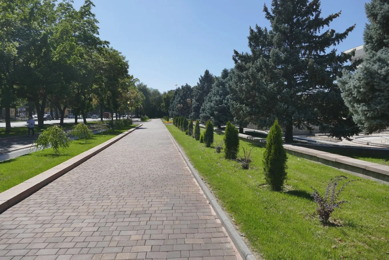
Today, central Bishkek’s basic bone structure is still that of a Central Asian capital city constructed during Soviet times. The classic elements are all there – wide boulevards, substantial parks, central spaces for mass rallies, backed by imposing ‘public’ buildings and, of course, statues of Lenin. It scrubs up well though and gives a maturity and presence to the capital of this new Kyrgyz Republic.


The wide boulevards are harder to photograph, cluttered as they are with both parked cars and moving vehicles, but they still slice through Bishkek’s urban area, creating a central grid pattern lined with trees, and radials which connect with surrounding areas, and offer tantalizing glimpses of the mountains.


Parks are a welcome addition in any Kyrgyz town, providing much needed shade, colour and social space, particularly in summer.


Independence was not an easy ride, however. Under the Soviets, there were jobs for all, housing and sufficient food, schools and universities. After independence, the economy crashed and none of the basics provided by the Soviets was a given. In addition, there was political instability, and ethnic friction in the geographically more distant south west, close to Uzbekistan and Tajikistan. Violence and revolution flared on a number of occasions.
Colin Thubron’s journey through Kyrgyzstan in the mid 2000s (Shadow of the Silk Road, first published 2006), describes poverty in both town and countryside. One chance acquaintance is quoted as saying, “We’re a poor country. We never looked for independence. It just fell into our hands. We should have had battles and rebellions against Moscow. But it was all done for us by others…”. His younger, post-communist, cousin describes being Kyrgyz as “hav[ing] no burden… Others have a burden of history. But we – nothing!”

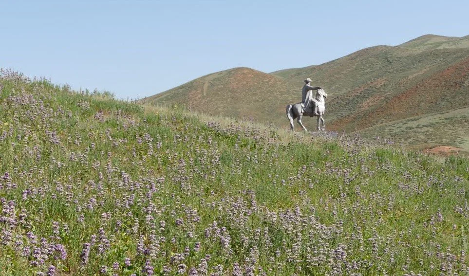
We saw and felt the impact of this historical void in 2022 but also appreciated the actions taken to fill it: the increased self-esteem with the re-introduction of the Kyrgyz language into daily Kyrgyz life, the pride in the re-establishment of the legendary hero Manas (image left), the awareness of the need to conserve nomadic customs and traditions.
Bishkek’s statues reflect some of this re-acquisition of the Kyrgyz identity. Manas is huge, of course, literally, figuratively – and numerically. It’s a delight to see him pop up on road sides, town squares and mountain sides.

Perhaps surprisingly, Lenin is still present (image right), but has been moved from his original postion. He is no longer gesturing at distant mountains but seems to be waving at the former Central Committee Building . Read into that what you will.
Marx and Engels are still deep in conservation (below left). The Soviet Friendship Monument (below centre) is still floating above Ala-Too Square. But new post-Soviet monuments are also appearing, the most arresting being the black and white marble monument (below right) dedicated to ‘Those who Died for Freedom’. It is located close to the President’s Palace where protestors chained themselves to the railings.


The reinstatement of religion also tells a story: “A poor Islam and a disgraced Communism...” (Colin Thubron’s Shadow of the Silk Road again). Our guides were somewhat embarrassed to tell us that there are now more mosques in Kyrgystan than there are schools. Funding appears to pour in for mosque construction, from Turkey, from the Middle East, and there are fears of fundamentalism. On the other hand, Kyrgyz people seem to practice a brand of ‘relaxed’ Islam, mixed with, or influenced by other, older influences such as Shamanism and Buddhism.

Some mosques are elaborate affairs (left), but many look like flat pack Ikea kits, consisting of a squat base, usually (but not always) a small dome, and a stick-on minaret which no muezzin could ever hope to climb.


In contrast, the Soviet era cemeteries seem ethereal, arresting - and distinctly un-egalitarian.


In the countryside, the 19th century Russian immigrants had already wrought significant, if small scale, changes by cultivating land and living in houses. But the Soviet approach was based on centralised control, via the collective farm, with its larger scale agricultural buildings.
We could only imagine the impact of the return to a market economy, combined of course with outward migration which presumably meant fewer agricultural workers but at least some money coming back in from remittances sent home.
We saw very little evidence remaining of the former collective farm stores and structures, and the scale of post-Soviet agriculture seemed very variable. Some fields were being tilled by hand; some showed a basic degree of mechanisation while other areas were growing arable crops across significantly large areas – all presumably for the home market. Wonderful apricots and other fruits also feature. Some fields were fallow, or possibly just totally neglected. A few were irrigated, some not. We saw few cash crops such as cotton or tobacco. But then we didn’t visit the Fergana Valley which may have a very different landscape.


Growing fodder for livestock still appears to be very significant. We were there at ‘hay’ time. For hay read green grass, cut and raked into windrows to dry, then either baled or raked into heaps for transporting loose. The domestic architecture of hay stacks was glorious.

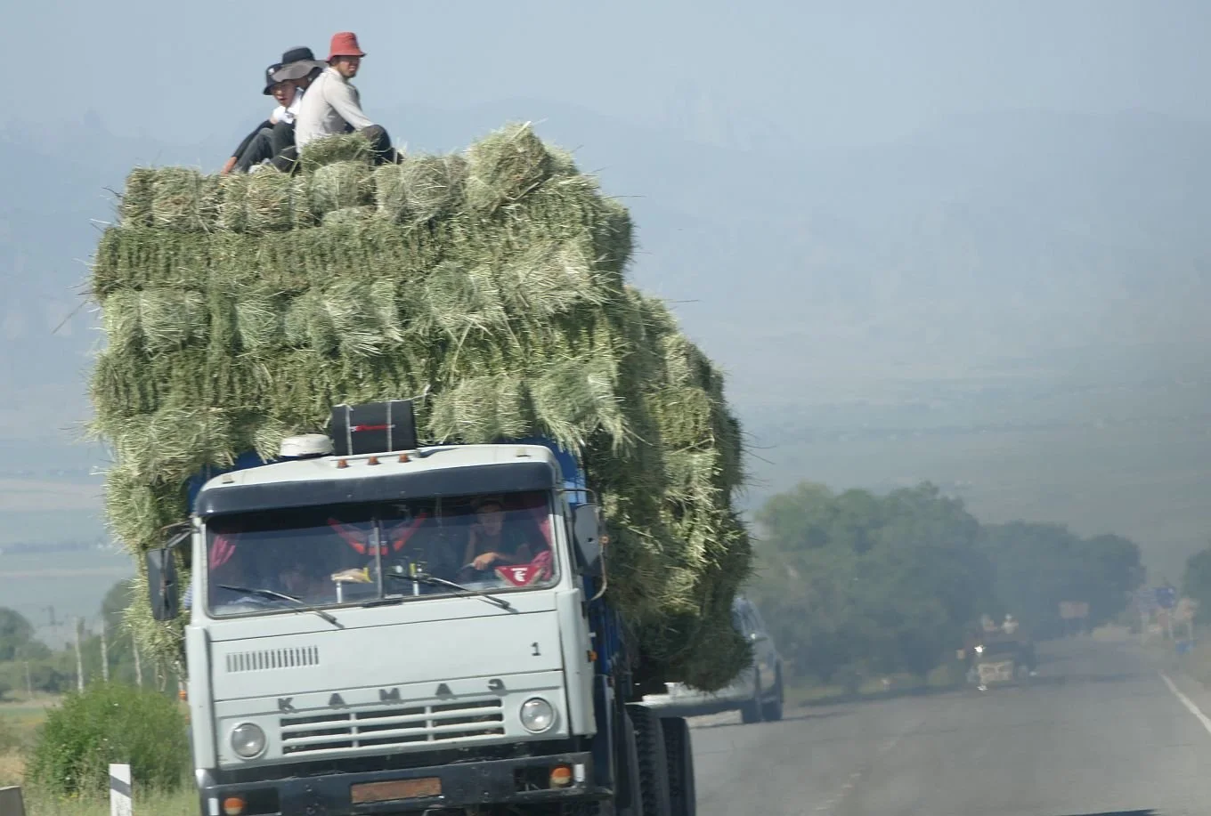


We presume the basic, single storey, rectangular housing unit started life as a 19th Russian import. Most of the older houses we saw had a pitched, or pitched and hipped, or Mansard roofs, with the roof space bulging with last year’s hay. Rural fences come in all shapes and sizes but there was one common theme, a picket style with a diamond panel. Again, we assumed this was a Russian phenomenon, but cannot find its like on the internet.


Larger towns and urban areas are still not a significant feature of the Kyryz landscape but there is a feature of the Kyrgyz transport infrastructure which is something which the Russians did do for Kyrgyzstan. We’ll leave you with pictures of Central Asia’s quirkiest Soviet inheritance: the bus shelter.


Live On
We started preparing this week’s blog on Wednesday of last week, with the words: ‘We hadn’t planned on posting another blog on Kyrgyzstan quite so soon, but life is unpredictable and ‘stuff happens’. Our ‘stuff’ turned out to be very small fry compared with the events of the following Thursday afternoon. Whatever you think of living in a constitutional monarchy, the death of a highly respected, empathetic and influential women, who is also one of the world’s longest standing monarchs, must take priority. It’s a cliché but it is the end of an era.
Society and its landscape have changed markedly through the seventy years of the Queen’s reign. During the latter part, climate change was – finally – recognised as significant. Charles III, in the guise of the Prince of Wales, recognised this significance much earlier than many and was vocal in his responses and calls for action. Slowly his reputation and approach has been rehabilitated from say, eccentric, to unnerving realist.
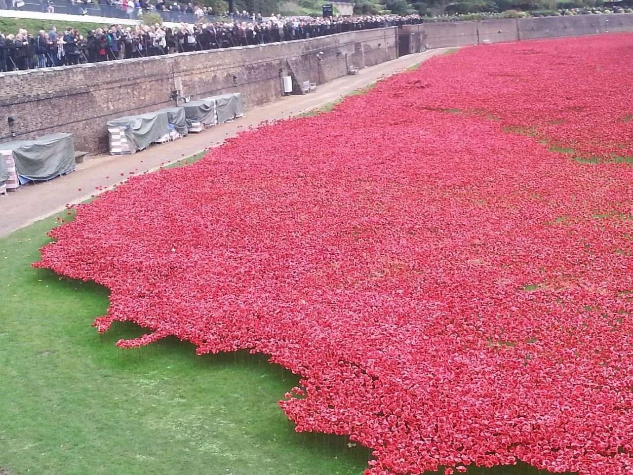
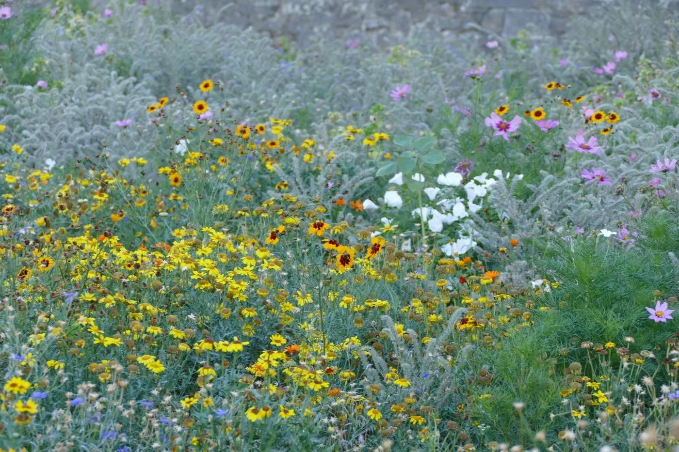
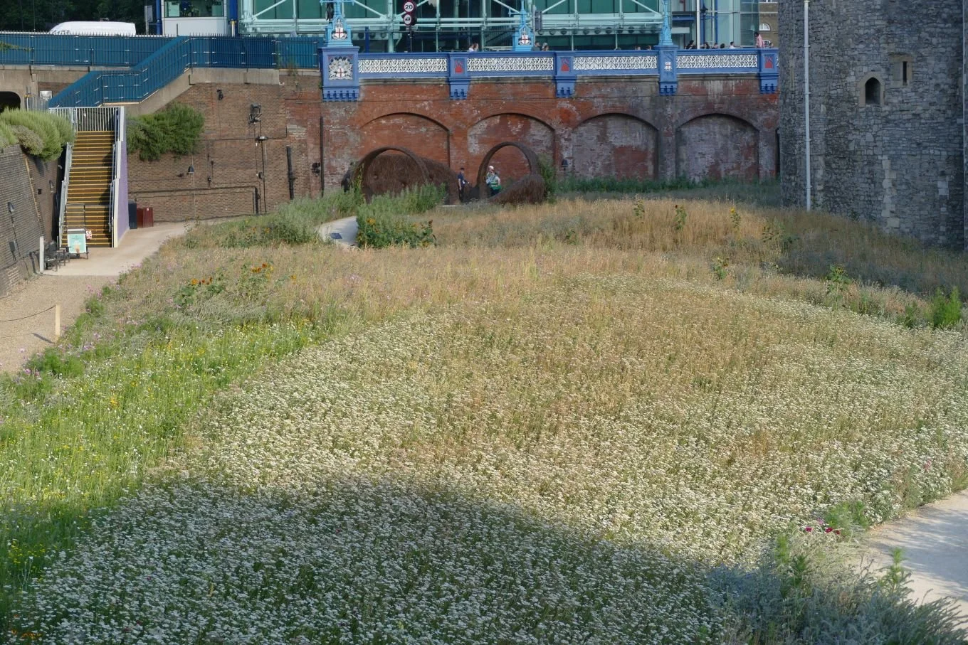
Who would have thought, at the end of the 20th century, that the Tower of London, that massive and assertive symbol of English history and power, would have turned its moat over to ceramic poppies in 2014, in an act of remembrance, before progressing to real flowers in 2022, with the spectacular London ‘Superbloom’, in an act of hope and to signal the way forward. Thank goodness that Queen Elizabeth II lived long enough to see them both.


Sadly, as King Charles III, the former Prince of Wales can no longer pursue his campaigning lifestyle. This he confirmed in his address to the nation last Friday evening. In this carefully crafted speech, one phrase struck Terroir: ‘we must retain our values’. I think we all know what he meant – values relating to service, steadfastness, honesty – but we suspect that many of us define ‘values’ as being able to continue to live our lives as we have always done. These values have to change. Whether it be by not mowing our lawn so often, not eating meat, eschewing non-recyclable plastic wrapping, giving up the car, or supporting the erection of more windfarms and solar panels, we absolutely must change our values, and our way of life, if we are to have any life worth valuing.
The Queen is dead, but the Monarchy is not. Long live the King. The future of our planet, however, is not so well assured.

Building History
If you read Terroir’s previous blog on Kyrgyzstan, you might be forgiven for thinking that the whole country consists of sweeping mountain pastures, picturesque nomads, woolly yaks, woolly yurts and re-purposed railway carriages. This isn’t quite true, of course, and this week we will, finally, give you a peep at those three historic monuments we mentioned previously.
But we will start our story in prehistory – perhaps 4,000 years ago – with Bronze Age rock carvings (images below from the Cholpon-Ata Open-air Petroglyph Museum) …


… and fascinating Balbal figures. The Balbals reminded us very much of the archaeological site at Filitosa in southern Corsica and the southern mainland of France, some 4,000 miles to the west.
Below: left Balbals at Cholpon-Ata Open-air Petroglyph Museum); right, at Filitosa, Corsica (© Amaury Laporte https://www.flickr.com/search/?text=Filitosa%20corsica&license=4%2C5%2C6%2C9%2C10)


Subsequent political geography seems complex. The early silk trading routes started over two thousand years ago and the ‘owner/occupiers’ of what is now Kyrgyzstan included the Saka tribes (who seem to have successfully seen off Alexander the Great), Huns and Tocharians. Turkik peoples, from the west, started to arrive from the 6th century AD and Arab invasions brought Islam to central Asia in the 7th century AD.
[Various sources including the Bradt guide to Kyrgyzstan].

So now we can go to our first heritage building - the Burana Tower - a remant of the ancient city of Balasgun, founded in the 10th century by the Karakhanids, a Turkik group described by our guide book as ‘cultured’. It seems they were also heavily into trade, and Balasgun (in the Chui valley of northern Kyrgyzstan) is said to be one of three cities in the region controlling the silk roads. The tower is thought to have been a minaret, heavily restored in the 1970’s.
The surrounding urban complex (a fortress plus dwellings, shops, baths, mausoleums, etc) is hard to imagine now, but the small museum is interesting - and also amusing due to a bad attack of that universal problem of mis-translation. The Russian text refers to ‘women’s adornments’, the English text to ‘wallies’. If you know what the ‘wallies’ might be (image below right), please let us know. A couple of Scottish suggestions are already in (china dogs and ‘peely-wally’ ie pale/off-colour), but they don’t seem to get quite to the heart of the matter!


Tash Rabat – our second monument - is a breathtaking, 15th century, silk road caravanserai on a site which may also have been used as an earlier monastery (Christian or perhaps Buddhist) prior to the arrival of Islam. The location is remote – over 100 km from the town of Naryn – but well worth the long climb into the Tian Shan Mountains. The Chinese border is maybe 30 km away, as the Eagle flies.
Half buried in the hillside, the stone built structure must have been part hotel, part secure warehouse and perhaps part administrative centre too. The situation is phenomenal, and the building’s historic aura is almost tangible. Inside it is cool, secure, but cunningly constructed to make good use of natural daylight. Around 30 small rooms provide bedrooms, kitchens, storage, prayer rooms and prison cells. It was thronged with ghosts.


By the time the Tash Rabat caravanserai was built, it seems that ethnically Kyrgyz people (nomads/warriors) had arrived in the Tien Shan Mountains and spread into what is now called Kyrgyzstan. This journey from northern Mongolia included robust altercations with rivals and futile attempts to resist Ghengis Khan and his Mongolian Golden Horde. Later (17th century) the western Mongol Oirats got involved, only to be replaced, in the 18th century, by the Chinese. Things seemed to get tough again with a takeover by the Uzbek Kokand Khanate (the guide book mentions issues relating to Silk Road fortresses, high taxes and violent repression).
Next: enter the Russians. The Tsar’s armies defeated the Kokand forces in 1865, annexed the territory and took control. It seems that, in social and landscape terms, nothing was ever the same again.
A new breed of migrants started to enter Kyrgyzstan – sedentary, house dwelling, farmers. Many were soldiers, but many others were landless peasants, offered free land (well, actually nomadic, seasonal grazing) and building materials, in exchange for populating what the Tsar saw as a frontier zone. Russian or Soviet rule would last until the early 21st century.
Not all incoming migrants were Russian, of course, but all needed some form of shelter. Permanent military and domestic structures must have started to make significant inroads into the nomadic Kyrgyz people’s lowland pastures.
Many of the new incomers were Muslim Hui and Uyghur refugees from China and one assumes their spritual needs were already met, at least in part, by the existing Islamic infrastructure of the Kyrgyz society. But the Russians would have been Orthodox Christians, looking to construct churches as well as homes, barns and barracks.

And so we come to our third historic Monument, the splendid, wooden Orthodox Cathedral of the Holy Trinity, in Karakol.
The cathedral website is in Russian, but travel websites (such as https://visitkarakol.com/holy_trinity_cathedral), dedicated to enticing tourists to Kyrgystan, provide useful background information.
Once a garrison town, Karakol is now described in our guide book as “delightfully serene … resonant with the ghosts of 19th-century rural Russian life”. We can thoroughly recommend the small Museum of Local History which illustrates, amongst many other things, the lives and homes of the peasants who arrived to take up their homeland’s offer of a better life. Building the church must have been a significant event in their new lives and their new landscape.
Below left: Museum of Local History and, right: agricultural machinery and dolls dressed in the costumes of the immigrants who came to farm here

The first church, apparently a small brick building, was destroyed by an earthquake in 1885, some sixteen years after it was constructed. The larger, wooden replacement took six years to build and, at the time, was by far the tallest building in town. The cathedral survived a rather chequered career in Soviet times but was returned to the church in 1991, when the Soviet Union collapsed. It has, of course, needed considerable but we would judge, pretty successful, restoration.


Of course there are other places of worship in Karakol. We also visited the Dungan, or ‘Chinese’ Mosque. This too is constructed from wood (completed in 1910) and also symbolises the migrant journey of the muslim, Dungan Chinese, escaping persecution. In terms of architecture, Holy Trinity brought Russia to Kyrgyzstan, but this mosque’s history is slightly more complex. As you can see, despite it's rectangular minaret, it resembles more pagoda than mosque, and reflects the Dungan’s Buddhist past.


In Britain, this would probably be a listed structure by now. We suggest it’s time Kyrgyzstan increased its heritage building list from three to four!

No Fixed Address
It can take a lot of driving and a robust vehicle to visit the historic buildings of Kyrgyzstan. We managed to visit all of them over a 9 day visit. In the UK, that would be pretty amazing; there are over 370,000 structures on the Heritage list for England alone. But in Kyrgyzstan, our guides informed us, there are only three monuments regarded as heritage buildings. Kyrgyzstan is great on archaeology, but very light on early architecture.
This lack of old structures is largely due to Kyrgyzstan’s social and geographical history: this bit of central Asia was largely about nomads until well into the 19th century. Despite being traversed by the ‘silk road’ trading routes between China and Turkey, despite sharing a border with Uzbekistan (a settled, farming country rich in trade and Islamic architecture with legendary cities such as Bukhara, Samarkand and Khiva), Kyrgyzstan is startlingly different. Kyrgyzstan’s heritage is about wide open spaces, about seasonal movement, and about yurts, not houses. It takes quite a lot of getting used to.
So why is the nomadic landscape so hard to ‘read’? What’s different from any other grazed hillside? Most Europeans are very familiar with the bi-annual transhumance of domestic animals: up in spring time to those picturesque, mountain meadows, leaving the lowlands to grow hay for winter fodder; down in the autumn as the days shorten and the uplands prepare for snow.
But no, that’s not the same as nomadic. Down in those European valleys are quaint farm houses with barns and cow sheds, villages, churches and inns, where humans and livestock can overwinter in permanent structures. This isn’t part of a truly nomadic tradition.
So what is a nomad? Wikipedia’s definition seems as good as any:

‘A nomad is a member of a community without fixed habitation who regularly moves to and from the same areas. Such groups include hunter-gatherers, pastoral nomads (owning livestock), tinkers and trader nomads. In the twentieth century, the population of nomadic pastoral tribes slowly decreased, reaching an estimated 30–40 million nomads in the world as of 1995.’ [Terroir’s highlighting] https://en.wikipedia.org/wiki/Nomad
Trying to locate information on the current status of nomads in Kyrgyzstan is difficult. Understandably, many of the websites which offer information are those promoting tourism and selling ‘experiences’ in Kyrgyzstan. We have no problem with that - we ourselves were tourists and glad to be supporting the Kyrgyz economy - but the sources of the tourist sites’ data are unreferenced and hard to verify. One such site suggests that there are still 4.4 million Kyrgyz nomads, ‘who mostly live in Kyrgyzstan’. Assuming that the current population of Kyrgyzstan (not all of which are ethnic Kyrgyz, of course) is about 6.7 million people (depending on which website you check), then about half the Republic’s population could be classified as nomadic. From what we experienced, however, we assume that the continued use of the term ‘nomads’ is somewhat misleading as most families now have permanent winter/all year round quarters with, perhaps, summer yurts on the upland pastures. A great many of the yurts we saw are now also, or possibly only, servicing the tourist industry. One family we chatted to spent their winters in Bishkek and their summers on the Tien Shan uplands, providing visitor facilities at Tash Rabat - one of those three historic buildings we mentioned earlier.
Below: summer uplands near Tash Rabat, 21st century style - yurts, trucks, tourists and horses


What are the key elements of Kyrgyzstan’s historic nomadic lifestyle? Terroir would suggest that the combination of vast areas of upland, combined with robust and sure footed livestock, is key.
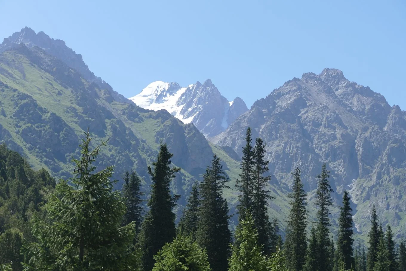
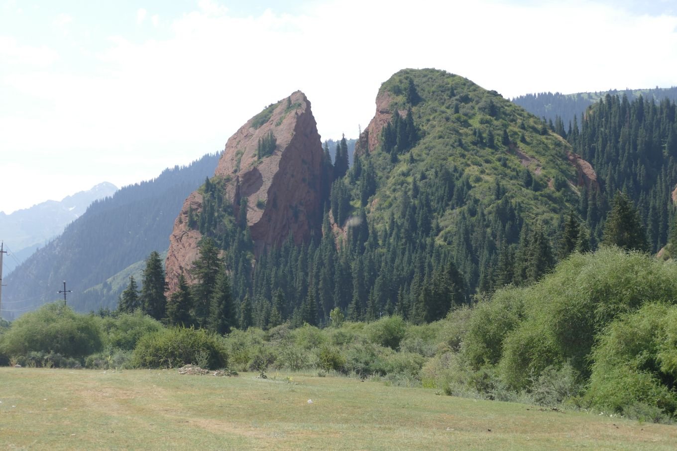
According to our guide book, a staggering 90% of Kyrgyzstan is over 1,500m (around 5,000 ft). If you read our previous blog (The Bin), you’ll know that Ben Nevis is ‘only’ 1,345 m (or 4,413 ft). The north and east of the country is dominated by the Tien Shan mountain range, which stretches from Uzbekistan, thrugh Kyrgyzstan and on into western China. The highest peak, on the Kyrgyz side of the China border, clocks 7,439 m (over 24,000 ft) which is not far off 84% of the height of Everest. The geology and age of the rocks varies and so does the landscape (see below).
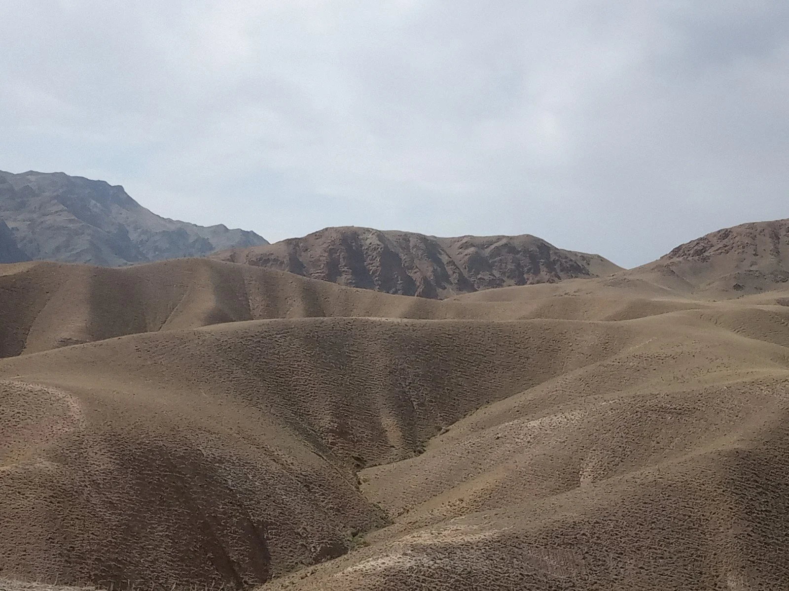
South western Kyrgyzstan sports sections of the Pamir and Pamir Alay ranges, older and more rounded mountains but still achieiving a Kyrgyz summit (second highest in the Pamir range) of 7,134 m (23,400 ft) at Peak Lenin.
Below: glimpses of the Tien Shan range


How do you create a way of life which makes best use of such a vertical country? Livestock is the obvious answer. Horses, donkeys and camels - the four legged equivalent of the modern four wheel drive - provide transport and draft power. Cattle, yaks and sheep provide food, drink, housing, clothing and an outlet for artistic expression. But communities have to keep moving to ensure the meagre pastures can continuously support the animal based ‘capital’.
Below: livestock on the summer pastures - horses, sheep, camels, yak, a donkey on child care duties and cattle


Need some ready money for a lowland shopping expedition? Cash in a beast or two at the cattle market.


Obviously meat is an important part of the nomadic diet (traditionally mutton and horse were particularly significant) but fermented mare’s milk (kumis) is also a Kyrgyz speciality and is now an important part of that new aspect of the nomadic economy - tourism.
We experienced both meat and kumis at Lake Son Kul - a water body frozen in winter, but a dusty experence in summer thanks to climate-change induced mega temperatures. The lake is described in guide books, and on tourist websites, as ‘isolated’ and ‘only accessible by hiking and walking’. In fact we were driven there, but our non four-wheel drive minibus did not enjoy the off-road experience.
An ‘all in one’ meal of mutton and vegetables was prepared for us (below left) (Terroir found it utterly delicious) and which was served to us in an adjacent yurt (middle picture). The low table was laden with the stew, plus salads, fruit, biscuits, jams and sweets, laid out in very generous quantities. The yurt was beautifully decorated but as there was nothing else in it apart from us and the table, it felt rather like eating in the little used parlour or ‘front room’ of an English, Edwardian, terraced house.
After lunch we were introduced to kumis and shown how the women milked the mares to obtain the basic raw material (below right). Before and after fermentation tasting samples were available; the kumis reminded Terroir of kefir but of a thinner consistency.


Kyrgyz nomadic housing, is of course, based on the yurt, a structure made from wood, reed, leather and thick, home made felt. It can be collapsed, packed away, loaded onto a cart, transported to a new area of meadow, and reconstructed with remarkable efficiency.
Here is Terroir’s guide to erecting a yurt in ten (uneasy?) steps. Please note that the yurt in question is tiny so that the building team could fit in the demonstration before another generous lunch was served in the family house!


Actually it should be eleven steps - it was pointed out that we had missed the shots of vodka taken inside on completion.
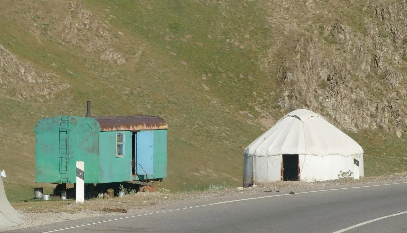
And, of course, no modern yurt is complete without its converted railway carriage extension.
A mobile life means that crafts and artistic expression must use easily available raw materials. It must also adapt well to life in an upland pasture and be easily packed away and transported.

Animal skins are great for boots and bottles but you can’t beat home-made woollen felt for stunning interior decoration and inspired needle work.
Our first introduction to Kyrgyz shyrdaks was in hotels and guest houses where these patterned felt rectangles had been re-puposed from domestic decorative wall hangings, carpets and table covers to doing the same job in the hospitality sector. They are stunning in either location.
Thankfully, we were soon taken to visit a fascinating collection of costumes and decorative textiles lovingly kept by a Kyrgyz family who were concerned, not just with interested tourists like ourselves, but with the conservation of this heritage and with raising awareness, both locally and regionally, of a traditional art and craft form which could easily be lost.


Women created these fabrics. The work was slow, laborious but social and one can imagine that process was as important as finished product. Our guide book suggests that two colour embroidery was formerly the norm but, with the availability of modern, 20th century dyes, more dramatic colour schemes have developed. We have yet to verify this and, foolishly, didn’t ask when the opportunity arose. We could certainly spot the difference between items produced for tourists (smaller, easier to carry, quicker to make, often involving machine rather than hand stitching) but that’s fine. We bought.
How many in Kyrgyzstan can afford to risk investment (time, finance, market research) to produce modern pieces using traditional techniques? How many women still have the skills? What are the risks of cultural appropriation? Who would buy? I would - if I could afford it, of course.
We haven’t even touched on two other nomad staples which delight visitors to Kyrgyzstan.

One is the use of eagles for hunting. Extraordinarily dramatic and picturesque - an adult eagle can take out a wolf, as well as kill prey for human consumption - and steeped in tradition. Does it exist now just for tourists? Can it adapt to a modern but non-tourist context? It reminded me of our European traditions of hunting with birds. Now largely a tourist spectacle, it does have a few modern commercial functions, but I can hardly see eagles being employed to rid Kyrgyz airports or football grounds of starlings and pigeons.
The other is a modern tradition built on nomadic skills and sports - the Kyrgyz invention of the Nomad Games. First held in 2016 and now with a permanent stadium in Cholpon-Ata on Lake Issyk Kul, this biennial event is largely based on equestrian skills, wrestling, falconry (yes, the eagles do have a role) but also includes yurt building and board games - nomadic aspects you don’t usually see at that other great horse based tradition, the North American rodeo.


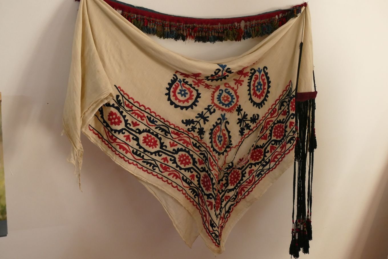
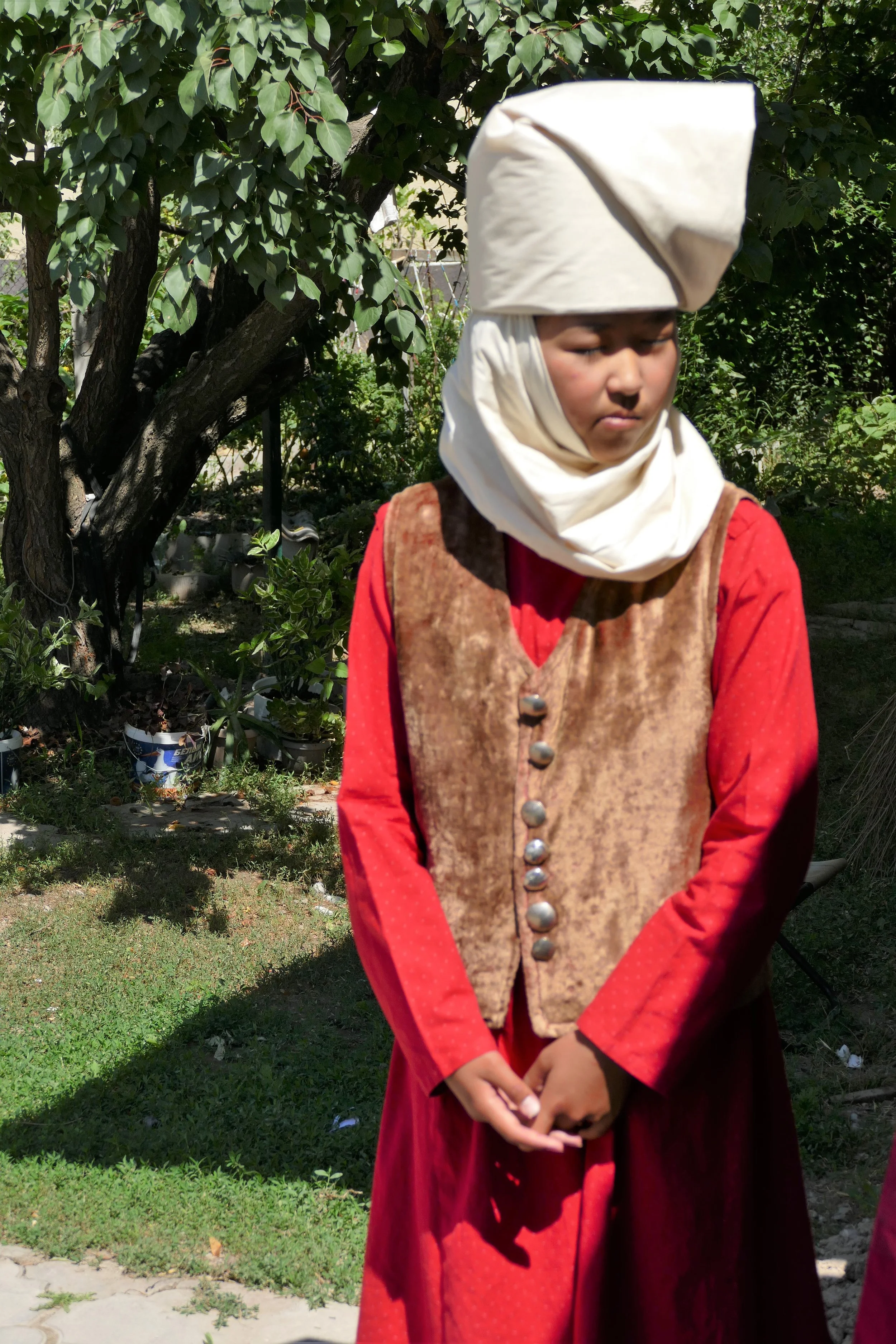
But we can’t finish a blog on the nomadic traditions of Kyrgyzstan without mentioning one final, great Kyrgyz icon. The hat or headress is key, of course.

The man’s jaunty, felt, titfer is modelled for us by the yak herder at the top of this blog, and by our eagle toting friend above. It comes in a variety of patterns. If you don’t fancy making your own, new ones can be bought in the Bishkek bazaar. It is such a symbol of the Kyrgyz male, that there is even an older version in the excellent Karakol museum (image left).
In contrast, women tend to have moved on from the traditional yards of cotton which once swathed their heads and which, unlike the man’s headgear, could also be pressed into service to swaddle babies or staunch wounds, as required.
Below (left) women’s traditional and (right) more modern headgear


We might get to those three heritage buildings next time.

The Bin
We’re in Central Asia. New experiences are flooding in, unfamiliar landscapes surround us, cultural assumptions are being challenged, flora and fauna are simultaneously familiar and exotic.


We have reached a pass at about 3,400m (that’s around 11,155 ft in old/Boris money). For a bit of context, Ben Nevis is 1,345 m (4,413 ft), Mont Blanc is 4,807 m (15,770 ft) and Everest is 8,849 m (a tad over 29,000 ft). We’re in a minibus in T shirts and trainers, by the way, not on foot in full climbing gear. We’ve just passed that herd of yak.
We stop for a toilet break and photos. It has the potential to be a memorable moment. And it is: for Terroir, at least, this turns out to be the most memorable and, sadly, the most shocking view of the whole trip.


No - not the toilet block (men on the left and women on the right - it’s in Kyrgyz, not Russian).
The issue is the awful, ghastly, horrendous abomination of plastic litter, accumulating so unexpectedly in this vast landscape. It hit us hard, straight between the eyes and sent us reeling.
This isn’t Kyrgyzstan’s fault. This is the fault of the whole world.
This blog is not about Central Asia. It’s about the environment, global responsibility, and to some extend, international tourism. Specifically it’s a desperate plea regarding the misuse and abuse of so-called single use plastics.
Single use plastic is any plastic item which is designed to be thrown away. Even if it’s technically recyclable, it’s still far more likely to be thrown away, as demonstrated in the pictures above.
Single use plastic isn’t just bottles - it can be plastic shopping bags (again, see pictures) labels and tags, drinking straws, takeaway containers, packaging and cutlery.
Despite what we are led to believe, single use plastic DOES NOT biodegrade but merely breaks down into micro particles, too small to see. But its still there, polluting land, rivers, sea - and our food.
Plastics which aren’t recycled get burnt or dumped, polluting water, air, land - and our food.
And inevitably, the pollution caused by single-use plastics’ impacts disproportionately on poorer and disadvantaged communities.
But:

We can take action
.
The immediate and short term solution, suggested by our picture above, is to take your litter home and dispose of it responsibily!
This Kyrgyz litter bin (right) is trying hard too, although one wonders how much of the plastic deposited here can actually be recycled.
Better and more long term solutions include:
political pressure - write to your MP, join a pressure group, sign petitions
find alternatives to single use plastics - use zero waste shops, avoid that chippy with polystyrene containers, buy drinks in cans, take a cloth bag when shopping
wear natural fabrics or go to a charity shop for recycled clothes
if you can afford it, boycott items in plastic packaging; change the mindset of manufacturers and suppliers
It’s not simple - it never is - but that is a very bad reason for doing nothing.
Please take action now. Not everyone will have been brought up short by the experience we had in Central Asia. Plastic pollution is usually invisible and insidous, impacting on every corner of the globe. We musn’t ignore it.
Our thanks to Greenpeace, amongst others, for some hard, cold reality to temper the rather emotional response to the Kyryzstan high level bin. https://www.greenpeace.org/africa/en/blogs/14052/everything-you-should-know-about-single-use-plastic/

Wall Flowers

No, not this sort of wallflower (Erisymum) which, unromantically, is part of the cabbage family, the Brassicaceae.

Nor this sort of wall flower either: the flamboyant flower varieties that can be encouraged to grow next to walls, or dangle down walls from hanging baskets or project themselves from walls in window boxes.

We’re talking about the sort of plants which grow in walls, and which plant themselves there without the aid of potting compost and irrigation.
This maidenhair spleenwort (left) is a classic example.
Terroir North writes:
A suprising number of plants are tenacious enough, and versatile enough, to successfully colonise all sorts of nooks and crannies in what appear to be very inhospitable environments, including man-made structures like stone and brick walls.
For obvious reasons, this sort of ‘wall flower’ needs to be able to withstand drought. Such flora can also be typical of horizontal environments such as dry, bare ground, where there is no competition from other plants. White stonecrop, a native succulent, has fleshy, waterstoring leaves, which enable it to grow in the free-draining conditions of crevices as well as rocky soils.
Similarly, plants which thrive in the lime mortar, which holds many walls together, may also be typical of more horizontal limestone outcrops.
Where mosses have established they can provide humus and a more favourable seed bed for many subsequent wall colonisers.
Some wall plants are true natives to the UK such as wall speedwell and wall lettuce. But others may have been introduced some time ago from beyond our shores and have ‘naturalised’ and become accepted as part our native flora. Ivy-leaved toadflax (below left) probably started life in Britain adorning the walled gardens of large country houses, following introduction from the Mediterranean as far back as the 17th century. Pellitory of the wall (below centre) is another incomer, thought to have been introduced to Britain for its (doubtful and unproven) herbal medicinal uses. Old cottage garden plants, such as common red valerian (below right) and purple toadflax, have escaped from gardens and also naturalised in the wild.


In centuries-old castles, such as Caerphilly in South Wales, or Thirlwall Castle near Hadrian’s Wall in Northumberland, a diverse range of plants have successfully established themselves all around the walls. Over time the lime mortar between the stone blocks has crumbled, providing a more suitable foothold for these plants. Seeds, either carried on the wind or excreted or dropped by birds, may land in these spaces and, where a crack or crevice in the mortar has developed, they can germinate and become established. In the damper and more shady parts of the walls the spores of ferns carried on the wind may also establish themselves.
Thirlwall Castle:


At Caerphilly Castle in June 2021, the wall flower display was dazzling. Ivy leaved toadflax and pellitory of the wall were present in abundance, but the other star of the show was the navelwort (also called pennywort), in various stages of its spectacular development.


The Caerphilly supporting act was diverse.


Of course the grasses get in on the act with their wonderfully evocative names. Here is a selection:


The former induustrial buildings of Cornwall provide a lush wall habitat with an eclectic mix of mosses and shrubs, reflecting the local rainfall statistics, the shelter of surrounding landforms and seed from the adjacent scrub regeneration.


No review of wall botany would be complete without a mention of lichens. Terroir is far better at taking photographs of lichens than in identifying them, as illustrated by the uncaptioned images below. If you can assist us, please use the comment box at the bottom of this blog. We would be very appreciative. Sadly a quick trawl of lichen related websites demonstrated a preponderance of sites dedicated to removing lichen from stone work, paths and many other substrates. As we assume the search engines list sites in order of popularity/hits/willingness of product manufacturers to pay, this is deeply worrying.


On the whole, lichens, mosses and herbaceous plants don’t seem to do significant harm to their host structures and can certainly add a great deal to local biodiversity, provide a source of food for pollinators, and enhance the interest and appearance of old walls.

Of course disasters do happen. This wall collapse (right), which probably had nothing to do with its attendant plant community, has wiped out a section of the habitat for wall loving flora. If left alone, however, or if repaired using traditional techniques, soil creation will start again and the surrounding vegetation will provide ample seeds and spores for recolonisation.

Fences and fence posts aren’t a patch on walls for biodiversity of course, but are good for perching birds and can also do quirky!

Ophelia’s Brook
When down her weedy trophies and herself
Fell in the weeping brook. Her clothes spread wide,
And, mermaid-like, awhile they bore her up
Hamlet, Act IV, Scene vii
Shakespeare first launched poor Ophelia into the weeping brook at the beginning of the 17th century. The play, ‘Hamlet Prince of Denmark’ is thought to have been written between 1599 and 1601 and Terroir likes to think that the first night might have been in 1601 or 1602 (for reasons which will later become obvious), prior to print versions being published in 1603 and 1604.
For over 400 years, Hamlet’s story has continued to resonate with audiences and artists alike. Ophelia would fit in well today; her issues relating to such things as mental health, domestic abuse and feminism have not gone away.
Thus the troubled Ophelia was muse to many painters, and the Victorians were particularly fascinated by her. British artists Richard Redgrave, Arthur Hughes, Thomas Francis Dicksee and John Williams Waterhouse all had a go, depicting her in various states of frailty and/or innocence. Photographs of their interpretations can be found at https://shakespeareandbeyond.folger.edu/2018/01/30/ophelia-nineteenth-century-english-art/
But it was John Everett Millais, a founder member of the Pre-Raphaelite Brotherhood, who really put Ophelia on the artistic map and probably inspired the many subsequent renditions of the Ophelia image.

Of the artists listed above, only Richard Redgrave’s portrait (left) predates Millais’. Our heroine sits on a tree trunk with her flower garlands in her lap, and her gaze fixed on an unknown view. Behind her, her own landscape is diminished, fading into a dark wooded tunnel, a hollow way, which holds we know not what untold nightmares.
Image:
© Victoria and Albert Museum, London
Using content from V&A Search the Collections for non-commercial purposes
In July 1851, 250 years after ‘Hamlet’ was first performed, Millais started work on his version of Ophelia. His model for Ophelia herself was Elizabeth Siddal, described as a ‘favourite of the Pre-Raphaelites’. Siddal posed for the work lying in a bath. The water was heated by lamps from below, but the experience must still have been extraordinarily unpleasant. Understandably, she became ill – her father threatened Millais with legal action until he consented to pay her doctor’s bills – but survived, and later married Dante Gabriel Rossetti, another founder member of the Brotherhood.
Millais’ model for the “weeping brook” was the Hogsmill River, a chalk stream which rises in Ewell in Surrey and flows into the Thames at Kingston. The clear waters and floriferous banks must have made it an attractive and appropriate location and perhaps its brief life ‘on this earth’ (it flows for a mere six or seven miles before being swallowed by the mighty Thames) also made it an appropriate watery symbol of Ophelia’s brief existence.
When Millais was painting the Hogsmill River it would probably have been a classic, rural, chalk stream and an integral part of the water meadows through which it flowed. We can imagine it as a thread of clear water running over long fans and tassels of water crowfoot, which Terroir likes to think must have been very redolent of a women’s wet and trailing skirt.
The finished painting provides a vivid illustration of water crowfoot (seen, in flower, in the extract below), accentuating the line of Ophelia’s fabulous and floral garment.

Extract from Nicole Ameda https://www.flickr.com/photos/153228408@N06/33651078923/
In the 1850s the flow of the river was sufficient to drive a number of corn and gunpowder mills, so commercial and industrial establishments were also co-habiting with Ophelia. Indeed, William Holman Hunt, another founder member of the Pre-Raphaelite Brotherhood, also found inspiration along the Hogsmill, and his painting, ‘The Light of the World’, portrays Christ knocking at a door said to be modelled on the that of a disused hut, once used by workers at one of the gunpowder mills. https://eehe.org.uk/?p=25294
The flowers which Millais painted with great botanical accuracy – including daisy, violets, the white field rose, pansies, poppies, forget me not and purple loosestrife – could all have grown hereabouts, although not necessarily all flowering at the same time nor all growing in the exact same location!

In 2001, 150 years after Millais started work besides the Hogsmill River, The London Walking Forum launched the ‘London Loop’, a 150-mile hiking route around the green spaces of outer London. As a result, many ‘Loopers’ will be familiar with the Hogsmill and its links to Millais, as it/they take a star turn in Section 8, ‘Bourne Hall Park, Ewell to Kingston upon Thames’.
Although part of Terroir had already circumnavigated London on the ‘Loop’, we started again in 2021 to ensure that all of ‘Terroir South’ could get full Looping honours. In June 2022, 170 years after the completion of the Ophelia magnum opus, we went back again, to look in detail at where Millais would have planted his easel.
From a review of the Ordnance Survey maps, it seemed likely that the first major development in the area was the building of a railway line very close to the ‘Ophelia Site’, in 1859. If Millais, and indeed Holman Hunt, had postponed their projects by just a few years, ‘Ophelia’, The Light of the World’ and HH’s ‘Hireling Shepherd’ might have been located in some other valley. Thereafter, however, there seems to have been little significant change until the beginning of the 20th century.
In 1910, a sewage works was built close to the Hogsmill (to the west of Millais’ ‘Ophelia’ site), and this may well have been a good thing for the river. But by the 1933 map survey, significant changes can be seen, as Ewell’s urban area expanded hugely thanks to the mass construction of pre-war, speculative, housing. The estates were kept at least one field’s width from the river bank, but the die was cast for the change from a largely agrarian landscape to a significantly suburban one.
Today, the river runs shallow and often turbid, through a recreational landscape which is well used – and no doubt highly valued - by the many who live close by. The landscape is a mix of open grassy spaces (based on former meadow areas) and encroaching scrub and secondary woodland which provides a good mosaic of actual and potential wild life habitat. A good network of paths and river bridges provides easy access to and from local housing (as well as for London Loopers). It hasn’t the open, rural , traditional, meadow feel which Millais probably experienced, but it fulfils its modern function more than adequately.
These days, a summer Looper’s landscape along the Hogsmill looks something like this:


And the river itself, often running through a tunnel of woodland, looks something like this (there is a glimpse of that chalk stream clarity in the image below right):


While the massive structure of a fairly modern railway bridge contributes images like this:


Finally we reach the spot which Millais chose to illustrate Ophelia’s ultimate tragedy. Here is a reminder of how Millais saw the river bank:

Extract from Nicole Ameda https://www.flickr.com/photos/153228408@N06/33651078923/
In 2022, the water is clear but very shallow - not enough to power a flour mill, let alone support a flower bedecked Ophelia. Where once were massive veteran pollarded willows and field roses, there is now sycamore, ash, field maple and remnants of elm, all significantly younger than Millais (probably post WWII). Where once was purple loosetrife and teasels there is now Alexanders, stinging nettle, Himalayan balsam and bramble, all symptomatic of changes in landuse from agriculture to urban fringe (although, to be honest, we did spot teasels elsewhere - below right - where light levels were higher).


Behind Millais, there would probably been well-watered, species rich, hay meadows. There is grassland there still, but evidence indicates a series of changes. Rye grass along the edges may indicate a mutation to a more productive monoculture, perhaps for grazing. But it appears that meadows are being reintroduced again, and the whole area managed to create a haven for wildlife, to improve water quality and boost biodiversity, as well as providing a green oasis for residents and visitor alike. Its good to see that much of the area along the Hogsmill is now designated as Local Nature Reserves.


Above: glorious June meadows

Currently, the river banks remain wooded and this rustic ‘memorial’ to Millais and Ophelia (left) is slowly being swallowed by hawthorn and blackthorn, with no direct view of the river itself. But at least the bramble flowers, peaking into the top right corner of the photograph, provide a floral memory of Millais’ field rose tribute to Ophelia, on the banks of the ‘weeping brook’

Serendipity
Albania 3
All countries reveal quirky and unexpected glimpses of themselves to those who travel through or spend some time there. These glimpses can often be surprising, puzzling or amusing, but always revealing and sometimes challenging.
What follows is a pictorial tour through Albania through the medium of the quirky and the unexpected. And don’t worry - this is the last Albania blog!
Transport is certainly a mixed bag. Of course there are modern cars, motor bikes, taxis and buses. But push bikes (above and below) are still part of the psyche.


Agricultural transport can be pretty varied too.


Railways are struggling - but colourful.


In a country of rivers and lakes, ferries are important but idiosyncratic.
Below left: a rope ferry, connecting communities across an inlet; the fare is equivalent to a few pennies
Centre: the Lake Komani stopping service - a bus body on a boat’s hull
Right: the view from the Komani Lake vehicle ferry; part tourist boat, part freight lifeline; both uses are illustrated - just - in the bottom right hand corner of the photograph


Of course, where there is water, there are also bridges. These are a long standing feature of the Albanian landscape but design, function, size and materials vary dramatically. The photograph (left) is the best image we could get of the Roman bridge and aqueduct which crossed the Vivari Channel and linked Roman Buthrotum (now Albanian Butrint) with the Straits of Corfu.
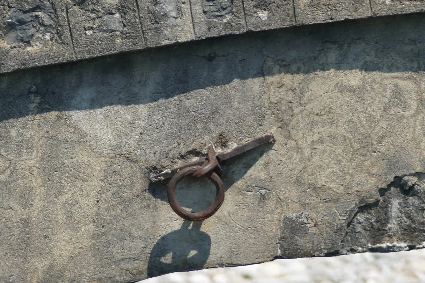
The subsquent Ottoman bridges are one of the great symbols of Albania, adorning the landscape, and all Albanian guide books, with their simplicity, curvature - and unexplained items of metal work.


More recent bridges are of a less curvaceous form of engineering, with a metal superstructure and stone buttresses.
Below left and centre: this one features hardware from Middlesborough (M ˑ BRO), and
Below right: some dodgy timber planking on a bridge to a former mill.
Both are slightly scary, in their own way, crossing narrow gorges of foaming mountain waters - very much a feature of Albania.


Many railway bridges are similarly meccano like (nearer bridge, below left) but what appear at first glance as modern road bridges, do reveal more historic supporting structures (below left and right). We don’t think the Ottomans went in for fancy metal balustrades.


This is the Balkans and the concept of nationalism is never far from the surface. The Luftetari Kombetar or national fighter is remembered and memorialised in many statues around Albania. These representations are sometimes war like in stance but many stand in a more watchful pose, garlanded with ammunition, shod in traditional Albanian footwear and appearing surprisingly well built. Malnutrition or even a lithe, lean look does not seem to be part of the sculptors’ lexicon.


Sadly, the most obvious, physical, memorial to the Cold War years seems to be a collection of concrete ‘mushrooms’, actually the outward manifestation of a system of underground bunkers sufficient, apparently, to give shelter to every Albanian man, woman and child, should the nuclear threat become a reality.


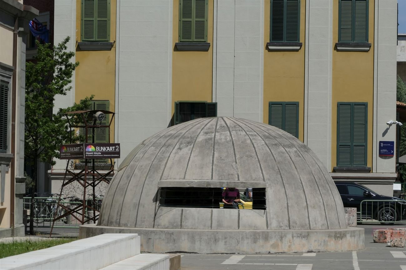
The bunker below this ‘mushroom’ (left) has been converted into a museum charting the history of the Albanian police force. It starts innocently enough with the story of the 1920s, Dutch trained, Gendarmerie but all too soon progresses to the far darker and scarier repressive years from 1944 to 1991.
Religion was banned, and faith leaders persecuted, during the Communist dictatorship. “In 1976, the Party of Labour even declared Albania to be the first atheist country in the world, putting a ban on religious belief in the constitution and imposing punishments for participating in religious ceremonies and possessing religious books” (https://balkaninsight.com/2019/08/28/how-albania-became-the-worlds-first-atheist-country). Mr G, our guide, described it as a complete vacuum in scoiety, with religious buildings demolished or repurposed, and two generations brought up with no faith or spiritual related input. In the 21st century, we found a very relaxed approach to religion throughout Albania. The population is a mix of Muslim (mainly but not exclusively Sunni) with a significant minority of Christians (Catholic and Orthodix). Nearly 10% identify as either atheists or of no religion.

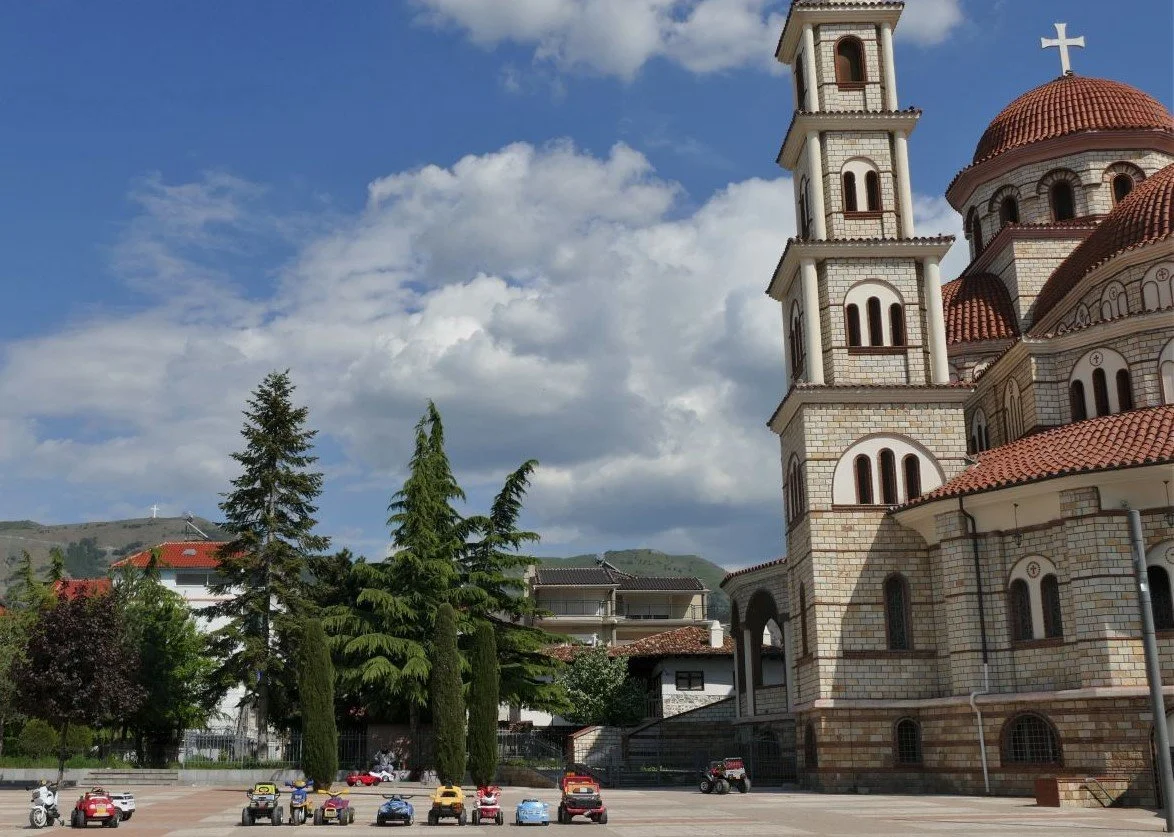

As tourists we didn’t see many shops. Even tourist shops were hard to find, which was actually quite a relief. But spot the upmarket bric-a-brac shop, below!


Albanian craft products are also hard to find. Albanian carpets, fabrics and embroidery are a feast for the eyes, but shopping is challenging if you don’t want red or white! Silver filgree work is also making a modest comeback.


Of course, any journey will ‘throw up’ some linguistic jokes.


But here are our favourite quirky insights into Albania.

In third place, an early encounter with a restaurant toilet door. Such an attractive and homely welcome.

In second place: a traditional Albanian broom - and yes, it’s made out of a broom plant, in flower too.

First place:
this is what Albania is all about - good coffee, good beer, and a very warm welcome

Rectangular Agriculture
Albania 2
After Terroir’s take on Albanian architecture, we promised you something more rural. Field patterns, seen from the air, initiated the angular theme. Here you can see why:

Agriculture, we were told, is still very important to the Albanian economy. We decided to check this out and see how Albania compared with its neighbours and some of the world’s big players. Using https://www.statista.com (for no better reason that it’s easy to use and seemed to produce roughly comparable figures to other websites we looked at) we discovered that around 20% of Albania’s gross domestic product (GDP) does indeed come from agriculture – rectangular or otherwise. As an aside, a further 10% comes from remittances sent from abroad by the Albanian diaspora.
Looking simply at agriculture, here are some interesting comparisons which do, indeed, confirm the importance of this sector to the Albanian economy.

We started investigating what Albania produces as part of our attempts to identify the many fruit trees which were in flower – in orchards, in back gardens, beside roads and tracks, and in a whole variety of plots which didn’t fall into any of those definitions. The angularity theory was already becoming eroded.


We spotted apple, pear, plum, cherry and lemons but were temporarily discomforted by these enthusiastically large and curvaceous blossoms. Quince, of course: soon to become buxom fruit, alongside their more familiar companions.
One could be forgiven for dividing Albania’s countryside into three main geographies: absolutely flat; very hilly; vertiginous. Google Translate insists that the Albanian for undulating is ‘valëzuar’, but I bet no one ever uses it.
It was the ‘absolutely flat’ that had started my obsession with the rectangular nature of lowland Albania. Valley bottoms and some more extensive plains are characterised by small, oblong plots separated from each other by narrow ditches. On the assumption that the ditches fulfill either irrigation or drainage functions (some were indeed carrying water) then there must be a gradient but this is invisible to the eye of the passing tourist. Fences and hedgerows hardly feature at all.


We did occasionally see larger areas of pure wheat, but most of these small rectangles grow a variety of different crops: wheat of course, but barley, oats, potatoes, grass, vines and olives were also obvious. Many plots were tilled but still bare, presumably awaiting the planting of a rich variety of vegetable crops, a selection of which we were eating every evening. Herbs are also highly valued in Albania – for medicinal use as well as for cooking and cosmetics - and fields of sage or lavender were also spotted.
For days we didn’t see any form of mechanisation, just families with bent backs either sowing vegetables or cutting grass with scythes. Eventually we began to spot small tractors but in hilly areas, ponies, mules and the occasional donkey were also visible, kitted out in their pack saddles, waiting to be allocated an errand or a load. Cattle were also taken out to graze, either tethered or accompanied by a herdsman/woman/child.


The ‘very hilly’ landscapes seriously weaken the ‘rectangular agriculture’ theory in all aspects except one: hills appear to rise from the valley bottoms with an almost explosive suddenness. Albania does rivers big time. They carry silt and gravels which they deposit with remarkably evenness across the valley floor. The hills, however, are made out of tougher stuff which is anything but horizontal. The break of slope, where hill meets vale is nothing if not hard, sudden and dramatically angular.
These uplands are rich in deciduous woodland with an ample ground flora which kept the group’s botanists very happy – and, at times, puzzled. As Albania is well endowed with limestone uplands, it reminded us a little of the chalk and limestone habitats of home – but on steroids. The abundance of wild phlomis (below left) was also a clear statement of the proximity to the Mediterranean.


These hills are also the domain of sheep and goats, of bells and of shepherds. Who needs fences when the shepherd and perhaps a dog are constantly on duty and who will return the flock to the shelter of the farm before dark?


Hills can also be productive if they are terraced. But terracing requires considerable labour, to convert a sloping hillside into a stepped one, and a willingness to wait while the crop of olives or fruit trees, or whatever can survive this tough environment, matures sufficiently to bear a crop worth harvesting. One of our Albanian references postulated the use of slave labour (apologies for being unable to find the quote at the time of writing) and in a way this may be true, as a story, told by our guide - Mr G - demonstrates:
When Mr G was at university, the students spent their summers at camps, but not in the sense with which we are familiar. This student labour force was, well, ‘used’ to build terraces and plant trees in areas which were otherwise underproductive. Despite having little choice in the matter, the students did have a wonderful time, working during the day and larking about (Terroir’s word not Mr G’s) in the evenings. Mr G was very proud of the trees which he had planted and revisited them from time to time. But, by the time these trees were mature enough to bear fruit, the regime had changed and land was being redistributed to private owners. Many, many of the terraces we saw were no longer in productive use.


And the future? New uses for rural land will inevitably include tourism. Already the coast and some lake sides are very popular and already have, or are in progress of constructing, the necessary infrastructure.


But holidays in the ‘vertiginous’ landscapes are developing more slowly. Albania’s mountains, and their role in Albanian history and culture, are quite extraordinary. Possibly the best description which we have read to date is Rose Wilder Lane’s ‘Peaks of Shala’ - a record of a journey made in 1921, and available for free download via The Project Gutenberg. Others may have met Albania’s mountains via the activities of Britain’s Special Operations Executive during WWII or, more peacefully and more recently, via Robin Hanbury-Tenison’s book, ‘Land of Eagles’. Today, visiting hikers are increasingly exploring the mountains during the brief summer window when such activities are relatively safe, and new hotels are being constructed at the ends of the few roads which penetrate the world of these craggy horizontals. Good for Albania but less so for the wilderness which they represent.


Albanian Odyssey

Terroir has recently returned from a group trip to Albania, with a side helping of Montenegro, Serbia and an unexpected day in Kosovo. We can’t quite remember why we chose this particular combination – the excursion was booked well over two years ago – but it was probably something to do with knowing nothing about Albania and because Montenegro and Serbia host one of the world’s most spectacular train journeys. This blog will be about Albania. We’ll get to the trains another time.
Right: Skanderbeg - Albania’s national hero - in Tirana’s Freedom Square
First of all, we must confess that we flew from London to Tirana. The view of Albania from the plane was, thus, a guilty pleasure and appeared to reveal a landscape made up entirely of rectangles and what we believe are technically known as rectangular prisms, ie shoe box shapes. Tirana appeared to be built completely of brown, grey and beige shoe boxes set on end, and surrounded by rectangular green and brown fields.
This perception of rectangularity proved to be not entirely false. To western European eyes, the flat roofed, reinforced concrete and rendered brick structures of Albania’s communist period hit us hard and for a few days we wandered around searching, rather pathetically, for an older, more vernacular form of domestic architecture.
Below: shoebox apartment blocks in Tirana


As Albanian history is intensely complicated, we coped by simplistically dividing the country’s past into three phases: before Communism, the nearly 50 years of Communist dictatorship, and after Communism (from around 1992 onwards).
Pre-communism was dominated by the Ottomans, followed more briefly by the 20th century Balkan Wars, independence, nationalism, King Zog (pause for sniggering from British school children) and a number of feisty British men and women who travelled, dabbled, supported or fought for Albania (the latter with the partisans in the WW II).
Communism in Albania wasn’t like that experienced by say Poland or Czechoslovakia, within the Soviet Union, or the former Yugoslavia under Tito. Albania’s Communist dictator, Enver Hoxha, took an impoverished, post war Albania down a different route, sided with Russia when Yugoslavia broke away in 1948 and withdrew from the Warsaw Pact in 1968. Those of us who had been to other post-communist states – the bright lights of Dubrovnik, the rebuilt Warsaw, historic Prague, the playground which is Slovenia or even the slightly tense atmosphere of Mostar - had to re-set our frames of reference. Albania still appears to be playing catch up.
So thank goodness for Mr G. One of the many advantages of a group trip is the ‘local guide’. Born into Communism, a student at the time of regime change (how amazing/frightening must that have been?) and an adult in the post Hoxha era, Mr G’s guidance was unbelievably valuable. No question was too challenging for him; all were answered with thoughtfulness, good humour and a hefty dose of realism.
So, lets get back to that rectangular theme.
Central Tirana offered welcome, if somewhat unexpected, rectangular variety, starting with its Italian influenced architecture of the 1920s and 30s.
Below: left - Tiranan’s Italian Cultural Institute and right - a newly decorated Italinate offering in a very unexpected colour scheme; anyone for Battenburg cake?


Nearly a century later, Skanderberg Square, the central hub of the capital, has once again been redesigned. And once again, it is strong on straight lines and right angles (including the litter bins and benches). It does, however, provide a massive, contemporary, traffic free space, with its shiny modernity softened by planting
and enlivened by all shapes and sizes of humanity, including a glimpse of the suited and booted mayor and his entourage, energetically pedalling through on their bicycles to the nearby city hall.


On the residential front, angles are beginning to soften and colour is becoming more vibrant. But, despite investing in modern art (yes, we assume the bus is intentional, below right), sustainable urban drainage is still a thing of the future. One can only hope that the ‘Go Green’ logo is a promise of things to come.


And finally, a wonderful capital city moment: an architectural ensemble of 18th century mosque, 20th century Italian design and 21st century modernity.
Further afield we began to get a feel for that massive, pre-communist, chunk of history. According to our guide book, early 18th century Voskopoja, in south east Albania, was “the largest city in the Balkans, bigger even than Athens or Sofia” (Albania, the Bradt Travel Guide, Gillian Glover, 2018). Today it is a tiny, remote village, but enough remains to give us a flavour of the Albanian end of the Ottoman empire. Of the 24 orginal churches, only seven remain and even fewer are in a condition to be open to the public, but it’s still a real eyeful.


Local stone and timber have created magnificent structures. Even the restored agricultural building (right) with its string courses and less traditional corrugated iron roof and wire-scape, is a delight. Other cottages and farm buildings in the village were romantically tumble-down. In Britain they would be snapped up and restored; the growing tourist industry may have the same impact here.
The ‘beautiful and austere’ town of Gjirokastra (Bradt Guide again) ‘spread downhill from its castle in the 13th century’. Unlike Voskopoja, it is still very much a town to be reckoned with, built in grey stone and slate, its modern suburbs oozing out over flat valley bottom in startling white, buttoned down by the occasional red tile roof. Here we saw our first souvenir shops, a wider choice of cafes, and steep, block paved roads obstructed by cars trying to access our traditional, Ottoman style, hotel.


North east of Gjirokastra lies Përmet, perhaps 30 km away as the eagle flies but over double that by the road, which must travel the long way round from the valley of the Drin to the valley of the Vjosa. The River Vjosa, which gives this small town its raison d'être and its identity, is described by the Bradt Guide as ‘one of the lovelist rivers in Albania’, a description which Terroir is happy to endorse. If the balconies of the shoe box flats were sporting gernaiums rather than carpets and washing, one could be forgiven for thinking we had strayed into Austria.


Our final destination for this particular blog is Korça, perched high up between the Greek border to the south and Lakes Ohrid and Prespa to the north. It is the home of good beer and the first Albanian language schools. Its architecture is equally diverse, ranging from the modern (such as the National Museum of Medieval Art, left) to a far more traditional vibe.


Next time, we’ll take a look at rectangular agriculture!
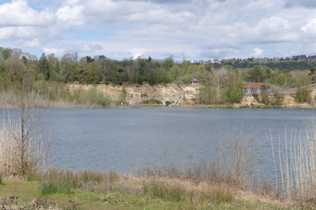
Sand Pit
What do you do with a hole in the ground?
Surface mineral extraction can be a landscape blight as well as an industrial resource. Clay, sand, aggregate, granite, limestone, slate – all can make huge impacts on their environments as well as, more positively, on their local economies. All create holes with very differing characteristics and potential. Clay holes are often filled with waste, and have gone on to expand upwards, creating hills where none existed before. Slate and granite are good at new vertical landscapes with scars and screes. Once the pumps are turned off, sand and gravel pits usually fill with water, creating widespreading horizontal changes to the local landscape character.
Recently Terroir visited a sand pit, once impenetrable behind its industrial security fencing, ‘keep out’ signs and all the paraphernalia of extraction health and safety requirements. Eventually, however, new mineral extraction planning permissions were no longer forthcoming and the pit was allowed to flood.
Nothing unusual there, you may say. ‘Soft’ restoration schemes are very common, with management for nature conservation and visual amenity, and frequently including some sort of revenue earning, water-based recreation facilities, such as sailing, kayaking, fishing, but with plenty of public access. Last week’s blog featured The Moors, a mixed development with new housing adjacent to flooded lagoons and seasonal water bodies. Here, existing public access has been extended and linked into the National Cycle Network which takes you onwards to two older flooded sand pits, one managed for water based recreation at one end (with fishing and nature conservation at the other), and the second purely as a nature reserve.
Buckland Park Lake, however, is trying a different model. With no pre-existing public rights of way, the whole, post-industrial, lake-and-landscape combination, is concealed behind a pay-wall. Well more of a pay-woodland, actually, with a wooden shed located half way down the old mineral access road, to sell you entrance tickets; £7 a pop for adults during the High Season or £99 for the year. Various concessions are available.

Once inside this ‘new and unique recreation space’ (https://bucklandparklake.co.uk/) access to the whole park and the paddling pool is free but ‘open water swimming, water sports and bushcraft should be booked directly with The Surrey Hills Adventure Company’. There’s also a restaurant and a variety of tracks and trails suitable for strolling or running. No dogs are allowed.
It sounds, and one day may feel, like an inland resort. But this is not a word used by the website:
‘Our 100-acre site blends tranquillity with breath-taking views over one of Surrey’s largest lakes. We have around 50 acres of mature mixed woodland, abundant bird life, walking trails and a small sandy beach.’
Terroir went to take a look.
First of all, it is still very new. As the landscape matures and the facilities bed, one hopes that many of the raw edges will be softened.


Above: The water sports area
Below: theview from the restaurant (the pods get very hot during the day) and the less formal recreational areas


Surprisingly, drainage appears to be an issue. A cut off ditch edges the car park and supports a lush, linear wetland habitat which we hadn’t expected, but were delighted to see. Yet the car park itself presented a bizarre contradiction: its outer edge blending with the ditch habitats - dominated by juncus rush and other indicators of wetland and poor drainage - while a few feet away the sprinklers were working hard (the car park had taken a hammering the day before) and the local ducks were in irrigation heaven. One feels, perhaps, that a rethink of car park surfacing is urgently required.


Above: the stream/ditch/drain
Below: left - car park ‘outfield’, full of rushes; right - the actual parking areas, full of ducks

Elsewhere the sand cliffs are a delightful mix of dry and acid loving species including gorse, broom and birch, with sheets of nettles where the richer overburden or spoil was probably stored or subsequently buildozed.


The woodland walk sounds inviting. The current offer is a mixed bag of developing ‘secondary’ woodland on areas no longer used for sand extraction, and older stands of exotic conifers. Terroir has no problem with that - indeed it’s fascinating evidence of the sand pit’s history - but the information signs fail to take advantage of the story. Why not explain why there is such a mix of local species (including birch, sweet chestnut, sallow, sycamore, English oak, evergreen oak and field maple), in some areas and single species stands of Scots Pine or the non-native western red cedar, in others?

A number of Scot’s pines ‘interspersed in the woodland’. It sounds so romantic but what the viewer is actually looking at is a 1950s commercial, single species, conifer plantation surrounded by a delapidated fence. Why not tell the story of why these planations were planted and what is (or more likely isn’t) happening to them now. And possibly remove that fence.
The story of the local sand extraction is told on - just one - interpretation board (below left). There is scope for a lot more and one hopes that this will follow. The retention of the processing plant (below right) is also a plus, adding welcome historical links.


The bird life mentioned on the web site is certainly developing and the multistorey sand marten nesting wall seems to be well used. Sensitive management should increase the lake’s attraction for bird watchers, but currently the hide looks rather lonely.


We have no knowledge of whether the bookable, water based activities, and the fishing, are providing the income required to make this into a going concern, but even on a chilly day in early May, there was at least some activity on the lake.


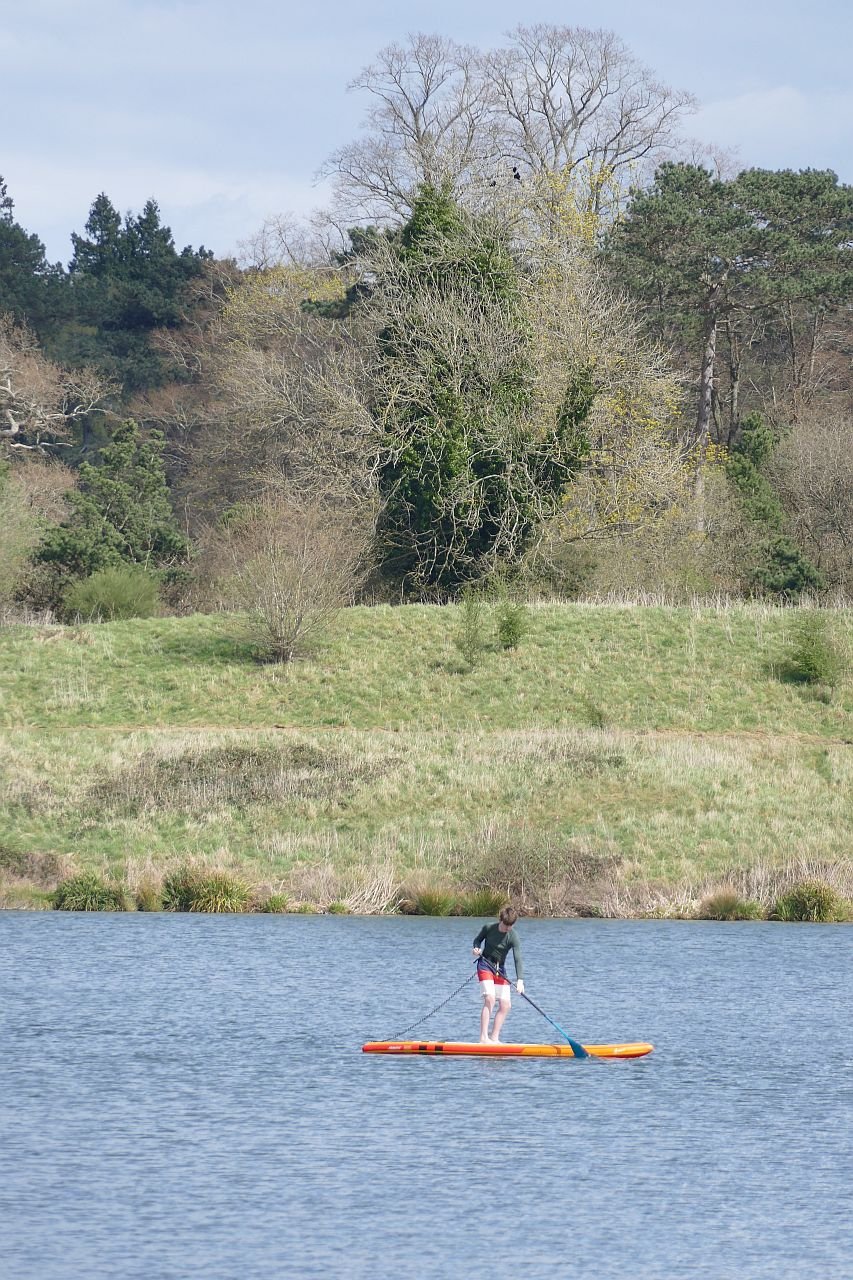

But surely the big question is, will the punters pay the site entry charge? Will they cross the pay wall? With so many free countryside, wetland and greenspace facilities nearby, not to mention the Surrey Hills Area of Outstanding Natural Beauty, the North Downs Way and the Greensand Way, is their any incentive for the casual user to pay up? Curiosity there certainly is. This year, the Annual Buckland May Fayre was held in the Buckland Park Lake. Numbers attending were hugely underestimated, traffic queued to get in, food supplies ran out, the bottle tombla wiped clean and stories of chaos were legion. The entry fee was reduced to £2 and it was reported that many turned up out of sheer curiousity to see what Buckland Lake was all about. £7 a time is definitely offputting, but a village fete at £2 is worth a go.
But maybe that is exactly the point. Maybe the business plan for Buckland Park Lake is based on creating an exclusive environment for those willing to pay for it.

Change of Management
With an ever growing image library, this blog was meant to be a comparison of spring 2020, 2021 and 2022, based on Terroir’s photographs of our favourite urban landscape, The Moors, near Redhill in Surrey. Those new to Terroir can catch up on the back story in Blogs 1, 11, 16, 31, and 54.
We discovered - the hard way - that unless you can indulge in fixed point photography and keep excellent records of camera settings, view points etc, taking and comparing before and after images can be at best frustrating and at worst, useless. Take a look at the disastrous attempt below!

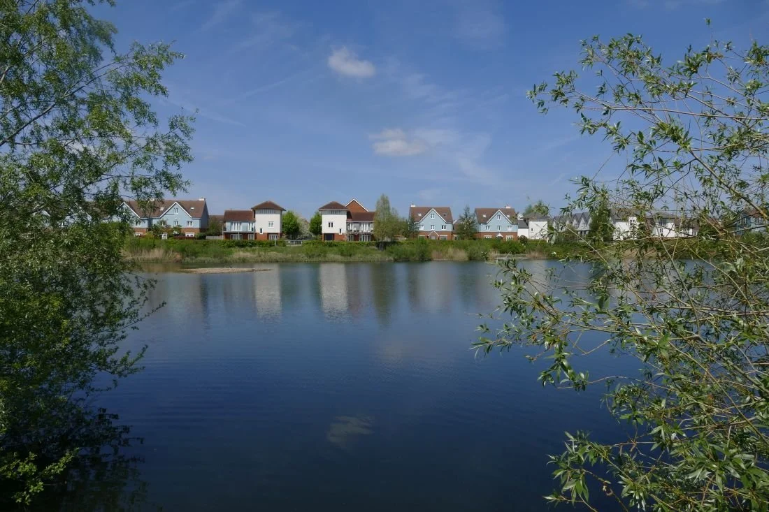
Above: ‘before’ on the left (2020), and ‘after’ on the right (2022). Well, maybe that islet has moved, but as the photographer’s location and camera settings are different, it is impossible to verify!
The changes which were most obvious, however, were not those necessarily linked to seasonal variation. It was the changes which had occurred to this post industrial landscape over the (nearly) three year time span of the pandemic.
Here is what we found.
A hugely expanded clump of dogs mercury: usually regarded as an indicator species for ancient woodland; so good to see it not just hanging on, but now thriving.
During the pandemic, there has been little active maintenance and management at the Moors. This isn’t necessarily bad - just different. At the moment the wild flowers which thrive on the edge of hedgerows are blooming, providing a range of colour and form. The summer grassland flowers, however, may not be so copious this year as the scrub is slowly extending over the grassy verges, alongside the paths and cycle way. But already a healthy growth of young willowherb, and some spikes of common agrimony, pressage a blaze of pink and mauve, with yellow highlights, later on in the year.


From left to right - top row: common sorrel, common forget-me-not, and a young teasel
Middle row: red campion, bugle and white dead nettle
Bottom row: garlic mustard (the tangy leaves are delicious at this time of year), meadow buttercup and cuckoo flower/ladies smock, a lover of ditch sides and damp rough grassland.
Thankfully, the encroaching scrub is not without interest either: flowers, fresh foliage and tinges of red on some newly opened leaves are all welcome accessories to a late spring walk.


From left to right - top row: holly in flower, a sycamore sapling and an alder - the latter another wetland lover.
Bottom row: a wild rose, buddleia (a naturalising garden escape) and the soft, glossy leaves of young brambles
The blackthorn is over but other shrubs and trees are adding to the spring time vibe. And, as is usual these days, the May (hawthorn) is fully out in April.


From left to right - top row: hawthorn hedge in flower, elderflower and gean or wild cherry: with its straight branches, awkwardly angled from the trunk, the gean flowers always make me think of handkerchiefs on a washing line or stars on a Christmas tree.
Bottom row: willows, and a rogue horse chestnut complete with candle
Sadly, the ash dieback is very obvious (below).


Despite the lack of rain, water levels are still high, the main footpath/cycle way is still partly flooded and the seasonal wetlands are inundated. This excess of water is possibly why the swan pair have moved their nest; still close to the path but further to the west of last year’s location. A beady-eyed heron stands very close. We’ve not heard of herons taking eggs but they certainly eat ducklings and cygnets.


The brook itself has also changed. Some of the mature trees have been felled or partly felled, presumably for safety reasons, and more light is reaching sections of the water course. The partly felled ‘totem’ trees look bizarre but the organisms which will inhabit the slowly rotting wood will be a welcome addition to the area’s biodiversity.


The ‘offline’ balancing pond has turned a rusty brown colour - an algal bloom? - and there are traces of it along the edge of the shadier, slower flowing, sections of the stream (image below left). Some green waterweed still remains, however (below right), but the areas of yellow flag (centre) have extended enormously and will be spectacular later in the month.


We have given up on fixed point photography, but we will report back later in the year on how the Moors post-pandemic (is that tempting fate?) summer of 2022, compares with its lock down predecessors.
Changes to Terroir
Terroir blog had a long gestation period but eventually went live in October 2020. It was the perfect lockdown project and a weekly post seemed ideal. Thankfully, our life styles have changed and now that we are ‘learning to live with Covid’ we will be travelling more often and more extensively than we were able to, in the previous two summers. For the next six months at least, therefore, the Terroir blog will be appearing on a fortnightly basis. Blog 81 will appear as normal on Thursday 12th May but blog 82 will not be posted until Thursday 26th May. Further postings will follow at two week intervals.

Rewilding

What is rewilding and why do we do it? How to cover this in one short blog? You would need to write a book to even begin to answer that one. Luckily that book has already been written, by many competent authors, including George Monbiot (Feral), Jepson and Blythe (Rewilding – The Radical New Science of Ecological Recovery) and Isabella Tree (Wilding).
But what is rewilding and why does it create so much controversy?
Definitions vary in subtle ways; here are a couple of extracts from rewilding websites:
“Rewilding is a progressive approach to conservation. It’s about letting nature take care of itself, enabling natural processes to shape land and sea, repair damaged ecosystems and restore degraded landscapes. Through rewilding, wildlife’s natural rhythms create wilder, more biodiverse habitats.” https://rewildingeurope.com/what-is-rewilding-2/
Nature has the power to heal itself and to heal us, if we let it. That’s what rewilding is all about; restoring ecosystems to the point where nature can take care of itself, and restoring our relationship with the natural world. Reconnecting with what matters.” https://www.rewildingbritain.org.uk/explore-rewilding/what-is-rewilding
As you can see, there is a lot about stepping back and letting nature take care of itself. Terroir prefers:
“Rewilding, or re-wilding, activities are conservation efforts aimed at restoring and protecting natural processes and wilderness areas. https://en.wikipedia.org/wiki/Rewilding_(conservation_biology)
Practical, realistic and un-romantic.
From Terroir’s experience, most non-ecologists and non-farmers seem to favour rewilding for the emotional pull of recreating what we think was there before, for reintroducing species which we ‘remember’ in folk lore or in our childhoods, but which have gone extinct. But there are always lines to be drawn, usually around wolves and beavers. Many would mourn the loss of the ‘quintessential’ English patchwork landscape (although probably still dependent on fertilisers and pesticides) or heathland, while others want to plant trees over everything.


These are headlines, of course, and we need to dig deeper. Here are some key issues:
Why Rewild?

Emotion: we mourn the loss of hedgerows, wild flowers, song birds. We hope re-wilding will bring back our lost youth, our lost countryside, lost culture and salve our guilty consciences. Cynical? Yes. True? Probably.

Climate change: sadly, you have to dig a lot deeper to find the real elephant in the room (if you'll pardon the expression). It has to be about climate change, the carbon crisis and saving the planet. Biodiverse ecosystems are more stable and resilient, can sequester carbon and are more productive, but not necessarily in a way which will support our current lifestyle.
And there is the rub: rewilding changes how things look and how things work.
Put things back to how they were before we messed up. But:
· when we began to mess up there were rather fewer of ‘us’
· and do we really know how things were?
· so how do we get there from ‘now’, which is a radically different starting place compared with ‘before we messed up’.
This doesn’t mean we shouldn’t do it, though. But believe you me, it is not just about ‘letting nature take care of itself’.

The piece of rewilding which is best known to Terroir is the Knepp Estate in West Sussex – and we thoroughly recommend Isabella Tree’s book, ‘Wilding’, now also available in paperback. Previously an arable farm on heavy clay which struggled to make ends meet, Knepp is now a gloriously diverse landscape, contributing hugely to a healthy planet – and probably still struggling to make ends meet!!
Knepp’s landscape is not unmanaged. They say it is ‘process led’, in other words natural ecological processes lead the way, but that belies the degree of management required to reach where they think they might be going, on the basis of where they think they have come from.
Following the research of the Dutch ecologist Frans Vera, Knepp is aiming at wood pasture, which many now think was our climax vegetation, rather than the high forest which Terroir’s generation learned about. Wood pasture requires grazers and browsers. Some of those which might once have grazed in West Sussex are now extinct of course, but the herd of old English longhorn cattle, red, roe and fallow deer, and Exmoor ponies are doing a grand job.


Wild boar, which would rootle through the vegetation, opening up soil to the benefit of a wider range of plant species, are expert escapists and a feral nuisance in southern England, so a small number of Tamworth pigs have been employed to do the same job.


But of course, in a natural landscape, there would also be predators, controlling the number of herbivores who are controlling the vegetation. Back to those wolves. But southern Britain isn’t yet ready for wolves. So the ‘carnivore’ is represented by a culling regime.
Letting nature take care of itself? The processes are very close to ‘natural’, but humans are still in control. Every year, management decisions are taken, largely on how many browsers the project can sustain while still achieving wood pasture. Natural famine amongst herbivores has been eliminated.

A natural landscape? Again, very close, particularly as rare, or extinct, locally native species (such as nightingales, turtle doves and purple emperor butterflies) have flocked back into the estate.
Image right: purple emperor butterfly © R Stephens
Not all species can make it back without help, however. White storks, long extinct in Britain, were introduced to Knepp, from Poland, in 2016. They finally felt settled enough to successfully breed in 2020 and are now an established part of the estate.


Is it biodiverse? Very much so.
Do we like it? It’s nothing like what was there before. It’s nothing like that idyllic Sussex agricultural landscape which we think we remember. To many 21st century eyes, it may appear scruffy, untidy and unkempt.


But the number of visitors, thronging the public rights of way on a sunny afternoon, speaks of enthusiastic interest and, yes, approval. The Knepp ‘safaris’ are pretty much booked out for the whole of the summer. The tree platforms are an amazing way to visit the inside of the canopy of a mature oak.


And of course animals do add to the attraction; 21st century eyes do love an antlered fallow deer or a cute Tamworth piglet.

Walls
Walls often get a bad press: they can divide, separate, segregate, exclude, banish, prohibit, hide, and lock away, in all the very worst ways.
But walls can also shelter and protect. They can be beautifully crafted, decorative, characterful, symbolic. They can tell stories about their locality, about history and prehistory. They can be political, advertorial, or works of art in their own right
Here is a selection of walls to celebrate spring and the opportunities to be on the outside of walls after a winter of looking at their insides. We’re starting with some stunningly beautiful ones.


That trip to Seville gave some lovely quirky details:


Closer to home: under a railway bridge on the Hogsmill River near Kingston (left) and Eastbourne sea front (right).


Multi-media in Georgia (below left) and showing off in London’s Whitehall (below right).


Local materials: Surrey stone (pity they got the mortar too strong) and Surrey clay work - brick and tile hanging.


The Glencoe Creel House: constructed in local turf and heather (images © T Thompson).


Walls with messages:


Heritage Walls: much admired today but these structures hint at dark histories.


These mud walls once said, ‘Keep Out’. But now they are ‘heritage’, tourists are more than welcome.
Khiva, Uzbekistan
And here is a Romanian warning, of the consequences of an ill-spent life. It’s all in the detail.


Happy springtime.

White Stuff
Cornish holidays: beauty, wildness, mystery. Crashing seas, coves, beaches, wind-swept uplands, lighthouses, fishing villages, smugglers, sea shanties, tales of adventure, romantic ruins and mineral extraction. Yep, it’s all part of that Cornish allure.

“Metal mining, especially for tin, is Cornwall’s greatest and most romantic industry…” (Richard Stanier, Cornwall’s Industrial Heritage, 2005). Where’s the romance in shanty towns, arsenic poisoning, deep mining and limited life expectancy (Blog 71)?
Well, precious little of course, but when industry becomes heritage, perception changes. Those “hundreds of roofless engine houses across the landscape” (Peter Stanier again) are an alluring hint of bygone times. But, as we noted in the ‘Tinners’ blog, tin mining not only left a landscape of iconic industrial archaeology, it also left very little obvious waste.
Not so Cornwall’s other “massively important” (more Stanier) mineral industry – China Clay. China clay extraction and processing changed the rural landscape from green to an often startling white, either as holes in the ground, or as conical heaps (sky tips) of waste materials. It had an enormous visual impact over a huge area. Characteristic of many areas of Cornwall, and yes iconic, but I suspect few find it romantic.
The internal environment created by China Clay processing could be very different, however, and the lives of the workers, though tough and physically exacting was probably very different to the life of a tin miner.
In Terroir’s school days, China Clay was always mentioned in secondary school geography lessons, although I have no memory of being told of its use in ceramics, merely as an additive to fabrics and toothpaste. I don’t think historical geography was well regarded then. I do remember references to ‘rotting granite’ which we thought was highly amusing. So a very quick summary of the history of china clay may be appropriate.
China clay or kaolin results from decomposition of feldspar in granite. The Chinese knew its ceramic properties centuries before Europeans got a handle on it. In Cornwall it had been used as a building material until a Plymouth Quaker apothecary, one William Cookworthy, produced ‘hard-paste’ porcelain and patented the mix in 1768. Naturally, he opened a pottery. Cookworthy’s partner later tried to extend the patent but the guys from Staffordshire, led by Josiah Wedgwood, broke the monopoly. Other uses were also found for kaolin and extraction expanded rapidly.

China clay was valuable enough to support a system based on extraction of vast quantities of raw material, followed by lengthy processing, to produce only a small amount of the final clay product. Around 90% of the material quarried is discarded as waste. Although the landscape impact was enormous, the processing details can be surprisingly beautiful. Our thanks to the Wheal Martyn Clay Works Museum (right) for showing us the processes involved and the technology created to undertake the journey from ‘rotting granite’ to porcelain, or indeed, paper and toothpaste.
The quantities required, and the softness of the raw material, meant that a flow of water was the simplest way of removing the kaolinised granite. Gravity fed water flows were soon replaced by hand held hoses, which later developed into the high pressure, serpent like, ‘Monitors’.


The clay slurry had then to be pumped from the pit to surface level. Initially water wheels provided the energy until replaced by steam powered pumps.


At Wheal Martyn, waste material – quartz, sand and rock - which couldn’t go up the slurry pump shaft, was sent up by skips on an inclined tram road. Here was the first load of spoil needing to be dumped.
Right: self tipping skip waggon, image courtesy of China Clay History Society
The slurry of clay, sand and mica, went to the sand ‘drags’, a system of gently sloping channels, which allowed the sand to settle out - and this spoil was discharged to the river.
Next the mica drags performed a similar job for the smaller mica particles, which were also discharged to the river, often mixed with a smidgeon of clay slurry; the rivers ran white as a result.
At Wheal Martyn, the pure clay slurry then entered the Blueing House (still with us?), was sieved through a wire mesh to remove leaves or other materials which may have dropped in, and a blue dye could be added, to hide any discolouration which would have reduced the value of the clay.
Next, the slurry flowed into the settling pits and clear water was drained off as the clay dropped to the bottom over a number of days. Once the clay was the consistency of single cream, the slurry was run into the settling tanks and the process repeated until the slurry was as thick as clotted cream. This could be a slow process.
Finally, the ‘cream’ flowed or was trucked into the pan kiln. This was lined with porous pan tiles which allowed heat from flues beneath the floor to rise upward and dry out the clay. At least the pan tiles at Wheal Martyn were made from waste clay and sand, but we doubt this made much of a difference to the volume of waste material to be dicarded.
The pan kiln at Wheal Martyn is remarkably well preserved and imaginatively interpreted. It reminded Terroir of hand made brick works, where the craft and skills of the individual brick makers belies the external mayhem of clay winning outside. Similarly at Wheal Martyn, the pre-mechanised, human scale of the clay processing presented craft skills and human endeavour which stand at odds with the large scale business of hauling china clay out of the ground.


The final product (in block form, or packed in casks or sacks) was stored in the linhay (pronounced ‘linny’), before dispatch to customers by road (impacting on the bypass-less local towns) or rail.
Image right: China Clay History Society
The human element was largely made up of men and boys, although women were employed to scrape clean the bottom and sides of air dried clay blocks.


Images above: China Clay History Society
The techniques shown above did not last, and increased mechanisation did nothing to reduce the quantity and quality of waste, stacked around the clay pits.


Images above: China Clay History Society
The industry continues today, of course. Many Victorian companies amalgamated into larger units, but around 70 producers still existed prior to WWI. Three of the largest - West of England and Great Beam Clay Co, Martin Brothers, and the North Cornwall China Clay Co – were amalgamated in 1919 to become English China Clays and, through further mergers and reorganisations the company survived the lean times before and after WWII. In 1999, the core of the company was purchase by Imetal, now known as Imerys. It’s signs are everywhere throughout the Cornish China clay territories.

Attitudes to waste disposal and restoration are, however, finally changing.
The most famous restoration scheme – The Eden Project – opened in 2001: “We bought an exhausted, steep-sided clay pit 60 metres deep, with no soil, 15 metres below the water table, and essentially gave it life.” (https://www.edenproject.com/mission/our-origins). The projects mission is to “create a movement that builds relationships between people and the natural world to demonstrate the power of working together for the benefit of all living things”. It is a significant player in Cornish Tourism.
Schemes in other areas have been less ambitious but our overwhelming experience of the 2022 Cornish China Clay landscape is of gentler land forms, of colour schemes now in a palette of browns, greens and yellows, of native species, grassy areas and new woodlands. Of ‘come in’, rather than ‘keep out’. It’s not perfect. But words such as ‘healing’ and ‘biodiversity’ come to mind. The iconic Cornish Alps have largely gone but a symbolic sky tip or two remain, although these, too, are turning from grey and white, to brown and green.


Is it romantic yet? Terroir thinks not. But we are hopeful that, one day, derelict 21st century wind turbines will be considered romantic - that is if we and the planet make it that far.

The Pool of London
On crossing London Bridge, one of Terroir’s parents would always look east to see what shipping was in the ‘Pool’. The Pool of London was always a bit of a mystery to the offspring. It looked just like a normal stretch of tidal Thames to us. But for a woman who had commuted to work in the City of London before, during and after WWII, and who had watched the bustle and vibrancy of the Thames wharves and docks from the top of London buses, the Pool of London would always hold a special place in her Londoner’s heart.

More recently – much more recently - Terroir took a visit to the Tower of London to see how the Superbloom was coming on (image right). More of that in future blogs, but the walk along the north bank of the Pool, from the Tower of London to London Bridge was like stroll along a historical transect from the medieval to the modern.

The Pool of London played an integral part in the growth of the City of London and has a long history of commerce, crime and social issues. Wikipedia gives a good summary. Originally, the Pool of London was the name given to the stretch of the Thames along Billingsgate. This is the stretch you can see from London Bridge and where HMS Belfast is moored.
And this was where ‘all imported cargoes had to be delivered for inspection and assessment by Customs Officers, giving the area the Elizabethan name of "Legal Quays".’ (https://en.wikipedia.org/wiki/Pool_of_London and https://en.wikipedia.org)
London Bridge, itself, prevented shipping from going any further up river but, as both overseas and ‘coastal’ trade increased, the concept of the Pool spread downriver, eventually reaching the Rotherhithe/Limehouse area. By the end of the 18th Century, with the slave trade and Caribbean colonies in full swing, the Pool could no longer cope with the volume of trade and shipping, and the first, off-river dock was constructed specifically for the West Indian trade. Other off-river docks followed, of course. The whole maritime commercial area, including the Pool, remained viable right into the 1950s despite damage caused during the Blitz.
Terroir walked along the north bank of the Pool of London (now part of the modern Thames Path) from the south west corner of the Tower of London to London Bridge. The map extract, below, shows what it all looked like in 1873. The Great Ditch of the Tower of London is just visible on the right, London Bridge on the left.

All map extracts reproduced with the permission of the National Library of Scotland' https://maps.nls.uk/index.html
Sugar Quay Wharf

Known as the Wool Quay in the 13th century, this wharf was the location of a building which was key to the Port of London: a custom house. In this case it was used to collect duties on exported wool. There were a number of iterations of this Custom House: a new building, overseen by the then Lord High Treasurer, William Paulet, was built around 1559, but was destroyed in the Great Fire of London in 1666.
Christopher Wren designed the replacement, which was constructed in the early 1670s, but fire hit again in 1715, necessitating a fourth rebuild. This one managed to function, unsinged, until the early 19th century and then, yes, a fire started in the house keeper’s quarters where, apparently, both spirits and gunpowder were stored (really?) and Customs House No 4 exploded. And people criticise modern Health and Safety Regulations. https://en.wikipedia.org/wiki/Sugar_Quay
By 1934, Wikipedia reports that the Batavia Line, which ran a steam ship passenger service between Rotterdam and London, was berthing its ships here. In 1970, Terry Farrell designed an office building for Tate and Lyle, but the final break from both shipping and sugar came with its conversion to a mixed use development in the 20 teens. Or maybe that statement isn’t quite true: the developer – CPC – was owned by the Candy Brothers.


Custom House

Custom House No 4 was doomed before it exploded. London’s maritime trade was booming and a larger Custom House was commissioned for the site adjacent to the one described above. Bear Quay, Crown Quay, Dice Quay and Horner's Quay were all subsumed by the new build, leaving a single Custom House Quay or Wharf.
Designed by architect David Laing, the new Custom House was completed in 1817. The building contained warehouses and offices, and the basement cellars (fireproofed) were used to store wine and spirits seized by the revenue men (https://en.wikipedia.org/wiki/Custom_House,_City_of_London).
The Custom House curse had yet to be appeased, however, and the building partially collapsed in 1825, when the timber pilings under the building caved in. Wikipedia reports that the building contractors “had grossly underestimated the cost of the work and had started to cut corners. The foundations were totally inadequate” and “questions were asked in Parliament”. Familiar? After rebuilding, no further disasters seem to have occurred, until the east wing was destroyed in the Blitz. It was later rebuilt behind a re-created historic façade.

The former Quays have gone but the building remains. It is listed grade I. Plans to convert the building into a hotel were rejected in 2020 and the project went to appeal early this year.


Billingsgate Market

As a market, Billingsgate started out as a general wholesale supplier of corn, coal, iron, wine, salt, pottery, fish and miscellaneous goods, and it wasn’t until the 16th century that it became for specifically associated with fish (https://www.cityoflondon.gov.uk/supporting-businesses/business-support-and-advice/wholesale-markets/billingsgate-market/history-of-billingsgate-market)
And it wasn’t until 1850 that the first market building was erected, to replace an array of market stalls and sheds. It quickly proved to be inadequate – this was the 19th century, after all, an era of constant change and expansion – and a new market building was erected in 1875, designed by City Architect Horace Jones and built by John Mowlem and Co.
Just as Covent Garden’s real estate was released when the Fruit and Vegetable Market moved to more spacious and accessible premises in 1974, so the fish market was removed to Docklands (the Isle of Dogs) in 1982. The Pool of London building – listed grade II - remains beside its Grade 1 Custom House neighbour, and was refurbished for office use by architects Richard Rogers. It is now a hospitality and events venue.


Grant’s Quay Wharf

We’ve called this section of the water front Grant’s Quay Wharf simply because this name features on one of the City of London’s signs.
From studying the historic maps – there is an excellent sequence at https://theundergroundmap.globalguide.org/article.html?id=34336&zoom=16&annum=2022 – this area appears to have resisted major redevelopment until the first half of the 20th century. 19th century maps appear to show a succession of narrow, bonded warehouses. Their northern elevations abut Lower Thames Street and cover the site of St Botolph's, Billingsgate, a church destroyed in the Great Fire of London and never rebuilt. To the south, the warehouses are just a road’s width away from the riverside quays and wharves with which they were intimately linked. Names include Fresh Wharf, Cox’s Quay, Hammonds Quay, Botolph Wharf, Nicholson’s Steam Packet Wharf, and at the eastern end next to Billingsgate Market, an ominously named residential street called Dark House Lane, which links to Summer’s Quay stairs.
By 1950, much has changed but the area still appears to be a working wharf. Not so today. The area is now a rather uncoordinated and largely uninspring development, which does little to reflect the lives and times of its riverside forebears.


Church of St Magnus the Martyr and London Bridge

Walking the Thames Path to London Bridge, you would hardly know that the parish church of St Magnus the Martyr is still squeezed in between the Bridge and the west end of the developments described above. As with St Botolph’s, St Magnus’ church was also destroyed in the Great Fire but was rebuilt by Wren in the 1670s and 80s.

Glance north as you approach the bridge and you will see the church spire fighting for vertical supremacy with the Monument, lamp posts and modern buildings.
The end of our historic transect reminds us of the importance of stairs in Thames-side life: stairs to reach the Watermen who ferried passengers to and fro, and up and down the river. Stairs which enabled mudlarking at low tide. And now a modern flight to enable Londoners and visitors to reach the Thames Path, its cafes, its views and its historic treasures.
Modern access between London Bridge and the northern riverside had been problematic for many years, but an elegant solution, in the form of a cantilevered, stainless steel, spiral staircase (designed by Bere:architects) was opened in 2016 and has revolutionised the Thames Path in this area. An honourable addition to the more traditional Thames stairs.

