
The Ecology of Archaeology
Did we really say that? How pretentious. I suppose we are really talking about the study of plants which love growing on walls but, as archaeological work often provides such walls (both vertical and horizontal), there is a strong connection between rock loving flora and excavations. Tourists who love plants and history/prehistory get a double dose of excitement.
Last year, we sent you postcards from mainland Italy and Sicily, featuring the flora growing on the ruins of Pompeii and the Parco Archaeologico della Neapolis, in Siracusa. This year we ventured to Greece, also rich in archaeology of course, but which offers a different collection of wild flowers, lichens and ferns. As we only got back a few days before blog posting day, we thought you might like a kind of appetiser, a Greek salad perhaps, before offering you the main course moussaka in a couple of weeks.

Northern Greece was showery and cloudy, an atmosphere which did not deter either the flowers or the botanists. The swards and rocky nooks and crannies provided a plethora (a word partly borrowed from the Greek, apparently) of plant delights – and identity challenges.
Right: Nafpaktos Castle with botanists at work
Image below: surely not a gentian? No - sufficient knee work and app use suggests an Alkanet (Anchusa undulata?) Both images © M Chilvers


Some of the wall plants with which we are so familiar in Britain are also stalwarts (stalworts?) in Greece. Ivy leaved toad flax (below left), navelwort (the flower spike, not the leaves behind it, below centre) and pellitory of the wall can all be found embedded in all sorts of cracks and crevices.


Garden escapes are also familar and frequent components of the habitat. Even a fig can squeeze into tight space, when absolutely necessary.


Other flowers were less familair but well worth the effort of trying to identify them. And by the way, if we have mis-identified (or mis-spelled) any of these plants, please let us know.
Below left to right: salsify (Tragapogon porrifolius), giant fennel (Ferula communis) and Campanula ramosisissima. And not fogetting, at the top of this post, the tiny, delicate flowers of Micromeria graeca, clinging grimly to a wall.


Ferns, mosses, lichens and liverworts inhabit damper and or shadier areas.


Less cramped spaces were populated with the sort of plant which can quickly get a toe-hold in rough but ready places. Here we have sow thistle, poppies, yellow hop trefoil and purple (winter?) vetch, with (lower row) the gloriously named basket of gold (Aurinia saxitilis), Arabian pea and bladder vetch, not quite ready to flower.


More fertile places with deeper and/or damper soil provided a cornucopia of colour and form. It is hard to justify including such beauties in a blog post supposedly devoted to walls and rocky places but we did find them in a museum devoted to industrial archaeology…
A welcome please to cut leaved self heal, a pyramidal orchid and - oh - a wreath of Laurus nobilis, the laurel with which the Romans crowned their Olympians and which we just put in our casseroles.


Time for Tea
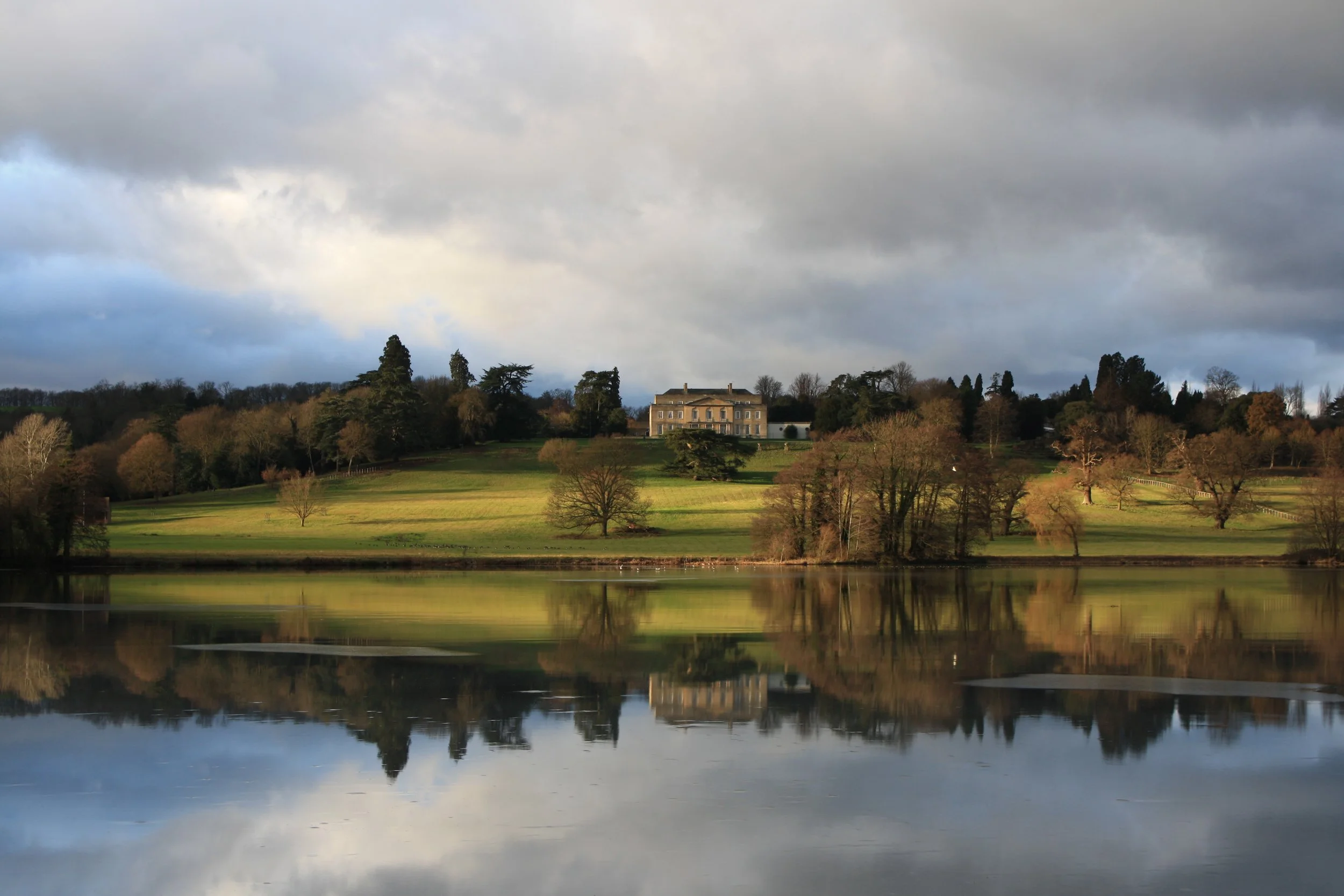
We are spending a lot of time on the allotment these days. Regular readers of this blog will know that time spent on the allotment does not necessarily correlate with work done, as watching the neighbour’s hens is compulsive, therapeutic - and time consuming. So this will have to be a short blog! We do, however, want to tell you a little bit about one of our favourite ‘stately estates’. For reasons which will become evident, we cannot really call it a stately home anymore, but the grounds still deserve the ‘stately’ qualifier.
Gatton Park lies on the North Downs towards the eastern end of Surrey. The 1987 Surrey edition of Pevsner & Nairn’s ‘The Buildings of England’ refers to it as ‘under the downs N of Reigate’. This is geographically incorrect (it is on the downs and north of Redhill) but probably illustrates the terrible snobbery which can exist between an old (ie recorded in Domesday Book) town (Reigate) and a new upstart Victorian railway town (Redhill). So imagine Terroir’s delight on finding that Pevsner (or perhaps Nairn) refers to Reigate as a ‘characterless little town’! But we digress.
The Gatton estate seems to have been around since Saxon Times and was recorded as a manor in – yes - the Domesday Book! OK, it only consisted of 9 households (6 villagers and 3 smallholders, compared to Reigate’s 67 villagers and 11 smallholders) but it passes the antiquity test nicely (https://opendomesday.org/place/TQ2752/gatton/).

By 1450 Gatton became a parliamentary borough, probably as a political pawn in the hands of the third Duke of Norfolk. In 1765, Sir George Colebrooke added a ‘Town Hall’, created in the form of a little Doric temple with ‘voting urn’. The multi coloured decoration is definitely a later addition!
By GrindtXX - Own work, CC BY-SA 4.0, https://commons.wikimedia.org/w/index.php?curid=35375105
At around the same time, Colebrook also upgraded his estate on a much larger scale by employing a design/build contractor called Lancelot (Capability) Brown. Gatton Park was ‘improved’ and became a fine example of the English Landscape style.
By the 19th century, Gatton had also achieved fame as a ‘rotten borough’. In 1830 William Cobbett described it as a ‘very rascally spot of earth’ and, following the 1832 Reform Act, Gatton finally lost its Borough status.

By this time the estate was owned by a Lord Monson, who made some significant changes, including reconstructing Gatton Hall on a scale suitable to house the treasures he had ‘acquired’ on his travels around Europe. The works included the construction of a grand Marble Hall which he filled with paintings and sculptures.
Thanks to the Gatton Trust for above Image
By 1888, the Estate had been acquired by mustard-magnate, Sir Jeremiah Colman. Tragedy struck in 1934 when the house burnt down and Monson’s Marble Hall was destroyed. On a more positive note, however, Colman was a plantsman and became a global authority on orchids. As with Sir George Colebrook before him, Colman also hired specialist help to create many new landscape features around the periphery of Capability Brown’s parkland.

The partnership of Milner White and Son established a parterre, pleasure gardens and an ‘old world’ garden (by landscape gardener Henry Ernest Milner) while son-in-law Edward White designed a fashionable Japanese Garden, and an equally fashionable rock garden (image left), built in association with James Pulham and using their artificial (‘Pulhamite’) stone.
As an aside, the Milner White practice remained in business for over a century, and only finally closed its doors in 1995 with the retirement of Frank Marshall, who had joined the company in 1960 (https://merl.reading.ac.uk/collections/milner-white/).

The rebuilt house is now home to a voluntary aided boarding school and the grounds have been - carefully -modified to include sports pitches and other educational structures.
Image right: modern view of the mid 1930s rebuild (designed by Sir Edwin Cooper). The scaffolding shrouds the tower of the beautiful, grade I listed, 13th century, St Andrews church. © Terroir
The park and garden is registered Grade II, however, and is managed and maintained to respect the basic structure provided by Capability Brown and Milner White. The wooded western part of the estate is also in good care, being now in the ownership of the National Trust.
The Japanese Garden is very special indeed. Constructed in 1909, Edward White incorporated lanterns, flowing water, bridges and a tea house, in a Europeanised style of what Edwardian Britain thought was Japanese. Sadly, but probably inevitably, the garden ‘rewilded’ when maintenance ceased after WWII.
Some 25 years ago, however, research and survey work began to piece together what this boggy corner of Gatton Park may once have looked like. ‘Help’ came from many sources including Monty Don’s ‘Lost Gardens’ series in 1999, support from the Japanese Embassy, the skills and knowledge of a Japanese Garden designer, and the planting of 100 young cherry trees as part of the Sakura Cherry Tree Project https://japanuksakura.org/. But the real power house for this restoration project was provided by the scores of Gatton Trust volunteers who donated thousands of hours of their time to back breaking hard labour, undertaken in all weathers. Who knew that Japanese gardening could involve so much mud?
Last month (April 2024) the project was declared ‘open’. A very English tea was laid on with a very Japanese musical recital from Keiko Kitamura playing the koto, before a tour of the garden in very British spring weather.


You weren’t invited? Don’t fret. Just watch this superb video filmed and edited by Sean Bate.
https://www.youtube.com/watch?v=jTTavjVJv6w&t=1s
Unless otherwise stated, all photos © Chris Hoskins/Gatton Trust

Four Go Mad in Berlin
Well not quite, but there was plenty of ginger-free beer available.
All of us had been to Berlin before, some on multiple occasions, so there was no imperative to go to Checkpoint Charlie, the Stasimuseum, or the Berlin Wall Memorial. We even forgot to check whether we were wandering through the former East or West Berlin. It was very liberating (I use the word intentionally) and we were able to celebrate Berlin as a modern, forward looking, European Capital. So where does the (in our case more mature), 21st century tourist choose to go?
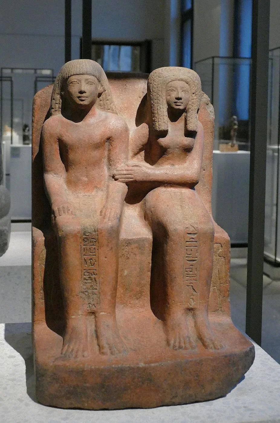
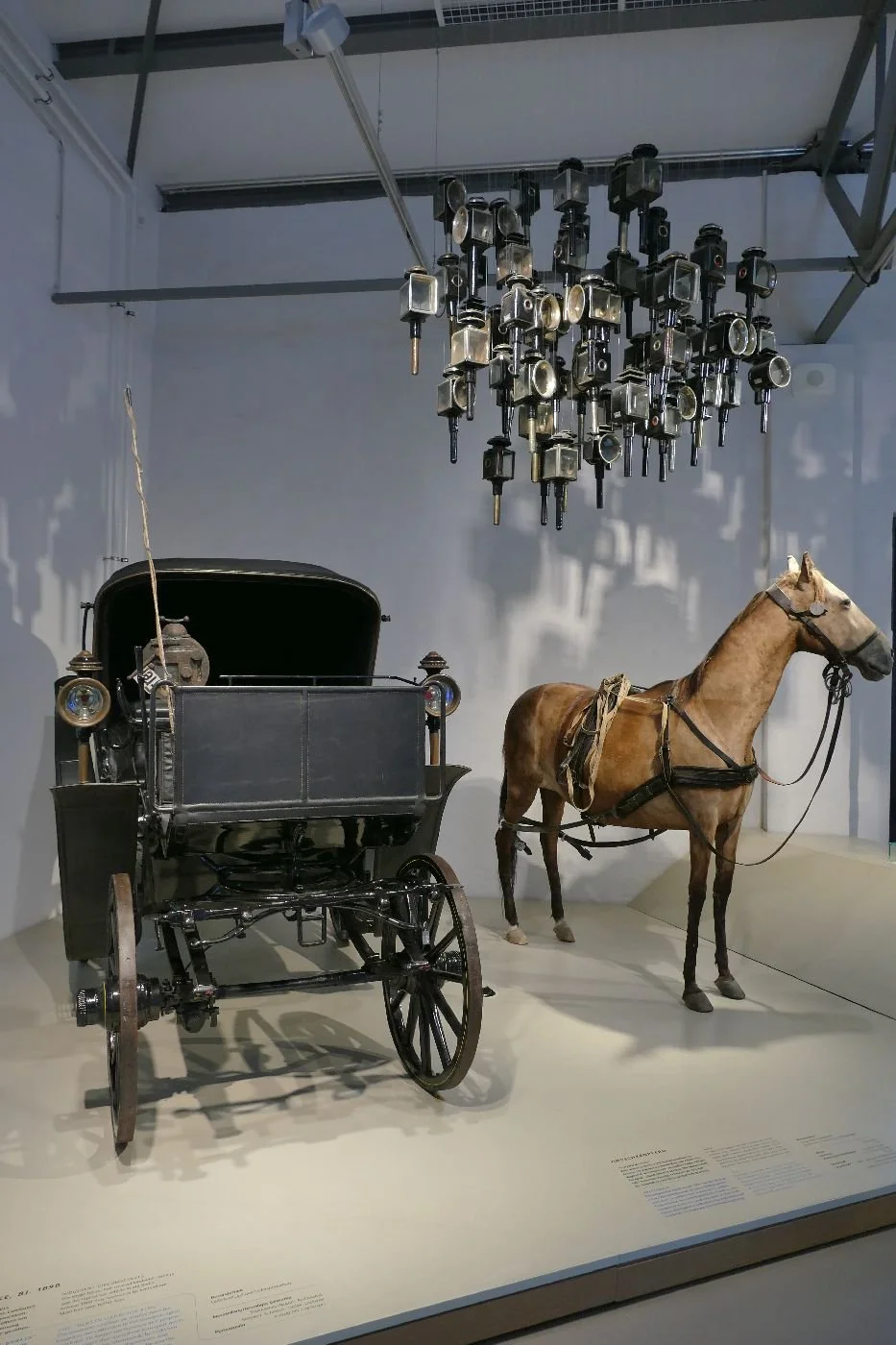
For one of us, it all started in the allotment. Our uphill neighbour had recently fortified his plot against foxes and introduced a fine troupe of hens, which are, as their owner pointed out, terrible time wasters, just begging you to stand and watch as they burble around, scratching and preening. So these days, allotment chats tend to be longer and allotment activity abbreviated. Thus I learnt, on a recent dose of hen relaxation therapy, that our neighbour’s other area of expertise was in Egyptian archaeology and that no visit to Berlin was complete without a visit to see the statue of Nefertiti.
Thankfully, on consultation, all four of us agreed that the Pergamon Museum’s archaeological treasures were a must. But Berlin’s Museum Island no longer appears to house such an establishment. A UNESCO World Heritage site since 1999, the geography of Museum Island seems to have been in flux for many decades. Nefertiti, however, is safe, well and very much on view in the Neues Museum.
Entering the Museum is a modern and minimalist experience and, as the corridors are uncluttered with signage, deciding where to start feels like a sort of pastel potluck. We were headed, of course, for the Egyptian stuff and once into the appropriate labyrinth, we found it utterly absorbing, clean, fresh and beautifully presented, with no feeling of indigestible overload. Some items seem fabulously exotic and feed our preconceptions of pyramids and mummies. My particular ‘take home’ from this section was the wall art (below).


Other items are startling modern or, more accurately, suggest that nothing modern is actually new.
Below: left - the original flip flop? Centre - a very familiar cane chair and folding chair (minus its fabric/leather seat) Right - such seats in use (probably best not to ask what the sitters are up to)


Cute cartoon figures are not a 20th century invention.
“There is a strong emphasis on the diverse fauna of Egypt, with the hippopotamus, ape, dog, shrew and hedgehog often depicted in cute poses. Nile plants are painted on the body of the hippopotamus, as an indication of its habitat.”

“Despite the attention to detail, the anatomy of the animals is not reproduced to scale but the accentuation of their features still gives the observer a sense of the perfect accuracy and realism which characterise animal drawings in Egyptian art.”
Quotes taken from the Museum interpretation boards accompanying this section of the exhbition.

Finally we get to Nefertiti herself. She reigns supreme in a circular room giving 360 vision and space for viewers to move and linger. She is sublime: one of us immediately thought of Eltham Palace, the art deco mansion in south east London, where she would be so at home. Is she a fake? Of course rumours abound. Why did the German archaeologist credited with finding her in 1912, keep her out of view for so long? "A beautiful woman and a putative scandal …That always sells." Dietrich Wildung rebuffing the allegations of forgery (quoted in the Guardian in 2009 https://www.theguardian.com/artanddesign/2009/may/07/nefertiti-bust-berlin-egypt-authenticity)
I so hope she is genuine. Mona Lisa? Nah – give me Nerfertiti every time.
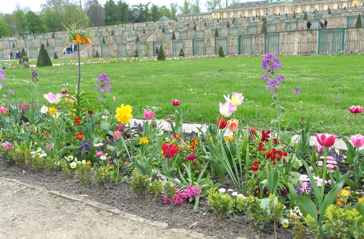
How do you follow that? You go to Potsdam of course, the residence of Prussian Kings and a German emperor, a place of palaces and lakes, of fine art and architecture and, more recently, a significant role in 20th century history and politics as host to the 1945 Potsdam Conference and the location of the Cold War focal point, the Glienicke Bridge.
We took as our specialist subject the Palace of Sans Souci, the summer residence of Prussian King Frederick II (so maybe April wasn’t the best time to go?). Admittedly, It was cold and chilly but we did manage a quick tour of the park and gardens. The park was full of that fresh green which only trees in spring time can produce and reprodue, year after year. The leaves were bright, cheerful, full of hope and spring promise (even when dodging rain showers) and never overpowering.

What a contrast in the garden! Formality, fabrication, humanity, structure, control, colour, power - and potaoes!
Below - migraine inducing spring border with formal lawns, sculpted conifers and the most magnificent, formal, south facing vineyard terraces which were completed in 1746. Despite its slight similarity to a (horticultural) prison, it makes a tremendous visual impact and completely overshadows the palace itself.


And those potatoes? Frederick II (looking anxious below left) was known as the Potato King. The story goes that, after successfully introducing potatoes into the diet of his army, Frederik tried to do something similar when famine hit his civilian population. The peasants were not keen. The threat of ear and nose amputation for those who refused to grow spuds did little to encourage potato production so he tried more seductive methods. A royal potato plot was established. The King advertised his admiration for both potato flowers and tubers, had the field ostentatiously guarded, and sat back. Of course, the peasants were soon sneaking in by night to steal the crop so that they might grow their own fashionable tubers. Job done. To this day, potatoes are regularly left on Old Fritz’s grave, which lies under the terrace of Sans Souci Palace (below right).


But it seems that Frederick was ahead of his game in hospitality as well as basic nutrition.
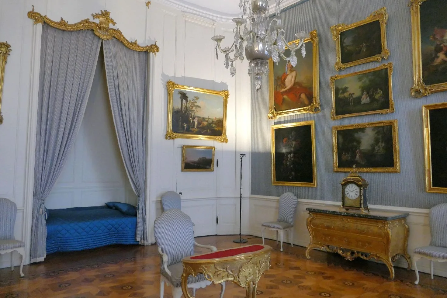
Within the Palace, Team Terroir was particularly impressed by a line of guest bedrooms, all sumptuously decorated and furnished, each with a garden view, a bed in an alcove and a discrete door for the below stairs staff to service the room. These apartments reminded one of us of a string of up market AirBandBs.
The décor of these apartments was, and is, magnificent. There was a distinctive, ornate floral theme in many of the rooms, with artists and crafts people using a variety of styles and materials to decorate floors, walls and ceilings in pursuit of royal grandeur. This is the garden within, but without the migraine tulip.


Voltaire was a particularly regular visitor who is said to have stayed for extended periods of time. Apparently Old Fritz spoke French better than German. The poet’s regular appartment stands out from the rest with with a particularly bold and fruity theme (images below).


By now we were suffering from traumatic visual overload to which there can be only one solution: lashings of tea.
A change of enviornment was also required and the obvious answer was a visit to the German Museum of Technology (Deutsches Technikmuseum), for a dose of trains, planes and automobiles. Natch.


The railway exhibition is housed in the original locomotive sheds of what was once Berlin’s main rail-head, Anhalter Station. Opening in 1841, Anhalter became a mecca for this new transport technology and traffic expanded significantly. In 1880, a vast new station was opened, replacing the fairly modest original complex, and for a while became the largest station in continental Europe.
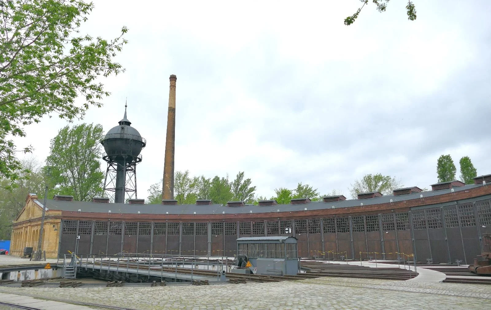
Original round houses and turntables still stand (image right) and the old yards now form the open air section of the Technical Museum, areas of which are supposed to house various exhibits (such as a Dutch windmill) most of which seemed to be shut or inaccessible during our visit.
So here comes the exciting part for people like Team Terroir. The raillway yards have been allowed to return to nature (a sort of railway re-wilding scheme). The extent and mix of regenerating vegetation – grasses and herbs, shrubs and trees, occasionally ‘enhanced’ by new tree planting - creates an amazing, and exciting young jungle, laced by a network of gentle, unsurfaced paths. But it gets better: remnants of the railway era can still be found, littered around the site, creating an intriguing and surprising visual adventure playground of transport industrial archaeology. It’s magic.


So what is the ultimate ‘take home’ image which symbolises 21st century Berlin. Nefertiti? The deorated floral ceilings in Frederick II’s 18th century AirBandBs? The magic of a Narnian style buffer-stop-and-lamppost combo in the old Anhalter stationyards? No, none of those. For Terroir it’s still the East German traffic light ‘Ampelmann’ who marches across the top of this blog. He started ‘walking’ in 1961, survived the fall of the wall and re-unification, and is still loved around the world.

Does Colour Matter?
Actually, timing is everything. In February, the Mayor of London announced new names and colours for the six London Overground lines which are currently identified by a drab and dull orange. The new names provide something for everybody – women, football, healthcare, LGBTQ+ community, the Caribbean community, textiles, Huguenots, democracy, freedom and independence. More details on https://tfl.gov.uk/info-for/media/press-releases/2024/february/london-s-overground-lines-to-be-given-new-names-and-colours-in-historic-change-to-capital-s-transport-network

And the colours ? The Lioness line – yellow! Mildmay – blue! Windrush – red! The Weaver line comes in with – Maroon! The suffragettes get – green! And Liberty – grey. GREY? How did that sneak in? Apparently the Liberty line references ‘the historical independence of the people of Havering’. What did Havering do to deserve grey?
We are also disappointed to note that the drab orange is still in evidence. Please note: opinions on orange may differ.
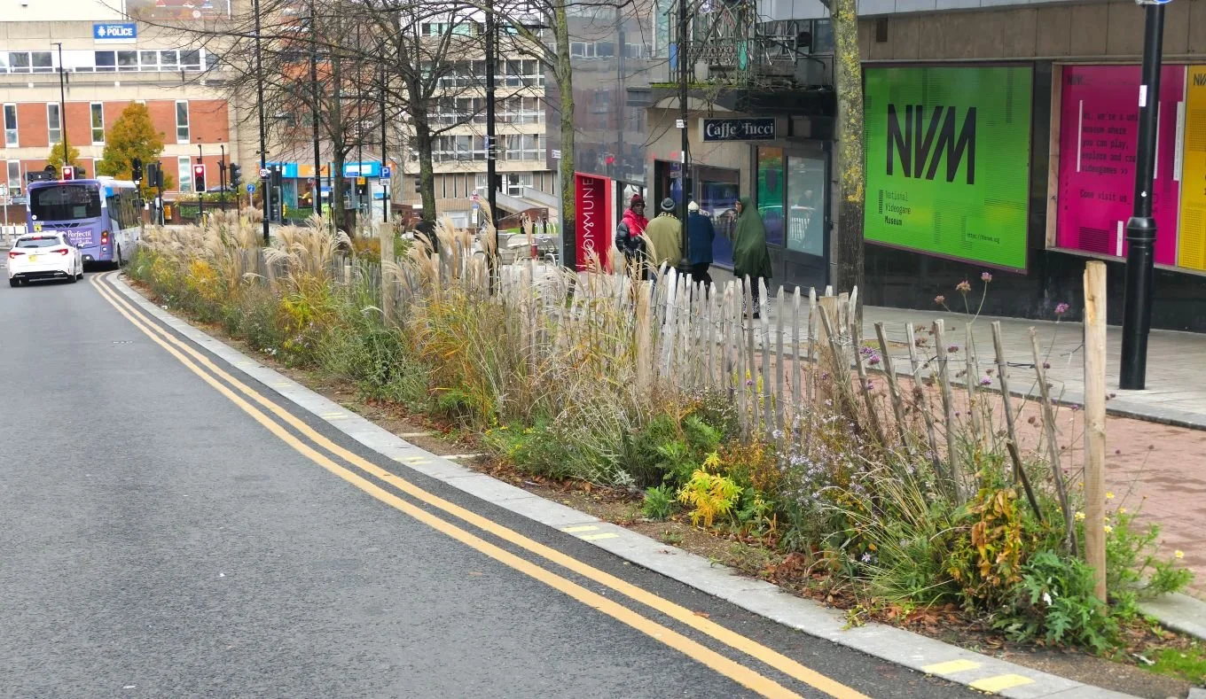
In March, Transport for London (TfL) went green - again - with the launch of the Green Link Walk. This is the eighth route in the Walk London Network (a group of trails which includes the Green Chain and The Capital Ring). Terroir has yet to find out if Walk London green is a significantly different Pantone colour to Suffragette green…
More of the Green Link in a minute, but the timing of these colourful initiatives must surely have some significance? Ah yes: ‘good’ news is always helpful in the run up to an election. Sadiq Khan will be battling for a second term as Mayor of London on 2nd May. Choose your political pantone with care.
Back to the Green Link. It wobbles for 15 miles between Epping Forest and Peckham, somewhat like a banana lying on a roughly north/south axis. It aims to improve Londoner’s health and well-being, be accessible, cycle and wheelchair friendly, sustainable (with the ultimate inclusion of two new rain gardens) and link with a variety of green spaces.
We are also told that it ‘fulfil[s] a mayoral manifesto commitment’. Yes, I think we have already mentioned that election!

To date, the main criticism which Terroir has heard is that the route entails a lot of pavement pounding, suggesting that the Link is more grey than green. Having trialled just one section, we agree that tarmac terrain is hard on the joints but that ‘green’ ocurs fairly frequently and that ‘grey’ can be beautiful.
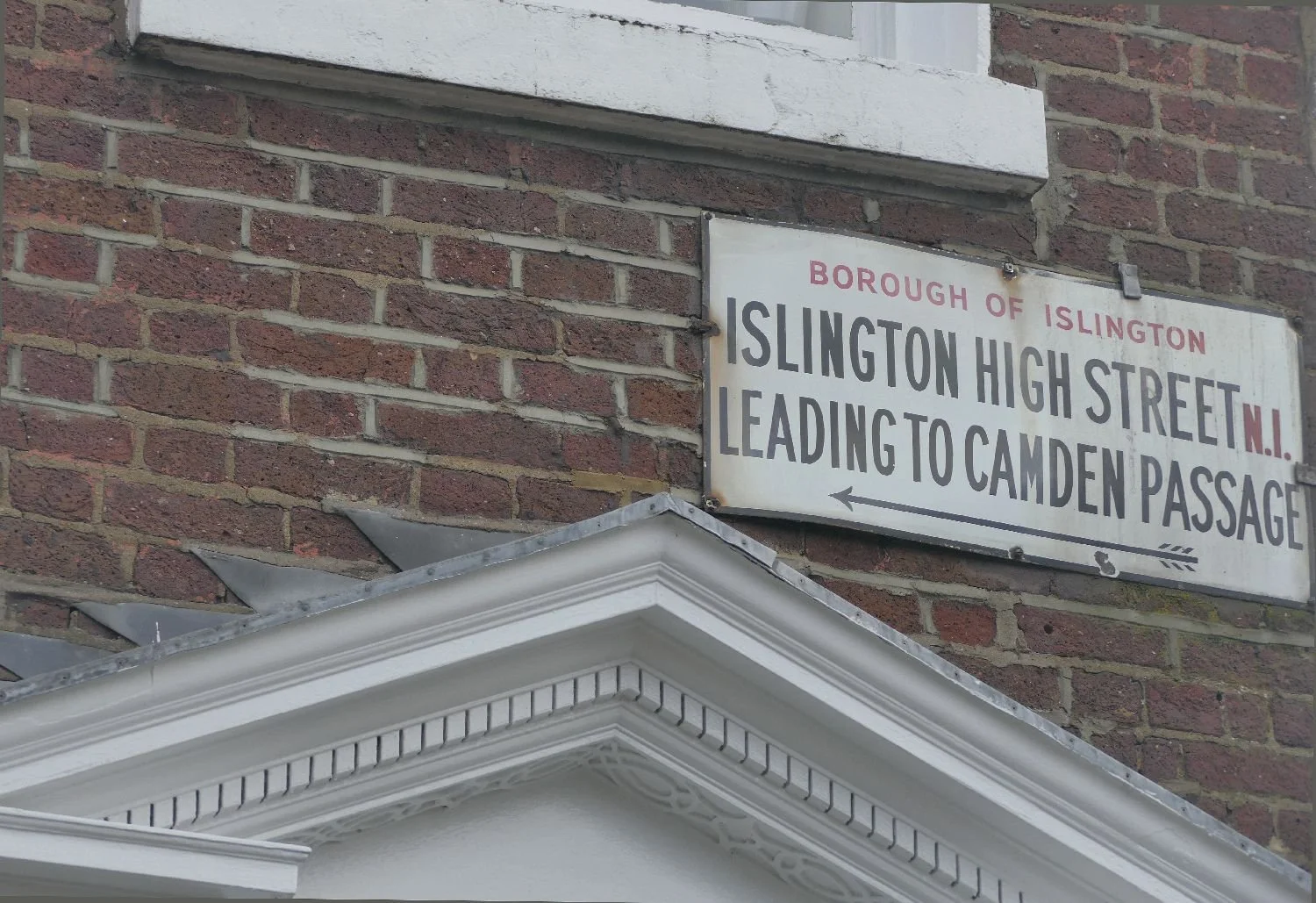
Follow us on a walk from the Angel to Clerkenwell, probably less than 2 miles but packed with interest. We’ve annotated a section of the Footways map to show our start (the red arrow) and finish, at the yellow arrow. https://footways.london/the-green-link

Our start at Angel Tube is perhaps 200m from the Regent’s Canal and the Green Link. The Link doesn’t use the canal-side paths, however, but sticks to the local roads to ensure good access for wheelchairs. In the image below right, the Link runs behind the trees on the left hand side of the photograph.


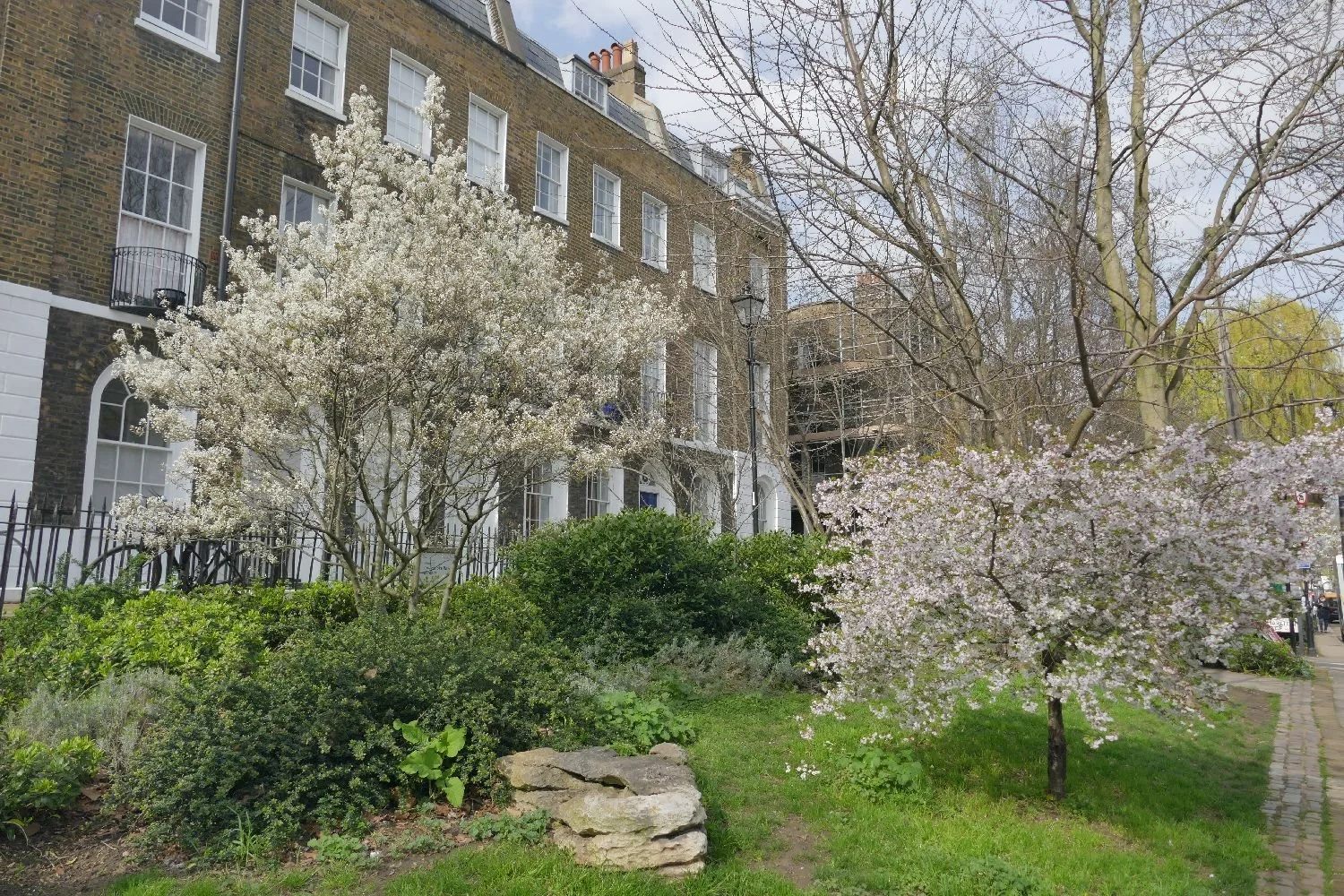
The Link crosses the canal (left) over the top of the 960 yard long Islington Tunnel, which was opened in 1816. In March 2024 you can still see something of the canal through the springtime foliage.
The first stop is Colebrook Row Gardens and Duncan Terrace Gardens. These linear spaces were laid out on the route of the New River, an early 17th century water way constructed to bring drinking water from Hertfordshire into London. You can walk the route and admire the green spaces which adorn its route. https://londongardenstrust.org/features/NewRiver.htm

Colebrook Row Gardens (above) and Duncan Terrace Gardens (below) including a spectacular view of some of the nearby ‘grey’ elements.


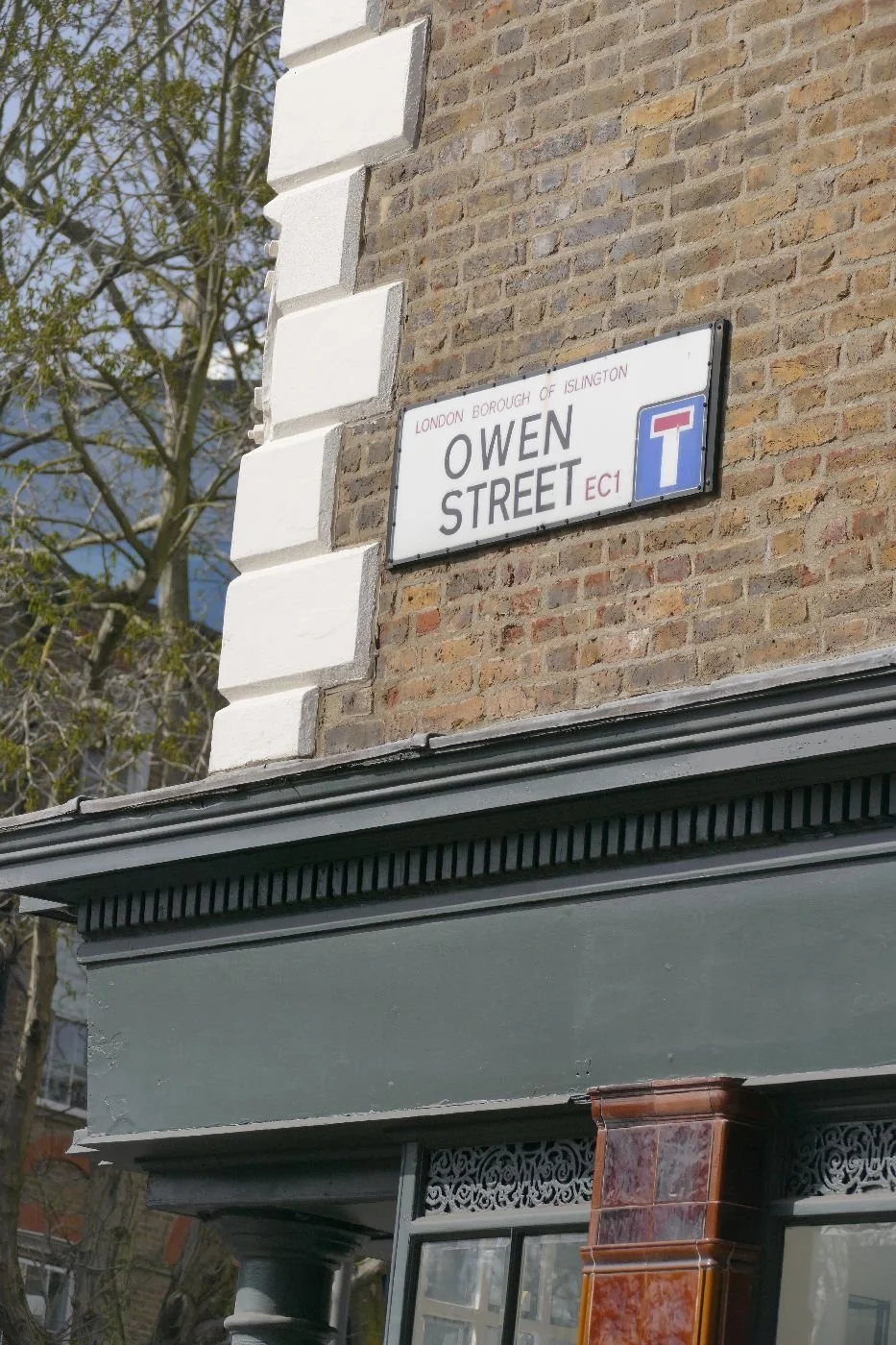
Crossing City Road reveals the splendid spectacle of the 1903 Angel Hotel (now offices), before going ‘green’ again in Owens Fields. No moans about the lack of apostrophe, please (see below).


Crossing into Chadwell Street we find some more spectacular townscape (I’ll stop referring to it as ‘grey’as I think I think I’ve made the point that it’s anything but)...


… and pass on through into Myddleton Square (below). We presume this is named after the Sir John Myddleton who oversaw the construction of the New River. The square was laid out by William Chadwell Mylne, the second son of Robert Mylne (1733–1811), surveyor to the New River Company (you just can’t get away from it), as well as builder of the first Blackfriars Bridge. Son William constructed the square ‘in a Georgian style’ between 1822 and 1843 (remember that George IV had died in 1830, but I suppose the Victorians hadn’t really got going by then) and set his St Mark’s church (built 1825 - 27) right in the middle. https://en.wikipedia.org/wiki/St_Mark%27s_Church,_Myddelton_Square


LLoyd Square comes next, a ‘Garden Square’ constructed between 1828 and 1832 by John Booth and family, surveyors; I can find no connection with the New River but Wikipedia tells me that these sharp suited, clean-shaven, Greek revival style, structures are all Grade II Listed. https://en.wikipedia.org/wiki/Lloyd_Square


The pavement pounding is probably taking its toll by now, so we will hurry on to Wilmington Square, for a bit of green and pink relief.
Meant to be the size of Myddleton Square, ambitions for Wilmington Square had to be curtailed for ‘financial reasons’. This one was built by ‘John Wilson (born c. 1780), a Gray's Inn Lane plumber and glazier who had become a builder and developer’. https://en.wikipedia.org/wiki/Wilmington_Square


Rested? We’ll look in on Spa Field Park. History suggests that Spa Field has always been well frequented by the living and the dead, by those seeking a cure at the 18th century spa and those seeking a venue for political rallies. It was well used on the day of Terroir’s visit, but maybe a tad too much Photinia?


And now for the big finale: St James’ Church, Clerkenwell. The current church dates from 1792, built by local architect James Carr and ‘clearly influenced by Wren and Gibbs’ and subsequently altered by many as need arose.


So, does colour matter? Absolutely! We need a world full of colour, in landscapes, in people, in politics, in society, in life. Thankfully, the ‘Green’ link is as varied and rainbow coloured as TfL’s Overground ideas. Although I’m still not convinced by Liberty grey.

‘Pa was a fool’
Having your windows replaced can have some strange consequences. The impact on the bank balance was to be expected of course and our hopes for a warmer world indoors were immediately fulfilled. We also have a nice, warm, smug feeling about using less carbon based fuel, although we try not to think about the carbon footprint of the uPVC window frames installed upstairs.
We also knew that quite a lot of junk would have to be moved to allow access for the installation guys and we promised ourselves that much of this stuff would end in the charity shops. This process is – very - slow!
One of us, started on the piles of books (yes, yes, we know that was probably unwise). So this blog is a consequence of uncovering a book that we had forgotten we possessed.

The book which had caught my eye was Young Pioneers by Rose Wilder Lane. Rose Lane was the daughter of Laura Ingalls Wilder, of Little House in the Big Woods fame. Although now far less well known than her mother, Mrs Lane was, in her time, a very successful journalist and author and it is thought that she encouraged her mother to write. Some suggest she may even have ghost written some of Wilder’s books, but as an old romantic, I like to think that Rose merely provided editorial support and access to the world of publishing.
Re-reading Young Pioneers reminded me of the debate which Laura Wilder’s books provoked in the 20-teens over her inclusion of what would now be regarded as inappropriate language regarding native Americans. Here are a couple of quotes from 2018 which illustrate the controversy.
‘Wilder’s depictions of African Americans and Native people are flawed and racist. Some will argue that at the time she wrote the books, things like blackface and stereotyping weren’t seen as wrong. But, of course, African Americans and Native peoples knew them to be wrong.’ American Library Association (https://www.thefussylibrarian.com/newswire/2018/06/26/ala-were-not-banning-or-censoring-laura-ingalls-wilder)
‘Laura Ingalls Wilder is my hero, but her books tell a painful American story’ Haley Stewart (https://www.americamagazine.org/arts-culture/2018/07/12/laura-ingalls-wilder-my-hero-her-books-tell-painful-american-story)
This debate has been pretty thoroughly aired on both sides of the Atlantic and I have no problem with reporting that Terroir is firmly on the side of Bristol’s response to the Colston statue’s swim in the harbour. Colston is no longer (dis)gracing Bristol’s streets but is tucked up in the M shed, on public view and close to a selection of protesters’ posters. Conservation includes a protective environment to conserve the 21st century graffiti with which the statue was daubed prior to its immersion in Bristol harbour (https://www.theguardian.com/uk-news/2024/mar/14/edward-colston-statue-placed-quiet-corner-bristol-museum).

For those who not have actually read the ‘Little House’ books, the stories are based on Laura Ingalls’ childhood and adolescence in the American mid-west. The second story, in terms of the chronology of her life, is Little House on the Prairie and relates the Ingalls family’s journey from Wisconsin to Kansas to settle in what was defined as Indian Territory in the 1870s. Pa is portrayed as having some sympathy with the original inhabitants, but Ma is frightened of Indians. Ma and her neighbours use phrases such as, ‘the only good Indian is a dead Indian’; hence the debate.
Of course, one of us has now further delayed book sorting by re-reading Little House on the Prairie as well. Even from an adult’s perspective it is wonderful travelogue, but it is of outstanding significance as a record of the American prairies before ‘the white man’ changed them so drastically.
‘Day after day they travelled in Kansas, and saw nothing but the rippling grass and the enormous sky. In a perfect circle the sky curved down to the level land, and the wagon was in the circle’s exact middle’. Hands up who has ever experienced a scene like that. No, I didn’t think so.
‘Then they sat on the clean grass and ate pancakes and bacon and molasses … All around them shadows were moving on the swaying grasses, while the sun rose. Meadow larks were springing straight up from the billows of grass into the high clear sky, singing as they went’.

Unfortunately Pa and Laura were probably unaware that technically there are two types of (nearly identical) meadow larks (the eastern and the western). Here is the western variety (Sturnella neglecta).
By Cephas - Own work, CC BY-SA 4.0, https://commons.wikimedia.org/w/index.php?curid=133943809
Other birds which impacted on Laura were the dick-sissels (a small seed-eating bird), whip-poor-wills (a night jar, the eastern variety aptly named Antrostomus vociferous, more easily heard than seen and symbolic of rural America), blue jays (an omnivore with plenty of attitude) and night hawks (scooping up insects on the wing).
Prairie hens (now endangered through hunting and loss of habitat) were a regular part of the Ingalls’ diet and wild turkeys supplied the Thanksgiving meal.
Laura also mentions ‘nightingales’. I understand that nightingales are not native to North America so any hints on what this bird might be would be very welcome. Furthermore, there are 18 or 19 species of owl in the USA and neither Laura nor I are attempting to identify which ones she listened to at night.


Blue jay - photo by and (c)2009 Derek Ramsey (Ram-Man) - Self-photographed, GFDL 1.2, https://commons.wikimedia.org/w/index.php?curid=7081461
Prairie chicken - by GregTheBusker - Prairie Chicken, Puffed UpUploaded by Snowmanradio, CC BY 2.0, https://commons.wikimedia.org/w/index.php?curid=10312117
Although the ocean of waving grasses made a huge impact on Laura there is no record of her identifying any of the individual species. Wild flowers, however, were a big hit and she notes wild larkspur, golden rod, and oxeye daisies, plus buck brush (presumably a Ceanothus?) and sumac.
Squirrels, gophers, bull frogs and snakes provided interest and movement in the landscape while white-tailed rabbits/buck rabbits, varieties of deer and many ducks and geese provided food and fur or feathers.
Two larger mammals take a more frightening role in the prairie story: the buffalo wolf and a lone black panther, finally shot, not by Laura’s adored father (Pa) but by an Osage Indian, if the account is correct. The buffalo wolf, a sub species of the grey wolf is now recorded as extinct due to hunting of both the buffalo and the wolf. Wolf pelts were among the furs which Laura’s father traded for a plough and seeds.
Illustrations from the Puffin edition of Little House on the Prairie drawn Garth Williams


Oh and I nearly forgot the malaria carrying mosquitoes which inhabited the creek valleys.
Here we see Dr Tan, an African American doctor who Laura reports as working with the Indians, supervising Ma and Pa taking their quinine.
But why was Pa ‘a fool’? This statement was made during a radio debate on how the 21st century should approach the 19th century racist language and attitudes displayed in the Little House Books. The speaker was commenting on Charles Ingalls’ journey into Indian Territory when the area had not yet been opened up for settlement.
As America expanded, the government was pushing indigenous inhabitants further and further west and Pa had heard that this area of Kansas might soon be open for settlement. He took a gamble and decided to travel to Kansas to get ahead of the rush. He wasn’t the only one and the Ingalls had two or three neighbours within a few miles of their own little farm. When the news came that the area was not to open for settlement at that time after all, the family left and headed back east before soldiers arrived to physically eject them. Pa had already started the cultivation of the wild prairie and Laura quotes him as saying, ‘I’ve been thinking what fun the rabbits will have, eating that garden we planted.’


I would suggest that Pa was disappointed, but not a fool. In the terms of society at that time, it was a risk worth taking. Government was not rooting for the Indians. Why should Pa? He wanted land where he could be self-sufficient and create a home for his family. It was central to the notion of American independence, freedom, self-determination and equality (well, for European immigrants at least) and for what was to become the great American Dream. On this particular occasion the gamble didn’y pay off, but Pa wasn’t deterred in his ambitions for his family’s future and finally settled in South Dakota.
I also guess that Pa would not have been perturbed by the attitudes of his granddaughter, Rose Wilder Lane, writing the following in her book, Young Pioneers. (Our heroine Molly is talking to her Swedish neighbour. A plague of grasshoppers has destroyed all crops and grazing for miles around. The Svensons are going back east).
‘Only once, without meaning to, her eyes confessed the truth, and quickly Molly looked away. Mrs Svenson knew that her husband was giving up, that he would be only a hired man in the East.’
Perhaps unsuprisingly, Rose Wilder Lane went on to become a passionate Libertarian, speaking out for individual freedom; she is described as very anti-interventionist and very anti initiatives such as Roosevelt’s New Deal.
But I wonder what Pa would vote today?

Window Dressing
In early January, Terroir exhorted us all to ‘Keep looking out of the window’. In February, we paid a visit to Bath and discovered that looking at the window was equally enjoyable and informative.
Our window safari started with a visit to an exhibition of Gwen John’s paintings at Bath’s Holburne Museum. This may seem like an unnecessary diversion from the subject of windows, but please stick with us. Up until our visit to Bath, our perception of Gwendolen Mary John (1876 – 1939) was of a woman overshadowed by her younger brother Augustus (1878 - 1961). Many exhibitions seemed to include a token work by Gwen to illustrate how wonderful she was but how neglected, implying that her sex and her sibling were largely responsible.
Sadly, however, we – a trio of Team Terroirs plus other visitors with whom we chatted – were in agreement that Gwen’s work, as exhibited on the Holburne’s walls, was underwhelming. We did try very hard to like or at least appreciate it, but on re-grouping, we were unanimous in our disappointment. Two of us, however, were agreed on which one, if push came to shove, we would take home with us. Here it is: a view of Gwen’s apartment in Paris, apparently focussed on her dormer window.

What is so interesting is that the painting isn’t about the view from the window; it’s intriguing for what she arranged around the window - the flowers, the table and chair, the parasol. It tells us a lot about Gwen herself and her use of a window to light her story. The view through the frame and from that window seems irrelevant.

Returning to the city, you could say that Bath is all about buildings. The tonnage of oolitic limestone which has been marshalled into bath-houses, temples, abbeys, pump houses, hospitals, streets and crescents gives Bath its character and …
… the stone its name. Bath stone is Bath stone whether it’s in Bristol, Claverton, Weston-super-Mare, Reading or London.
But how many of us, when viewing the Royal Crescent, the Circus or the Assembly Rooms have given serious thought to the windows? Just Georgian sash windows surely? Apologies to architects and window fanatics who are by now screaming at this blog, but how many of the rest of us really appreciate the importance of windows in the overall impact of any building, let alone a Georgian Bath terrace? Is the Crescent’s geometry and overall classical proportions (image above) the most important aspect? Or are we all Gwen Johns? Is the significance of the parasol - aka columns/balustrades/railings etc - greater than that of the windows?

Let’s look a little closer. This is how unsympathetic window replacements can ruin the symmetry and eye candy of a run of paned Georgian sashes!! The windows with ‘pelmets’ and single glass pane sashes stand out the worst. Of course that brown wood front door and a load of motor cars don’t help either.

Other modifications are available. Here are some of our favourites.:
Right - is this the asymetrical impact of the window tax?
Below left - add a balcony; below centre - add a fire escape; below right - add some colour


Thankfully, many of the fanlights still seem to be original.


While wandering along a footpath behind The Circus, we came upon a new window, a sort of Narnian style entrance to a parallel universe. We entered though a wooden door and climbed to a viewing platform before descending into the 18th century, as represented by the restored ‘Georgian Garden’. The original 1760s back garden to No. 4 The Circus was, of course designed to be viewed from the windows at the back of the house. The 20th century restoration is entered via the back gate (we leave you to draw your own conclusions on significance of this), but entry at all is thanks to the Bath Archaeological Society who excavated the plot and revealed three garden layouts, all pre the 1920s. Restoration was completed in 1990, based on a plan of c1770.


Of course, not all Bath’s windows are Georgian. Here we have the gothic windows of Bath Abbey.

But we leave you with some very serious window (or perhaps column) dressing back at the Holburne Museum.


Lubaina Himid’s exhibition, ‘The lost threads’, connects the visitor to a very different time and place via the activities of Dutch traders, whose mercantile endeavours with Javanese fabrics left a bold mark on the textile designs of West Africa (https://www.holburne.org/opening-soon-lubaina-himid-lost-threads/). Himid discusses issues of cultural identity, female labour, colonial trading and enslavement, topics which were also touched on in the novels and letters of Jane Austen, another of Bath’s more famous visitors.

Kerala Case Study
Of all the countries I have ever visited, I find India one of the hardest to understand.
You may say that this is obvious, considering the sheer size and variety of India’s ‘terroir’. With around nine climate zones, the range of landscapes is enormous: ‘polar’ Karakorum in the north to tropical Kerala in the south.
But, as you all know, ‘Terroir’ is about human, cultural and economic geography as well as latitude and longitude, and the one thing India excels in is economic inequality.
“As per the 'World Inequality Report 2022', India is among the most unequal countries in the world, with rising poverty and an 'affluent elite.'” [That last phrase could apply to the UK]
https://economictimes.indiatimes.com/news/economy/indicators/india-amongst-the-most-unequal-countries-in-the-world-report/articleshow/88141807.cms?utm_source=contentofinterest&utm_medium=text&utm_campaign=cppst
Or
“While India is one of the fastest growing economies in the world, it is also one of the most unequal countries.
“What is particularly worrying in India’s case is that economic inequality is being added to a society that is already fractured along the lines of caste, religion, region and gender.” Professor Himanshu, Jawaharlal Nehru University
https://www.oxfam.org/en/india-extreme-inequality-numbers
[That looks familiar too.]
In January, we were invited to visit Kerala. Our host and driver was Muslim. Kerala, with a heritage influenced by Portugese and French, as well as Dutch and British, has a small but significant Christian (mainly Roman Catholic) population. The Kochin Jews settled in Kerala as traders, although the community is now tiny. Over half the state of Kerala is Hindu.
Compared with national statistics, Kerala has a lower than average birth rate, a higher than average literacy rate and, for India, an usual gender balance - more females than males. The state government is currently led by the Communist Party of India. Make of that what you will. Could we have divined any of this from our visit?

Politics is a big deal in India and elections are due in May. There is certainly a lively debate and we saw marches and flags and banners relating to the Communist Party, Modi’s Bharatiya Janata Party (BJP), the Indian National Congress Party and the Indian Union Muslim League. DYFI by the way is not a Welsh county but the Democratic Youth Federation of India.


We understand that the DYFI’s somewhat negative references to ‘Sanghi’ (see photographs below, left and centre), relate to their distaste for the Sangh Parivar (Hindi for "Sangh family") which includes the BJP. Kerala, it seems, still remembers the poor handling of the 2018 flooding by Modi’s administration (see Blog 125).


While religion is obviously a factor for some in their selection of political affiliation, we neither saw nor heard any sign of intolerance during our visit, and our Muslim host was a keen supporter of the ruling Communist party. He rated education very highly and was proud of Kerala’s literacy levels.

The poster (illustrated left), was, however, the only reference we saw to any political/relgious situation beyond India’s boundaries.
Townscape reflects the variety in religious affiliation in the usual higgledy-piggledy fashion of Keralan urban development.


Above:
left: a mosque in a typical south Indian landscape of palm trees and advertising hoardings
centre: a temple in Guravayoor - a significant Krishna (Hindu) shrine and pilgrimage site
right: a church with its foundations in colonialism but still a living place of worship for Kerala’s Christian population.
Remembering the poverty implied by Delhi’s streetscape (ie a multitude of beggars) we were curious about the low level of both beggars and pestering in Kerala. Did the state forcibly remove them or was abject poverty just not a thing? A very partial internet trawl revealed two contrasting websites – The Government of Kerala’s ‘Economic Review Volume 1’ (https://spb.kerala.gov.in/sites/default/files/2024-02/ER_English_Vol_1_2023.pdf) and a Wikipedia post on ‘The Economy of Kerala’ (https://en.wikipedia.org/wiki/Economy_of_Kerala). One was written in a dense bureaucratic style, the other was clear and to the point. They seemed to be saying roughly the same thing, so we’ll continue with the Wiki article. We think the information below relates to 2020 or 2021.
Kerala’s economy is the 9th largest in India (the Kerala Phenomenon)
It is the 2nd most urbanised state in India
2.8% of the Indian population living on 1.2% of its land area, contribute 4% of India’s GDP (don’t be fooled by thinking this is all down to Bangalore’s digital outsourcing successes; that city is in the neighbouring state of Karnataka).
Lots of other stats illustrate low poverty, low unemployment and a strong service sector. No wonder they keep voting in the same political master (the Communist Party of India). Incoming workers support the smaller industrial and agricultural sectors of the economy while many Keralans go elsewhere in search of higher wages.
No prizes for guessing or knowing where many of them go for this perk – the Middle East. Remittances from Keralans in the Arab world make up a very significant proportion of the economy. Our Keralan friend makes annual visits to Qatar to boost his family’s income. To quote the WIKI article: ‘Kerala's economy is based on a social democratic welfare state. Some, such as Financial Express, use the term "Money Order Economy” ’.
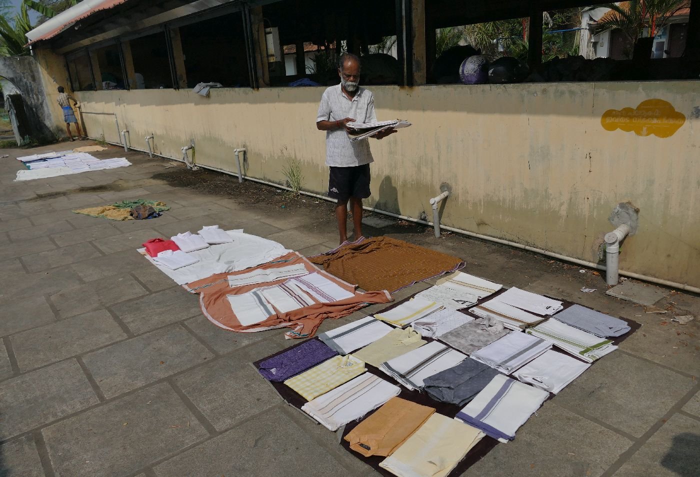
One fascinating heritage hangover and exemplar of Keralan aspiration is the Dhobi Khana laundry in Fort Kochi. Established here in colonial times to wash uniforms (accounts differ as to whether the first clients were Dutch or British) the technology is distinctly old-fashioned and physical. Unsurprisingly it is likely to close soon as the workers aspire to the better paid jobs in Kerala and elsewhere.


As probably many readers have already been to Kerala, you will know that tourism and hospitality is also a significant element of the state’s economy. Heritage forts, ports and museums, cultural performances and chic eateries make for an enjoyable experience.


Above - Fort Cochin sea and riverscapes. The anchor (left) is from a 20th century dredger which helped to transform Fort Cochin’s port.
Centre and right - 15th century technology in the form of Chinese fishing nets.


Above: ancient and modern - St Francis Church in Fort Kochin. Left - complete with colonial fabric punkha fan (the poor wallah had to operate it remotely in the heat outside) and right - a post-colonial hymn board.


Above left: historic Jew Town in Fort Cochin (they are trying to change the name) and, above right, the beautifully adorned synagogue which now operates simply as a tourist attraction


Above left: so that’s what a palenquin looks like (Fort Cohin Museum); centre - boats near Alappuzha (Alleppey), and right - Fort St Angelo in Kannur (weddings and school parties a speciality).


Left: preparing for and, centre, performing a significantly shortened Kathakali dance/drama. Right a demonstration of dance skill outside the Krishna Temple
Tourism contributes about 10% of Kerala’s GDP and is a significant employer. Agriculture makes a similar or perhaps slightly smaller contribution to GDP but employment statistics seem to vary wildly from say less than 8% to ‘most of the population’. According to Wikipedia (https://en.wikipedia.org/wiki/Economy_of_Kerala) cash crops are the most important and produce a significant proportion of India’s total output. Production of black pepper is, apparently, enormous, but if we did see pepper (or nutmeg, vanilla and cinnamon) we didn’t recognise it.

We did, however, see coffee, tea, coconut, rubber, cashew nuts, and cardamom, often growing as mixed plantations or multi-layered under light tree cover. The image, right, is the Keralan version of an allotment, a succulent mix of trees, shrubs and ground crops in a (literally) pick and mix tapestry of plant life.


In contrast, the whole rice thing seems very complex – issues such as conversion of paddy to other uses, soil health, productivity/double cropping, water management etc etc, abound. All we can say is that we were struck by the apparent lack of mechanisation (this applied to many of the other crops we saw too), the scary size of some enormous paddy fields – acres and acres all devoted to just one plant - and the fact that they were often below the level of the neighbouring water course. The words safety and sustainability instantly came to mind.

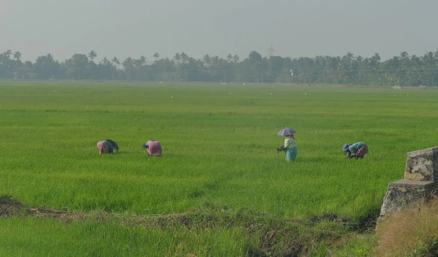


The two photographs (above) were both taken looking down from the banks of a substantial river. Gravity must make flooding the paddy fields much easier, but it must be disastrous during other types of floods.

But some things are universal. This poster calls for a mass sit-in by rail drivers. You can probably read their demands for yourself. We sense a rail replacement bus service coming on.

SAD
One of us has Seasonal Affective Disorder. Strongly linked to hours of daylight, we find it impacts the way your mind and body processes the world around you and has some strange implications for appreciation of your local Terroir.
www.nhs.uk/mental-health/conditions/seasonal-affective-disorder-sad/symptoms/ describes the symptoms as starting in the autumn/winter and improving in spring and summer. Apparently some really perverse people do it the other way round and hit rock bottom in the autumn. Thankfully, one of us is not that awkward and loves autumn and all it has to offer.
Typical signs are:
a persistent low mood – well, in Terroir’s case it’s more a feeling of being permanently below par which we guess is the same thing
a loss of pleasure or interest in normal everyday activities – or just lacking the energy to get out of bed; the bar for getting going is much higher than normal
feeling irritable – oh yes!!
feelings of despair, guilt and worthlessness – thankfully not so much of this
low self-esteem – as for above
tearfulness – it’s tempting
feeling stressed or anxious – this is the big one for Terroir
a reduced sex drive – that would be too much information
becoming less sociable – yep, although enjoy being distracted once the effort has been made
be less active than normal, feel lethargic (lacking in energy) and sleepy during the day, sleep for longer than normal and find it hard to get up in the morning – yes, yes and YES
find it difficult to concentrate – oh yes!
have an increased appetite – some people have a particular craving for foods containing lots of carbohydrates and end up gaining weight as a result – it was such a relief to discover this symptom; yesterday the only thing which kept me going was a steady supply of cake
these symptoms may make everyday activities increasingly difficult. Understatement!
So what has this to do with Terroir’s blog?
The most crucial impact on the blog itself was the inability to prepare the intended content for Blog 126. Thinking that a warm and sunny environment might lessen the symptoms, we accepted an invitation to go to Kerala in southern India for a chunk of January. Tales of Indian terroir was to be this fortnight’s topic, but the deadline loomed and despite that extra tropical sun, I just couldn’t pull it together.
Here’s a taste of what you missed:


By lunch time on Wednesday, as anxiety levels rose, an alternative solution became obvious: write about the landscape of being SAD. Is there anyone else out there who can share experiences?
The spring landscape is actually a mixed bag. On the down side, constant Instagram images of the first primrose, or carpets of snowdrops, become very irritating. You’d think that smug Instagrammers (Instagrammars?) had invented them but they are symbolic of the worst time of year for SAD sufferers.

The absolute nadir of SAD landscapes centres around the daffodil. Just a vase or a clump of daffodils, all sounding their trumpets in a shrill chorus of over loud, over bright, over done ‘look at me’ egotistical happiness, reduces me to a surly, cynical, head-under-the duvet, SADette.

Wordsworth certainly didn’t have SAD although one suspects that Dorothy may have had knowledge of many of the symptoms simply from cohabiting with William. Thank goodness our violent pink, brutish, full-of-the-joys-of-spring Camellia was not a Lake District native.
By the time the bluebells are out, the worst symptoms are abating and bluebell-loving friends can usually be tolerated and even accompanied on woodland visits without Terroir suffering revulsion at either the colour or the sappy fragrance.

On the upside, working in the garden is an absolute tonic. Again, the bar is high but having overcome the reluctance to don coat, clogs and gloves, the satisfaction of working up a sweat with the pruning kit is enormous. But even here, climate change has a negative impact. Increased rainfall and warmer days mean that spring starts earlier despite the still wintry day length. SAD sufferers now have to complete their pruning tasks earlier and earlier, with less to do when symptoms get really bad. If it would only stop raining we could get on with sowing the vegetable seeds.
A friend once asked me why I was SADdest in the spring. Surely, she said, with lengthening days, this would be a cheerful time? But the darkest hour is just before dawn or, in SAD terms, just before summer. Currently we are just before spring, which is no help at all! Maybe I’ll be pleased to see the fritillaries.


Flood Alert
Please don’t groan but we’re banging on again about rivers and flooding.
Why two consecutive blogs on the same subject? The cynical amongst you will presume it’s just because we’ve got the relevant photographs. Not quite true – we’ve mislaid some of the best!
So we’re continuing with this subject but this week we’re looking at flooding on a much bigger scale. Flooding is a global problem with immense local impacts and is a real threat to the wellbeing of hundreds of national economies and of millions of individuals. So, yes, it makes last week’s rain gardens look pretty small beer. But, if you are lucky enough to live in a democracy, then you, yes YOU, have the choice to play an active role in promoting policies which can begin to mitigate the devastating impact of floods of all sizes.

In the late summer of 2013, we visited the city of Calgary – prairie cow-town turned city slicker oil-town, which lies in the valley of the Bow River to the east of the Canadian Rockies. Regular readers will realise we also visited in 2023. We are not proud of our resulting carbon footprints, but both visits were linked to the passing of people who had played an important role in our lives.

The Bow River rises in the Banff National Park and flows south eastwards through the towns of Lake Louise and Banff before reaching Calgary. These mountain waters finally join the Oldman River (to the west of Medicine Hat (wonderful name), to form the South Saskatchewan River. That’s a total distance of 365 miles.
The Bow’s influence continues, however, as the South Saskatchewan flows into the Saskatchewan River which finally flows into Manitoba’s Lake Winnipeg.
For Albertans, 2013 is memorable for the massive flooding which hit the Bow River catchment area.


Above left: Looking downtown from Riverfront Ave in Calgary, during the Alberta floods 2013 (Ryan L. C. Quan - Own work, https://www.flickr.com/photos/ryan_quan/9147845946/)
Abov right: The Centre Street Bridge (June 21, 2013) (by Michael Dorosh Own work, CC0, https://commons.wikimedia.org/w/index.php?curid=26872133)
What we saw later that year was a huge compliment to the clear up process. The limited evidence of the flood included details like damage to the river banks, cycle paths which suddenly disappeared only to reappear further along, and bridges which continued to teeter over the water with only one end attached to land. Sadly this latter image was one of the photographs which have disappeared.
The story seems to go something like this:
Weather: in mid-June, high pressure builds up in northern Alberta and blocks air flow. Humid easterly winds are forced up the foothills of the Rockies and drop colossal quantities of rain, exacerbated by snow melt from the mountain ‘front ranges’. In a ‘typical’ June, it seems that Calgary receives about 115mm (4.5”) over the whole month. Between 19th and 21st June 2013, the region received over 200mm (around 8”) of rain. One town – ironically called High River – recorded 325mm (that’s more than a foot) in less than 48 hours.
Impact: massive flooding. Calgary’s Bow and Elbow Rivers are reported to have been flowing at three times their previous flood peak in 2005. There are plenty of other scary stats across South Alberta, but I think you get the picture.
People affected: in Calgary alone, the floods impacted on 75,000 people and triggered a huge evacuation. City authorities, the army, the police and a huge crew of volunteers, aided by social media, were all involved.
Irony: Oil company headquarters in downtown Calgary were flooded.
Special mention: both Calgary’s famous Saddledome arena and the adjacent Calgary Stampede ground were flooded. Amazingly, staff and volunteers enabled the 2013 Stampede to go ahead, just two weeks later. Apparently it was a very near thing.
Downstream: Saskatchewan and Manitoba braced for flooding but despite very high river levels, the impact was minimal compared with Alberta.
Cost in human life: 5 people died directly from the impact of the flood. Impact on the lives of Albertans: impossible to estimate; huge increase reported in mental health issues.
Cost in monetary terms: estimates vary hugely. C$5 billion or C$500 billion? You reads your websites and you takes your choice. Funding sources - largely local, provincial and national.
Lessons learnt: there seems to be a range of post flood investments in flood mitigation, resilience, forecasting, response planning and so on, but the viability of Canada’s longer term planning in resilience and carbon reduction is beyond the scope of this blog to assess.


On a local level, however, one thing is obvious: Calgary has fallen in love (again?) with its riverside.
The investment in riverine improvements makes a stroll, a run, a commute, a coffee, a sit-and-watch-the-world-go-by a pleasing and varied experience. Assuming you like large areas of hard surface … Good for people but is it good for climate resilience?


For southern India the key year is 2018 when massive floods hit Kerala.

The story in this tropical area seems to go like this:
Weather: significantly increased rainfall over the whole monsoon season and a period of excessive rainfall which fell on a number of days in the middle of the month – often over double that normally expected in any one day. Cause assigned to climate change.
Impact: Kerala’s water storage lakes were already full and 35 out of the State’s 54 dams (figure disputed) were opened, creating a massive downstream deluge and landslides, exacerbated by already sodden ground, deforestation/clearance of vegetation, inappropriate land uses and sand mining in streams, plus Kerala’s (lack of) disaster planning.
People affected: hard to find numbers but maybe one sixth of Kerala’s population directly affected by flooding; regional, state and government rescue and relief operations included military, police, medical teams, volunteers, fishermen, plus use of social media. Whole villages, roads and water treatment plants destroyed, Kochi airport temporarily closed.
Cost in human life: around 500 people dead or missing.
Irony: flood damage exacerbated by subsequent severe drought.
Costs in Monetary Terms: at the time the FT estimated $2.7 billion
Lessons (learnt?): better dam design (dams created for Irrigation and hydro-electric power not flood alleviation), better dam management, better record keeping, better disaster planning and disaster management, better catchment management.
Special Mention: film released last year entitled ‘2018’ subtitled ‘everyone is a hero’; Malayalam-language survival drama film based on floods, directed by Jude Anthany Joseph.
After the flood, life is still vulnerable for the river bank villages. Those who could afford it, rebuilt their houses on stilts. Others have made do with reparing what they have. The protective walls along the river’s edge still appear insubstantial and the level of the paddy fields is well below that of the level of the river channel.
Boats are the mainstay, and often the only, mode of transport but the blue and white river buses are nippy and frequent. The much more substantial Keralan rice barges are converted into houseboats for tourists. On the wider stretches of rivers there is plenty of room for all.


Where does this leave us? With an awful lot still to do. Can we leave it to our political leaders? Probably not. Britain, at least, has an election coming up. Please vote and please vote thoughtfully.
But the last word goes to the Indian Pond Heron, pottering happily through the ubiquitous water hyacinth.


River Hacks
A blog on rivers is a bit like trying to eat an elephant – where do you start? Every day there is news of more sewage being pumped into our rivers, of pollution from agricultural residues, highway run off or illegal dumping (from old mattresses to plastic bottles and unwanted chemicals), of rivers flooding or drying up and of drastic reductions in river and wetland biodiversity.
Water has been crucial to life since life began. Rivers, in particular, have been of primary importance to humankind: water to drink, for food production, sewage removal, power generation and transport are just a few of their benefits. Rivers, as opposed to ponds and lakes, flow, so that whatever you chuck in ‘disappears’ downstream. Heaven help you if you are a downstream community.
So, as with eating the proverbial elephant, Terroir is going to tackle the topic of rivers just a little bit at a time. Today we’ll take a brief look at flooding. Please don’t ask which bit of the pachyderm this subject symbolises.
Flooding is usually defined as the inundation of land that is usually dry. This simple definition ignores, however, the cultural reaction to ‘flooding’ and to the definition of ‘usually’. In towns, flooding is regarded as alien, fearful and, until recently, a fairly unusual phenomenon. It also inspires anger, that ‘somebody’ allowed this to happen - again - to our town/village/road/footpath etc etc. Yet we still build and buy houses located in a flood plain.
In contrast, farmers have long used flood plains or marshland for grazing. Perhaps ‘usually’ in this case means land which is dry (or dry-ish) for longer than it’s wet (or very wet) which, combined with seasonal knowledge (wetter in winter than summer) and appropriate agriculture (stock rearing) means that temporary inundation is a very useful and positive phenomenon.
Going a step further, let’s look at the concept of ‘water meadows’. Constable loved painting them – all those pollarded willows and romantic cattle set in a lush, bucolic landscape. The Historic England publication, ‘Conserving Historic Water Meadows’ (July 2014) describes water meadows as ‘areas of land that used to be flooded deliberately, under carefully controlled conditions, the timing being at the discretion of the farmer or landowner. They had three main purposes: to force early growth of grass in the spring, to improve the quality of the grass sward and to increase the summer hay crop. Here is society actively encouraging flooding, with sufficient technology and knowhow to make a success of it. [Terroirs highlighting]


Above left: exciting, wild, primeval, a natural phenomenon? © Christine, ref below
Above right: scary, damaging, expensive, someone else’s fault?
So Terroir’s definition of flooding for the 21st century is something which happens when more water flows into a river than the river system and society can cope with. I imagine that prehistoric society adapted quite quickly to this sort of thing. It probably didn’t take too long for sedentary communities to work out that building too close to the water’s edge was distinctly risky. Something which we seem to have forgotten.
Which brings us to flood and risk management: Terroir sees this as creating a balance between greed and disaster. Greed can be as simple as building too close to water course, or straightening and canalising a river to create more ‘usable’ land, thus giving storm water nowhere to go except into your house. On the other hand, London recognised that the cost implications of the Thames overflowing its banks, not to mention potential loss of life, were so enormous that money was spent on creating flood barriers.
The Thames Flood Act of 1879 was introduced to build higher and better river walls along the Thames and these walls have been rising ever since. The Thames flood of 1928 overtopped the then current walls and 14 people died and thousands were made homeless. Anyone living in a basement flat would have been particularly vulnerable and these were often the abodes of the less well off.


Above left: Thames flood walls on duty at the Houses of Parliament
Above right: clearly illustrating the business of building higher, these walls form the riverside boundary of Victoria Tower Gardens, Westminster

Of course, the more you build, the more you have to maintain. One small breach in the wall can lead to catastrophic effects. Sir Thomas Frank was knighted, in 1942, for his organisation of rapid repair teams to retain the integrity of the Thames flood walls during the Blitz.
The 1953 flooding of eastern England impacted a far wider area, including the Thames estuary and parts of London itself. As a result, serious thought was given to alternative flood control.
The Thames Barrier and Flood Prevention Act was passed in 1972 and the Barrier was finally operational in the early 1980s. It was expected to operate in earnest about once or twice a year. This figure has since risen to 6 to 7 times a year, on average, but this statistic disguises some extraordinary peaks in three extraordinary seasons: 2000/01 (24 closures), 2002/03 (20 closures) and – wait for it – 50 closures in 2013/14. https://www.gov.uk/guidance/the-thames-barrier#thames-barrier-closures


So what’s going on? There are a whole host of factors involved – a selection is listed below - and when they combine the results can be catastrophic.
Sudden thaws creating high volumes of melt water (yes even in the UK!)
Increase in rainfall and increase in significant heavy rain storms which create runoff beyond the short term capacity of the drainage system
Increase in hard surfaces in urban areas and corresponding decrease in permeable areas such as gardens and verges, playing fields etc etc
In estuaries, high tides and storm surges such as created the 1953 floods in the UK
Canalising rivers and destroying the natural flood water holding capacity of a river valley
And, of course, climate change, not just changing rainfall patterns but raising sea levels.
In Terroir’s view, one of the cheapest and most attractive methods of improving flood resilience in urban areas, is the construction of rain gardens. These areas go some way to compensate for the loss of permeable areas in towns and cities, absorbing water and slowing down the run off to the river. They come with massive added benefits as well, creating a series of spaces for city dwellers and wild life alike. As linear gardens, they provide year round, urban oases with places to sit, to walk, to jog, to eat lunch, to meet a mate, to watch the butterflies or the dragon flies, all in the knowledge that they are not only reducing flood risk and water pollution, but also enriching the local environment in many other ways.
Here are two of Terroir’s favourites.
Sheffield ‘Grey to Green’

Sheffield is over familiar with urban flooding. With its two rivers – the Don and the Sheaff – and a large, hilly urban area which feeds water downhill fast, the city watches water levels carefully.
To be honest, the two flood levels shown on this Kelham Island pub are a tad misleading as the 1864 flood was caused by a reservoir dam collapsing some 8 miles upstream of Sheffield, but the lower line is 21st century - 2007 - and quite scary enough, thank you.
Many places flooded in 2007, but Sheffield was particularly badly hit. As it happened, the construction of Sheffield’s Inner Relief Road was completed the following year leaving a significant amount of redundant road surface.

Thanks to some blue sky thinking (sorry couldn’t resist that one), much of this impervious ‘grey’ was converted into ‘green’ water gardens. Planting was designed by members of Sheffield University’s innovative Department of Landscape. The plant palette is robust, low maintenance and undemanding, but never dull.


It is terrible jargon, but yes, we do need to ‘roll this out’ everywhere.

Through the Looking Glass
Happy New Year
When interviewing prospective landscape architecture students, there is much to be said for starting with the question, ‘How did you get here?’ If, as must often be the case, the answer is ‘I came by train’, the supplementary would be, ‘And what did you do while you were on the train?’. The interviewer is, of course, fishing for at least part of the answer to be, ‘I looked out of the window’. Who wants to train a landscape designer with no visual curiosity?
Some might say that looking at the world through glass is too conventional, too much of a cliché and makes it too easy to ‘edit’ the view to create a safe, blinkered or fictional perspective. Terroir disagrees of course. We have found that looking through a frame can stimulate a new way of seeing the view, create a window on history or a reflective mood, or a new frame of mind. All puns intended.
Below, Terroir presents a backward glance at some of our favourite window views from 2023. Looking forward, we wish all our followers a healthy and happy New Year. And please, keep looking out of the window.


Above: same window, different days, different messages, different emotions. Near Clitheroe, Lancashire.
Below: ruination (left) and new life (right). Morriston, Swansea.


Above: the straight lines of the city from the top (of the Calgary Tower) and
Below: curving lines of the city from the ground (left - reflecting in Monte Carlo, and right - relaxing in London)


Above: Mind the gap - views from the bridge. Left: the Chicago River Right: London Blackfriars


Above left: New Mexico through a shop window. Above right: Alberta through the rear window


Above - Texas through the plane window. Left - irrigation; right - oil.


Above: the view of the artist.
Below: a view of history.


Happy New Year

An Advent Calendar for 2023
Part 2


It’s time for the Big Door: Granada nativity with a nod to the use of sustainable transport and a relaxed donkey.
Very best wishes for the festive season to all out readers from Team Terroir. Thank you for following us. We’ll see you again at New Year.

Rock Island Line
The Rock Island Line is a mighty good road
The Rock Island Line is the road to ride
The Rock Island Line is a mighty good road
If you want to ride you gotta ride it like you find it
Get your ticket at the station for the Rock Island Line
In Britain, the ‘Rock Island Line’ is probably better known as the American folk song, made famous by Lonnie Donegan, than the Chicago, Rock Island and Pacific Railroad which forms the subject of the song’s lyrics. The history of both the Rock Island railroad and the song is convoluted and there are some interesting parallels between their development. These will become apparent as we take a look at the Chicago railroads, one of the ‘elements’ of Chicago which we identified in Blog 120 (we’ll come back to the final element, water, sometime in the New Year).
The history of American railroads appears to be extraordinarily complicated. Early rail based transport systems seem to have consisted of relatively short stretches of line to transport coal and stone from quarries and mines, often using horse power or gravity. Longer distance, locomotive drawn railroads appeared in the eastern states by the 1840s usually connecting two fairly large cities in fairly close proximity. Links were then developed as new settlements and markets opened up, making the railroad map seem fairly haphazard in comparison with the European system of servicing an already well known geography.


This quote from the Britannica website is a delight and seems to sum it all up:
“It was the brute strength of American locomotives, their great tolerance of cheap and crude track, their durability, their economy of operation, and their simplicity of maintenance that determined almost from the first years of operation that there would be a distinctively American railroad sharing little with British practice.”
The quote continues: “It seems reasonable to argue that once the British had shown that railroads could be made to work the Americans reinvented them for a very different terrain, economic climate, and demographic level. The creation of the American railroad was a contemporaneous but not a derivative development.” https://www.britannica.com/technology/railroad/Early-American-railroads
Chicago’s first railway (not even started until 1848) was the Galena & Chicago Union, which was planned to connect the city to the lead mines at Galena (north west Illinois) but which never got further than a place called Elgin, a mere 40 miles from the city centre. A shaky start, perhaps, but it wasn’t long before Chicago was connected by railroad to the great grain fields of Illinois and Wisconsin and then to numerous mid-west cities.
Inevitably, Chicago’s significant location between east and west coasts, combined with excellent water transport options and the natural resources to build tracks and fuel engines, meant that the city became the core of the American railroad system.
According to “Illinois Railroads in 1901” (http://www.genealogytrails.com/ill/cook/railroads.html), “not less than thirty-eight distinct lines enter … [Chicago in 1895], although these are operated by only twenty-two companies. Some 2,600 miles of railroad track are laid within the city limits. The number of trains daily arriving and departing (suburban and freight included) is about 2,000. Intramural transportation is afforded by electric, steam, cable and horse-car lines. Four tunnels under the Chicago River and its branches, and numerous bridges connect the various divisions of the city.”
This chaotic network of railroads, coming from all corners of the nation, restructured the landscape and the future of Chicago. Most companies set up their headquarters in the city and built the necessary infrastructure to operate the railways and to tranship what they carried: manufactured goods from the east, grain from the prairies, timber from the north and meat from the west. And people: people from all over the United States and from all over the world – both the free world and the freed populations from the Caribbean - poured into Chicago. No wonder the railroads became legendary.

Above: freight trains were and still are the back bone of the US railway system.
But back to the Rock Island Line. The precursor of the Chicago, Rock Island and Pacific Railroad was, geographically, a wholly Illinois affair, born in 1847 and, according to Britannica, reached Chicago by 1866. It quickly extended both its name and its network and, by 1907 the line had attained its maximum length of 14,270 miles (22,975 kilometres) [Britannica again] over 13 states to the west and south of Chicago. It was, indeed, something to sing about.
According to Wikipedia (https://en.wikipedia.org/wiki/Rock_Island_Line) the earliest known version of the song was written in 1929, by one Clarence Wilson, a member of the ‘Rock Island Colored Booster Quartet’, a group of Railroad employees who worked at the Biddle Shops freight yard in Little Rock, Arkansas. Like the confusing and ever changing railroad companies and routes, the song has a pretty confusing history too. Although many would associate it with Lonnie Donegan’s 1956 rendition, we have John A Lomax to thank for the earliest known recording which, in Terroir’s view, is much the best. Lomax recorded it a few times, the first with the help of Huddie Ledbetter, better known as Lead Belly, at the Cummins Prison, where it was performed by Kelly Pace and Prisoners. The third recording is available on https://www.youtube.com/watch?v=0NTa7ps6sNU. It’s well worth a listen. If you think the name of Lomax is familiar, you would be right. His better known son Alan Lomax carried on his father’s work and, with the help of Shirley Collins (English folk singer extraordinaire) recorded folk music on both sides of the Atlantic.


Of course numerous others have re-arranged, re-written and re-recorded The Rock Island Line including Led Belly himself, Donnie Lonegan and Pete Seeger. It’s easy to see the history and development of this ballad as a microcosm of US railroad history and, like the railroad, you don’t hear so much about it these days.
So what is Chicago’s relationship with the railway in the 21st century? The massive meat packing, timber and other freight yards, which characterised much of the 20th century, are now long gone, built over by ever continuing expansion of a new style metropolitan Chicago. Much of the associated railway architecture has also vanished and freeways and airports have taken their place.
Some remnants of former glory still remain and the pictures below illustrate elements of multiple tracks still in use and the tiny signal boxes which once controlled vast numbers of train movements.


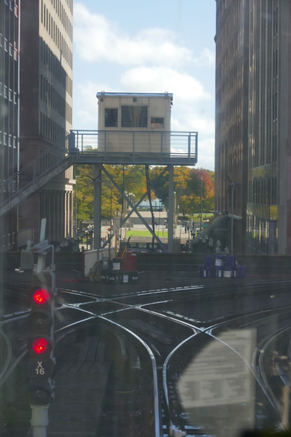

One aspect of railway life does remain however, and is now devoted to carrying people rather than livestock, timber and grain. Chicago's 19th century railroad depots were located at the edges of the business district and provided a circle of stations around the city centre. This pattern was an obvious route for a city centre rapid transit system and the first elevated lines (cheaper than subways) were constructed in the 1890s.


This is the Loop, the elevated lines which enclose the core of Chicago city. If it’s not happening within the Loop, then you probably don’t want to know about it. The Loop carries thousands of passengers a day on, yes, a very confusing system of coloured railroad route possibilities.

Today, the ‘L’ trains (L for elevated), scuttle round the city like an enormous model railway, nipping between high rises, shooting through canyons, and leaping over busy thoroughfares like a greyhound on a race track.


Once started, the system soon threw out several tangents to connect the city centre with its ever growing suburbs. These tentacles have been forced to stretch further and further out as the city continues to expand.


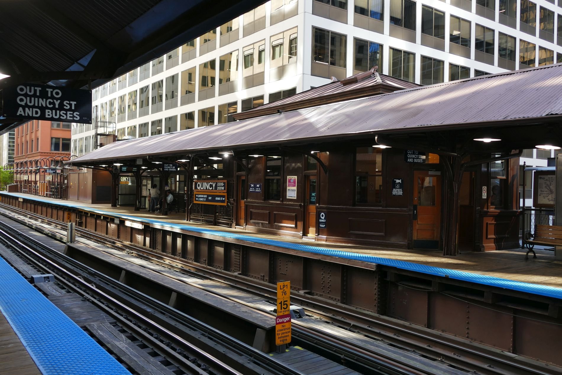
The modern stations are strictly utilitarian, but Quincy, on the Loop itself, has been allowed to retain some of its earlier glory.


The Loop is no urban pussy cat, however. On its equivalent to the London Tube map, the Loop is represented by a sedate rectangle but rattling around those corner curves is far more exciting than the hidden, swaying, bends of the London Underground.


Trails and Rails
To tell the story of Chicago’s railways, you really need to tell the story of America. Sitting comfortably? Then we’ll make a start.

Indigenous North American travel, as far as Terroir can ascertain, was undertaken on foot, by canoe (or kayak in northern areas) and on horseback.
Right: a highly stylised and European image of American indigenous travel by horse, but you get the idea. Part of ‘The Bowman and The Spearman’ by Croation sculptor Ivan Meštrović, Chicago.
Horses were long felt to be introduced by the Spanish colonists but new research suggests horses may have a much longer history on the North American continent so, for the sake of this blog, we are listing horse power as an indigenous means of transport. Neither settled nor nomadic tribes and nations existed in isolation and movement of people, goods and information occurred for a variety reasons, including hunting, trade, warfare, and ceremonial purposes.
Visiting Chicago (see Blog 120) has already introduced us to the development of extensive trail networks and navigable waterways created long before the arrival of other peoples from other continents, with other cultures and technologies. But Chicago has also introduced us to the concept of the ‘route appropriation’ practised by these incoming trappers, traders and settlers, who adopted these pre-existing routes for European style immigration, trade and warfare and social and ceremonial uses. What (English speaking) Europeans would consider to be ‘just’ foot paths, bridle ways or packhorse routes were converted into wagon trails, then railroads, then repurposed and resurfaced for the internal combustion engine and, more recently, retrofitted as hiking trails for recreation.

One of the most famous of these appropriated routes was the Santa Fé Trail.
In our experience, most websites start the history of the Santa Fé Trail with the trade between European Plains settlers and the Spanish/Mexican peoples from the south west (now mainly New Mexico and Texas). But The Santa Fe Trail Association web site (https://santafetrail.org/history/) suggests that indigenous peoples were trading goods and ideas between the valleys of, say, the Rio Grande and the Ohio River for many centuries before the arrival of the Spanish.
Successful European use of this long distance trade route is usually credited to one William Becknell from Missouri, but he was by no means the first European to attempt trading with this northern outposts of the Spanish/Mexican empire. Santa Fé was very isolated, separated from Mexico City by 1,700 miles of inhospitable terrain, and must have seemed a tempting business proposition to new Americans from eastern Missouri, a mere 850 miles away across significantly easier country.
But despite this geographical isolation from the bulk of Spanish Mexico, early attempts at American trade with Santa Fé were unsuccessful due to locally stationed Spanish soldiers who seemed keen to capture mercantile visitors and drag them over the mountains to prisons in Mexico City. One can imagine that, despite the travel issues, an excuse to get back to the capital must have been quite attractive.
The images below show the sort of buildings which these traders might have seen before they were unceremoniously captured and sent south.


Images centre and lower rows: typical Santa Fé architecture and wood detailing of the Spanish colonial period
William Becknell set out in September 1821. It seems he was in debt and probably desperate and/or foolish, but he was certainly lucky. When he arrived in Santa Fé he found that Mexico had thrown off the Spanish yoke some years before and was very happy to trade with new partners. It seems that the town’s inhabitants were very willing to pay high prices for his goods.
Like many long distance trade routes, the Santa Fé trail has more than one route (the Silk Road across central Asia is another classic example of this phenomenon). Encouraged by the success of his initial trip, Becknell upgraded from pack horses to wagons, loaded up and set off again in 1822. He amended his route to accommodate his now much wider, wheeled, freight carriers, but the resultant need to cross the Cimarron Desert, where water was scarce, proved to very hazardous. A second route was developed, therefore, over the Raton Pass in the Sangre de Cristo Mountains (a southern outlier of the Rockies) on the borders of Colorado and New Mexico. This Mountain Route is longer and much steeper but has plentiful water supplies.

Above: Sante Fé route map: Raton Pass on the Mountain Route outlined in red; note the references to springs on the shorter Cimarron Route. With thanks to https://www.nps.gov/parkhistory/online_books/safe/shs1.htm
Commercial traffic along the Sante Fé trail boomed and became a two way international trade route for Mexicans and Americans alike. It also played a part in troop movements connected to the Mexican-American war in the 1840s and, following the resultant adjustments in borders, the Trail became a significant national link in connecting the new south west territories with the more established states in the north east. As well as trade goods and military supplies, the trail carried stage coaches, emigrants, missionaries and thousands of fortune seekers heading for the Colorado and California gold fields.


The wagon illustrated above is presumably far smaller than covered wagons used by Europeans moving west or for trade, but it does give a hint of the fragility of the transport using the Sante Fé Trail. Both photographs taken at the Santa Fé History Museum.

The Trail’s death knell, of course, was sounded by the great American railway boom of the 1860s. By 1873, two railway lines had been constructed all the way from Kansas to Colorado, thus significantly reducing the distance which horse drawn wagons had to haul goods destined for Santa Fé and New Mexico. No less than three railway companies were interested in the Raton Pass route, and the ‘winner’, the Atchison, Topeka, and Santa Fe Railroad (aka The Santa Fe), reached the top of Raton Pass, following the Mountain route of the Santa Fé Trail, in late 1878. Despite its name the line bypassed Sante Fé itself. When a branch line eventually reached the state capital in 1880, the life of the Sante Fé trail as a commercial transit route was finally over – and, indeed, partially under its Grim Reaper’s rails.
Eventually the Santa Fe rail road reached Chicago (in 1887) and Los Angeles (in 1893). It was the second of America’s great trans-continental railroads.


Images above: constructing the Santa Fe rail road
In the 1960s, car and air transport was in the ascendancy, to the detriment of some of the great railways of the world. In response to this situation, the United States Congress established the National Railroad Passenger Corporation to run the intercity passenger services which had formerly been operated by the private railroads. Amtrak started delivery of that service in 1971, including the ‘Southwest Chief’ service from Los Angeles to Chicago, via Albuquerque.
Meanwhile, that 1880 track extension to link Santa Fé to the main route, still has a rather quaint branch line feel to it. It is operated by Rail Runner (aka the New Mexico Rail Runner Express), which is a commuter rail system, serving the metropolitan areas of Albuquerque and Santa Fe.
Thanks to both companies we can now claim to have travelled from Santa Fé to Chicago by train using, in part, the route of the old Sante Fé Trail. What follows is a photographic record of that journey, stitched together from two seperate journeys from Santa Fé to Albuquerque and from Albuquerque to Chicago.
Stage 1 Santa Fé to Albuquerque:


Stage 2 Albuquerque to Raton Pass


Above: Albuquerque station - waiting for the Southwest Chief.


The journey north eastwards through New Mexico towards Colorado and Kansas is a slow progress. The landscape of Mediterranean type open scrub and small trees (above) eventually gives way to the beauty of the great plains (below). These photographs do not do justice to the rolling majesty of the open prairie.


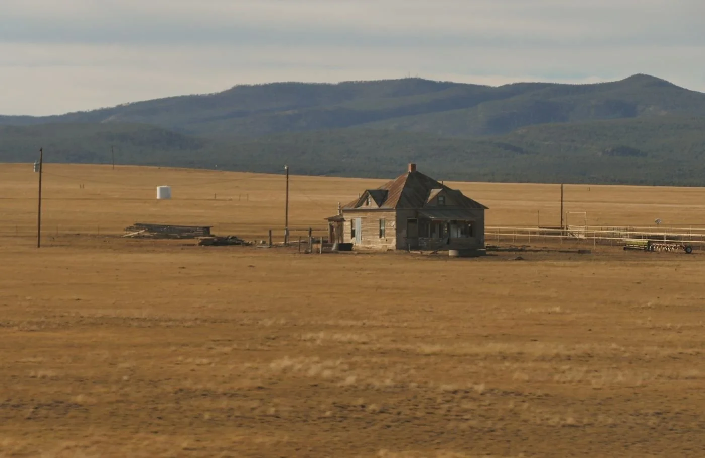


And, finally, sunset as the train leaves Raton Station and crawls up the gradients of Raton Peak.


Stage 3 Leaving New Mexico and overnight to Kansas City


Stage 4 Through the great grain lands and over the Mississippi into Illinois


Chicago here we come.

Elemental Chicago
How do you describe Chicago? And I do mean, how do you describe Chicago? Terroir is going to have a crack at it now, but we’d like to know how you saw this complex city. I’m sure many of you have been there.

How does the woman with her buggy (sorry, stroller) think of Chicago, or the guy on the bike? Here (below) is how many tourists see it.


As we explored, we (or one of us, anyway) began to think of this city in terms of fire, water and air – three of the four classical Greek elements used to explain the complexity of the world. The fourth element – earth – is of course underpinning the whole thing, but to us in Chicago, the four elements which appeared to best explain the city are fire, water, air and, underpinning the whole thing, railways.

Amazingly, we managed to arrive in Chicago by train, using Amtrak’s Southwest Chief service from Los Angeles (we got on at Albuquerque).
Locomotive 158 (right) is a big beast but still struggled with some of the steeper gradients.
Amtrak LA to Chicago is a historic line but with a modern service: if you have time to spare and don’t mind sleeping in some pretty luxurious recliner seats, then it’s cheaper than flying. Sleeper accommodation is pricey but includes all meals, free scenery and use of the observation car. Worth every penny.
Excited by the idea of arriving in Grand Central Station, that legendary piece of Chicago history and architecture, we hoped for a memorable initiation into the ‘Windy City’. Not so. ‘Legibility’ was poor. How do we get out of this damned rabbit warren? We stumbled into the recently renovated Great Hall and nearly missed it due to a bizarre installation blocking our way and rendering that amazing centre piece, with its lines of wooden benches, all but invisible. Outside the ‘temporary main entrance’, on Clinton Street, the traffic roared past, annihilating any sense of a triumphant arrival. Heigh ho.


Above: left - the way in to Grand Central seemed simple, but the way out (right) was much trickier.
Below: we passed some lovely detailing - sometimes more than once. That stairway to heaven was very misleading.


We will return to railways in a later blog, but let us now turn to fire.
Everyone told us about Chicago’s architecture, so our first visit was to the much-hyped Chicago Architecture Center, located close to the Chicago River. Good location, wide range of tours, interesting displays, funky shop (box set of small wooden blocks to build your own park – so tempting), clean loos but - no café. We’d booked an architectural walking tour which was excellent but decided against the Center’s own river boat tour on grounds of cost, duration (long) and competition from other providers. We did, eventually, book a trip with the competition and had an excellent tour which better suited our pockets and timetable. Such is business.
We were told, as I’m sure many of you know, that fire was key to the development of modern Chicago.

Due to its Lake Michigan location, the area was always important. The indigenous population enjoyed the bounty of its rivers and forests and developed extensive trade routes, exploiting water transport, and good portage routes to drag boats from one waterway to another. The future site of Chicago City would be located at a particularly advantageous portage point.
Sadly most internet histories of Chicago start with the destruction or exploitation of this indignous culture, merely noting the legacy of mispronounced names (probably mangled by both French and then Anglophone speakers) and some modern roads and railways built on the routes of the original trails. We did, however, particularly enjoy this website (https://interactive.wbez.org/curiouscity/chicago-native-americans/) which provided a much longer perspective.
As the Europeans started to arrive on the continent, many traders and missionaries passed through this area, but Chicago’s first permanent settler is usually cited as Jean-Baptiste-Point Du Sable who is reported to have set up a thriving trading post towards the end of the 18th century (although he seems to have moved away by 1800). Fort Dearborn was established soon after, was destroyed in the (US/British) war of 1812 but reconstructed in 1816.

Illinois became a state in 1818 and Chicago was incorporated as a (very small) town in 1833. Then somebody thought of constructing a canal between Lake Michigan and the Illinois River, and boom, Chicago was on the map! The town became a city in 1837; the population had multiplied 12 fold in just four years.
Right: ‘Urbs in Horto’ - a fascinating and revealing glimpse of Chicago history
So, back to fire and architecture. Inevitably, the Chicago building boom made great use of timber, presumably still a readily available and local resource. Just as in the London of 1666, so in the Chicago of 1871, when a fire did break out, there was very little to stop it. Exacerbating circumstances in Chicago are said to include drought, exhausted fire fighters who had been working the night before (yes, there had already been other fires), a steady south west wind, a collapse of water pumping apparatus and mis-directed fire equipment. Apparently over 17,000 buildings were destroyed in an area of nearly four square miles, leaving nearly 100,000 people homeless and damage valued at $200 million dollars. And an enormous area of prime building land.

Above: an arresting image from the Chicago Architecture Center. The caption reads ‘Surviving Structures offered lessons on wooden, ballon frame builldings’
As with London, so Chicago rebuilt. We were told that, at first the rebuild was in wood but this quick, if perhaps short-sighted, method of construction was rapidly overtaken by the opportunities offered by new designs, new and more fire proof materials, new building heights for better financial return and, one presumes, a better resourced fire-fighting operation.

Above: the Chicago Architectural Center’s summary of Chicago’s, post fire, architectural residetial development
As in London, some stunning new architecture was created (Christopher Wren was particularly busy, of course) and, as with London, land values were such that many blocks have been developed and re-developed on numerous occasions.
Some might regard St Paul’s Cathedral as the phoenix rising from the ashes of the Fire of London. In Chicago, two hundred years’ later, it is probably fair to say that the phoenix’s legacy is still architectural. But with hugely different technologies, economics, and social structures, the ashes of Chicago have stimulated a secular, residential and commercial response, creating buildings of great height and great density and of spectacular designs. Visually powerful indeed, but the only inhabitants of Chicago that we met, live way out of town in the suburbs!


The Glory of the Garden
Creating an RHS Show Garden
Kipling’s allegorical poem of England as a glorious garden was set in a time when
‘…a garden that is full of stately views,
Of borders, beds and shrubberies and lawns and avenues,’
was created and maintained by
‘…the gardeners, the men and 'prentice boys
Told off to do as they are bid and do it without noise’
From The Glory of the Garden by Rudyard Kipling
Today, most of us tend our gardens unaided, but reap significant benefits from the therapeutic nature of working with plants and creating an open air environment which relaxes and stimulates in equal measure.
Many of us also enjoy visiting flower shows to admire, and be inspired by the glorious gardens created by skilled designers and knowledgeable plants men and women. How do they do it?
So welcome Sarah ‘Rosegrows’ Collings for a story of what it is really like to create a show garden.

Sarah writes:
In January 2023, I had been studying Landscape Architecture for about four months. I was on a conversion course because I wanted to change careers, but so far everything we had done at university was theoretical: we made designs, but we would never build them. So I was pretty interested when I saw the chance to design and build a show garden at the prestigious RHS Flower Show Tatton Park. The theme was “sensory Long Borders”.
In spring, I heard that I’d been accepted. I was so excited, but I quickly learned that exhibiting at an RHS Show is quite the undertaking. Did I find sponsorship first, order the plants, or sow seeds? How would I build the thing? The more information we got from the RHS the more things I realised I had to do.
About a month before the show, a close friend of mine said to me, “I’m enjoying your increasingly manic [Instagram] posts about Tatton Park.” Her comment didn’t worry me, but it made me feel ‘seen’. Preparing for the flower show was manic. It was daunting, it was frightening and at times I was completely overwhelmed. I am really proud of the garden and I learned so much - about the RHS, about plants, about myself.
As I reflect on that experience, here are some of the lessons I am most grateful for.
Lesson 1 - Be humble and be persistent
Preparing for the show is not like normal gardening, which I consider relaxing. A show garden requires skills in project management, horticulture and design but, for me, the biggest challenge was the mental barrier: I just didn’t think I would be able to do it.
It’s a humbling experience to wake up in the morning, feel sure you are unable to do something, and then spend the next eight or nine hours diligently working on it anyway. Reasoning with myself that “everything will be fine” just didn’t work. I just had to accept that maybe it would be a complete disaster, but nevertheless, I was going to keep doing it anyway.
Lesson 2 - Judge success on your own terms
One of my biggest fears was that I would “fail” and it would all go wrong. So before the show, I took some time to reflect on why I was doing this thing in the first place.
I wanted to take a design all the way from an initial idea to completion.
I was trying to learn as much as possible, particularly about plants.
I wanted to meet people, network, raise my profile and progress my career as a new designer. I hoped this would give me a competitive edge when applying for future work.
And, of course, I wanted people who came to the show to like my garden and learn something about plants.

I loved my garden, but the feedback from the RHS judges and mentors suggested that they didn’t like it. The judges gave it a bronze medal, and said it was unclear, too ambitious and complicated. I felt disappointed. Did “only” getting bronze mean I hadn’t done well?
Returning to my own goals assured me that wasn’t the case. Actually, getting critiqued from the judges meant I could learn a lot, which is exactly what I wanted.
In addition, while the judges didn’t connect to the concept, other people did. I got to speak to loads of visitors about the garden and share it on social media.
Lesson three: what kind of designer are you?
Months before the show, my personal tutor at university asked me what kind of Landscape Architect I wanted to be. This would have been a great opportunity to pitch myself as, say, a future leader, but I couldn't answer. I didn't feel like I even knew the options. However, it was such a good question that I've been thinking about it ever since.

Tatton gave me the beginning of an answer. When I finished the garden, I could see a lot of myself in it. Most show gardens are built by professionals, but I loved working with my friends and family (image left). It was rewarding to bring people into the event who had never been before.
I was also proud that I produced so little waste: all the structures in my garden were made from recycled metal (see images below)…


… I grew my plants in peat free soil and, thanks to sponsorship, donated the plants and tools to the Gatis community garden. https://www.gatiscommunityspace.co.uk/our-history/
My design aimed to create the garden of a botanist who wanted to observe how plants used their senses to react to external triggers. This building process reminded me a lot of my experiences doing drama as a teenager and working in set design. Having worked in education, it’s not surprising that I chose an educational theme (if you’ve got people’s attention you might as well teach them something, right!?)
I wonder if it’s possible to work out what kind of designer you are without actively designing? It reminds me of a Picasso quote: “Inspiration exists, but it has to find you working.” When the RHS judges marked me down because my design was too ambitious, I had to take it as a compliment. As a designer, I want to be ambitious, as well as dramatic, engaging, sustainable, and inclusive.
Final thoughts

I gained so much practical experience from working with suppliers, growing my own plants and meeting other designers. One of my key goals was to further my design career. I exceeded my expectations when the border was featured on Gardeners World and on international news sites. A brilliant highlight!
Left: Sarah with Frances Tophill, filming for BBC Garders’ World
https://www.bbc.co.uk/iplayer/episode/m001nxvf/gardeners-world-2023-episode-17 Sarah’s garden features at 20.56 minutes in.
Creating a show garden - even a small one - is prohibitively expensive and support from the RHS is limited. I wouldn’t have been able to personally afford the project, but I managed to secure sponsorship from the University of Sheffield, the Yorkshire Gardens Trust and Burgon and Ball. I hope sharing my lessons shows that, yes, this is a challenging project, especially for a new designer, but it is not impossible.
I am now preparing for my final year on my Landscape Architecture course and will be spending the first half of that year studying abroad. I hope these lessons stand me in good stead for the inevitable challenges ahead! You can follow my progress on Instagram or on my blog https://sarahrosegrows.substack.com/

Pastizzu
We recently went on a holiday entilted ‘The splendours of Corsica’.

Here’s one of them.
Le pastizzu is a dessert, a sort of meeting between an English bread and butter pudding and the French crème caramel. Corsican restaurants don’t always excel in the dessert department so, when we were offered this, we ordered it, ate it and asked for the recipe. They printed it off the internet for us and were delighted with our interest! Here is the link https://cuisine.journaldesfemmes.fr/recette/1017831-le-pastizzu-le-dessert-corse-a-base-de-pain-rassis. There are plenty of other pastizzu recipes on the net but they all have one thing in common: they look nothing like the version we produced, see above!!
So here is a rough translation of the recipe which we made, with some hints based on our own experiences.
Le Pastizzu: the Corsican dessert based on stale bread
If stale French bread could generate renewable energy, the French would be 100% carbon free tomorrow. They are way ahead of the rest of us anyway because of their reliance on nuclear electricity generation, but what I meant was that stale bread is a very common by-product of the Francophone kitchen, so this slightly unappetising title may be a sort of culinary recycling advertisement. Even so, I’m glad the Brits don’t refer to one of our classic traditions as ‘bread and butter pudding made with stale bread’.
Ingredients:
350 ml of milk
A vanilla pod
50 g butter
4 eggs
200 g crème fraîche
Zest of 1 lemon
150 g of stale French bread, sliced
100 g sugar
For the caramel:
120g sugar
10 ml water (note: the recipe we were given - see link above - asks for 10 g of water but others suggest 10 mls of the stuff. We strongly recommend the latter!)
Method
Please note that this is not a direct translation of the recipe we were given but our adaptation to suit the sort of equipment found in a British kitchen with a few extra instructions reflecting our own experiences.
1 Gently heat the milk, crème fraîche, vanilla pod, butter and lemon zest until it comes to the boil. Turn off the heat and leave to infuse for 3 to 4 minutes. Strain the mix into a cake or flan tin and add the bread in a layer. Make sure the cake tin doesn’t have a loose bottom as it will probably leak all over your kitchen surfaces.
2 Meanwhile make the caramel by heating the sugar and water until it becomes a lovely amber colour. Allow to cool.
3 Blanch the eggs with the sugar: we presume this means beat the eggs and sugar over a gentle heat for two to three minutes until pale and foamy. Pour over the bread mix. We would then suggest leaving the dish for a while to allow the egg mix to soak into the bread.
4 Re-heat the carmel until it is liquid again and pour over the bread and egg mix.
5 Place the cake/flan tin in a bain Marie/baking dish full of hot water and bake in an oven at 180 degrees for 55 minutes until golden brown.
Enjoy!

Ashby dans la Forêt
If you know Ashby de la Zouch, then you probably won’t need to scrutinise the rest of this blog post. I’m betting, however, that at least some of you may never have visited this Leicestershire town. As it happens, we hadn’t either, but we did have reason to be in neighbouring south Derbyshire around 6pm of a Friday evening and, thanks to a certain chain of hotels offering a decent rate, we elected to stay the night in nearby Ashby de la Zouch. We were glad we did.
It turns out that Ashby dl Z seems to exemplify everything you ever learnt in history and geography lessons (and quite a few other subjects as well). Obviously Terroir enjoyed history and geography, but even if you didn’t, there is something very comforting in experiencing a real life example of the sort of things which teachers tried to instil in us from the age of four-and-a-bit to those teenage years when we were forced to specialise and may have parted company with history or geography, or indeed both.
Ask the internet for a history of Ashby de la Zouch and you tend to be tipped straight into Medieval England largely because of Ashby’s Castle (now part of the English Heritage portfolio) and partly because most people want to know why it is ‘de la Zouch’. We’ll come back to that when we’ve taken a look at what was around before the Norman Conquest.
School, legend, Shakespeare and the film industry taught us that the English midlands were once largely enormous forests: Sherwood Forest, Charnwood Forest, Needwood Forest, the Forest of Arden and so on. Terroir isn’t arguing with this but would point out that the legal term Forest as in say, a royal hunting forest, didn’t necessarily mean the areas was totally covered in trees. I suspect that there were plenty of clearings in this wooded area where people lived, farmed and mined useful materials, as well as hunted.
Aschebie, as it was known in pre Norman times, was probably typical of this type of landscape. It is recorded in the Domesday book of 1086 as having 21 households ‘putting it in the largest 40% of settlements recorded’ (https://opendomesday.org/place/SK3616/ashby-de-la-zouch/). Thank goodness for websites like these - we couldn’t make head nor tale of the Domesday survey when we were school kids but now access and interpretation is so much easier.
In modern times, this woodland heritage is beautifully referenced by the glorious ‘floorscape’ which was designed and constructed in Ashby just prior to Covid. Sadly, its nearby companion piece, ‘The Heart of the Forest’ struck us as less photogenic.


Enter the Normans in 1066: junior school history lessons were big on Norman castles - there were lots of them and they were, and still are, major features in the English landscape.

According to English Heritage, Ashby Castle started out as ‘just’ a manor house and formed part of the estate of the Earls of Leicester who ‘granted it to a family of Breton descent with the name ‘le Zouch’ (meaning ‘a stock’ or ‘stem’) in return for military service’ (https://www.english-heritage.org.uk/visit/places/ashby-de-la-zouch-castle/history/). So now you know.
After the de la Zouchs, the manor was granted in 1462 to William, Lord Hastings, a wealthy and powerful man who cracked on with constructing the castle from the 1470s. However, we don’t think that Lord Hastings featured in junior school history lessons.


While we are in the middle ages, did you have those lessons on medieval agriculture? All that stuff about lords of the manor, villeins and strip farming? Leicestershire was always quoted as having very visible remnants of the ridge and furrow landscape created by the open field system. Here is how the Ashby Museum describes the sort of landscapes which developed around this feudal world.


The 19th century poet John Clare mourned the loss of these vast, medieval open fields as the Enclosure Acts enabled landowners to divi up the fields and commons into smaller units delineated by quick thorn hedges. In the late 20th century, we mourned the loss of so many miles of these hedgerows, grubbed up to allow landowners to farm this same land with ever larger machinery.
It seems that the Ashby parish church – St Helen’s - was technically medieval, as Lord Hastings started its construction, but it was reworked around 1670, 1829 and again in 1878-80. It is splendid inside and out and is Grade I listed, despite all that restructuring.


Two features, in particular, struck Terroir. At first inspection, the list of incumbents (image below left) appeared pretty standard until we spotted that not only were the vicars listed but also their patrons, ie the Lords of the Manor in whose gift the living lay. Not until 2015 did the patron become the established church itself, in the person of the Bishop of Leicester.
The finger pillory (below right) is mentioned in every website devoted to St Helen’s history, and rightly so. School taught us about pillories for the neck and stocks for the legs but no-one ever mentioned a finger pillory.


There are plenty of other churches in Ashby today and their denominations and history are a great example of all the politico-religious shenanigans which you may or may not have studied but will certainly have heard about.
Obviously St Helen’s incumbents were caught in the revolving catholic/protestant door initiated by Henry VIII in the 16th century.

During the Civil War in the 17th century, Ashby Castle was held for the King and became a geographically significant garrison town and the subject of an uncomfortably long siege. Royalist Commander Henry Hastings was finally forced to surrender in 1646, much to the ‘great relief to the surrounding towns and villages’ (https://en.wikipedia.org/wiki/Ashby-de-la-Zouch).

Take one look at Ashby’s ‘townscape’ and you will know immediately that it is that quintessential English urban phenomenon, a market town. Market Street is the main north/south highway and is lined with magnificent timber frame buildings, or Georgian and Victorian brick properties, punctuated only occasionally with an unsympathetic 20th century intrusion. Ashby is heaving with listed buildings.


Even today, Ashby is well supplied with that essential adjunct to any market place - the inn or tavern. During the 17th century, however, there were more than 40 ale houses in the town, an abundance which caused the Puritan community much concern over unruly drunken behaviour, but also evidenced the continuing religious diversity of the English community.


In our brief visit, we saw little physical evidence of the industrial revolution, but the countryside around was pocked with mining enterprises, supplying coal, limestone and other minerals to industry throughout the Midlands. The Ashby canal – aiming to link the Trent to the Coventry Canal – never quite made it to Ashby itself and transport was supplemented by a horse drawn tramway. The 19th century brought the railway boom, with the Midland Railway finally arriving the 1870s, carrying coal and, increasingly, passengers. Passenger services stopped in 1964 but the neo classical, grade II* listed station still remains.


As an aside to the industrial and transport geography of the 19th century, Ashby also had aspirations to become a spa town, using water from a local spring, transported by canal and later railway. A large bathing complex, theatre, race course and assembly rooms were built but, after some initial success, the town failed to compete with more fashionable spa towns.
Our reminiscences of childhood geography lessons would not be complete, however, without returning to where we started, in the forests of Robin Hood and Shakespeare. The great midland forests are returning under the guise of ‘The National Forest’. Planting started in the 1990s, to extend and blend new woodland with the remnants of the old forests:
‘The National Forest is right in the heart of the country, embracing 200 square miles of the Midlands. It spans across parts of Derbyshire, Leicestershire and Staffordshire and aims to link the two ancient Forests of Charnwood and Needwood. With a history of coal mining and heavy industry, the landscape is now that of rolling farmland, ancient forests and new planted woodlands. Its main towns and villages include Burton upon Trent (famous for its brewing), Coalville and Swadlincote (formerly associated with the clay and coal mining industries) and the historic town of Ashby-de-la-Zouch.’ https://www.nationalforest.org/about/what-is-the-national-forest
So it looks as though Ashby de la Zouch will once again become Ashby dans la Forêt. Bonne chance.


August
August - the time when those of us not involved in education, in any way, stay at home.
Well mostly.

Normally we would be busy on the allotment but this year has not been so great. Plenty of gooseberries and red currants in early summer (although no black currants this year), and the rhubarb keeps on giving, of course.
But much of the vegetables are inside something else. If we depended on the plot for our sustenance, we would now be on a diet of potatoes and dandelion salad.
So where else have we been?

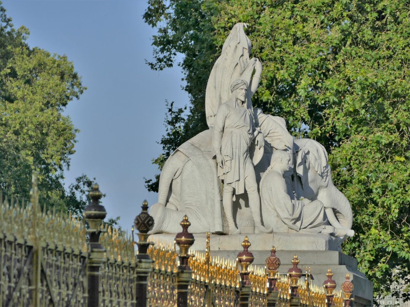

London - for the Natural History Museum (above left), and the Proms (detail of the Albert Memorial, above centre), followed by London by night (above right).


Some garden visiting: micro moth on mint flowers (above left, in Surrey), greenhouse carnivores in Kent (above centre) and, also in Kent, some Sicilian ceramic flower pot heads, with heuchera hair (above right).


Horsham in West Sussex, looking very summery at the top of the this post, with lunch in the Horsham Museum (above centre and left).


Osterley Park: its address is almost as historic as the house and garden - Jersey Road, Isleworth, Middlesex, TW7 4RB, aka West London. The Park is enormous and still in agricultural production, sandwiched between Southall and Brentford.


A town house and two cathedrals: Coventry of course.


And back to London: St James’ Palace (above left) for supper with a friend (in a modest Thai restaurant around the corner) and two glimpses of Shakespeare’s Globe theatre, dwarfed by its massive, Tate Modern, neighbour (above centre) and inside the tiny-theatre-with-big-ideas (above right).
But thank goodness August is over - others’ vegetable gardens are cropping well, and we can finally come off the potato diet.
See you soon.