The Box Hill Work Out
When a friend was planning a hiking trip in Nepal, his fitness training involved trekking up and down Box Hill, in Surrey. With a somewhat lower altitude and less onerous trip in prospect, one of us decided to try the same technique.
A training walk up Box Hill on a sunny day in the Easter school holidays is not as straightforward as you might think. For starters, although one of us was walking alone (the other one was elsewhere on the Hill, with the decent camera, recording butterflies) and with only a camera phone, the temptation to stop and take photographs was still irresistible. And just because you don’t have to inspect every inch of the terrain for butterflies, there are plenty of other distractions to look at, such as plants, birds, views and all of landscape’s little idiosyncrasies. Nothing ruins an attempt at a Strava record more than an interest in one’s environment.
My other worry was overcrowding. How many others would also be ambling/walking/climbing/ running up or down the Hill? The answer was not as many as I feared, but plenty enough for some very enjoyable sociable chit-chat: greetings to be exchanged, different route options to be discussed, offers or requests to take photographs and commiserations when children were too slow or too fast. It was holiday time and no-one wanted to be grumpy.
So here is my diary of a sunny day out in one of Surrey’s MAJOR beauty spots. We start at the bottom of the hill.

If you studied geography at school, you may well have heard of, or even taken a field trip to, the Mole Gap. Not a dental problem but a picturesque cutting through the chalk of the North Downs, the Gap was created by the river Mole as it flows from its source (now unromantically described as ‘near Gatwick Airport’) to its confluence with the Thames close to Hampton Court (a much classier location).
Image above right: the arrow shows the approximate position of the Mole Gap within the folds of the North Downs
Box Hill forms the eastern side of the gap and, if you want to climb the shortest but steepest route to the top, you must also effect a crossing of the River Mole where it flows sandwiched between the A24 and the chalk flank of the Hill.
Want to get the kids involved? Tell them about the stepping stones, first recorded in 1841 and still an extremely popular way to cross. Want to get the less adventurous involved? Tell them about the much more recent bridge built nearby. The bridge becomes extremely popular when the river rises and the stones disappear under water.


On Maundy Thursday, the stones were high and mostly dry, but seemed to have got further apart since the days when one of us could cross with a hop, skip and a jump. Galling to be outclassed by a 7 year old with much shorter legs.
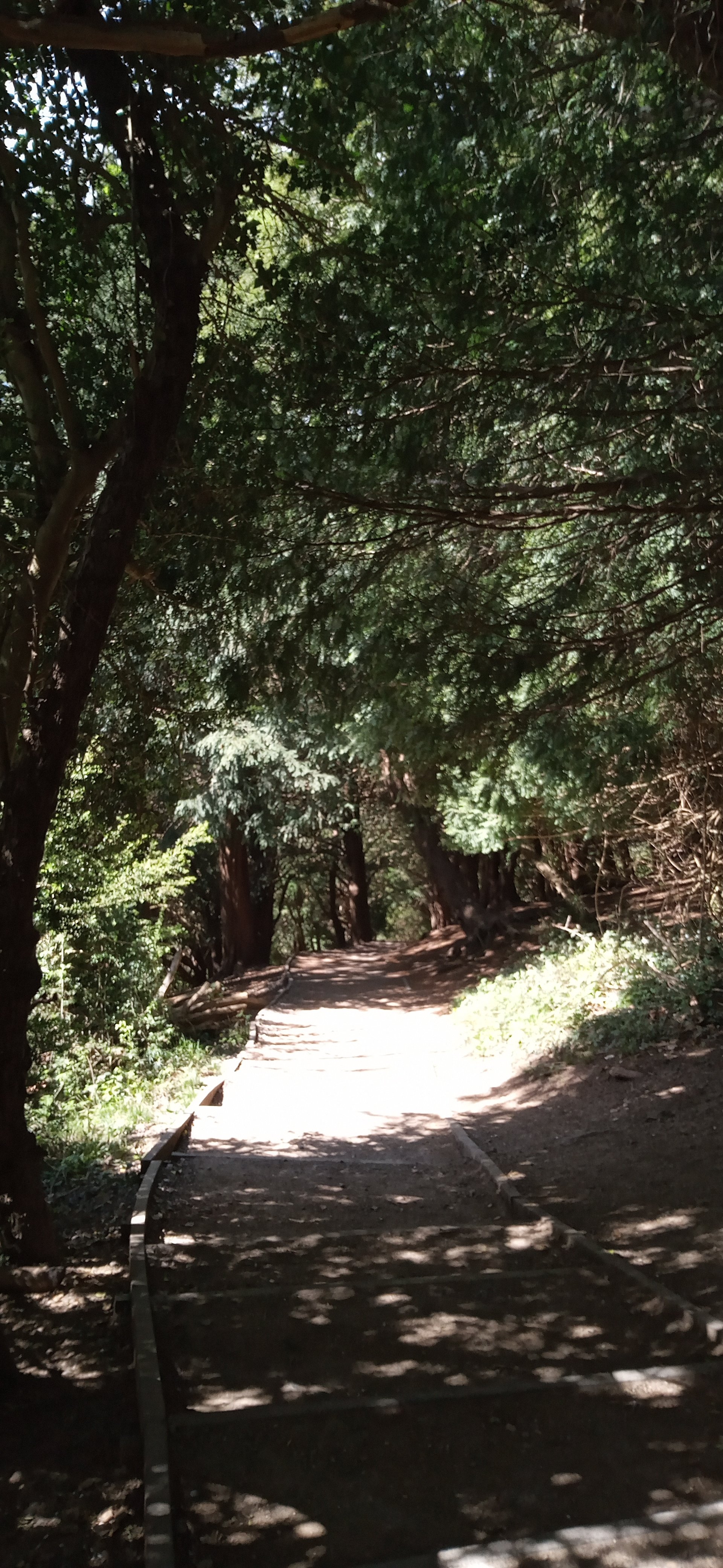
In this dry spring, the area close to the stepping stones and the path to the bridge is bare earth, beaten hard by the passage of feet, but vegetation closes in as the path begins to rise slowly but surely away from the river bank. A strong, almost tangible fragrance hits the nose a fraction before the eyes identify the dense ground cover of wild garlic.


- The path begins to tackle the incline, curving and climbing to reveal – oh no - steps!! For one of us, this is the hardest form of scaling a hillside. These steps are robust and unforgiving, essential if they are to survive the footfall and changing weather conditions, but a relentless challenge for the climber! Delighted to report that not a single step was bypassed in the making of this blog.


Thankfully management of the scrub and young woodland which is colonising this west facing chalk slope provides sufficient excuses to stop and admire.


But also gives us an ecology lesson in both colonisation – bramble (below left) and blackthorn (centre) - and the much, much older specimens of the classic yew groves of the chalk downlands (below right).


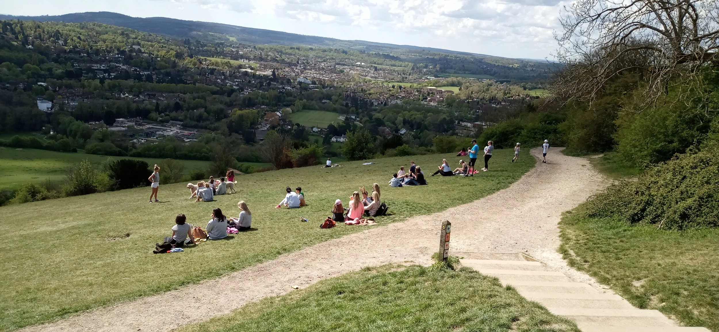
Suddenly, as one of us rounds a corner, the world opens up into an expanse of chalk grassland. How did that happen so quickly? This is nearly the top of the climb! Above lies the famous viewpoint with its panorama of the Weald, the South Downs and the town of Dorking (at the southern end of the Mole Gap). Strava records an elevation gain of a mere 204 m (c 670’). It’s time to saunter up that last slope and turn into tourist. I don’t think that climb has done much for my fitness training.


Where’s the cafe?