
The Box Hill Work Out
When a friend was planning a hiking trip in Nepal, his fitness training involved trekking up and down Box Hill, in Surrey. With a somewhat lower altitude and less onerous trip in prospect, one of us decided to try the same technique.
A training walk up Box Hill on a sunny day in the Easter school holidays is not as straightforward as you might think. For starters, although one of us was walking alone (the other one was elsewhere on the Hill, with the decent camera, recording butterflies) and with only a camera phone, the temptation to stop and take photographs was still irresistible. And just because you don’t have to inspect every inch of the terrain for butterflies, there are plenty of other distractions to look at, such as plants, birds, views and all of landscape’s little idiosyncrasies. Nothing ruins an attempt at a Strava record more than an interest in one’s environment.
My other worry was overcrowding. How many others would also be ambling/walking/climbing/ running up or down the Hill? The answer was not as many as I feared, but plenty enough for some very enjoyable sociable chit-chat: greetings to be exchanged, different route options to be discussed, offers or requests to take photographs and commiserations when children were too slow or too fast. It was holiday time and no-one wanted to be grumpy.
So here is my diary of a sunny day out in one of Surrey’s MAJOR beauty spots. We start at the bottom of the hill.

If you studied geography at school, you may well have heard of, or even taken a field trip to, the Mole Gap. Not a dental problem but a picturesque cutting through the chalk of the North Downs, the Gap was created by the river Mole as it flows from its source (now unromantically described as ‘near Gatwick Airport’) to its confluence with the Thames close to Hampton Court (a much classier location).
Image above right: the arrow shows the approximate position of the Mole Gap within the folds of the North Downs
Box Hill forms the eastern side of the gap and, if you want to climb the shortest but steepest route to the top, you must also effect a crossing of the River Mole where it flows sandwiched between the A24 and the chalk flank of the Hill.
Want to get the kids involved? Tell them about the stepping stones, first recorded in 1841 and still an extremely popular way to cross. Want to get the less adventurous involved? Tell them about the much more recent bridge built nearby. The bridge becomes extremely popular when the river rises and the stones disappear under water.


On Maundy Thursday, the stones were high and mostly dry, but seemed to have got further apart since the days when one of us could cross with a hop, skip and a jump. Galling to be outclassed by a 7 year old with much shorter legs.
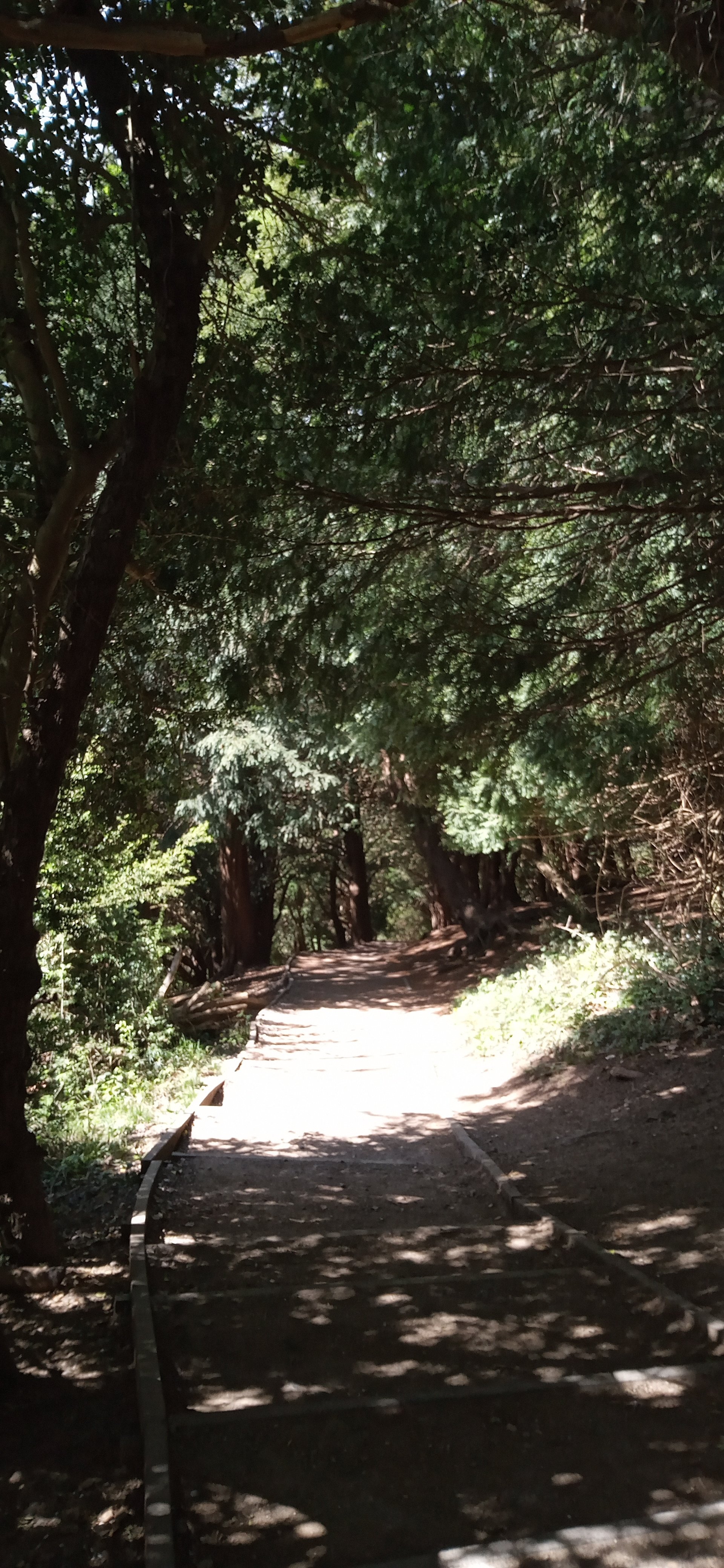
In this dry spring, the area close to the stepping stones and the path to the bridge is bare earth, beaten hard by the passage of feet, but vegetation closes in as the path begins to rise slowly but surely away from the river bank. A strong, almost tangible fragrance hits the nose a fraction before the eyes identify the dense ground cover of wild garlic.


- The path begins to tackle the incline, curving and climbing to reveal – oh no - steps!! For one of us, this is the hardest form of scaling a hillside. These steps are robust and unforgiving, essential if they are to survive the footfall and changing weather conditions, but a relentless challenge for the climber! Delighted to report that not a single step was bypassed in the making of this blog.


Thankfully management of the scrub and young woodland which is colonising this west facing chalk slope provides sufficient excuses to stop and admire.


But also gives us an ecology lesson in both colonisation – bramble (below left) and blackthorn (centre) - and the much, much older specimens of the classic yew groves of the chalk downlands (below right).


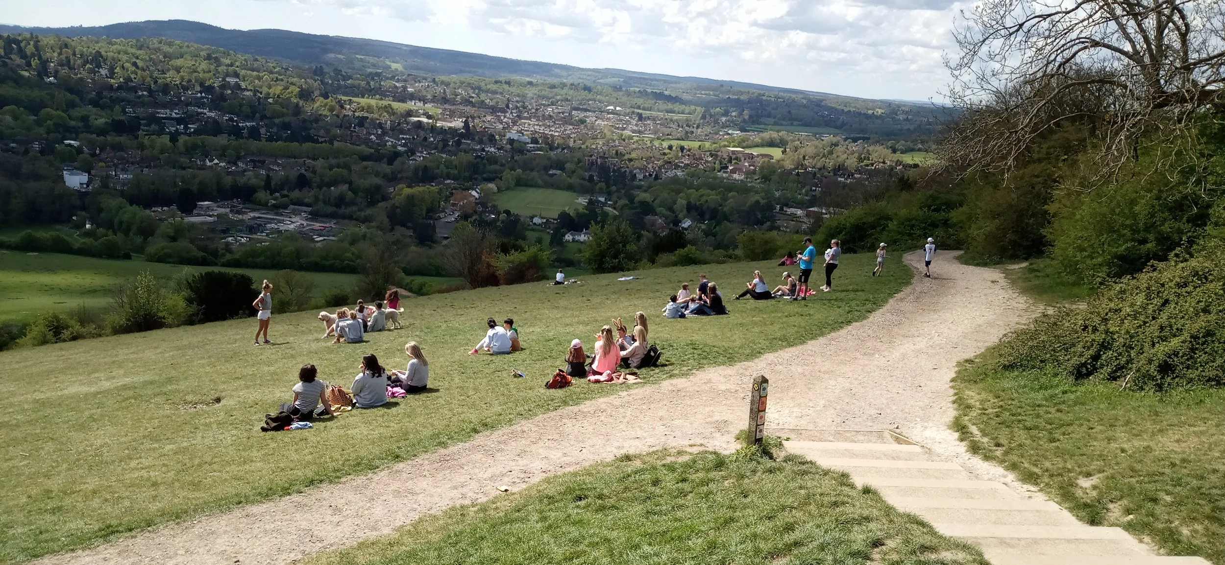
Suddenly, as one of us rounds a corner, the world opens up into an expanse of chalk grassland. How did that happen so quickly? This is nearly the top of the climb! Above lies the famous viewpoint with its panorama of the Weald, the South Downs and the town of Dorking (at the southern end of the Mole Gap). Strava records an elevation gain of a mere 204 m (c 670’). It’s time to saunter up that last slope and turn into tourist. I don’t think that climb has done much for my fitness training.


Where’s the cafe?
I Spy
Pre Covid, Terroir defined four criteria for determining where we wanted to live. These criteria were, in no particular order:
· Good transport links to make leaving (and coming back) easy! Tick
· Access to a lively city with plenty going on. Tick (in fact 2 cities within easy reach)
· Great countryside. Tick (lovely, long linear belts of the stuff)
· Near the sea – it takes about an hour to reach the coast from the current chez Terroir, so seaside is technically null points but not an impossibility.
Three out of four suits us pretty well for the time being.
With regard to our local countryside, familiarity has not bred contempt. A couple of days ago, we trialled anther local Slow Way (see Blog 29, on 13th May) and were embarrassed but also delighted to find that here was another walk which we had never tried before. We climbed the scarp face of the North Downs, turned round and admired the view.
Here are a couple of samples, the distant haze showing just how hot a day it was turning out to be.


As we contemplated the panorama, we started that conversation which is usually spawned by looking down on a familiar landscape from an unfamiliar view point. It went something like this: ‘Oh look, there is St John’s Church tower. Can you see that tower block? Where is the new school? Why can’t we see the railway?’
Here is a list of all the things we spotted. Can you find them?
13th century church tower, Victorian church tower
A Capability Brown landscape
Two motorways and a lot of railway,
Telecomms tower
Sand quarry and a landfill site
A high pressure gas pipeline (trick question)
1930s housing
1960s block of flats
21st century housing estate on former minerals site
20th century industrial estate, 20th century commercial ‘sheds’
21st century primary school
Answers below!
It is amazing what you can hide in a summer landscape. We will go back in the winter to see just how much a visual impact assessment is influenced by seasonality.
So here are the ‘answers’. This second set of photographs has zoomed in on sections of the view, panning from east to west. Terroir is standing on the crest of the North Downs chalk ridge, looking south across the gault clay below, to the Greensand ridge on the other side of the valley.

This is, pretty obiously, one of the two mortorways, in this case the M23 heading towards Gatwick Airport. For once we were unable to see the airport buildings from our viewoint and, as the aiport is pretty much closed, there was no flight traffic to indicate its whereabouts.

Next up is the sand quarry, tucked in at the foot of the greensand ridge. A hint of the 1930s housing can be seen at the western extent of the picture.

Picking up again on the tile roofs of the 1930s housing estate, we have moved west to the landfill site. At gound level, this seems like a veritable mountain, especially as it is so obvious now, in its white shroud, waiting for final restoration. From our viewpoint above it looks more like a water body. The fields rising behind the white mound are older reclamation works, from the area’s long history of Fullers’ earth excavation.

Now we move on the to the industrial estate - the collection of light coloured roofs to the right of the image - which is a suprisingly extensive affair of light engineering, car show rooms, vehicle repairs, interior and exterior building trades etc - bounded by one of the railway lines (so hard to see). The 21st century housing estate, just off picture, comes snugly up to its boundary.

Moving ever westward into increasing haze, we can just pick out the spire of the Victorian church on its wooded knoll, just under the skyline to the left of the picture. Here is also the paraphnelia of the local town looking, from this height, as though it lies in a woodland clearing. The block of flats (right of photo) looses its dominance when seen against the wooded hillside, but the 20th century commercial ‘sheds’ are very visible below. These latter lie adjacent to the main railway line, which is entirely hidden by the early summer foliage.

Moving form the 20th century sheds, you can just make out the blocky shape of the 21st century primary school just to the left of centre of the photo. The wedge of green sace to the right is an outlier of the Capability Brown landscape!

The North Downs are back in the picture now. Another railway line runs parallel to the chalk escarpement, but is impossible to see. Once renowned for its views of the Downs, the trackside scrub and tree growth is rapidly expanding, reducing vistas of the Downs to just quick glimpses - and hiding the railway itself from the views above.

And there is the telecomms tower, exploiting the North Downs ridge to provide signals to north and south. Less obvious, but there if you look carefully, is the spire of the 13th century church; a dark grey cone piercing the tree canopy, just right of centre on the photgraph.

Finally, we have swung full semi-circle to watch (and sadly listen to) the M25 carving its way up the North Downs escarpment to its highest point at 213 m above sea level.

And the gas pipeline? Well it goes under the view somewhere. When we had finished admiring the vista, we turned round to continue our walk and spotted the tell tale red topped marker over to our left.