
Rectangular Agriculture
Albania 2
After Terroir’s take on Albanian architecture, we promised you something more rural. Field patterns, seen from the air, initiated the angular theme. Here you can see why:

Agriculture, we were told, is still very important to the Albanian economy. We decided to check this out and see how Albania compared with its neighbours and some of the world’s big players. Using https://www.statista.com (for no better reason that it’s easy to use and seemed to produce roughly comparable figures to other websites we looked at) we discovered that around 20% of Albania’s gross domestic product (GDP) does indeed come from agriculture – rectangular or otherwise. As an aside, a further 10% comes from remittances sent from abroad by the Albanian diaspora.
Looking simply at agriculture, here are some interesting comparisons which do, indeed, confirm the importance of this sector to the Albanian economy.

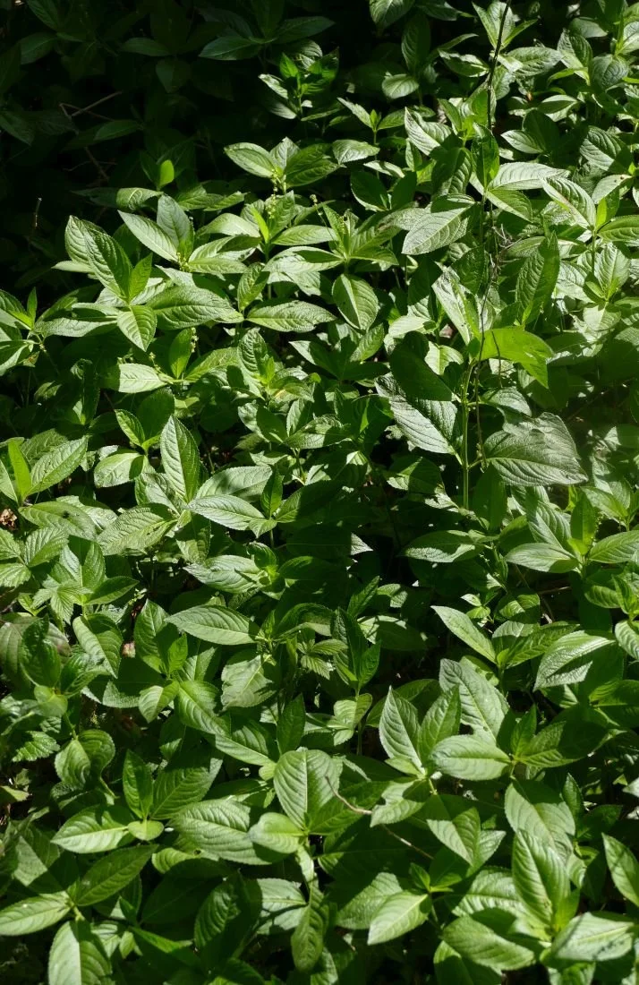
We started investigating what Albania produces as part of our attempts to identify the many fruit trees which were in flower – in orchards, in back gardens, beside roads and tracks, and in a whole variety of plots which didn’t fall into any of those definitions. The angularity theory was already becoming eroded.


We spotted apple, pear, plum, cherry and lemons but were temporarily discomforted by these enthusiastically large and curvaceous blossoms. Quince, of course: soon to become buxom fruit, alongside their more familiar companions.
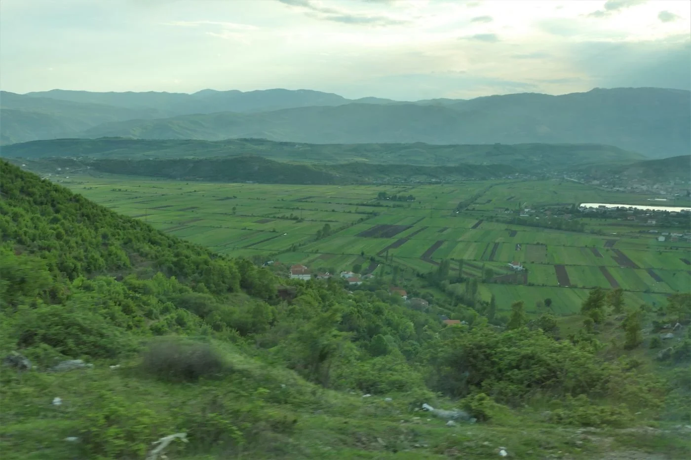
One could be forgiven for dividing Albania’s countryside into three main geographies: absolutely flat; very hilly; vertiginous. Google Translate insists that the Albanian for undulating is ‘valëzuar’, but I bet no one ever uses it.
It was the ‘absolutely flat’ that had started my obsession with the rectangular nature of lowland Albania. Valley bottoms and some more extensive plains are characterised by small, oblong plots separated from each other by narrow ditches. On the assumption that the ditches fulfill either irrigation or drainage functions (some were indeed carrying water) then there must be a gradient but this is invisible to the eye of the passing tourist. Fences and hedgerows hardly feature at all.


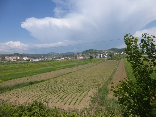
We did occasionally see larger areas of pure wheat, but most of these small rectangles grow a variety of different crops: wheat of course, but barley, oats, potatoes, grass, vines and olives were also obvious. Many plots were tilled but still bare, presumably awaiting the planting of a rich variety of vegetable crops, a selection of which we were eating every evening. Herbs are also highly valued in Albania – for medicinal use as well as for cooking and cosmetics - and fields of sage or lavender were also spotted.
For days we didn’t see any form of mechanisation, just families with bent backs either sowing vegetables or cutting grass with scythes. Eventually we began to spot small tractors but in hilly areas, ponies, mules and the occasional donkey were also visible, kitted out in their pack saddles, waiting to be allocated an errand or a load. Cattle were also taken out to graze, either tethered or accompanied by a herdsman/woman/child.


The ‘very hilly’ landscapes seriously weaken the ‘rectangular agriculture’ theory in all aspects except one: hills appear to rise from the valley bottoms with an almost explosive suddenness. Albania does rivers big time. They carry silt and gravels which they deposit with remarkably evenness across the valley floor. The hills, however, are made out of tougher stuff which is anything but horizontal. The break of slope, where hill meets vale is nothing if not hard, sudden and dramatically angular.
These uplands are rich in deciduous woodland with an ample ground flora which kept the group’s botanists very happy – and, at times, puzzled. As Albania is well endowed with limestone uplands, it reminded us a little of the chalk and limestone habitats of home – but on steroids. The abundance of wild phlomis (below left) was also a clear statement of the proximity to the Mediterranean.


These hills are also the domain of sheep and goats, of bells and of shepherds. Who needs fences when the shepherd and perhaps a dog are constantly on duty and who will return the flock to the shelter of the farm before dark?


Hills can also be productive if they are terraced. But terracing requires considerable labour, to convert a sloping hillside into a stepped one, and a willingness to wait while the crop of olives or fruit trees, or whatever can survive this tough environment, matures sufficiently to bear a crop worth harvesting. One of our Albanian references postulated the use of slave labour (apologies for being unable to find the quote at the time of writing) and in a way this may be true, as a story, told by our guide - Mr G - demonstrates:
When Mr G was at university, the students spent their summers at camps, but not in the sense with which we are familiar. This student labour force was, well, ‘used’ to build terraces and plant trees in areas which were otherwise underproductive. Despite having little choice in the matter, the students did have a wonderful time, working during the day and larking about (Terroir’s word not Mr G’s) in the evenings. Mr G was very proud of the trees which he had planted and revisited them from time to time. But, by the time these trees were mature enough to bear fruit, the regime had changed and land was being redistributed to private owners. Many, many of the terraces we saw were no longer in productive use.


And the future? New uses for rural land will inevitably include tourism. Already the coast and some lake sides are very popular and already have, or are in progress of constructing, the necessary infrastructure.


But holidays in the ‘vertiginous’ landscapes are developing more slowly. Albania’s mountains, and their role in Albanian history and culture, are quite extraordinary. Possibly the best description which we have read to date is Rose Wilder Lane’s ‘Peaks of Shala’ - a record of a journey made in 1921, and available for free download via The Project Gutenberg. Others may have met Albania’s mountains via the activities of Britain’s Special Operations Executive during WWII or, more peacefully and more recently, via Robin Hanbury-Tenison’s book, ‘Land of Eagles’. Today, visiting hikers are increasingly exploring the mountains during the brief summer window when such activities are relatively safe, and new hotels are being constructed at the ends of the few roads which penetrate the world of these craggy horizontals. Good for Albania but less so for the wilderness which they represent.


Albanian Odyssey

Terroir has recently returned from a group trip to Albania, with a side helping of Montenegro, Serbia and an unexpected day in Kosovo. We can’t quite remember why we chose this particular combination – the excursion was booked well over two years ago – but it was probably something to do with knowing nothing about Albania and because Montenegro and Serbia host one of the world’s most spectacular train journeys. This blog will be about Albania. We’ll get to the trains another time.
Right: Skanderbeg - Albania’s national hero - in Tirana’s Freedom Square
First of all, we must confess that we flew from London to Tirana. The view of Albania from the plane was, thus, a guilty pleasure and appeared to reveal a landscape made up entirely of rectangles and what we believe are technically known as rectangular prisms, ie shoe box shapes. Tirana appeared to be built completely of brown, grey and beige shoe boxes set on end, and surrounded by rectangular green and brown fields.
This perception of rectangularity proved to be not entirely false. To western European eyes, the flat roofed, reinforced concrete and rendered brick structures of Albania’s communist period hit us hard and for a few days we wandered around searching, rather pathetically, for an older, more vernacular form of domestic architecture.
Below: shoebox apartment blocks in Tirana


As Albanian history is intensely complicated, we coped by simplistically dividing the country’s past into three phases: before Communism, the nearly 50 years of Communist dictatorship, and after Communism (from around 1992 onwards).
Pre-communism was dominated by the Ottomans, followed more briefly by the 20th century Balkan Wars, independence, nationalism, King Zog (pause for sniggering from British school children) and a number of feisty British men and women who travelled, dabbled, supported or fought for Albania (the latter with the partisans in the WW II).
Communism in Albania wasn’t like that experienced by say Poland or Czechoslovakia, within the Soviet Union, or the former Yugoslavia under Tito. Albania’s Communist dictator, Enver Hoxha, took an impoverished, post war Albania down a different route, sided with Russia when Yugoslavia broke away in 1948 and withdrew from the Warsaw Pact in 1968. Those of us who had been to other post-communist states – the bright lights of Dubrovnik, the rebuilt Warsaw, historic Prague, the playground which is Slovenia or even the slightly tense atmosphere of Mostar - had to re-set our frames of reference. Albania still appears to be playing catch up.
So thank goodness for Mr G. One of the many advantages of a group trip is the ‘local guide’. Born into Communism, a student at the time of regime change (how amazing/frightening must that have been?) and an adult in the post Hoxha era, Mr G’s guidance was unbelievably valuable. No question was too challenging for him; all were answered with thoughtfulness, good humour and a hefty dose of realism.
So, lets get back to that rectangular theme.
Central Tirana offered welcome, if somewhat unexpected, rectangular variety, starting with its Italian influenced architecture of the 1920s and 30s.
Below: left - Tiranan’s Italian Cultural Institute and right - a newly decorated Italinate offering in a very unexpected colour scheme; anyone for Battenburg cake?


Nearly a century later, Skanderberg Square, the central hub of the capital, has once again been redesigned. And once again, it is strong on straight lines and right angles (including the litter bins and benches). It does, however, provide a massive, contemporary, traffic free space, with its shiny modernity softened by planting
and enlivened by all shapes and sizes of humanity, including a glimpse of the suited and booted mayor and his entourage, energetically pedalling through on their bicycles to the nearby city hall.


On the residential front, angles are beginning to soften and colour is becoming more vibrant. But, despite investing in modern art (yes, we assume the bus is intentional, below right), sustainable urban drainage is still a thing of the future. One can only hope that the ‘Go Green’ logo is a promise of things to come.


And finally, a wonderful capital city moment: an architectural ensemble of 18th century mosque, 20th century Italian design and 21st century modernity.
Further afield we began to get a feel for that massive, pre-communist, chunk of history. According to our guide book, early 18th century Voskopoja, in south east Albania, was “the largest city in the Balkans, bigger even than Athens or Sofia” (Albania, the Bradt Travel Guide, Gillian Glover, 2018). Today it is a tiny, remote village, but enough remains to give us a flavour of the Albanian end of the Ottoman empire. Of the 24 orginal churches, only seven remain and even fewer are in a condition to be open to the public, but it’s still a real eyeful.


Local stone and timber have created magnificent structures. Even the restored agricultural building (right) with its string courses and less traditional corrugated iron roof and wire-scape, is a delight. Other cottages and farm buildings in the village were romantically tumble-down. In Britain they would be snapped up and restored; the growing tourist industry may have the same impact here.
The ‘beautiful and austere’ town of Gjirokastra (Bradt Guide again) ‘spread downhill from its castle in the 13th century’. Unlike Voskopoja, it is still very much a town to be reckoned with, built in grey stone and slate, its modern suburbs oozing out over flat valley bottom in startling white, buttoned down by the occasional red tile roof. Here we saw our first souvenir shops, a wider choice of cafes, and steep, block paved roads obstructed by cars trying to access our traditional, Ottoman style, hotel.


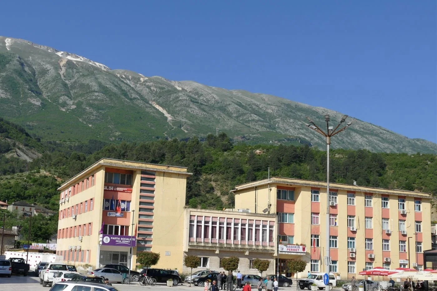
North east of Gjirokastra lies Përmet, perhaps 30 km away as the eagle flies but over double that by the road, which must travel the long way round from the valley of the Drin to the valley of the Vjosa. The River Vjosa, which gives this small town its raison d'être and its identity, is described by the Bradt Guide as ‘one of the lovelist rivers in Albania’, a description which Terroir is happy to endorse. If the balconies of the shoe box flats were sporting gernaiums rather than carpets and washing, one could be forgiven for thinking we had strayed into Austria.


Our final destination for this particular blog is Korça, perched high up between the Greek border to the south and Lakes Ohrid and Prespa to the north. It is the home of good beer and the first Albanian language schools. Its architecture is equally diverse, ranging from the modern (such as the National Museum of Medieval Art, left) to a far more traditional vibe.


Next time, we’ll take a look at rectangular agriculture!
Sand Pit
What do you do with a hole in the ground?
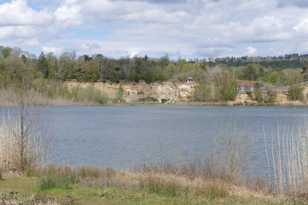
Surface mineral extraction can be a landscape blight as well as an industrial resource. Clay, sand, aggregate, granite, limestone, slate – all can make huge impacts on their environments as well as, more positively, on their local economies. All create holes with very differing characteristics and potential. Clay holes are often filled with waste, and have gone on to expand upwards, creating hills where none existed before. Slate and granite are good at new vertical landscapes with scars and screes. Once the pumps are turned off, sand and gravel pits usually fill with water, creating widespreading horizontal changes to the local landscape character.
Recently Terroir visited a sand pit, once impenetrable behind its industrial security fencing, ‘keep out’ signs and all the paraphernalia of extraction health and safety requirements. Eventually, however, new mineral extraction planning permissions were no longer forthcoming and the pit was allowed to flood.
Nothing unusual there, you may say. ‘Soft’ restoration schemes are very common, with management for nature conservation and visual amenity, and frequently including some sort of revenue earning, water-based recreation facilities, such as sailing, kayaking, fishing, but with plenty of public access. Last week’s blog featured The Moors, a mixed development with new housing adjacent to flooded lagoons and seasonal water bodies. Here, existing public access has been extended and linked into the National Cycle Network which takes you onwards to two older flooded sand pits, one managed for water based recreation at one end (with fishing and nature conservation at the other), and the second purely as a nature reserve.
Buckland Park Lake, however, is trying a different model. With no pre-existing public rights of way, the whole, post-industrial, lake-and-landscape combination, is concealed behind a pay-wall. Well more of a pay-woodland, actually, with a wooden shed located half way down the old mineral access road, to sell you entrance tickets; £7 a pop for adults during the High Season or £99 for the year. Various concessions are available.

Once inside this ‘new and unique recreation space’ (https://bucklandparklake.co.uk/) access to the whole park and the paddling pool is free but ‘open water swimming, water sports and bushcraft should be booked directly with The Surrey Hills Adventure Company’. There’s also a restaurant and a variety of tracks and trails suitable for strolling or running. No dogs are allowed.
It sounds, and one day may feel, like an inland resort. But this is not a word used by the website:
‘Our 100-acre site blends tranquillity with breath-taking views over one of Surrey’s largest lakes. We have around 50 acres of mature mixed woodland, abundant bird life, walking trails and a small sandy beach.’
Terroir went to take a look.
First of all, it is still very new. As the landscape matures and the facilities bed, one hopes that many of the raw edges will be softened.


Above: The water sports area
Below: theview from the restaurant (the pods get very hot during the day) and the less formal recreational areas


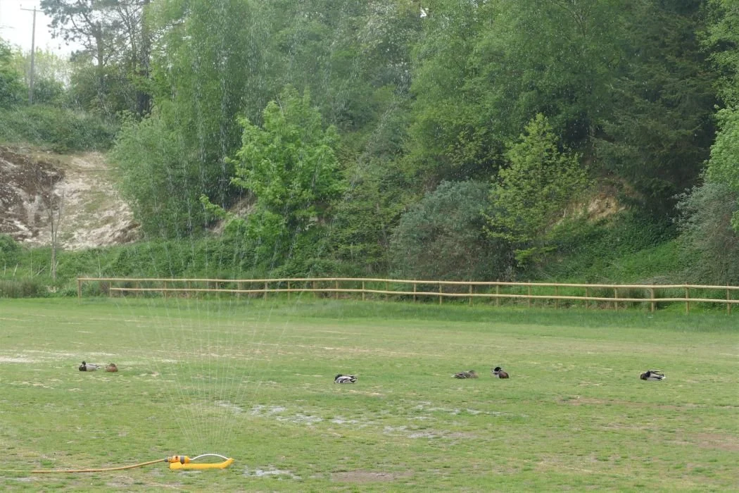
Surprisingly, drainage appears to be an issue. A cut off ditch edges the car park and supports a lush, linear wetland habitat which we hadn’t expected, but were delighted to see. Yet the car park itself presented a bizarre contradiction: its outer edge blending with the ditch habitats - dominated by juncus rush and other indicators of wetland and poor drainage - while a few feet away the sprinklers were working hard (the car park had taken a hammering the day before) and the local ducks were in irrigation heaven. One feels, perhaps, that a rethink of car park surfacing is urgently required.


Above: the stream/ditch/drain
Below: left - car park ‘outfield’, full of rushes; right - the actual parking areas, full of ducks

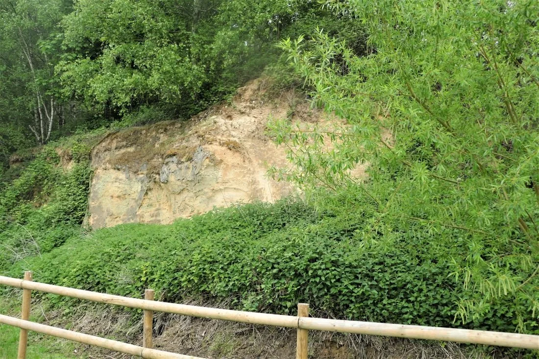
Elsewhere the sand cliffs are a delightful mix of dry and acid loving species including gorse, broom and birch, with sheets of nettles where the richer overburden or spoil was probably stored or subsequently buildozed.


The woodland walk sounds inviting. The current offer is a mixed bag of developing ‘secondary’ woodland on areas no longer used for sand extraction, and older stands of exotic conifers. Terroir has no problem with that - indeed it’s fascinating evidence of the sand pit’s history - but the information signs fail to take advantage of the story. Why not explain why there is such a mix of local species (including birch, sweet chestnut, sallow, sycamore, English oak, evergreen oak and field maple), in some areas and single species stands of Scots Pine or the non-native western red cedar, in others?

A number of Scot’s pines ‘interspersed in the woodland’. It sounds so romantic but what the viewer is actually looking at is a 1950s commercial, single species, conifer plantation surrounded by a delapidated fence. Why not tell the story of why these planations were planted and what is (or more likely isn’t) happening to them now. And possibly remove that fence.
The story of the local sand extraction is told on - just one - interpretation board (below left). There is scope for a lot more and one hopes that this will follow. The retention of the processing plant (below right) is also a plus, adding welcome historical links.


The bird life mentioned on the web site is certainly developing and the multistorey sand marten nesting wall seems to be well used. Sensitive management should increase the lake’s attraction for bird watchers, but currently the hide looks rather lonely.


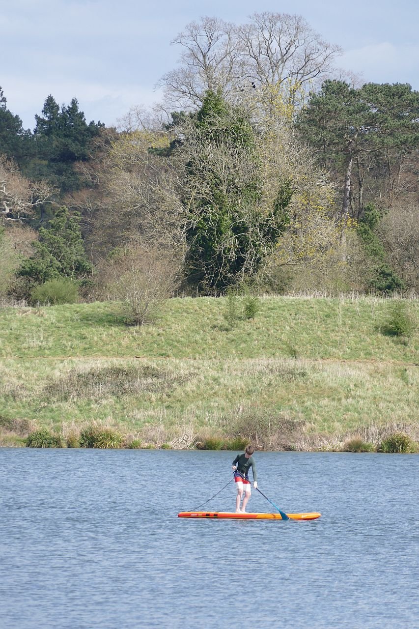
We have no knowledge of whether the bookable, water based activities, and the fishing, are providing the income required to make this into a going concern, but even on a chilly day in early May, there was at least some activity on the lake.


But surely the big question is, will the punters pay the site entry charge? Will they cross the pay wall? With so many free countryside, wetland and greenspace facilities nearby, not to mention the Surrey Hills Area of Outstanding Natural Beauty, the North Downs Way and the Greensand Way, is their any incentive for the casual user to pay up? Curiosity there certainly is. This year, the Annual Buckland May Fayre was held in the Buckland Park Lake. Numbers attending were hugely underestimated, traffic queued to get in, food supplies ran out, the bottle tombla wiped clean and stories of chaos were legion. The entry fee was reduced to £2 and it was reported that many turned up out of sheer curiousity to see what Buckland Lake was all about. £7 a time is definitely offputting, but a village fete at £2 is worth a go.
But maybe that is exactly the point. Maybe the business plan for Buckland Park Lake is based on creating an exclusive environment for those willing to pay for it.

Change of Management
With an ever growing image library, this blog was meant to be a comparison of spring 2020, 2021 and 2022, based on Terroir’s photographs of our favourite urban landscape, The Moors, near Redhill in Surrey. Those new to Terroir can catch up on the back story in Blogs 1, 11, 16, 31, and 54.
We discovered - the hard way - that unless you can indulge in fixed point photography and keep excellent records of camera settings, view points etc, taking and comparing before and after images can be at best frustrating and at worst, useless. Take a look at the disastrous attempt below!

Above: ‘before’ on the left (2020), and ‘after’ on the right (2022). Well, maybe that islet has moved, but as the photographer’s location and camera settings are different, it is impossible to verify!
The changes which were most obvious, however, were not those necessarily linked to seasonal variation. It was the changes which had occurred to this post industrial landscape over the (nearly) three year time span of the pandemic.
Here is what we found.
A hugely expanded clump of dogs mercury: usually regarded as an indicator species for ancient woodland; so good to see it not just hanging on, but now thriving.
During the pandemic, there has been little active maintenance and management at the Moors. This isn’t necessarily bad - just different. At the moment the wild flowers which thrive on the edge of hedgerows are blooming, providing a range of colour and form. The summer grassland flowers, however, may not be so copious this year as the scrub is slowly extending over the grassy verges, alongside the paths and cycle way. But already a healthy growth of young willowherb, and some spikes of common agrimony, pressage a blaze of pink and mauve, with yellow highlights, later on in the year.


From left to right - top row: common sorrel, common forget-me-not, and a young teasel
Middle row: red campion, bugle and white dead nettle
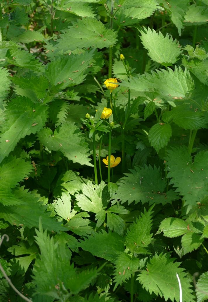
Bottom row: garlic mustard (the tangy leaves are delicious at this time of year), meadow buttercup and cuckoo flower/ladies smock, a lover of ditch sides and damp rough grassland.
Thankfully, the encroaching scrub is not without interest either: flowers, fresh foliage and tinges of red on some newly opened leaves are all welcome accessories to a late spring walk.


From left to right - top row: holly in flower, a sycamore sapling and an alder - the latter another wetland lover.
Bottom row: a wild rose, buddleia (a naturalising garden escape) and the soft, glossy leaves of young brambles
The blackthorn is over but other shrubs and trees are adding to the spring time vibe. And, as is usual these days, the May (hawthorn) is fully out in April.


From left to right - top row: hawthorn hedge in flower, elderflower and gean or wild cherry: with its straight branches, awkwardly angled from the trunk, the gean flowers always make me think of handkerchiefs on a washing line or stars on a Christmas tree.
Bottom row: willows, and a rogue horse chestnut complete with candle
Sadly, the ash dieback is very obvious (below).


Despite the lack of rain, water levels are still high, the main footpath/cycle way is still partly flooded and the seasonal wetlands are inundated. This excess of water is possibly why the swan pair have moved their nest; still close to the path but further to the west of last year’s location. A beady-eyed heron stands very close. We’ve not heard of herons taking eggs but they certainly eat ducklings and cygnets.


The brook itself has also changed. Some of the mature trees have been felled or partly felled, presumably for safety reasons, and more light is reaching sections of the water course. The partly felled ‘totem’ trees look bizarre but the organisms which will inhabit the slowly rotting wood will be a welcome addition to the area’s biodiversity.


The ‘offline’ balancing pond has turned a rusty brown colour - an algal bloom? - and there are traces of it along the edge of the shadier, slower flowing, sections of the stream (image below left). Some green waterweed still remains, however (below right), but the areas of yellow flag (centre) have extended enormously and will be spectacular later in the month.


We have given up on fixed point photography, but we will report back later in the year on how the Moors post-pandemic (is that tempting fate?) summer of 2022, compares with its lock down predecessors.
Changes to Terroir
Terroir blog had a long gestation period but eventually went live in October 2020. It was the perfect lockdown project and a weekly post seemed ideal. Thankfully, our life styles have changed and now that we are ‘learning to live with Covid’ we will be travelling more often and more extensively than we were able to, in the previous two summers. For the next six months at least, therefore, the Terroir blog will be appearing on a fortnightly basis. Blog 81 will appear as normal on Thursday 12th May but blog 82 will not be posted until Thursday 26th May. Further postings will follow at two week intervals.

Rewilding

What is rewilding and why do we do it? How to cover this in one short blog? You would need to write a book to even begin to answer that one. Luckily that book has already been written, by many competent authors, including George Monbiot (Feral), Jepson and Blythe (Rewilding – The Radical New Science of Ecological Recovery) and Isabella Tree (Wilding).
But what is rewilding and why does it create so much controversy?
Definitions vary in subtle ways; here are a couple of extracts from rewilding websites:
“Rewilding is a progressive approach to conservation. It’s about letting nature take care of itself, enabling natural processes to shape land and sea, repair damaged ecosystems and restore degraded landscapes. Through rewilding, wildlife’s natural rhythms create wilder, more biodiverse habitats.” https://rewildingeurope.com/what-is-rewilding-2/
Nature has the power to heal itself and to heal us, if we let it. That’s what rewilding is all about; restoring ecosystems to the point where nature can take care of itself, and restoring our relationship with the natural world. Reconnecting with what matters.” https://www.rewildingbritain.org.uk/explore-rewilding/what-is-rewilding
As you can see, there is a lot about stepping back and letting nature take care of itself. Terroir prefers:
“Rewilding, or re-wilding, activities are conservation efforts aimed at restoring and protecting natural processes and wilderness areas. https://en.wikipedia.org/wiki/Rewilding_(conservation_biology)
Practical, realistic and un-romantic.
From Terroir’s experience, most non-ecologists and non-farmers seem to favour rewilding for the emotional pull of recreating what we think was there before, for reintroducing species which we ‘remember’ in folk lore or in our childhoods, but which have gone extinct. But there are always lines to be drawn, usually around wolves and beavers. Many would mourn the loss of the ‘quintessential’ English patchwork landscape (although probably still dependent on fertilisers and pesticides) or heathland, while others want to plant trees over everything.


These are headlines, of course, and we need to dig deeper. Here are some key issues:
Why Rewild?

Emotion: we mourn the loss of hedgerows, wild flowers, song birds. We hope re-wilding will bring back our lost youth, our lost countryside, lost culture and salve our guilty consciences. Cynical? Yes. True? Probably.

Climate change: sadly, you have to dig a lot deeper to find the real elephant in the room (if you'll pardon the expression). It has to be about climate change, the carbon crisis and saving the planet. Biodiverse ecosystems are more stable and resilient, can sequester carbon and are more productive, but not necessarily in a way which will support our current lifestyle.
And there is the rub: rewilding changes how things look and how things work.
Put things back to how they were before we messed up. But:
· when we began to mess up there were rather fewer of ‘us’
· and do we really know how things were?
· so how do we get there from ‘now’, which is a radically different starting place compared with ‘before we messed up’.
This doesn’t mean we shouldn’t do it, though. But believe you me, it is not just about ‘letting nature take care of itself’.

The piece of rewilding which is best known to Terroir is the Knepp Estate in West Sussex – and we thoroughly recommend Isabella Tree’s book, ‘Wilding’, now also available in paperback. Previously an arable farm on heavy clay which struggled to make ends meet, Knepp is now a gloriously diverse landscape, contributing hugely to a healthy planet – and probably still struggling to make ends meet!!
Knepp’s landscape is not unmanaged. They say it is ‘process led’, in other words natural ecological processes lead the way, but that belies the degree of management required to reach where they think they might be going, on the basis of where they think they have come from.
Following the research of the Dutch ecologist Frans Vera, Knepp is aiming at wood pasture, which many now think was our climax vegetation, rather than the high forest which Terroir’s generation learned about. Wood pasture requires grazers and browsers. Some of those which might once have grazed in West Sussex are now extinct of course, but the herd of old English longhorn cattle, red, roe and fallow deer, and Exmoor ponies are doing a grand job.


Wild boar, which would rootle through the vegetation, opening up soil to the benefit of a wider range of plant species, are expert escapists and a feral nuisance in southern England, so a small number of Tamworth pigs have been employed to do the same job.


But of course, in a natural landscape, there would also be predators, controlling the number of herbivores who are controlling the vegetation. Back to those wolves. But southern Britain isn’t yet ready for wolves. So the ‘carnivore’ is represented by a culling regime.
Letting nature take care of itself? The processes are very close to ‘natural’, but humans are still in control. Every year, management decisions are taken, largely on how many browsers the project can sustain while still achieving wood pasture. Natural famine amongst herbivores has been eliminated.

A natural landscape? Again, very close, particularly as rare, or extinct, locally native species (such as nightingales, turtle doves and purple emperor butterflies) have flocked back into the estate.
Image right: purple emperor butterfly © R Stephens
Not all species can make it back without help, however. White storks, long extinct in Britain, were introduced to Knepp, from Poland, in 2016. They finally felt settled enough to successfully breed in 2020 and are now an established part of the estate.


Is it biodiverse? Very much so.
Do we like it? It’s nothing like what was there before. It’s nothing like that idyllic Sussex agricultural landscape which we think we remember. To many 21st century eyes, it may appear scruffy, untidy and unkempt.


But the number of visitors, thronging the public rights of way on a sunny afternoon, speaks of enthusiastic interest and, yes, approval. The Knepp ‘safaris’ are pretty much booked out for the whole of the summer. The tree platforms are an amazing way to visit the inside of the canopy of a mature oak.


And of course animals do add to the attraction; 21st century eyes do love an antlered fallow deer or a cute Tamworth piglet.

Walls
Walls often get a bad press: they can divide, separate, segregate, exclude, banish, prohibit, hide, and lock away, in all the very worst ways.
But walls can also shelter and protect. They can be beautifully crafted, decorative, characterful, symbolic. They can tell stories about their locality, about history and prehistory. They can be political, advertorial, or works of art in their own right
Here is a selection of walls to celebrate spring and the opportunities to be on the outside of walls after a winter of looking at their insides. We’re starting with some stunningly beautiful ones.


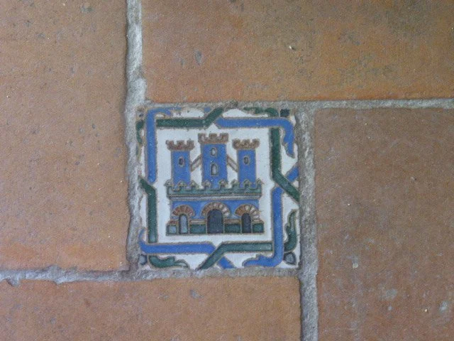
That trip to Seville gave some lovely quirky details:


Closer to home: under a railway bridge on the Hogsmill River near Kingston (left) and Eastbourne sea front (right).


Multi-media in Georgia (below left) and showing off in London’s Whitehall (below right).


Local materials: Surrey stone (pity they got the mortar too strong) and Surrey clay work - brick and tile hanging.


The Glencoe Creel House: constructed in local turf and heather (images © T Thompson).


Walls with messages:


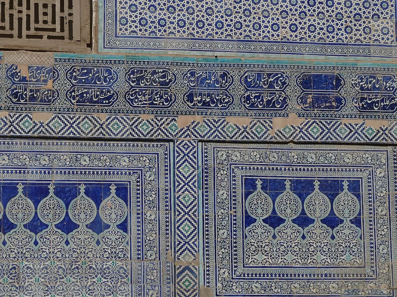
Heritage Walls: much admired today but these structures hint at dark histories.


These mud walls once said, ‘Keep Out’. But now they are ‘heritage’, tourists are more than welcome.
Khiva, Uzbekistan
And here is a Romanian warning, of the consequences of an ill-spent life. It’s all in the detail.


Happy springtime.

White Stuff
Cornish holidays: beauty, wildness, mystery. Crashing seas, coves, beaches, wind-swept uplands, lighthouses, fishing villages, smugglers, sea shanties, tales of adventure, romantic ruins and mineral extraction. Yep, it’s all part of that Cornish allure.

“Metal mining, especially for tin, is Cornwall’s greatest and most romantic industry…” (Richard Stanier, Cornwall’s Industrial Heritage, 2005). Where’s the romance in shanty towns, arsenic poisoning, deep mining and limited life expectancy (Blog 71)?
Well, precious little of course, but when industry becomes heritage, perception changes. Those “hundreds of roofless engine houses across the landscape” (Peter Stanier again) are an alluring hint of bygone times. But, as we noted in the ‘Tinners’ blog, tin mining not only left a landscape of iconic industrial archaeology, it also left very little obvious waste.
Not so Cornwall’s other “massively important” (more Stanier) mineral industry – China Clay. China clay extraction and processing changed the rural landscape from green to an often startling white, either as holes in the ground, or as conical heaps (sky tips) of waste materials. It had an enormous visual impact over a huge area. Characteristic of many areas of Cornwall, and yes iconic, but I suspect few find it romantic.
The internal environment created by China Clay processing could be very different, however, and the lives of the workers, though tough and physically exacting was probably very different to the life of a tin miner.
In Terroir’s school days, China Clay was always mentioned in secondary school geography lessons, although I have no memory of being told of its use in ceramics, merely as an additive to fabrics and toothpaste. I don’t think historical geography was well regarded then. I do remember references to ‘rotting granite’ which we thought was highly amusing. So a very quick summary of the history of china clay may be appropriate.
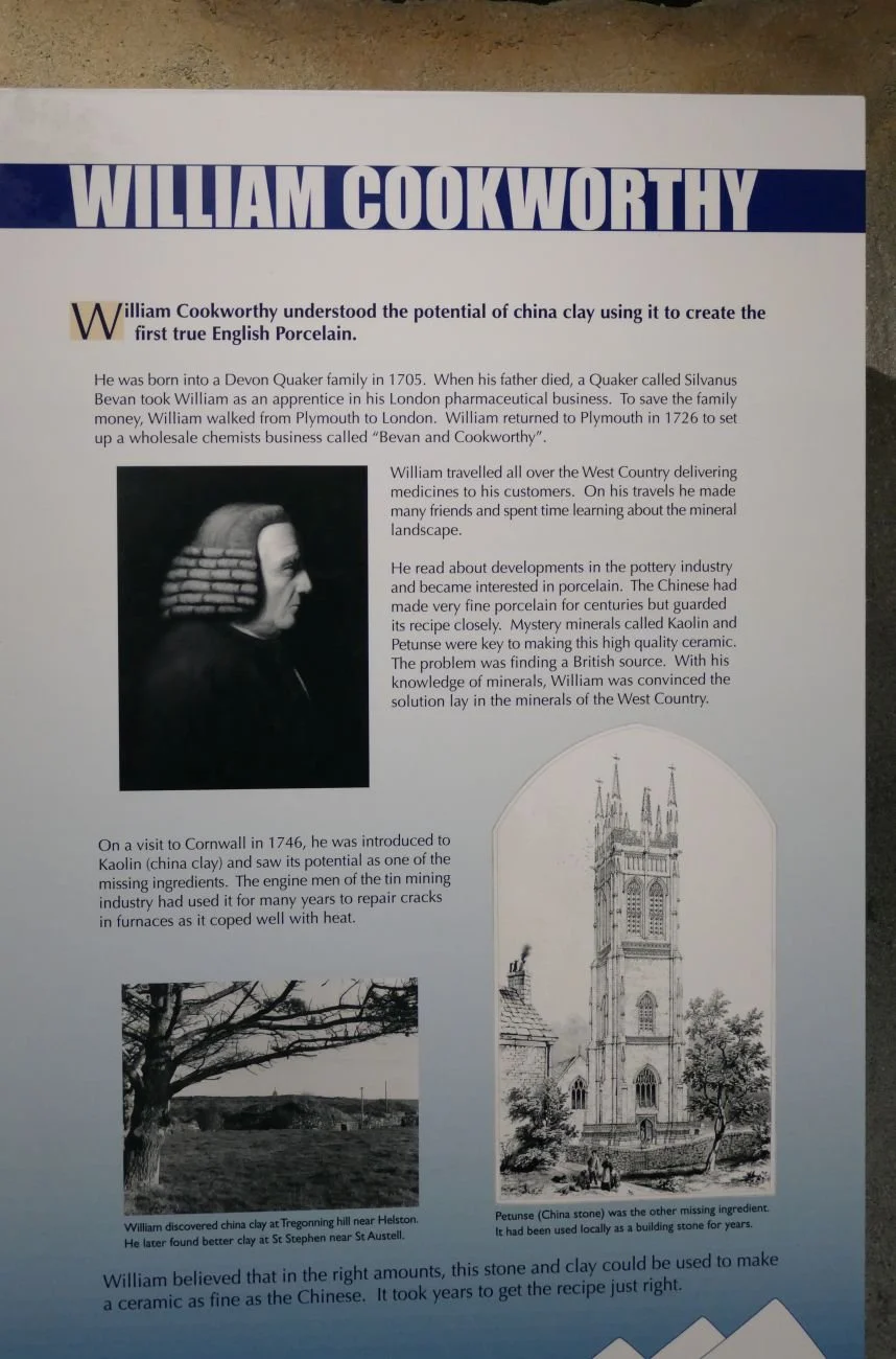
China clay or kaolin results from decomposition of feldspar in granite. The Chinese knew its ceramic properties centuries before Europeans got a handle on it. In Cornwall it had been used as a building material until a Plymouth Quaker apothecary, one William Cookworthy, produced ‘hard-paste’ porcelain and patented the mix in 1768. Naturally, he opened a pottery. Cookworthy’s partner later tried to extend the patent but the guys from Staffordshire, led by Josiah Wedgwood, broke the monopoly. Other uses were also found for kaolin and extraction expanded rapidly.

China clay was valuable enough to support a system based on extraction of vast quantities of raw material, followed by lengthy processing, to produce only a small amount of the final clay product. Around 90% of the material quarried is discarded as waste. Although the landscape impact was enormous, the processing details can be surprisingly beautiful. Our thanks to the Wheal Martyn Clay Works Museum (right) for showing us the processes involved and the technology created to undertake the journey from ‘rotting granite’ to porcelain, or indeed, paper and toothpaste.
The quantities required, and the softness of the raw material, meant that a flow of water was the simplest way of removing the kaolinised granite. Gravity fed water flows were soon replaced by hand held hoses, which later developed into the high pressure, serpent like, ‘Monitors’.


The clay slurry had then to be pumped from the pit to surface level. Initially water wheels provided the energy until replaced by steam powered pumps.


At Wheal Martyn, waste material – quartz, sand and rock - which couldn’t go up the slurry pump shaft, was sent up by skips on an inclined tram road. Here was the first load of spoil needing to be dumped.
Right: self tipping skip waggon, image courtesy of China Clay History Society
The slurry of clay, sand and mica, went to the sand ‘drags’, a system of gently sloping channels, which allowed the sand to settle out - and this spoil was discharged to the river.
Next the mica drags performed a similar job for the smaller mica particles, which were also discharged to the river, often mixed with a smidgeon of clay slurry; the rivers ran white as a result.
At Wheal Martyn, the pure clay slurry then entered the Blueing House (still with us?), was sieved through a wire mesh to remove leaves or other materials which may have dropped in, and a blue dye could be added, to hide any discolouration which would have reduced the value of the clay.
Next, the slurry flowed into the settling pits and clear water was drained off as the clay dropped to the bottom over a number of days. Once the clay was the consistency of single cream, the slurry was run into the settling tanks and the process repeated until the slurry was as thick as clotted cream. This could be a slow process.
Finally, the ‘cream’ flowed or was trucked into the pan kiln. This was lined with porous pan tiles which allowed heat from flues beneath the floor to rise upward and dry out the clay. At least the pan tiles at Wheal Martyn were made from waste clay and sand, but we doubt this made much of a difference to the volume of waste material to be dicarded.
The pan kiln at Wheal Martyn is remarkably well preserved and imaginatively interpreted. It reminded Terroir of hand made brick works, where the craft and skills of the individual brick makers belies the external mayhem of clay winning outside. Similarly at Wheal Martyn, the pre-mechanised, human scale of the clay processing presented craft skills and human endeavour which stand at odds with the large scale business of hauling china clay out of the ground.


The final product (in block form, or packed in casks or sacks) was stored in the linhay (pronounced ‘linny’), before dispatch to customers by road (impacting on the bypass-less local towns) or rail.
Image right: China Clay History Society
The human element was largely made up of men and boys, although women were employed to scrape clean the bottom and sides of air dried clay blocks.


Images above: China Clay History Society
The techniques shown above did not last, and increased mechanisation did nothing to reduce the quantity and quality of waste, stacked around the clay pits.


Images above: China Clay History Society
The industry continues today, of course. Many Victorian companies amalgamated into larger units, but around 70 producers still existed prior to WWI. Three of the largest - West of England and Great Beam Clay Co, Martin Brothers, and the North Cornwall China Clay Co – were amalgamated in 1919 to become English China Clays and, through further mergers and reorganisations the company survived the lean times before and after WWII. In 1999, the core of the company was purchase by Imetal, now known as Imerys. It’s signs are everywhere throughout the Cornish China clay territories.

Attitudes to waste disposal and restoration are, however, finally changing.
The most famous restoration scheme – The Eden Project – opened in 2001: “We bought an exhausted, steep-sided clay pit 60 metres deep, with no soil, 15 metres below the water table, and essentially gave it life.” (https://www.edenproject.com/mission/our-origins). The projects mission is to “create a movement that builds relationships between people and the natural world to demonstrate the power of working together for the benefit of all living things”. It is a significant player in Cornish Tourism.
Schemes in other areas have been less ambitious but our overwhelming experience of the 2022 Cornish China Clay landscape is of gentler land forms, of colour schemes now in a palette of browns, greens and yellows, of native species, grassy areas and new woodlands. Of ‘come in’, rather than ‘keep out’. It’s not perfect. But words such as ‘healing’ and ‘biodiversity’ come to mind. The iconic Cornish Alps have largely gone but a symbolic sky tip or two remain, although these, too, are turning from grey and white, to brown and green.


Is it romantic yet? Terroir thinks not. But we are hopeful that, one day, derelict 21st century wind turbines will be considered romantic - that is if we and the planet make it that far.

The Pool of London
On crossing London Bridge, one of Terroir’s parents would always look east to see what shipping was in the ‘Pool’. The Pool of London was always a bit of a mystery to the offspring. It looked just like a normal stretch of tidal Thames to us. But for a woman who had commuted to work in the City of London before, during and after WWII, and who had watched the bustle and vibrancy of the Thames wharves and docks from the top of London buses, the Pool of London would always hold a special place in her Londoner’s heart.

More recently – much more recently - Terroir took a visit to the Tower of London to see how the Superbloom was coming on (image right). More of that in future blogs, but the walk along the north bank of the Pool, from the Tower of London to London Bridge was like stroll along a historical transect from the medieval to the modern.

The Pool of London played an integral part in the growth of the City of London and has a long history of commerce, crime and social issues. Wikipedia gives a good summary. Originally, the Pool of London was the name given to the stretch of the Thames along Billingsgate. This is the stretch you can see from London Bridge and where HMS Belfast is moored.
And this was where ‘all imported cargoes had to be delivered for inspection and assessment by Customs Officers, giving the area the Elizabethan name of "Legal Quays".’ (https://en.wikipedia.org/wiki/Pool_of_London and https://en.wikipedia.org)
London Bridge, itself, prevented shipping from going any further up river but, as both overseas and ‘coastal’ trade increased, the concept of the Pool spread downriver, eventually reaching the Rotherhithe/Limehouse area. By the end of the 18th Century, with the slave trade and Caribbean colonies in full swing, the Pool could no longer cope with the volume of trade and shipping, and the first, off-river dock was constructed specifically for the West Indian trade. Other off-river docks followed, of course. The whole maritime commercial area, including the Pool, remained viable right into the 1950s despite damage caused during the Blitz.
Terroir walked along the north bank of the Pool of London (now part of the modern Thames Path) from the south west corner of the Tower of London to London Bridge. The map extract, below, shows what it all looked like in 1873. The Great Ditch of the Tower of London is just visible on the right, London Bridge on the left.

All map extracts reproduced with the permission of the National Library of Scotland' https://maps.nls.uk/index.html
Sugar Quay Wharf

Known as the Wool Quay in the 13th century, this wharf was the location of a building which was key to the Port of London: a custom house. In this case it was used to collect duties on exported wool. There were a number of iterations of this Custom House: a new building, overseen by the then Lord High Treasurer, William Paulet, was built around 1559, but was destroyed in the Great Fire of London in 1666.
Christopher Wren designed the replacement, which was constructed in the early 1670s, but fire hit again in 1715, necessitating a fourth rebuild. This one managed to function, unsinged, until the early 19th century and then, yes, a fire started in the house keeper’s quarters where, apparently, both spirits and gunpowder were stored (really?) and Customs House No 4 exploded. And people criticise modern Health and Safety Regulations. https://en.wikipedia.org/wiki/Sugar_Quay
By 1934, Wikipedia reports that the Batavia Line, which ran a steam ship passenger service between Rotterdam and London, was berthing its ships here. In 1970, Terry Farrell designed an office building for Tate and Lyle, but the final break from both shipping and sugar came with its conversion to a mixed use development in the 20 teens. Or maybe that statement isn’t quite true: the developer – CPC – was owned by the Candy Brothers.


Custom House

Custom House No 4 was doomed before it exploded. London’s maritime trade was booming and a larger Custom House was commissioned for the site adjacent to the one described above. Bear Quay, Crown Quay, Dice Quay and Horner's Quay were all subsumed by the new build, leaving a single Custom House Quay or Wharf.
Designed by architect David Laing, the new Custom House was completed in 1817. The building contained warehouses and offices, and the basement cellars (fireproofed) were used to store wine and spirits seized by the revenue men (https://en.wikipedia.org/wiki/Custom_House,_City_of_London).
The Custom House curse had yet to be appeased, however, and the building partially collapsed in 1825, when the timber pilings under the building caved in. Wikipedia reports that the building contractors “had grossly underestimated the cost of the work and had started to cut corners. The foundations were totally inadequate” and “questions were asked in Parliament”. Familiar? After rebuilding, no further disasters seem to have occurred, until the east wing was destroyed in the Blitz. It was later rebuilt behind a re-created historic façade.

The former Quays have gone but the building remains. It is listed grade I. Plans to convert the building into a hotel were rejected in 2020 and the project went to appeal early this year.


Billingsgate Market

As a market, Billingsgate started out as a general wholesale supplier of corn, coal, iron, wine, salt, pottery, fish and miscellaneous goods, and it wasn’t until the 16th century that it became for specifically associated with fish (https://www.cityoflondon.gov.uk/supporting-businesses/business-support-and-advice/wholesale-markets/billingsgate-market/history-of-billingsgate-market)
And it wasn’t until 1850 that the first market building was erected, to replace an array of market stalls and sheds. It quickly proved to be inadequate – this was the 19th century, after all, an era of constant change and expansion – and a new market building was erected in 1875, designed by City Architect Horace Jones and built by John Mowlem and Co.
Just as Covent Garden’s real estate was released when the Fruit and Vegetable Market moved to more spacious and accessible premises in 1974, so the fish market was removed to Docklands (the Isle of Dogs) in 1982. The Pool of London building – listed grade II - remains beside its Grade 1 Custom House neighbour, and was refurbished for office use by architects Richard Rogers. It is now a hospitality and events venue.


Grant’s Quay Wharf

We’ve called this section of the water front Grant’s Quay Wharf simply because this name features on one of the City of London’s signs.
From studying the historic maps – there is an excellent sequence at https://theundergroundmap.globalguide.org/article.html?id=34336&zoom=16&annum=2022 – this area appears to have resisted major redevelopment until the first half of the 20th century. 19th century maps appear to show a succession of narrow, bonded warehouses. Their northern elevations abut Lower Thames Street and cover the site of St Botolph's, Billingsgate, a church destroyed in the Great Fire of London and never rebuilt. To the south, the warehouses are just a road’s width away from the riverside quays and wharves with which they were intimately linked. Names include Fresh Wharf, Cox’s Quay, Hammonds Quay, Botolph Wharf, Nicholson’s Steam Packet Wharf, and at the eastern end next to Billingsgate Market, an ominously named residential street called Dark House Lane, which links to Summer’s Quay stairs.
By 1950, much has changed but the area still appears to be a working wharf. Not so today. The area is now a rather uncoordinated and largely uninspring development, which does little to reflect the lives and times of its riverside forebears.


Church of St Magnus the Martyr and London Bridge

Walking the Thames Path to London Bridge, you would hardly know that the parish church of St Magnus the Martyr is still squeezed in between the Bridge and the west end of the developments described above. As with St Botolph’s, St Magnus’ church was also destroyed in the Great Fire but was rebuilt by Wren in the 1670s and 80s.

Glance north as you approach the bridge and you will see the church spire fighting for vertical supremacy with the Monument, lamp posts and modern buildings.
The end of our historic transect reminds us of the importance of stairs in Thames-side life: stairs to reach the Watermen who ferried passengers to and fro, and up and down the river. Stairs which enabled mudlarking at low tide. And now a modern flight to enable Londoners and visitors to reach the Thames Path, its cafes, its views and its historic treasures.
Modern access between London Bridge and the northern riverside had been problematic for many years, but an elegant solution, in the form of a cantilevered, stainless steel, spiral staircase (designed by Bere:architects) was opened in 2016 and has revolutionised the Thames Path in this area. An honourable addition to the more traditional Thames stairs.


A Passage through Lyon
How much can you tell about a town through tourism?

When asked what we were going to do in Lyon, one of us replied, ‘sightseeing, eating and sleeping’. Another of us read a very out-of-date guide book before we left, but that was the sum total of our preparation.
So part of our plan for our two and two half days’ visit was made through the lens of the Tourist office, which provided us with maps, a tourist ‘access most areas’ card and a mini guide to what ‘Only Lyon’ suggested were the must-see sights. Thereafter it was all down to personal choice, based on the Tourist Office menu and our own particular interests. Did we achieve our goals and what did we learn about Lyon? As tourists we did well: ticks for enjoying ourselves, for sightseeing and for eating (as ever, sleeping was postponed). But what did we learn about Lyon?
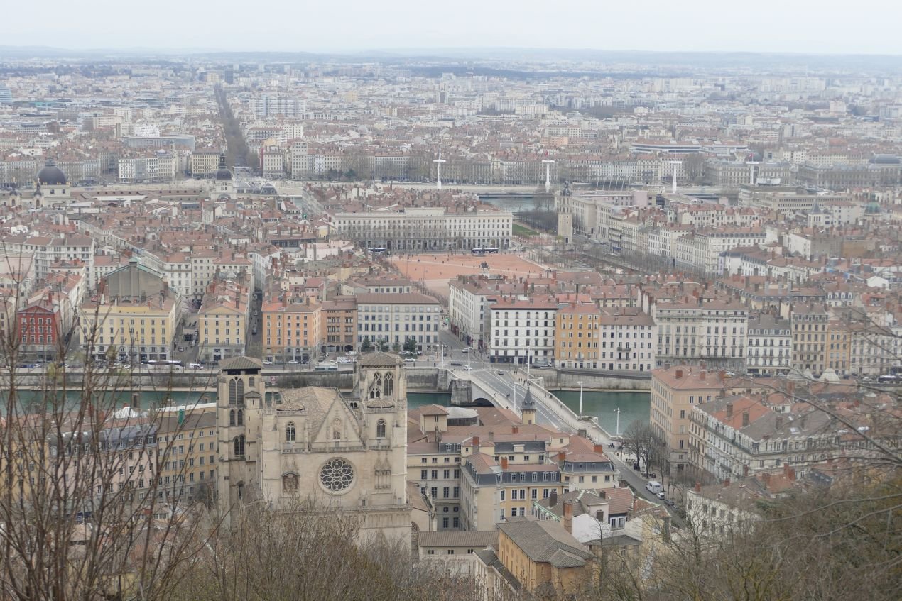
Our first lesson is that some things in French Society haven’t changed. A lot of places were closed on Monday, and Tuesday wasn’t a great day for post pandemic museums either. So personal choice and the tourist map featured early: two wide, sinuous rivers, a lot of cityscape exploring and one enormous park.


That Lyon is central to France is pretty obvious from the map. So is the fact that it is on the confluence of two significant rivers – the Rhône, and its less well known, and harder to pronounce neighbour, the Saône. If we had gone to any of the five museums dedicated to the history of Lyon, including the specialist stuff on the Romans, the Gauls and Christianity, then one might miss the fact that around 29 BC Marcus Agrippa set up the extraordinary network of roads (the Via Agrippa) which connected Roman Lyon (known as Lugdunum) to pretty much every part of what is now France. This is ‘Asterix’ territory and one suspects that Obelix was giving Agrippa grief. We also suspect that the use of BC is no longer PC, but as Christianity was also an important part of Lyon’s history, I hope we will be forgiven. Today, Lyon is still a hugely significant administrative, economic and financial centre.
So our early walks through Lyon, dictated by the location of railway station, hotel, rivers and park introduced us to the eastern banks of the Rhone and the post medieval city. Here is grid pattern cityscape, divided into administrative arrondissements and smaller local communities with their own local characteristics. The built environment is dense and angular too, like closely spaced cardboard boxes on end, decorated in the classic style of French domestic architecture, with the occasional modern redevlopment. Small open spaces appear at fairly regular intervals but larger parks are few and far between.


Of course, the French are comfortable, and very creative, with ‘hard’ open spaces and we saw some well-used and much appreciated areas with minimal ‘soft’ landscape. We could understand why the riverside water play was closed, but its appeal to youngsters on a hot summer’s day was obvious.


The exception to the small city green space is, of course, the Parc de la Tête D’Or which sits in a curve of the Rhone to the north of the centre ville. A classic in European Park provision, this once private landscape was purchased in 1856 to create a ‘nouvel et vaste espace’ for the people of Lyon.
It took paysagiste Denis Bühler 5 years to create this ‘manifique parc à l’anglaise’. Its mix of wide grassy spaces, lake, lake side walks, woodlands, botanic gardens and small zoo provide an eclectic mélange of landscape and recreational options. Imagine our surprise when none of the cafes was open. The Swiss duo of Denis and his brother Eugène Bühler created parks throughout France in the middle and late 19th century, including Lyon’s Jardin des Chartreux on the left back of the Saône immediately to the north of Lyon’s old town.
Generations of fallow deer have grazed the Parc de la Tête D’Or and have now been joined by a small zoo including giraffes and a large number of rescue turtles (see images below). The variable beige colour of the turtles (row 2, centre image) is not natural but due to a heavy, overnight, fall of Saharan dust. Those that stayed out all night are rather obvious.
Park trees include a couple of massive Taxodium distichum (swamp cyress) with their characteristic ‘knees’ poking up along side the main trunk. Those planted so generously around the United States Embassy in London, are mere toddlers compared with these. Planes are a hall mark of the Park and one of the oldest has been retained as a natural sculpture, close to the lake. More traditional statues are also a feature, as are the splendid gates which lead out on to the Avenue de Grande Bretagne. Madame is probably just doing some stretches (bottom row, right) but we prefer to view her as a modern day ‘Asterixe’


The narrow Presqu'île between the Rhône and the Saône (below left) forms a long narrow tongue dividing the mass of modern day Lyon on the east bank of the Rhône from the older medieval town on the west bank of the Saône. It is a busy area, and hosts the extensive open space of the Place Bellecour (home to the Tourist Office and an equestrian statue of Louis XIV, below right), Lyon’s other large railway station (Gare de Perrache), and numerous churches, museums, public buildings, cafes and restaurants. According to the tourist map, pretty much the whole area is designated as a Shopping Zone. This is tourism, I suppose.


The southern tip of the Presqu'île lies at the confluence of the two rivers. It’s somewhere you feel should go, but if your tourist programme doesn’t feature the Aquarium and the two museums located in this area, we get the feeling that it’s slightly off the beaten track. Most tourists will do as we did and press on over the River Saône to enter Vieux Lyon.
We mentioned in last week’s bog that Lyon is a silk city and it all started in this medieval town, perched under the hills which pinch the Saône into a tight curving valley before it finally exits into the Rhône. Here in Vieux Lyon are all the characteristics of an old town – narrow winding streets, small squares, medieval buildings, quaint shops and a mass of cafes and restaurants full of visitors.


Here too are Lyon’s famous Traboules, covered passageways which ran through the buildings and internal courtyards to link one street with another. Thought to have been first constructed in the 4th century, they provided short cuts to the river, to collect water, and later to transport textiles from workshops to merchants and ships by or on the river. They were probably use for silk workers’ meetings and, later, by the Lyon Resistance during WWII. They are spooky, often dark, and are intimidating to people (like us) who have a deeply ingrained sense of where we can and can’t go. Despite looking so private and providing intimate access to residents’ front doors, they are freely accessible to all.


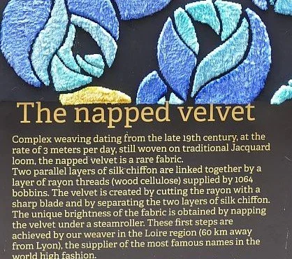
Silk became a significant part of the Lyon economy from the 15th century, but the industry waxed and waned for the next 500 years. The Silk Workers House, one museum we did manage to gain entry to, charts the history and technology of silk and has an extraordinary working display of the Jacquard loom which Wikipedia describes as ‘a mechanical loom that rapidly industrialized the process of producing silk’. Although the brocades and damasks produced by this method are stunning and the technology feels way ahead of its time – a punch card system installed on the top of a wooden loom, dictating the pattern to the weaver – the rate of production was around a third of a metre a day, and the financial risk lay entirely with the weaver.


We also went to the Lumière Cinema Museum, the Resistance and Deportation History Centre and the the Fine Arts Museum.


But there are huge holes in our knowledge of, and appreciation of, the city. Just a peek at the silk industry, no knowledge of Lyon’s printing heritage and, more to the point, a complete blank on modern architecture, the docks, the modern industrial areas and the banlieue.
Can you get under the skin of a city as a tourist? Of course not. Can you have a good time? You certainly can. Are we better informed about France’s third city? Well, just a bit. Will we need to go back? I hope so.
Oh yes – and the food. I don’t believe that French cuisine has declined. But I do now believe that British cooking has got a whole lot better.

Only Lyon
Yes, we’re sorry, our first trip abroad for nearly two and a half years and we only managed to get as far as Lyon.
In fact, this modest and self-deprecating blog title is actually Lyon’s badge of choice to head up its tourism offer. Why has Lyon – usually regarded as France’s third city – chosen such an unassuming logo? Of course ‘only’ is an anagram of Lyon. But it still didn’t make much sense to us. Perhaps we are supposed to think ‘only in Lyon will you find …’? On translating it back into French, however, we came up with ‘Uniquement Lyon’. Loses the anagram but we do feel it sells the destination a whole lot better. Stick with what you know? Translations can land you in trouble.
So what did we find in Only Lyon? Here are some of the quirkier bits.
We arrived by train. No not this station ….
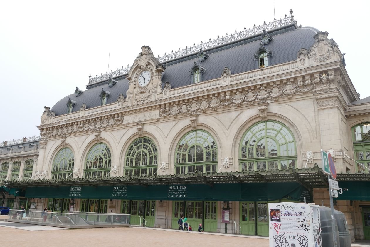

…. but a much newer one where the ‘Sortie’ currently discharges you straight into a chaotic building site .

Only Lyon then delivers you into the modern hell of a Westfield shopping centre.


It was a bad start, but things did improve. Lyon’s plane trees, for instance, are magnificent and, in our view, a really distinguishing feature of the city. Perhaps Plane Lyon instead of Only Lyon? But to British eyes, they do look as though they have been high pruned by the giraffes in the city zoo. There is also a very tall graffiti artist - or a very talented giraffe.


Younger plantings and a greater variety of species are beginning to take their place alongside the plane avenues. The city centre is densely built-up, but the rivers Rhône and Saône do provide opportunities to increase urban greening…


… as do the house boats, which line the river banks (below).


Choice of species can be interesting (Lyon is not alone in that of course). Spring is an exciting time in this Lyon suburb and the photograph (right) really doesn’t do justice to the migraine inducing colour combination. Further up the road, there is also an office block which does a thorough job of obscuring the views of the old town, below.
Labelling of larger new specimen trees appears in some places: usually informative (below left and centre) but not exclusively so (below right) and no, it’s not an avacado tree.


Another thing which Lyon does well is provision for two wheelers. Bicycles and electric scooters whizz around the city, often with children on the back (cycles), or in front (on the scooters). When the speed limit for the whole city drops to 30 k/h (around 20 mph) on the 1st April this year, two wheelers will have even more reason to smile. And again, there are some delightful consequences.


But our favourite quirky surprise, by far, is Ememem and ‘flacking’. Thanks to Wikipedia (https://en.wikipedia.org/wiki/Ememem) we now know that Ememem are a plural entity, live in Lyon, and go round at dead of night to create mosaics in cracked pavements and facades. ‘Flacking’, apparently derives from ‘flaquer’ (meaning a puddle, presumably linked to the holes in streets which Ememem’s artworks fill). In Lyon, the artist(s) have been dubbed le chirurgien des trottoirs, or the pavement surgeons and ememem refers to the sound of their moped. It’s a great city vibe.
They have also worked in Barcelona, Madrid, Turín, Oslo, Melbourne, Aberdeen and York, so you probably know all about them.


We will return to ‘Only Lyon’ in a future blog but we leave you today with a very Lyonnais poster which made us laugh out loud. Lyon was once a silk town (stand aside Macclesfield and Leek) and is rightly proud of its textile heritage. But it does need some linguistic help.


Collateral Consequences and the Brown Hart Gardens

During our research for the blog on Ukraine, we came across the quirky Brown Hart Gardens in London’s salubrious Mayfair. It’s just opposite the Ukrainian RC Cathedral, in Duke Street. For those of you who were watching television in the 1970’s, this is Duchess of Duke Street territory. For those of you who weren’t, here is a helpful link (https://en.wikipedia.org/wiki/The_Duchess_of_Duke_Street).
Wowed by the colourful, elevated and peaceful nature of the Gardens, we spent some time exploring and had lunch in the café. The sun was shining and the south facing benches quickly became popular. Others, like us, took photographs of the Cathedral. Unsurprisingly, in this area, it is part of the Grosvenor Estate, but why is it raised up, what is underneath it, why is it a garden and how did it become what it is today? The story of its Victorian beginnings and subsequent development would seem familiar to any design professional working now. Plus ça change, plus c'est la même chose.
Duke Street was not always the up market area it is today, despite its proximity to fashionable Grosvenor Square. The story of the Gardens appears to start in the late 19th century and a national outcry over the condition of working-class housing. In the Duke Street area of Mayfair, the Duke of Westminster was working with the Improved Industrial Dwellings Company (IIDC), to upgrade working-class living conditions on the Grosvenor estate.

The IIDC is variously described as a commercial company (www.nationalarchives.gov.uk) and a philanthropic model dwellings company (https://en.wikipedia.org/wiki/The_Improved_Industrial_Dwellings_Company), which developed high density housing blocks for artisans. Either way, the company needed to turn a profit and at Duke Street seems to have achieved this via a strict code of conduct for tenants, and reduced ground rents from the Duke. References to the building designs being developed by a surveyor rather than architects, raised a wry Terroir smile.
For fascinating and more detailed stuff on finances, planning, urban design and other aspects of social housing provision around Duke Street, we recommend an absorbing article at https://www.waymarking.com/waymarks/WMD779_1892_Moore_Buildings_Gilbert_Street_London_UK.
In addition to better housing, the Duke of Westminster also wished to improve the new estate with a coffee tavern, possible to counteract the influence of the numerous public houses in the area, and a spacious community garden to occupy an entire block between Brown Street and Hart Street.
The 1870 Ordnance Survey map (below), illustrates the high density townscape prior to redevelopment. The red ring sourrounds the Brown and Hart Street block. You may be able to pick out the two public houses within this area and a further three within a minute’s walk.

Reproduced with the permission of the National Library of Scotland' https://maps.nls.uk/index.html
The new garden was designed by Joseph Meston (assistant to Robert Marnock of gardenesque school fame) and was constructed in 1889. It appears on the Ordnance Survey plan of 1895 (below), complete with drinking fountain and urinal. We have yet to locate the position of the coffee tavern; if you know where it was, please let us know. Only one public house appears to remain.
The whole housing development was by built out by 1892; Peabody is now the social housing custodian. The Congregational Chapel to the north east of the new garden (built 1891, designed by Alfred Waterhouse of Natural History Museum and Manchester Town Hall Fame), was sold to the Ukranian Catholic Church in 1967.

Reproduced with the permission of the National Library of Scotland' https://maps.nls.uk/index.html
The original 1889 garden was clearly at ground level, but survived in that state for little more than a decade, thanks to the Westminster Electricity Supply Corporation. Having worked in the area in the 1890s, the Corporation approached the Grosvenor Estate again to build an electricity substation on the site of the gardens. The proposal involved a large, 7’ high transformer chamber plus housing, with the garden relocated on the roof. Eyebrows were raised, it seems, but complaints had also been growing about the garden, including reference to “disorderly boys”, “verminous women” and “tramps”, and agreement to develop was reached in 1902. “The substation was completed in 1905 to the design of C. Stanley Peach in a Baroque style from Portland stone featuring a pavilion and steps at either end, a balustrade and Diocletian windows along the sides to light the galleries of the engine rooms”. (https://www.waymarking.com/waymarks/WMPN21_Duke_Street_Electricity_Sub_station_Brown_Hart_Gardens_London_UK).
Peach specialised in the design of electricity structures, although it seems that the Grosvenor Estate surveyor had quite a lot to do with realising the final configuration of this one. Again, I suspect that we have all seen dramas like that. It is, however, a quite remarkable - and adaptable - structure despite urban clutter disguising some of its grandeur when viewed from the east (below right).


The garden was replaced as promised, with paving and trees in tubs, and was re-opened in 1906. Little seems to be recorded of its 20th century story and it was closed in the 1980s “by the then lessees, the London Electricity Board”, reopening again, briefly, in 2007.
Brown Hart Gardens’ current appearance, described by Grosvenor Estates as “A rejuvenated oasis in the heart of London” is due to – guess what – another regeneration scheme for this part of Mayfair. We are not knocking this; how can an area, last subject to a major refurb in the 1880s, still be fit for use in the 21st century?
The brief, to “rejuvenate a public space over a Grade II listed substation” and “create and manage a beautiful and flexible space to benefit the people who live in, work in, or visit the area” (https://www.bdp.com/en/projects/a-e/brown-hart-gardens/) appears to have been achieved, if one can make that judgement based on a single visit. BDP, a multidisciplinary design consultancy were commissioned to undertake the project and completed the gardens in 2013. Unless there has been another revamp which we don’t know about, it’s wearing well and is beautifully maintained.

Approaching from the Ukrainian end, so to speak, you can be forgiven for thinking that the Gardens are a lofty children’s play area. Climbing through the primary colour tubes to deck level, however, you discover that the space has been designed to appeal to the inner child of all ages - even those who just wish to sit and contemplate.
The piped swirl of colour with its convolvulus flowers looks complicated, but is actually very simple to negotiate or to enter if you want to sit in the middle of it. Once through, the key elements are wooden planting cubes dotted like a board game over the limestone paving, plenty of seats to await your turn to play, a modern café at one end and a discrete but effective water feature which has replaced one of the original stone seats.
Apparently the perimeter planters contain lights and power units and the central planters and seats can be moved around to create different patterns or simply to capture your opponent’s combative rook.
Below: a selection of surprising, attractive and amusing planters.


The overall effect in early spring sunshine is playful, relaxing, surprising, and delightfully isolated from the hurly burly below and beyond. It is a place to sit and read, admire the view, enjoy the plants, talk to neighbours, meet friends, watch the water flow and recharge the batteries (pun intended).

The cafe suits the space pretty well, but that inverted roof angle? Fine when viewed from the gardens but does the side elevation really work with Peach’s
pavillion canopies!?

SUPPORT UKRAINE
“Every day checking on the news with dread in case things are even worse... Feel so helpless.” MT

It is tempting to end the blog at this point, with these simple messages and images. But the issues relating to Ukraine and Russia are complex (what an understatement) and deserve at least a modicum of discussion.
Terroir has no specialist knowledge on the geography, history or politics of Ukraine. We have not even been there, although we have visited Bulgaria, Romania and, briefly, Russia (just Moscow and St Petersburg). So nothing qualifies us to talk with any sort of first-hand experience. A review of even the briefest histories of Ukraine and Russia has left us overwhelmed and confused. So what to do?
We decided to approach friends and family via email or WhatsApp. We asked if the recipient had been to Ukraine and what they felt we should do about current situation, either individually or as a nation. By this means we contacted well over 70 people. Thank you to everyone we pestered and a special thank you to those who responded in time to influence the content of this blog.


The unanimous suggestion for individual action was GIVE MONEY
. The Disasters Emergency Commitee (DEC) link is below but there are plenty of other options.
Image right: poster on door of Ukranian RC Cathedral, Duke Street, London
Other suggestions, in order of popularity, were:
More sanctions: there were many references to gas and oil but some went further - “By this [sanctions] I mean severing aLL trade with Russia (and not just the bits that suit us) … . Of course this would raise prices and probably shortages here but that's a price worth paying I think” TT. “My biggest worry is that the issue will fade into the background not to mention the people who will not make a sacrifice of their own to help the people of Ukraine (Higher prices for food, fuel, etc).” MK

Refugees: speed up/simplify visa applications system for refugees (“It would be nice if our government could stop being such bastards over visas“ PT), take in more refugees and help and support the refugees who get to the UK. “I think that, as a country, we would like to think that we will give a warm welcome to refugees but the actuality throughout history has not been at all the same“ DG. “We could have a family here. Plenty of room but they need their own country.” PM

Action against Russian money in UK: “deployment of the wealth of oligarchs supporting Putin to benefit the people of Ukraine” RW
Send supplies: send weapons; send items which Ukrainians actually need; sending money is more efficient.
NATO: don’t get NATO involved; get NATO involved in humanitarian work
No fly zone: impose and enforce.
Communication: strengthen diplomatic links; communicate with Russia via channels the people would trust. Works both ways though: “[Russian friend produced an article by] a famous journalist [John Pilger] which basically said everything that was happening could be laid at the feet of the West. I’m sure there is some truth in what he says but whatever the evils and decadence and weakness and mistakes of the West, there is surely only one person responsible for what is happening and that is Putin.” SC
Prayer: keep Ukraine in our thoughts/prayers


Safe Corridors: “probably wishful thinking, but create or improve safe corridors which lead to the places where Ukrainians wish to go” HN
British Government: all comments critical and mostly unprintable
Putin: again, largely unprintable but – “Putin is a man obsessed surrounded by brutal people who are keeping him there in their own self interest.” PM; “abolish toxic masculinity” RW.
There are other views though: “I cannot help but feel sorry for the people of Russia whose country will carry the guilt for Putin’s actions.” DG. “The Russians we know in the UK are as shocked as we are.” LD


Talking to others with a knowledge of Russian history, Terroir has begun to realise that the world cannot afford to ignore Russia’s feelings of insecurity, an emotion which often underpins antisocial actions. Terroir put this to a friend who has visited both Ukraine and Russia on numerous occasions, and we are deeply indebted to his response, excerpts of which we reproduce below:
“I'm trying to keep in touch with my Russian friends - those I have heard of I am sure are horrified about what is going on, although they are expressing it somewhat obliquely - partly I suspect because it’s very dangerous to say outright that the war is wrong, and partly because that's what Russians do anyway! But my friends are intellectuals and western looking, mostly in St Petersburg, the " window on the west", [and] have visited US, UK and other European countries - if they were English they would read the Guardian. Much harder to tell what the poorly educated Russian in the heartland thinks, who only get their information from Russia's answer to the Daily Mail and Fox News.
I think the importance of Russian insecurity, even paranoia, is not understood or discussed enough in the West. Anyone over 40 who grew up in Russia, grew up being told that the West were nasty imperialists out to do down the USSR. This was the world Putin was brought up in - he was in the KGB … . Russia went from being the top dog in an empire covering a third of the world to a single country with a collapsed economy. I remember when in the 1990's we were celebrating Russian Independence Day my friend Yuri, then in his 60's said ‘Independent from whom?’, even though he had been a dissident because of his interest in psychoanalysis and as he put it to me once " had been treated as a non-person"
In the 1990's and 2000's The West reached out to the Baltic states and Eastern European countries, but much less so to Russia - why did we not invite them to join NATO in 1995? Someone said that Russia now must feel as people in the UK would have felt in the late 20th century if Germany, Belgium and the Netherlands had all joined the Warsaw pact.
Going further back Russia has nearly always been governed by autocrats who combined incompetence with malevolence - Putin is in the tradition of most of the 19th and early 20th century Tsars, Lenin and Stalin.
Although most of the Ukrainians I met were proudly Ukrainian … the way the Government has flipped between Russia leaning and West leaning in the last 30 years suggests that there are probably divisions within the population - and we know there are many in Crimea and the East who want to be Russian.
None of this excuses Putin but it might help to understand what is going on.” https://sites.google.com/site/peterdtoon/

Help Ukraine to a good future.
Please donate to https://donation.dec.org.uk/ukraine-humanitarian-appeal
© Y Fontanel

Tinners
Four of us were gathered together this week (celebrating St David’s Day), and one of us asked what Cornwall meant to each of us.
Here are the responses:
Tintagel Castle, The Eden Project and St Mawes
China clay moonscapes and clotted cream
Cliffs and wild coasts, holiday homes and Posy Simmonds cartoons
Arsenic


Arsenic: how very perceptive.
As our collective list shows, Cornwall is good on memorable and iconic landscapes. Go to the home page of the Cornwall Area of Outstanding Natural Beauty and you will see a moody and romantic image of a tin mine engine house and stack, perched on the edge of a rugged coastal cliffs (https://www.cornwall-aonb.gov.uk/). These structures are symbolic of ‘an extended period of industrial expansion and prolific innovation’ (https://whc.unesco.org/en/list/1215/) which contributed enormously, not only to the landscape of Cornwall, but also to the industrial revolution, the British economy, to mining around the world and, of course, climate change.


The long term impact of mining and industrialisation on the planet was probably impossible to imagine during the heady years of technological development, sizeable profit margins and world-wide influence. But there were other issues, however, which could and should have been recognised at the time. Arsenic was just one of these.
Let’s go back to the beginning. Mining has a very long history in Cornwall, probably starting in the Bronze Age. Medieval mining of tin was so significant in the south west that separate Stannary Courts and Parliaments were set up in Devon and Cornwall in the early 14th century. The UNESCO world heritage site ‘Cornish and West Devon Mining Landscape’ (granted in 2006) focuses on the period from 1700 to 1914, and specifically mentions the significance of the ‘remains of mines, engines houses, smallholdings, ports, harbours, canals, railways, tramroads, and industries allied to mining, along with new towns and villages’. Of such fragments are romantic landscapes created.


Terroir’s induction into Cornish Tin Mining was provided by the Geevor Tin Mine (https://geevor.com/), on the north Cornish coast, near the villages of Pendeen and Boscaswell. It is part of the St Just Mining Area and the site is now run by Pendeen Community Heritage. Ironically, Geevor is a ‘modern’ mine established around 1906 and expanded significantly after World War I. The mine closed in 1990 and the pumps, which drained the mine, were switched off in 1991. Despite its modernity by UNESCO standards, the mine describes itself as the ‘Key Centre within the Cornish Mining World Heritage Site’. But, of course, if there were plenty of earlier mines remaining, with which to interpret Cornwall’s mining history, there might be no need for a World Heritage Site.
It took us two mornings to get our heads around the vocabulary of developers, stopers and samplers; of cross cuts, lodes, drives, pillars and box holes; of wagons, locomotives, rocker shovels, skips and, of course the grizzly. We learnt to interpret the photographs of young men, stripped to the waste, undertaking gruelling, skilled, manual labour in hot, deep, cramped, under-sea, mining levels. We began to understand the efficiencies brought by Trevithick’s steam technology (in, for instance, economics of production, and in underground safety through water pumping, ventilation and personnel transport) and the increased impact of steam-driven mining on Cornwall and around the world. We got a handle on the complexities of processing the ore to a marketable product which could be sold on to manufacturers. And we began to understand the cost in human life in winning, processing and supporting the entire industry.
Below:
Upper and middle row - a historical range of mining technology
Lower row - views of the Geevor Mine processing area


Below left: a model of the 20th century shaft and winding gear as it once was, and will be again. Below right: the winding gear currently under repair.

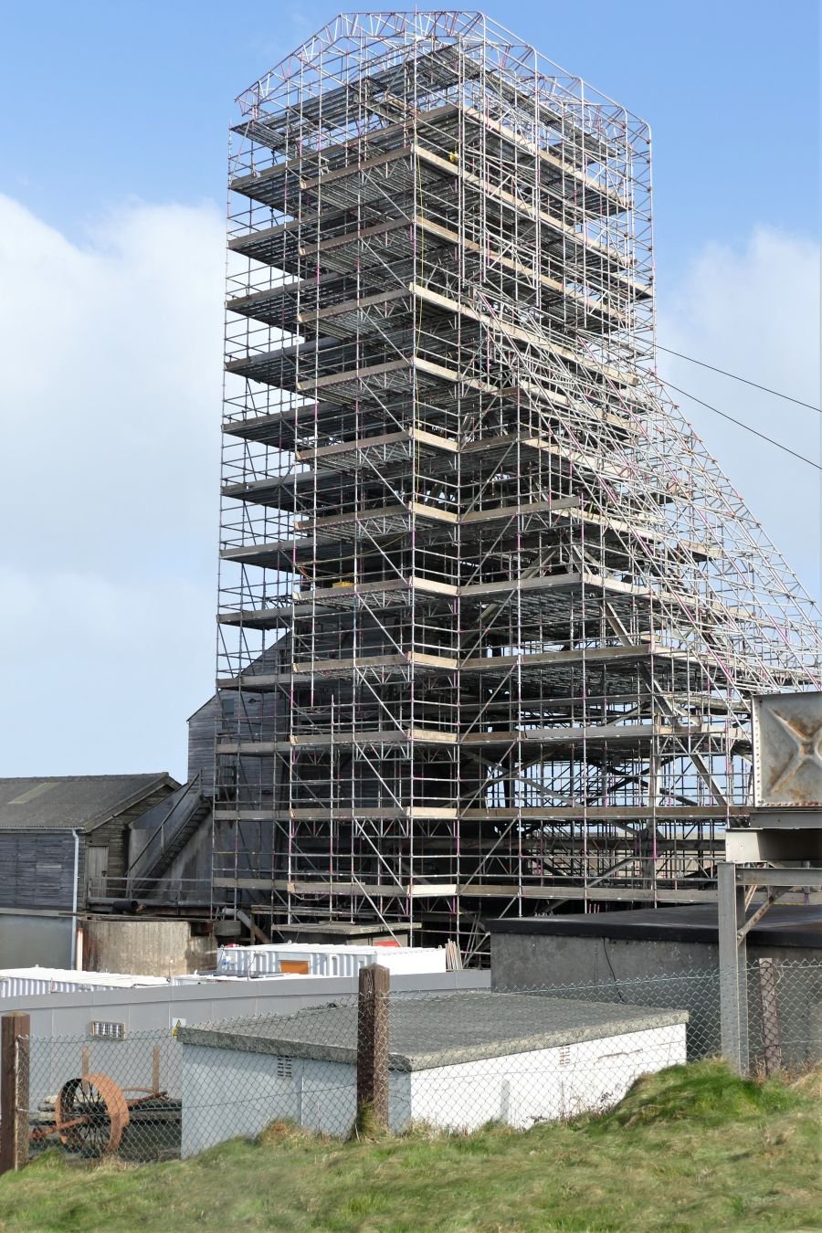
Despite this growing understanding of mining issues, the landscape around Geevor Mine seemed surprisingly innocent.


But, as a guide explained to us, the expanses of waste gravels and green fields below us would once have been occupied by extraction paraphenalia and a shanty town housing miners and all the ancillary workers who serviced the pre 20th century mines – candle makers, charcoal-burners, carpenters, smiths, smelters, carters, chandlers, shop keepers, ale-house keepers, and so on. Even in the 20th century (below right), it would have been a busy area.


The stonehenge style kit on the left, by the way, is the remains of the stamps, the steam-powered ore crushers which would have thudded relentlessy, 24 hours a day.
All the rest is gone now, leaving just these romantic ruins…


But how wonderful to be working in an industry which leaves no massive scars, no starkly white China clay pyramids, no coal heaps, no shale bings, no slag heaps. All the ‘arisings’ from tin mining can be sold on as aggregate for construction, can they not? Well, maybe only after technological developments made it worth reprocessing the waste rock heaps for the tin they still contained, while chucking the unsaleable rubbish into the sea.

And we are not just talking tin here. Tin and iron come up as an oxide, accompanied by sulphide minerals such as copper, zinc, lead, bismuth, antimony and, yes, the mineral beloved of murder mysteries, arsenic.
Arsenic became a saleable bi-product of tin mining and, in the 19th century, was processed by burning in a calciner which trapped the arsenic as soot. Children were often employed to scrape it out of the chamber and chimney. Our guide explained that despite wearing an early forerunner of PPE, most of these children never lived beyond their teens. Miners’ life expectancy was also short – perhaps into their twenties and thirties. It seems likely that, in these polluted and impoverished living conditions, a woman’s life expectancy was also limited. As so often, our romantic landscapes are built on the problems of the past.
And you still want to know what a grizzly is? It’s a set of parallel steel bars used to sieve out the large chunks of ore. Gravity sent the small stuff through the bars into the skip loading boxes below. The grizzly man had to break up the larger stuff with a hammer.

Lighthouse Lizard

Cornwall is famous for its stories but, as with all good tales, they change with the passing of time. Even the Cornish Wreckers are now being subjected to rehabilitation, as Terroir discovered on a visit to the Lizard Lighthouse.
There’s a lot going on at the Lizard Peninsula. Three main landowners (National Trust, Cornwall Wildlife Trust, Natural England) and an absence of fences, enhance the feeling of a windblown wilderness. It’s host to a large, if somewhat fragmented National Nature Reserve, forms an important part of the equally fragmented Cornwall Area of Outstanding Natural Beauty and is fringed with crashing seas, rocks, cliffs and, for those with a head for heights, the South West Coast Path. Lizard Point is also the southern-most tip of Britain and home to our southern-most lighthouse - and self-catering holiday let.

Our visit to the lighthouse was made the more dramatic by being sandwiched between storms Eunice and Franklin. You would think that there would be nothing much to blow over but even Trinity House does overgrown suburban windbreaks.
The first Lizard lighthouse was completed in 1619 (https://www.trinityhouse.co.uk/lighthouses-and-lightvessels/lizard-lighthouse), over a decade before warning braziers were constructed on the South Foreland in Kent, overlooking the Goodwin Sands (https://www.nationaltrust.org.uk/south-foreland-lighthouse/features/the-history-of-the-lighthouse-) and many years before the first Eddystone light was operative in 1699 (https://www.britannica.com/topic/Eddystone-Lighthouse-Eddystone-Rocks-English-Channel).
This early lighthouse was built by one John Killigrew who, despite opposition from local villagers (who foresaw a steep decline in income from shipwrecks), was granted a patent to construct a warning of hazardous waters, provided that the light was extinguished at the approach of ‘the enemy’. It was described as being, ‘a great benefit to mariners’, but as the ship owners refused to contribute to its upkeep, the bankrupt Killigrew was forced to demolish his philanthropic venture some 20 years later.
Peter Stanier’s ‘Cornwall’s Industrial Heritage’ notes that it was a “private lighthouse … opposed by Trinity House and local wreckers.” Trinity House says, “Many stories are told of the activities of wreckers around our coasts, most of which are grossly exaggerated, but small communities occasionally and sometimes officially benefited from the spoils of shipwrecks, and petitions for lighthouses were, in certain cases, rejected on the strength of local opinion; this was particularly true in the South West of England”. How tactful (Terroir’s highlighting). On this subject, we can also recommend a ‘Stories in Stone’ video at https://www.youtube.com/watch?v=BdKHi4JYrag.
Whatever the reason, subsequent lighthouse applications failed until, in 1748, Trinity House supported local landowner Thomas Fonnereau, in a successful lighthouse bid. The building (in operation by 1752) consisted of two towers with a cottage between them, which had a window facing each tower. Coal fires were lit on the towers, and required bellows-blowers to keep the fires burning brightly; if the fires dimmed, an overseer in the cottage would encourage their endeavours with a blast from a cow horn.
Trinity House took over responsibility for the lights in 1771, and, in 1811, replaced the coal fires with oil lights. Three additional cottages were also constructed in 1845. But the biggest change occurred with the construction of an engine room, in 1874, using “caloric engines and dynamos” to power the light and a new fog horn. Even more staff were required so more cottages followed. In 1903, a high powered rotating carbon arc light was installed on the east tower, thus eliminating the need for any light on the west tower. The arc light was replaced with an electric filament lamp in 1936. LEDs will follow soon. Automation arrived in 1998, and the resident lighthouse keepers worked their final shift.
The engine room is now a Heritage Centre, thanks to the Heritage Lottery Fund. Exhibits range from, unsurprisingly, engineering and lamps (see below), to communications, living and working conditions and a soft play area for trial constructions of your own lighthouse tower.


The tour of the lighthouse is a must, led by Hamish the cat (no longer the kitten as noted in his job description) and assisted by a guide who one suspects is descended from those who “officially benefited from the spoils of shipwrecks”, certainly knew the light house keepers, and came suitably attired in hat, coat and bright red Wellington boots. She entertained and informed an assorted rabble of adults, children and adolescent cat, with delightful and diverting composure.
Right: Puss-in-carrier and Wonder-Women-Guide-in-Boots
The lighting system currently consists of the most magnificent four panel rotating optic which was installed in 1903. These magnificent panels, framed in Cornish granite, and, according to Wonder-Woman-Guide, resting in a tank of mercury, rotate continuously. To non-physicists like Terroir, the optics seem to represent some of the best and simplest of art nouveau, but presumably this is merely an illusion based on association with the date they were installed. We were also captivated by our guide’s allusion to the history which these lenses would have illuminated, including the passage of the Titanic on her way to meet her iceberg fate.


Such was the intensity of the light, that the rotating beam provided night long illumination, upsetting both the local ecology and the local inhabitants. As a result, a blackout was provided for the lantern room window closest to the village.

The change to electric filament lamps also allows for a simple back-up, should the ‘duty’ lamp fail before it is due to be changed. If you peer closely at the image (right) you may be able to detect a vertical lamp (the ‘duty’ lamp, in Terroir parlance) and the horizontal back up lamp.
Since automation, the back up lamp can be raised into position remotely, by the Trinity House depot in Harwich. A further back up is also available for the ultimate unexpected event. A couple of other items, no longer required but still in situ, are illustrated below.


And why does the optic rotate continuously? We have heard at least two convincing explanations: due to the structure of the lenses, a static optic, bathed in sunlight, could cause a pretty nasty fire. In addition, an optic system which has been in operation continuously since 1903, just might fail to start again.

Southern-most tip of Britain. Southern-most light house. But what about those holiday cottages? The southern-most crown is claimed by the nearby, converted Lloyds’ signal station, built in 1872 to provide communications between passing shipping and Lloyds of London (white building, just visible, right). But six of the Lighthouse cottages are also holiday lets, available via the National Trust. Terroir feels that the ‘most southerly status’ is probably theirs.

Memorial Landscapes
Early in 2014, the then Prime Minister, David Cameron, set up a Holocaust Commission, to “ensure that the memory and the lessons of the Holocaust are never forgotten and that the legacy of survivors lives on for generation after generation“. https://assets.publishing.service.gov.uk/government/uploads/system/uploads/attachment_data/file/398645/Holocaust_Commission_Report_Britains_promise_to_remember.pdf
The brief was threefold: to create a striking and prominent new national memorial, to collect and record the testimony of the diminishing numbers of holocaust survivors, and to create a world class learning centre to enable others to understand and learn from that legacy.
Led by Mick (Sir Michael) Davis, the Commission’s report was published in 2015 and suggested three potential locations for a memorial and learning centre. These were The Imperial War Museum London, Potters Field (a site between Tower Bridge and the former London City Hall) and a site on Millbank, close to Tate Britain. The blue touch paper had been lit. The debate on where and what the new national memorial should be, has been raging ever since.
In 2016, and seemingly out of nowhere, Victoria Tower Gardens, immediately to the south of the Houses of Parliament, was put forward as a possible Holocaust Memorial site.
After an international design competition, the commission was awarded, unanimously, to a team led by Adjaye Associates and Ron Arad Architects. This was in September 2017.

The design - a massive line up of 23 bronze fins - was heavily criticised for, amongst other things, its size, its dominance over its setting and also because it looked remarkably similar to the design Adjaye Associates had submitted for Canada's National Holocaust Monument (it didn’t win).
Above - visualisation of Adjaye Associates’s design in situ at Victoria Tower Gardens
The idea of placing the monument in Victoria Tower Gardens (a mere 2.5 ha of well used public park) created a veritable storm of comment and criticism from all quarters.
As you can imagine, the planning process was a nightmare. A planning application was submitted at the end of 2018, followed by revisions in 2019. The application was subsequently ‘called in’ for a public inquiry, immediately before Westminster City Council’s planning meeting - where the application was unanimously refused. The public inquiry was held (remotely) in 2020 and, following the Inspector’s recommendation, planning permission was finally granted by Communities Secretary Robert Jenrick MP, in July 2021. By the September, The London Gardens Trust had launched a challenge on the basis that decision-makers failed to properly consider the impacts of the development (https://londongardenstrust.org/campaigns/victoria-tower-gardens/). The resulting Judicial Review will take place next week on the 22nd and 23rd of February.
Let’s take a look at the Gardens. Victoria Tower Gardens are designated Grade II on the Historic England Register of Parks and Gardens (https://historicengland.org.uk/listing/the-list/list-entry/1000845?section=official-listing). After construction of the Houses of Parliament, the site of the park was ‘occupied by wharves, a cement works, an oil factory, and flour mills’. Terroir can imagine that this was felt to be an inappropriate neighbour to Barry and Pugin’s Parliamentary construction and, by 1879, money had been found to lay out a public park.


Both images reproduced with the permission of the National Library of Scotland' https://maps.nls.uk/index.html
Let’s take a walk. At around 2.5 ha (6 acres) it is extraordinary what elements are contained within it, and what socially valuable functions it provides.

From a distance, and dwarfed by Parliament’s Victoria Tower, it appears to be small, flat and grassy. Perhaps the ideal space for a physically large memorial of international and historic significance.
But approaching over Lambeth Bridge towards the south end of the park, its true values begin to unfold.
First up is the playground, in use even on a chilly, February, term time weekday morning. From the play equipment (see right hand images below) this is, obviously, Horseferry Playground!


Beyond the slide and half submerged horses, the Gardens open out onto a wide, grassy space, framed by statuesque plane trees and book-ended by stunning vistas of Parliament. Surely the perfect spot for a memorial? The size of the proposed memorial structure is such that this ‘space’ and the views to it, from it and within it, would be dominated by the giant bronze fins. Terroir suggests that the Victoria Tower Gardens would become the Holocaust Memorial Apron, no longer a park in its own right, and cut off from the symbol of democracy which gave birth to the park. In other words, a piece of green heritage would be destoyed to create an, albeit very significant, memorial. Which should take priority? Well, the Holocaust Memorial doesn’t have to go here. Victoria Tower Gardens, by definition, does.


The first three images (above) reveal the Victoria Tower and Houses of Parliament in all their glory. Already the view has been compromised by the low level Education Centre, with its station platform outline - alien to the pattern and shapes of the architecture behind it and only slightly mitigated by its green roof. The fourth view (right) look south towards the Buxton Memorial and the apex of the triangular park. All views would be obliterated or radically changed if the Holocaust Memorial was built here.
But, I hear you cry, it’s just a small area of lawn, with hardly anyone using it. Remember this a February morning. Think about spring lunchtimes; sunny after school time; sun bathing weekends; evening promenades; a space for tourists, workers, local inhabitants, politicians, school children, teenagers, the retired, dog walkers, strollers. It’s not just the London Gardens Trust which is opposing this proposal. Take a look at the Save Victoria Tower Gardens Park website (https://www.savevictoriatowergardens.co.uk/), or the Thorney Island Society (https://thethorneyislandsociety.org.uk/ttis/). This is a much loved and well used park. Sufficient size for its current community? A tranquil space? Think what it would be like with the addition of the significant number of visitors likely to be attracted to a Holocaust Memorial of the proposed scale and significance.


The adjacent Thames (above) adds much to the Gardens. The waterscape becomes an intrinsic part of the park itself - including the views outward to London landmarks - but also makes the open space feel larger and the Embankment, with its mature plane trees, provides a seductive promenade and sitting area.
The park planting, although not ‘in your face’ spectacular, no doubt provides all round seasonal delight. A glimpse of February’s charms (below) was very welcome.


But wait a minute - isn’t this a Memorial Park already? Indeed it is. There are three memorials located here and all touch on human rights and democracy.

The Buxton Memorial Fountain (left) commemorates the emancipation of slaves and the contribution of some key anti-slavery campaigners. Designed by Samuel Sanders Teulon, it was first installed on the edge of Parliament Square in 1865, removed in 1949 and finally reinstated in Victoria Tower Gardens in 1957. The base is granite and limestone, and the mosaic decoration and enamelled roof are, in Terroir’s view, particularly attractive.
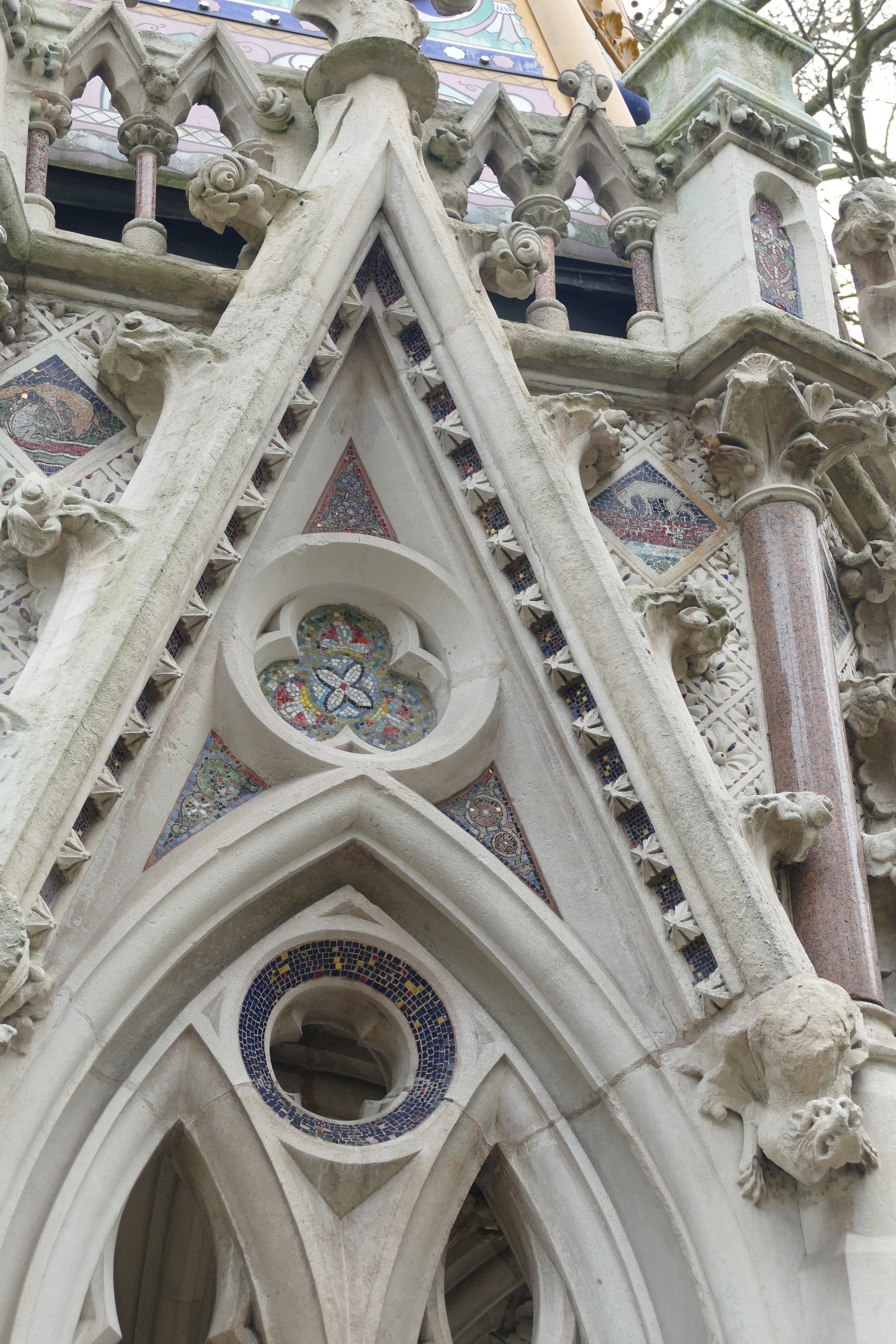


The Burghers of Calais (right), a cast of Rodin’s powerful 1889 sculpture, despicts the six leading citizens of Calais who agreed, in 1347, to surrender the keys of the town, and their own lives, to Edward III in return for an end to King Edward’s 11 month siege, and sparing the lives of the rest of the town’s people.
The story goes that the Burghers’ lives were also spared by the intervention of Edward’s Queen, Philippa of Hainault. The original scupture is in Calais, of course, but this is one of four subsequent castings, which was bought by the National Art Collection Fund in 1911. Rodin is said to have visited London to advise on where it should be placed (https://www.royalparks.org.uk/parks/victoria-tower-gardens/things-to-see-and-do/burghers-of-calais).


Tucked in a corner, under the shadow of British democracy, stands the memorial to Emmeline Pankhurst and her daughter Christabel. Surprisingly - perhaps suspiciously - modest, it is, nethertheless, a place to pause, to consider the treatment of the suffragettes, and to honour their achievements.


There are two possible ways forward in this Memorial siting dilemma. One is to move the Memorial site elsewhere, and a prime location would seem to be the Imperial War Museum London. The other is to significantly reduce the above ground impact of the Memorial and continue at the same site. This will not solve all the problems, nor will it satisfy many protestors, but Hal Moggridge, who gave evidence at the public inquiry, regarding the potential harm of the proposal, has drawn up an alternative scheme to demonstrate that a lighter touch is possible. The scheme is illustrated below.


Both images © H Moggridge
Having more than one alternative to a disputed proposal can often inspire greater confidence when searching, or fighting, for a better option.

Downing or Drowning?
As political open spaces go, the garden behind 10 Downing Street must currently one of the most infamous. Access is extremely limited, of course, but the number of images on the internet does make a digital visit remarkably easy.
Gardens are powerful allegories and have always played a role in politics and the search for influence and control. What does this one in London SW1A tell us?
Originally, the garden had power stamped all over it. But prior to becoming the haunt of our political leaders, Sir Anthony Seldon’s history of Downing Street suggests a more modest inauguration. (https://www.gov.uk/government/history/10-downing-street). Apparently the Romans created their Londinium settlement on Thorney Island, a marshy piece of land in an area now called Westminster. No one made much of a go of the new community and Seldon suggests it was ‘prone to plague and its inhabitants were very poor’.
But lo, a series of kings arrived (Canute, Edward the Confessor and William I), and a great abbey was built. Government and the Church had arrived, and this section of Thames-side was now ‘on the map’.
Seldon also reports that the first building known to be on the Downing Street site was the medieval Axe Brewery. What glorious irony.

Then Henry VIII got involved and, via various political manoeuvrings, created the spectacular Whitehall Palace immediately adjacent to what is now Downing Street. Of course Henry needed a place to hunt and the area which later became St James’ Park, was laid out and enclosed.
From Van der Wyngarde’s View of London, 16th Century, British Library
Remnant walls have been discovered embedded in the dining room of No 10 and in the garden. (https://londongardenstrust.org/conservation/inventory/site-record/?ID=WST027a). With this shift of royal influence to Whitehall, domestic residences were soon being constructed around the Park and the Palace, for those wishing to live close to the power source.
In 1682, one George Downing obtained the lease and engaged Christopher Wren to build a cul-de-sac of terrace houses. Seldon comments, ‘It is unfortunate that he [Downing] was such an unpleasant man. Able as a diplomat and a government administrator, he was miserly and at times brutal.’ Seldon continues, ‘In order to maximise profit, the houses were cheaply built, with poor foundations for the boggy ground. Instead of neat brick façades, they had mortar lines drawn on to give the appearance of evenly spaced bricks. In the 20th Century, Prime Minister Winston Churchill wrote that Number 10 was: “Shaky and lightly built by the profiteering contractor whose name they bear”’. You just couldn’t make it up.
And here comes the exciting bit. Thanks to the London Gardens Trust, we can report a first mention of a Downing Street garden: ‘a piece of garden ground scituate in his Majestys park of St. James's, & belonging & adjoining to the house now inhabited by the Right Honourable the Chancellour of his Majestys Exchequer’. https://londongardenstrust.org/inventory/picture.php?id=WST027a&type=sitepics&no=1 Even more exciting, there is a picture, painted by one George Lambert at around the time of Walpole’s residency.

© Museum of London
As you can see, the image depicts the formal, rectilinear, controlled expanse of a fashionable, early 18th century garden. Two be-wigged gentlemen stand amongst straight lines – railings, paths, steps, lawns, trees – all backed by a substantial brick wall which clearly separates politics from St James’s Park. The only light relief as a classical looking statue, set into the wall, and a small black dog. This is a garden in corsets; the rolling English Landscape tradition has yet to happen and 20th century domestic gardens are not even a twinkle in anybody’s eye.
From then on, the houses on Downing Street were constantly remodelled, joined together, improved and extended, a process which continues today.

George II tried to give the house to First Lord of the Treasury Sir Robert Walpole. Sir Robert turned him down but suggested it become an official residency and actually moved in, in 1735.
Extract from ‘A New Pocket Plan of the Cities of London and Westminster 1797’ British Library
But what about the gardens? Looking at the Google image below, there have been radical changes. The Downing Street grounds have been cut off from St James’s Park and have, to some extent, embraced informality. The whole area behind house numbers 9 - 12 Downing Street has been combined into a single unit of about a quarter of a hectare. Earl Mountbatten has his own space, overlooking the Park.

Google Imagery © 2022

The ‘front garden’ is visible – just - to all and sundry, and goes for the formal, short grass, bedding plants and hanging baskets combination. Perfect for that sweeping shot from television cameras. No chance of Terroir getting in to get some more attractive shots.
This back garden is no longer a statement of power and influence in its own right but a utility which has been forced to cater for a multitude of functions. These functions include the garden as play area for young families (Blairs, Browns, Camerons, Johnsons), as a place to grow vegetables (Michelle Obama’s influence on Sarah Brown), a setting for important visitors (including the Barak Obama/Cameron barbeque for military personnel), as stage for state visits and formal events, asan occasional venue for London Square Open Gardens Weekend, as a resource for the increasing numbers who work there and, now, as a Covid facility for fresh air, meetings, explanations, apologies, thanks and other forms of showing appreciation to the in-house team.
As a result, it is appears that the garden has a bit of everything except a cohesive design. From recent internet images, we have spotted a mix of small trees, large shrubs, whole shrubberies, herbaceous planting, perennial planting, bedding plants, hedges, bulbs in beds, bulbs in grass, raised beds, urns, yards of Wisteria, mounds of roses, lots of close mown lawns, assorted path surfaces and two ghastly municipal style lighting bollards. Oh and a huge terrace for, err, sitting out on.

It also appears that the garden sports some massive plane trees but this is actually a ‘borrowed landscape’ and these classic Londoners lean in and peer down from outside the garden walls.
View from Horse Guards Road of the ‘borrowed plane trees’ and the back of 12 Downing Street Google Imagery © 2022
It’s all maintained by the Royal Parks. Do look at this YouTube video (https://youtu.be/RMwL3GYtqjo) to get a real taste of what it takes to keep the space immaculate for any ocasion, with or without warning.
What does this horticultural jumble tell us? I would suggest:
A lack of respect for open spaces; you can take a virtual tour of the inside of 10 Downing Street (https://artsandculture.google.com/u/0/story/twXxuEIPr4FZJA) but not of the garden.
A failure to demonstrate good design.
An own goal for lack of sustainable management and biodiversity.
A lost opportunity for British horticulture.
A return to a good old fashioned head gardener.
Are we too harsh?

Perce-Neige
Snowdrops: the first flowering bulb of spring. What’s not to like?
When the Head Gardener of Gatton Park in Surrey takes you on a tour of the garden’s snowdrops, in advance of their first ‘open day’ of the year, snowdrops deliver at their delicate best. Set in a Capability Brown landscape perched on the North Downs, and accompanied by stunning views and the scents of Daphne and Sarcocca (Sweet Box), it’s a pretty sensual experience.


But is this delicate, early spring flower (the snowdrop, not the Sarcocca which is anything but delicate), able to overcome the clichés and past associations which follow it around?
Snowdrops in poetry are definitely seen as symbols of hope, purity and solace. I do have problems with the Romantic poets, however. Try Wordsworth (1770 to 1850):
From To a Snowdrop
“Chaste Snowdrop, venturous harbinger of Spring,
And pensive monitor of fleeting years!”
This ‘chaste’ thing is quite something for a flower which, in a stiff breeze, is quite happy to flaunt its frilly underskirts. What is the first thing we do when up close and personal with a snowdrop? Turn a flower upside down to admire the delicate floral layers within.


Tennyson (1809 -1892) was also a fan of the snowdrop purity angle. Think of this famous two liner from
The Snowdrop
“Many, many welcomes,
February fair-maid!”
or this extract from
The Progress of Spring
“Wavers on her thin stem the snowdrop cold
That trembles not to kisses of the bee”
No way was Tennyson going to identify the snowdrop with a knight in shining armour or a king’s courtesan.
Christina Rossetti (1830-1894) (technically brilliant, but in my view very capable of schmaltzy platitudes) actually fares better:
Another Spring (first verse)
“If I might see another Spring
I’d not plant summer flowers and wait:
I’d have my crocuses at once,
My leafless pink mezereons,
My chill-veined snowdrops, choicer yet
My white or azure violet,
Leaf-nested primrose; anything
To blow at once, not late.”
Or
The First Spring Day (again Verse 1)
“I wonder if the sap is stirring yet,
If wintry birds are dreaming of a mate,
If frozen snowdrops feel as yet the sun
And crocus fires are kindling one by one”
At Gatton Park it’s the fiery aconites which this year out-compete the crocuses, and we’ve already commented on the sweet smelling Daphnes even if they are D. bholua rather D. mezerium/mezereons.


The Hellebores (below left and centre) and a witch hazel (below right) also contribute to the spring show.


Despite the best efforts of the Romantics, or possibly because of them, the Victorian snowdrop began to develop a darker personality. Some suggest that, as snowdrops became popular to plant in graveyards, the flowers became associated with bad luck and a harbinger of death rather than spring. (https://escapetobritain.com/snowdrop-history-galanthus-nivalis/)
The 20th century snowdrop, however, seems to have survived this bad press and became a very popular addition to gardens and parks as well as poetry. Enthusiastic amateur and professional horticulturalists have developed many new varieties with subtle differences in the size of flower and the pattern of green markings on and within the blooms. Gatton Park features Galanthus elwesii and G. ‘Flore Pleno’ as well as G nivalis.
Perhaps it is not surprising, therefore, that 20th century Snowdrop imagery seems to be much more robust, and references to purity have tended to shift to more sombre themes.
East Coker, No. 2 of T S Eliot’s Four Quartets (surely tautology - how likely is it that there would be three or five quartets?) is, inevitably, rather disturbing but, in my view, very exciting and, in this extract, very pithy about hollyhocks:
“What is the late November doing
With the disturbance of the spring
And creatures of the summer heat,
And snowdrops writhing under feet
And hollyhocks that aim too high”
(Please don’t tread on the flowers).
My favourite Snowdrop discovery, however, is Louise Gluck’s Snowdrops - perfect for a 21st century in pandemic.
“Do you know what I was, how I lived? You know
what despair is; then
winter should have meaning for you.
I did not expect to survive,
earth suppressing me.
I didn't expect
to waken again, to feel
in damp earth my body
able to respond again, remembering
after so long how to open again
in the cold light
of earliest spring”
Many gardens open to the public in February to display their collections. Terroir will be going back to Gatton Park on Sunday 6th February. This is not a woodland garden display, but rather a spread of snowdrops naturalising through the Edwardian flower and shrub beds, under massive veteran trees, or spilling down grassy slopes. The ’drops trim the Brown landscape with green and white lace, showing that once more, snowdrops are able to remember,
“how to open again in the cold light of earliest spring“.


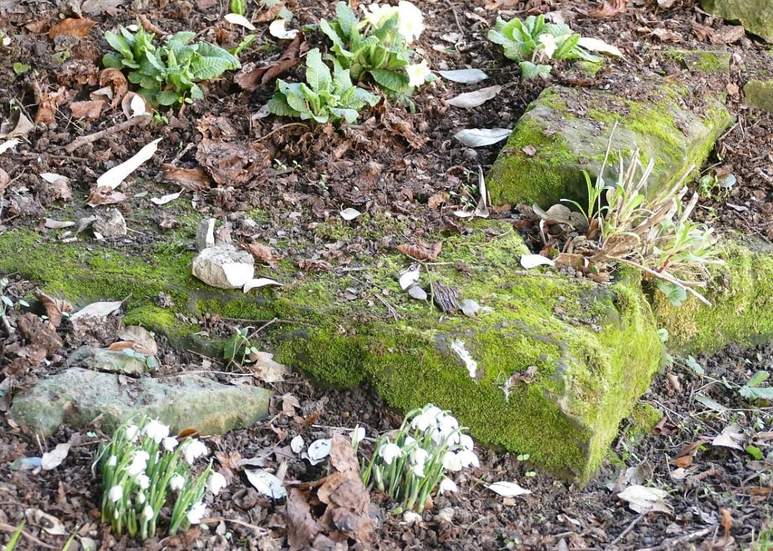
See you there.

Heaven and Hell
Thanks to Covid rules, Terroir spent a surprising amount of lockdown time in the village of Chaldon, perched high on the North Downs in north east Surrey. Whilst our Bubble visited in the residential care home (once the Rectory, below right), Terroir paced the lanes and footpaths, tarried in the Church of St Peter and St Paul and puzzled over historical enigmas.


There is enough history in this tiny village to fill a book. In fact, that book is no. 7 in the local Bourne Society’s series of Village Histories http://bournesoc.org.uk/.

Both the Bourne Society and its publications can be highly recommended. Village Histories No 7 (‘Chaldon’) fills nearly 200 pages with the results of extensive research and fascinating images of old maps, documents and photographs of village life and historic buildings.
But, as with all good books, it leaves some questions unanswered. Two questions have been niggling Terroir: who created the earliest known English wall painting, on an inside wall of the Parish Church and, what is behind the curious statistics relating to those who lost their lives in two world wars?
Before we tackle these issues, however, we can provide you with a taste of Chaldon’s back story. The village is only 17 miles from London’s Hyde Park Corner, and extremely close to Surrey’s only major east/west route (Chaldon is a mile from the so called ‘Pilgrims’ Way’ to Canterbury, and less than 5 miles from what is now the A25). Yet the village remained an agricultural hamlet with few amenities until after World War I. Despite archaeological finds representing 5 prehistoric periods, despite documentary references which may date back to AD 727, despite a mention in the Domesday Book, despite underground ‘quarries’, despite the arrival of the railway in nearby Caterham in 1856, Chaldon remained, for centuries, a largely agricultural community. In 1801 the population was around 100, rose to 280 in 1891 and then dropped to only 266 in 1901.
Yet, sometime prior to 1200, someone (or perhaps some people?) painted the most extraordinary picture on the west wall of the Church, a building which nestles close to one of Surrey’s many north/south trackways, at the northern tip of the modern village. At some point the painting was whitewashed over, but was rediscovered in 1870 and has subsequently been cleaned, restored and conserved on more than one occasion.
To quote Village Histories No. 7, the picture “is without equal in any other part of Europe. It is thought to have been painted by a travelling artist-monk with an extensive knowledge of Greek ecclesiastical art. The picture depicts the ’Ladder of Salvation of the Human Soul’ together with ‘Purgatory and Hell’”. It is, to the modern eye, exceptional, astonishing, visceral, blood curdling and stomach turning, and, in the phraseology beloved of Michelin guides, well worth the journey.


I doubt that Terroir’s desire to know more about the artist will ever be satisfied.
Terroir’s second niggling question also arose from a visit to the Church and has been exercising the Terroir mind for some time. We have asked around for views but, unusually, have decided to blog about this issue before reaching a conclusion, in case others can offer any thought on what follows.

A stone memorial on the south wall of Chaldon church commemorates those who died in WWI. Seven names are recorded including two of the then curate’s sons who died within three days of each other at the Dardanelles in 1915. A seond memorial tablet (left) commemorates the brothers’ military service in the Wiltshire Regiment.
The Chaldon Village Council website (https://chaldonvillagecouncil.org.uk/wp-content/uploads/2018/11/Chaldon-Matters-Winter.pdf) suggests that the roll of honour should actually include 10 names, so there is yet another mystery for which Terroir would welcome an explanation.

A third church memorial, in the form of a window, commemorates those lost in World War II, with 16 names including that of Lance Corporal John Harman VC, nephew of the William Harman who was commemorated on the WW1 Memorial.
There was something unusual about this window and it took a moment to realise that this was the first war memorial Terroir has seen where the list of names for WWII is longer than that for WWI.
The most popular theory to account for this apparent anomally, and indeed one which occurred to ourselves, is an increase in the population of Chaldon due to the expansion of the village during the inter-war years. This was a time when speculative builders constructed housing estates throughout Brtiain, and this uncontrolled building boom did much to prompt the post WWII planning regulations (we touched on this in last year’s Blog 21 - ‘Privet Land’).
On reflection, however, Terroir is still not convinced that this is the sole cause of Chaldon’s greater number of WWII deaths. Surely the Chaldon 1920s/30s expansion occurred in all the local villages? We cannot think of a village without some evidence of the classic ‘Tudorbethan’ design of the period (below left) but somewhat pared down for the construction of council houses (below right).


We also visited a number of local war memorials (online and in person) and nearly all demonstrate the usual pattern of, sadly, many more names carved on the original WWI memorials, than were later added to commemorate losses caused by WWII.
A summary of our ‘research’ to date is presented below. This is where you all have a good laugh at our cod stats. Yes we know we don’t have nearly enough data to make any of this significant, and no we haven’t listed our sources, or checked how comparable our data is. Talk about off the cuff. But, even at this stage, the investigation hints that it is very unusual to have more people die in WWII than WWI. It also hints that it is hamlets and villages with few inhabitants, which may not follow the typical pattern. At any rate, we are willing to stick our necks out far enough to say that we don’t think it is necessarily to do with inter-war village expansion, which was not exclusive to Chaldon.

We will continue collecting data but for now, we beg for comments from those who know far more than we do, about Surrey villages and their heroic contribution to two world wars.

Common History
OK, so let’s tackle the elephant on the heath before we get stuck into this week’s blog.
No doubt all Terroir readers know this, but just to be certain, common land is NOT owned by ‘everybody’ or the ‘community’ or the ‘commoners’. It will be owned by someone (eg the Lord of the Manor) or, more often these days, by some body (such as a local authority or the National Trust), who are responsible for managing what happens to it.

By a happy coincidence, Terroir recently visited Limpsfield Commons and also obtained a copy of Shirley Corke’s posthumously published book of the same name.
Shirley Corke’s detailed and quite extraordinary history of the Commons is the result of a historical landscape survey, commissioned by the National Trust in the 1990s. If you want to experience the life and landscape of lowland common land through time, want an exemplar in how to research and interpret a landscape, or live locally and want to delve into your local history, then this is the book for you (and no, we’re not on commission!) https://limpsfieldsurrey.com/2021/12/07/limpsfield-commons-new-book-on-our-beautiful-common-now-available-for-purchase/
Limpsfield parish is in the far east of Surrey, right on the Kent border (and is none the worse for that). It is geologically diverse, stretching down the scarp slope of the North Downs (lovely views), over the intervening ribbon of Gault clay (spring line villages), back up onto the Greensand Ridge (more in a bit) and then down again onto the clay lands of the Low Weald. Limpsfield Common and Limpsfield Chart are, like so many commons in Surrey, located on the Greensand.
Here’s an image of what it looked like around 1893.

Extract from Ordnance Survey, One-inch to the mile, Revised New Series Revised: 1893 Published: 1895. Reproduced with the permission of the National Library of Scotland' https://maps.nls.uk/index.html
The concept of a Surrey Heath is often perceived to be a heathery expanse of acid sandy common land, once grazed and now rapidly disappearing under a sturdy layer of post war, upstart woodland or housing, or a thinner veneer of military training land or golf course. Limpsfield’s commons do illustrate much of this but Corke’s history may imply a more complex history than many of us realised.
What has Limpsfield got today? Predictable, perhaps, the short answer is trees – lots and lots of them - and a golf course. Both Limpsfield Common and Limpsfield Chart are registered Commons, are open access land and are owned by the National Trust. The High Chart is none of these and is privately owned but at times it’s hard to tell the difference. All three areas are heavily used by walkers, strollers, dog exercisers - in other words anybody who fancies a breath of fresh air. There are public footpaths everywhere, and a plethora of forest rides and tracks on the High Chart which obviously get well used too. There is the Greensand Way, the Vanguard Way and even the Romans had a ‘way’ here in the shape of what is described as a minor Roman Road. Is this the Roman equivalent of a ‘B road’, or our modern historians’ denigration of what the Romans did for us?
Below - Limpsfield Common: lots of deciduous woodland, tracks and paths, car parks and welcoming signs and golfers; there is even some remnant heather.


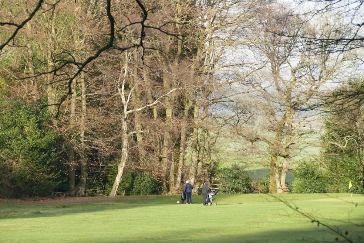


Below - Limpsfield Chart and High Chart: Limpsfield Chart is not dissimilar to Limpsfield Common but as you move into the High Chart the scale changes and so does the woodland. Here is Ancient Replanted Woodland, with stands of ‘exotic’ conifers amongst the native and deciduous species. There is evidence of ‘commercial’ forestry and Forestry Commission grant schemes. But the easy access and woodland mix still makes for a grand afternoon out.

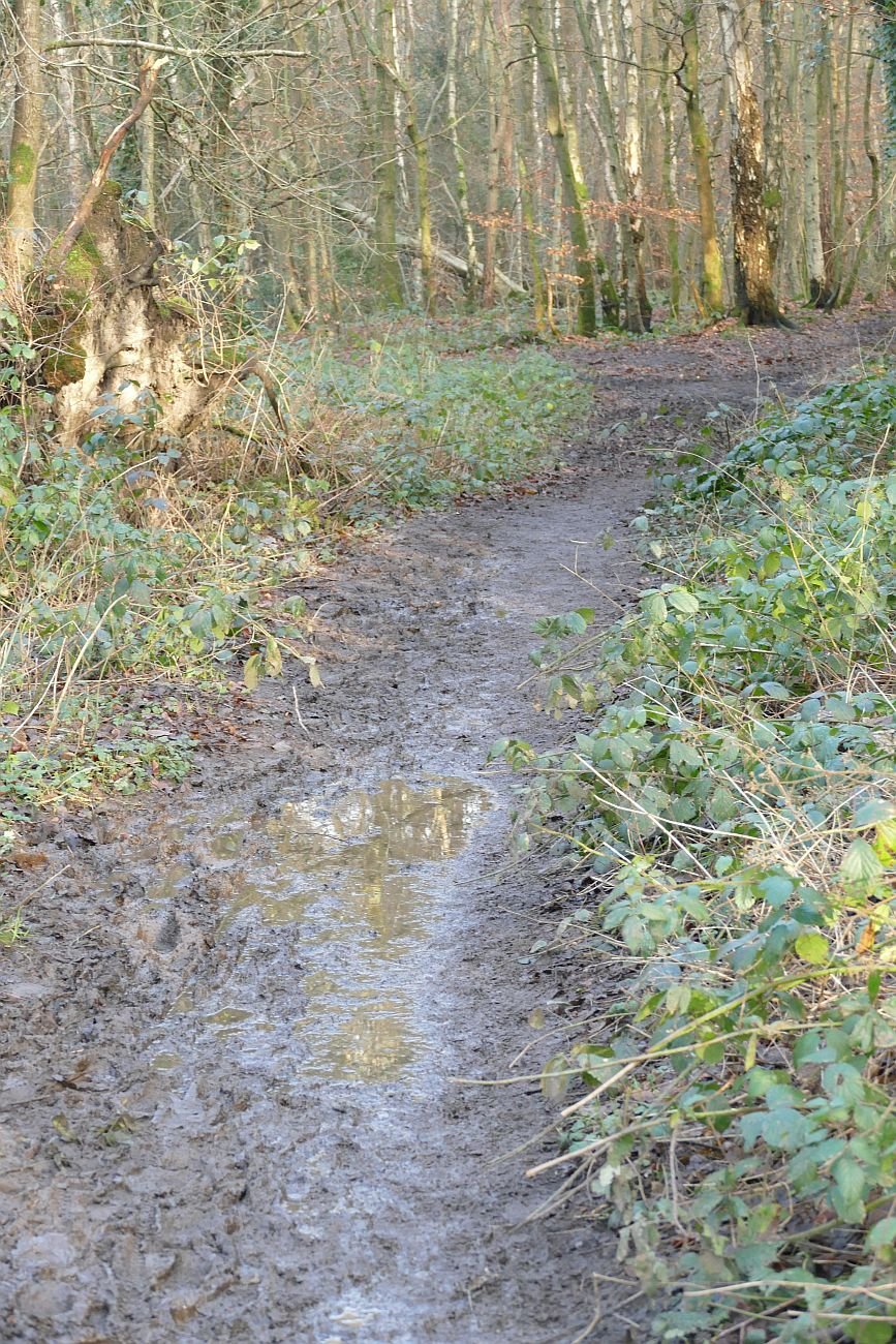


Back in the 11th Century, Limpsfield Estate belonged to one Harold, he who met his end when opposing William of Normandy at the Battle of Hastings. Subsequently, William I (aka William the Conqueror) gave the estate to the monks of Battle Abbey. By the 14th century, this Abbey outlier seemed to be fairly prosperous, and a document of 1312 makes mention of dovecots, water mills and fisheries. Corke notes that the list of woodlands is long. Three of these woods (Chert, Echenwode and Stafherstwode) “are common to all tenants of the manor both free and unfree throughout the whole year for their animals”. There is also mention of other woods which could offer rights of pasture, and seasonal ‘pannage’ ie for pigs to feast on fallen acorns at the appropriate time. In addition, documents indicate the presence of arable land, meadow and pasture, but Corke points out that there is no mention of open ground or of heath, gorse or furze.
The 15th century has been interpreted as one of neglect and decay and, by the Dissolution of the Monasteries (including Battle Abbey, of course), there Corke now finds reference to extensive areas of heath and furze. The customs which protected (or limited!) tenants’ rights, and the value of the commons (probably supporting a mixed landscape of woodland, underwood, and wood pasture, as well as arable and open pasture) were clearly being flouted; change would have been inevitable. The reduction of the population during the Black Death, suggests Corke, may also have resulted in the conversion of arable to heathland.
It is tempting to talk about many other fascinating aspects of Commons – reductions in area due to encroachment, of ‘digging’ (for clay or other useful products), of changes in agricultural and silvicultural practice, of social, economic and legal changes, but I will not steal Shirely Corke’s thunder and leave her to entertain and inform you on these topics.
By the 18th and 19th centuries, under the ownership and stewardship of the Leveson Gower family, the somewhat fragmented estate was being partially reassembled, but despite many other changes, the commons are still windswept open spaces, although the march of recolonising deciduous woodland can just be detected by the early 20th century.


In the 1920s, however, the Leveson Gowers bought out a number of commoners’ rights, and made the commons available for public ‘air and exercise’, to be managed by a committee of local people. In 1972, Richard Leveson Gower gave the Commons to the National Trust (https://www.nationaltrust.org.uk/limpsfield-common). The High Chart – always wooded - remained as part of the family’s nearby Titsey Estate. By the 1960s, the return to woodland is pretty much complete.


All map images reproduced with the permission of the National Library of Scotland' https://maps.nls.uk/index.html
To summarise a book of some hundred pages, and with extensive illustrations, in three paragraphs is ridiculous. Buy it, read it, and lose yourself in the world of an ancient estate. And don’t worry about the technical stuff (avowsons, copyhold, dottards, firbote and Frankpledge). There is an excellent glossary at the end.

Mining the Past
January is supposed to be the most difficult month of the year. Limited daylight, limited sunshine, limited garden and allotment time, inhospitable weather. Friends with Covid, friends with ‘the’ cold, the perceived need to detox after Christmas. The BBC reminded me recently that there won’t be another bank holiday for over three months, although Terroir sees this as a mixed blessing, as extra days off just seem to breed bad temper over the health, social, moral and legal implications of a day out.
Today, I am admiring the sunshine picking out the frost on neighbours’ roofs and the skeletal details of a sycamore tree creating its own sculpture garden and converting its backdrop (uninspiring urban architecture) into works of art. Get your kicks where you can. But yesterday, I spent the day in a sunny Northumberland, courtesy of the Terroir photo library and last summer’s lighter lockdown restrictions. Welcome, I hope, to a little uplift, to a virtual day out.

Hadrian’s wall (above) is a magnificent symbol of Northumberland (and Cumbria of course) and, as we were staying in Greenhead, which is pretty much at the midpoint of the wall, we spent our first few days wallowing in, on and around Roman remains. Here are a few classic tourist pictures.


As time progressed and as we read and visited more widely, mining became a recurrent theme, a sort of ground bass, if you will pardon the pun, to our visit. You will probably know all this, but Terroir was surprised at the variety and longevity of local mining and quarrying. Key commodities were limestone, sandstone, iron, lead, silver, zinc, lime, clay and, of course, coal. Mining has been going on for a long time in this area. A useful Historic England publication (https://historicengland.org.uk/images-books/publications/iha-preindustrial-mines-quarries/heag223-pre-industrial-mines-and-quarries/) suggests that Northumbrian communities as far back as the Iron Age had been quarrying stone for round house construction and for quernstones with which to grind flour.
Of course stone quarrying must have expanded significantly with the arrival of the Romans but production must have gone into overdrive after Emperor Hadrian landed in AD122 and ordered construction of a wall from Wallsend on the Tyne in the east to Bowness on Solway in the west.
Below: views of the dolerite Whin Sill cliff (which provided a natural route for much of the wall) and adjacent stone quarries.


Stone quarrying continued after the Romans left, with much plundering of the pre-cut, Roman wall-stone as well as production of newly quarried stone.
Below - some post Roman uses for the local building material
From left to right: Thirlwall Castle 12th century with subsequent alterations, listed Grade I/Scheduled Monument. Featherstone Castle 13th century with subsequent additions and alterations, listed Grade I. Greenhead Parish Church 19th Century, listed Grade II. Greenhead Methodist Church (now youth hostel), 19th century.


Quarrying contiuned into modern times with, unsurprisingly a rather mixed impact on the environment.
Below left - an artist’s impression of Cawfields Milecastle. Below right - an artist’s impression of Cawfields Quarry, located just under the Whin SIll, and where later mining of the Sill’s hard dolomite (great for road surfacing) destroyed the Roman structures above.


But where did the iron, lead, silver, zinc, lime, clay and coal fit in? Two aspects got us interested in these commodities. One was a day spent exploring Haltwhistle and the other was the Newcastle/Carlisle railway line which passed within yards of our accommodation, although Greenhead Station itself had been subject to Dr Beeching’s cuts in the 1960s. We’ll use these two settlements as examples of how pervasive mining used to be.
The railway is a particularly early route which opened in phases between March 1835 and July 1836. Such was the value of local products, and the need to get them to ports and markets, that transport improvements around Carlisle and Newcastle were being planned from the second half of the 18th century. A Carlisle/Newcastle canal was seriously considered. But once railways became a realistic option, and despite significant opposition to this noisy, smoky new-fangled transport, there was really no contest. Railway infrastructure was a fraction of the cost of canal building.
Coal had been mined at Haltwhistle since the 1600s and around Greenhead since at least the 1700s. But, thanks to the Haltwhistle Burn, the town also had significant woollen and corn mills, lime kilns and brickworks. The coming of the railway revolutionised all these local activities. But Haltwhistle was also located relatively close to the north Pennine lead ore area with production centred on Alston and Nenthead. Exporting both lead and the associated silver by road was slow and costly but the promise of a rail head at Haltwhistle changed the eonomics - and the industry - dramatically. Apparently lead was being stockpiled at Haltwhistle before the railway even opened.
Below, left to right: history of Haltwhistle and historic view of the Station; Haltwhistle Station today; ‘The rise of industry’ information plaque.


In today’s post industrial era, things are much quieter. Despite the loss of Greenhead’s station, the railway still functions as a strategic, coast to coast link, carrying mainly passengers and the occasional nuclear flask en route to Sellafield's reprocessing plant.
Above: the flask train passes through another classic Carlisle and Newcastle Railway station; this one is Wylam, to the west of Newcastle.
But the railway faces competition now for the honour of transporting walkers and visitors to the beauties of the wall. It may only run in summer but route AD 122 (geddit?) is an excellent way of travelling between Hexham and Haltwhistle via Greenhead and the must-see highlights of Hadrian’s massive construction project.


