
Rock Island Line
The Rock Island Line is a mighty good road
The Rock Island Line is the road to ride
The Rock Island Line is a mighty good road
If you want to ride you gotta ride it like you find it
Get your ticket at the station for the Rock Island Line
In Britain, the ‘Rock Island Line’ is probably better known as the American folk song, made famous by Lonnie Donegan, than the Chicago, Rock Island and Pacific Railroad which forms the subject of the song’s lyrics. The history of both the Rock Island railroad and the song is convoluted and there are some interesting parallels between their development. These will become apparent as we take a look at the Chicago railroads, one of the ‘elements’ of Chicago which we identified in Blog 120 (we’ll come back to the final element, water, sometime in the New Year).
The history of American railroads appears to be extraordinarily complicated. Early rail based transport systems seem to have consisted of relatively short stretches of line to transport coal and stone from quarries and mines, often using horse power or gravity. Longer distance, locomotive drawn railroads appeared in the eastern states by the 1840s usually connecting two fairly large cities in fairly close proximity. Links were then developed as new settlements and markets opened up, making the railroad map seem fairly haphazard in comparison with the European system of servicing an already well known geography.


This quote from the Britannica website is a delight and seems to sum it all up:
“It was the brute strength of American locomotives, their great tolerance of cheap and crude track, their durability, their economy of operation, and their simplicity of maintenance that determined almost from the first years of operation that there would be a distinctively American railroad sharing little with British practice.”
The quote continues: “It seems reasonable to argue that once the British had shown that railroads could be made to work the Americans reinvented them for a very different terrain, economic climate, and demographic level. The creation of the American railroad was a contemporaneous but not a derivative development.” https://www.britannica.com/technology/railroad/Early-American-railroads
Chicago’s first railway (not even started until 1848) was the Galena & Chicago Union, which was planned to connect the city to the lead mines at Galena (north west Illinois) but which never got further than a place called Elgin, a mere 40 miles from the city centre. A shaky start, perhaps, but it wasn’t long before Chicago was connected by railroad to the great grain fields of Illinois and Wisconsin and then to numerous mid-west cities.
Inevitably, Chicago’s significant location between east and west coasts, combined with excellent water transport options and the natural resources to build tracks and fuel engines, meant that the city became the core of the American railroad system.
According to “Illinois Railroads in 1901” (http://www.genealogytrails.com/ill/cook/railroads.html), “not less than thirty-eight distinct lines enter … [Chicago in 1895], although these are operated by only twenty-two companies. Some 2,600 miles of railroad track are laid within the city limits. The number of trains daily arriving and departing (suburban and freight included) is about 2,000. Intramural transportation is afforded by electric, steam, cable and horse-car lines. Four tunnels under the Chicago River and its branches, and numerous bridges connect the various divisions of the city.”
This chaotic network of railroads, coming from all corners of the nation, restructured the landscape and the future of Chicago. Most companies set up their headquarters in the city and built the necessary infrastructure to operate the railways and to tranship what they carried: manufactured goods from the east, grain from the prairies, timber from the north and meat from the west. And people: people from all over the United States and from all over the world – both the free world and the freed populations from the Caribbean - poured into Chicago. No wonder the railroads became legendary.

Above: freight trains were and still are the back bone of the US railway system.
But back to the Rock Island Line. The precursor of the Chicago, Rock Island and Pacific Railroad was, geographically, a wholly Illinois affair, born in 1847 and, according to Britannica, reached Chicago by 1866. It quickly extended both its name and its network and, by 1907 the line had attained its maximum length of 14,270 miles (22,975 kilometres) [Britannica again] over 13 states to the west and south of Chicago. It was, indeed, something to sing about.
According to Wikipedia (https://en.wikipedia.org/wiki/Rock_Island_Line) the earliest known version of the song was written in 1929, by one Clarence Wilson, a member of the ‘Rock Island Colored Booster Quartet’, a group of Railroad employees who worked at the Biddle Shops freight yard in Little Rock, Arkansas. Like the confusing and ever changing railroad companies and routes, the song has a pretty confusing history too. Although many would associate it with Lonnie Donegan’s 1956 rendition, we have John A Lomax to thank for the earliest known recording which, in Terroir’s view, is much the best. Lomax recorded it a few times, the first with the help of Huddie Ledbetter, better known as Lead Belly, at the Cummins Prison, where it was performed by Kelly Pace and Prisoners. The third recording is available on https://www.youtube.com/watch?v=0NTa7ps6sNU. It’s well worth a listen. If you think the name of Lomax is familiar, you would be right. His better known son Alan Lomax carried on his father’s work and, with the help of Shirley Collins (English folk singer extraordinaire) recorded folk music on both sides of the Atlantic.


Of course numerous others have re-arranged, re-written and re-recorded The Rock Island Line including Led Belly himself, Donnie Lonegan and Pete Seeger. It’s easy to see the history and development of this ballad as a microcosm of US railroad history and, like the railroad, you don’t hear so much about it these days.
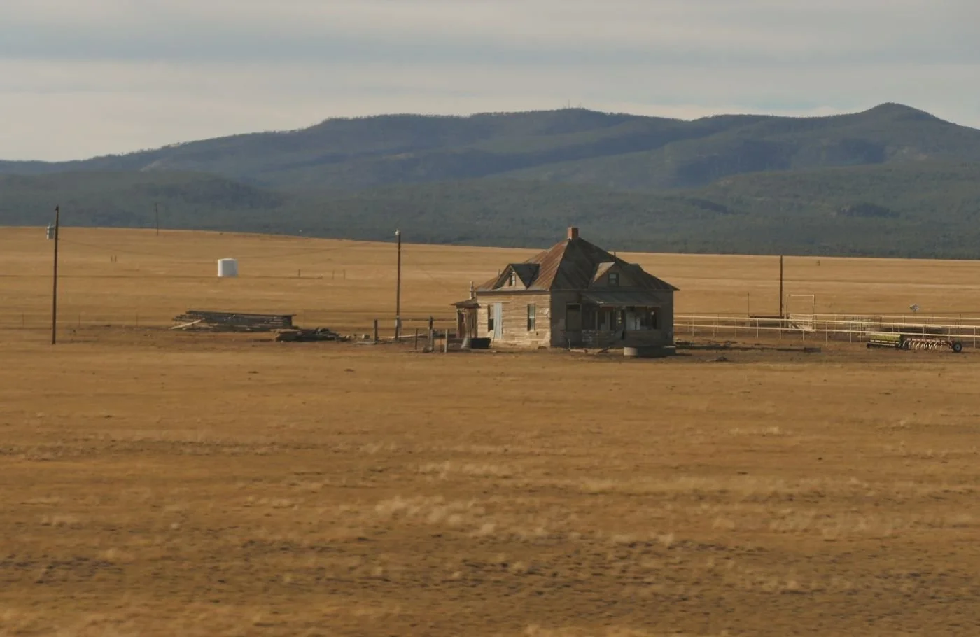
So what is Chicago’s relationship with the railway in the 21st century? The massive meat packing, timber and other freight yards, which characterised much of the 20th century, are now long gone, built over by ever continuing expansion of a new style metropolitan Chicago. Much of the associated railway architecture has also vanished and freeways and airports have taken their place.
Some remnants of former glory still remain and the pictures below illustrate elements of multiple tracks still in use and the tiny signal boxes which once controlled vast numbers of train movements.


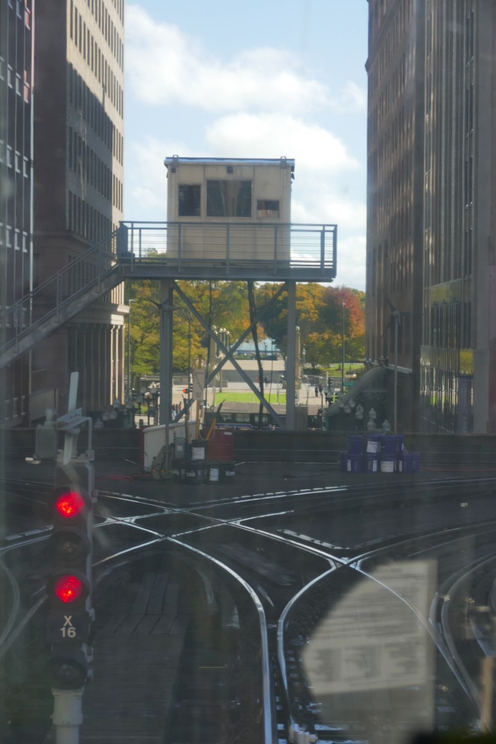

One aspect of railway life does remain however, and is now devoted to carrying people rather than livestock, timber and grain. Chicago's 19th century railroad depots were located at the edges of the business district and provided a circle of stations around the city centre. This pattern was an obvious route for a city centre rapid transit system and the first elevated lines (cheaper than subways) were constructed in the 1890s.


This is the Loop, the elevated lines which enclose the core of Chicago city. If it’s not happening within the Loop, then you probably don’t want to know about it. The Loop carries thousands of passengers a day on, yes, a very confusing system of coloured railroad route possibilities.

Today, the ‘L’ trains (L for elevated), scuttle round the city like an enormous model railway, nipping between high rises, shooting through canyons, and leaping over busy thoroughfares like a greyhound on a race track.


Once started, the system soon threw out several tangents to connect the city centre with its ever growing suburbs. These tentacles have been forced to stretch further and further out as the city continues to expand.


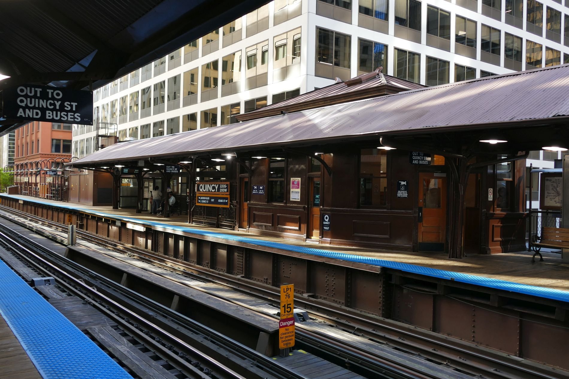
The modern stations are strictly utilitarian, but Quincy, on the Loop itself, has been allowed to retain some of its earlier glory.


The Loop is no urban pussy cat, however. On its equivalent to the London Tube map, the Loop is represented by a sedate rectangle but rattling around those corner curves is far more exciting than the hidden, swaying, bends of the London Underground.


Trails and Rails
To tell the story of Chicago’s railways, you really need to tell the story of America. Sitting comfortably? Then we’ll make a start.

Indigenous North American travel, as far as Terroir can ascertain, was undertaken on foot, by canoe (or kayak in northern areas) and on horseback.
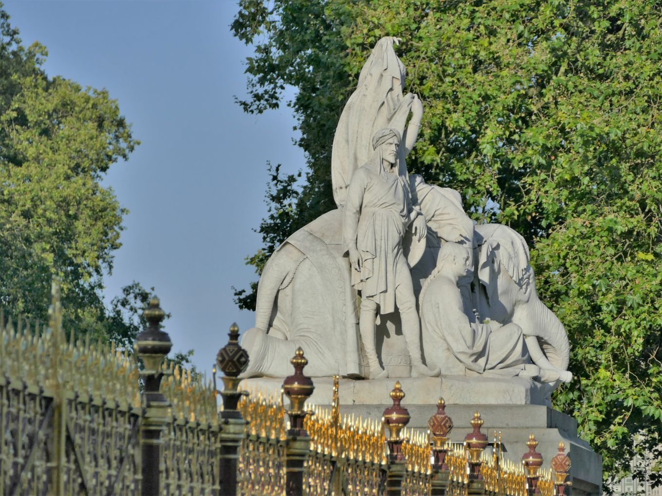
Right: a highly stylised and European image of American indigenous travel by horse, but you get the idea. Part of ‘The Bowman and The Spearman’ by Croation sculptor Ivan Meštrović, Chicago.
Horses were long felt to be introduced by the Spanish colonists but new research suggests horses may have a much longer history on the North American continent so, for the sake of this blog, we are listing horse power as an indigenous means of transport. Neither settled nor nomadic tribes and nations existed in isolation and movement of people, goods and information occurred for a variety reasons, including hunting, trade, warfare, and ceremonial purposes.
Visiting Chicago (see Blog 120) has already introduced us to the development of extensive trail networks and navigable waterways created long before the arrival of other peoples from other continents, with other cultures and technologies. But Chicago has also introduced us to the concept of the ‘route appropriation’ practised by these incoming trappers, traders and settlers, who adopted these pre-existing routes for European style immigration, trade and warfare and social and ceremonial uses. What (English speaking) Europeans would consider to be ‘just’ foot paths, bridle ways or packhorse routes were converted into wagon trails, then railroads, then repurposed and resurfaced for the internal combustion engine and, more recently, retrofitted as hiking trails for recreation.

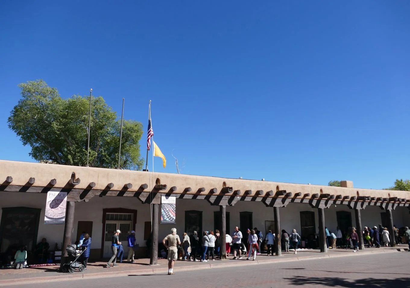
One of the most famous of these appropriated routes was the Santa Fé Trail.
In our experience, most websites start the history of the Santa Fé Trail with the trade between European Plains settlers and the Spanish/Mexican peoples from the south west (now mainly New Mexico and Texas). But The Santa Fe Trail Association web site (https://santafetrail.org/history/) suggests that indigenous peoples were trading goods and ideas between the valleys of, say, the Rio Grande and the Ohio River for many centuries before the arrival of the Spanish.
Successful European use of this long distance trade route is usually credited to one William Becknell from Missouri, but he was by no means the first European to attempt trading with this northern outposts of the Spanish/Mexican empire. Santa Fé was very isolated, separated from Mexico City by 1,700 miles of inhospitable terrain, and must have seemed a tempting business proposition to new Americans from eastern Missouri, a mere 850 miles away across significantly easier country.
But despite this geographical isolation from the bulk of Spanish Mexico, early attempts at American trade with Santa Fé were unsuccessful due to locally stationed Spanish soldiers who seemed keen to capture mercantile visitors and drag them over the mountains to prisons in Mexico City. One can imagine that, despite the travel issues, an excuse to get back to the capital must have been quite attractive.
The images below show the sort of buildings which these traders might have seen before they were unceremoniously captured and sent south.


Images centre and lower rows: typical Santa Fé architecture and wood detailing of the Spanish colonial period
William Becknell set out in September 1821. It seems he was in debt and probably desperate and/or foolish, but he was certainly lucky. When he arrived in Santa Fé he found that Mexico had thrown off the Spanish yoke some years before and was very happy to trade with new partners. It seems that the town’s inhabitants were very willing to pay high prices for his goods.
Like many long distance trade routes, the Santa Fé trail has more than one route (the Silk Road across central Asia is another classic example of this phenomenon). Encouraged by the success of his initial trip, Becknell upgraded from pack horses to wagons, loaded up and set off again in 1822. He amended his route to accommodate his now much wider, wheeled, freight carriers, but the resultant need to cross the Cimarron Desert, where water was scarce, proved to very hazardous. A second route was developed, therefore, over the Raton Pass in the Sangre de Cristo Mountains (a southern outlier of the Rockies) on the borders of Colorado and New Mexico. This Mountain Route is longer and much steeper but has plentiful water supplies.

Above: Sante Fé route map: Raton Pass on the Mountain Route outlined in red; note the references to springs on the shorter Cimarron Route. With thanks to https://www.nps.gov/parkhistory/online_books/safe/shs1.htm
Commercial traffic along the Sante Fé trail boomed and became a two way international trade route for Mexicans and Americans alike. It also played a part in troop movements connected to the Mexican-American war in the 1840s and, following the resultant adjustments in borders, the Trail became a significant national link in connecting the new south west territories with the more established states in the north east. As well as trade goods and military supplies, the trail carried stage coaches, emigrants, missionaries and thousands of fortune seekers heading for the Colorado and California gold fields.


The wagon illustrated above is presumably far smaller than covered wagons used by Europeans moving west or for trade, but it does give a hint of the fragility of the transport using the Sante Fé Trail. Both photographs taken at the Santa Fé History Museum.

The Trail’s death knell, of course, was sounded by the great American railway boom of the 1860s. By 1873, two railway lines had been constructed all the way from Kansas to Colorado, thus significantly reducing the distance which horse drawn wagons had to haul goods destined for Santa Fé and New Mexico. No less than three railway companies were interested in the Raton Pass route, and the ‘winner’, the Atchison, Topeka, and Santa Fe Railroad (aka The Santa Fe), reached the top of Raton Pass, following the Mountain route of the Santa Fé Trail, in late 1878. Despite its name the line bypassed Sante Fé itself. When a branch line eventually reached the state capital in 1880, the life of the Sante Fé trail as a commercial transit route was finally over – and, indeed, partially under its Grim Reaper’s rails.
Eventually the Santa Fe rail road reached Chicago (in 1887) and Los Angeles (in 1893). It was the second of America’s great trans-continental railroads.


Images above: constructing the Santa Fe rail road
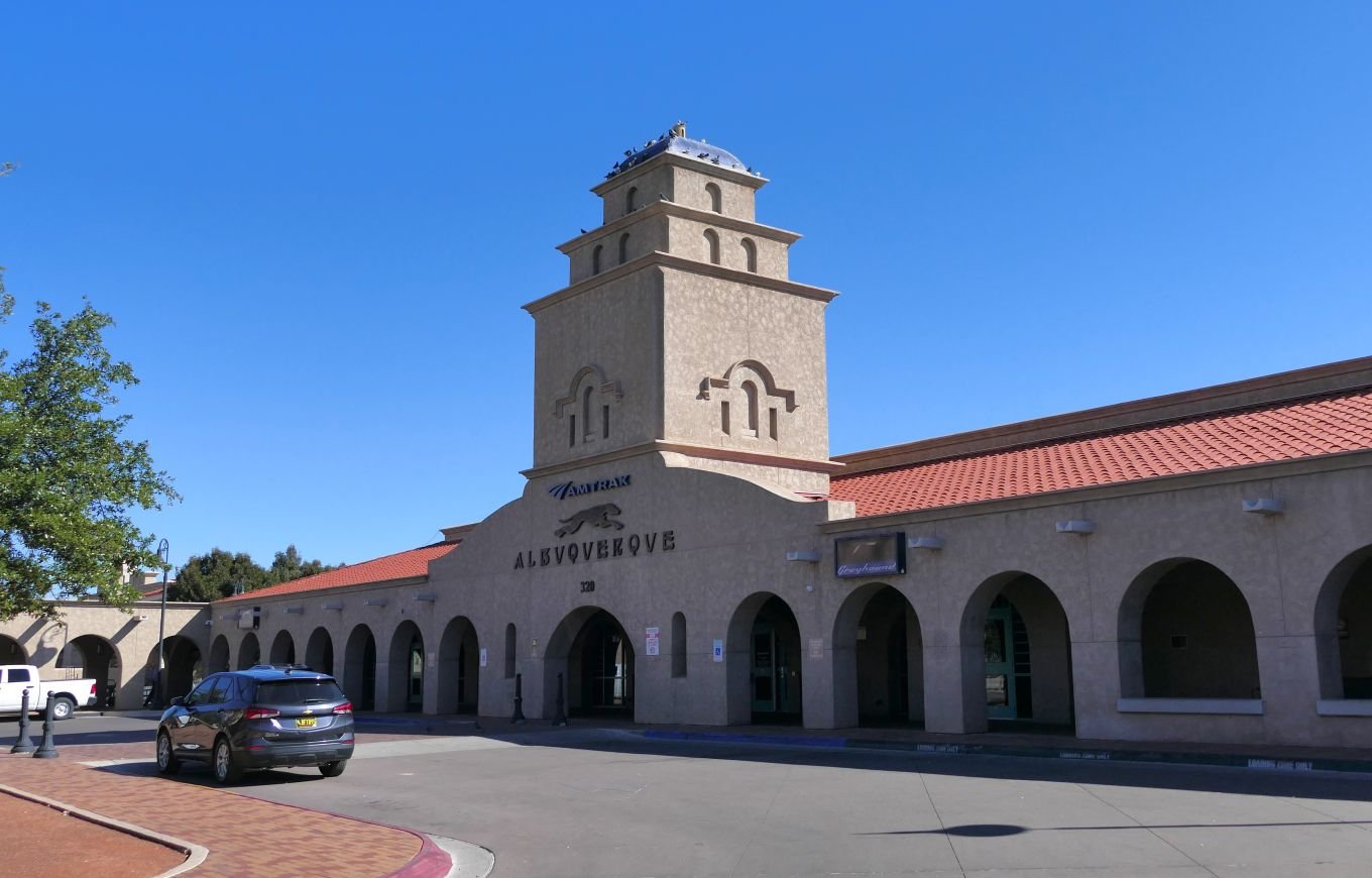
In the 1960s, car and air transport was in the ascendancy, to the detriment of some of the great railways of the world. In response to this situation, the United States Congress established the National Railroad Passenger Corporation to run the intercity passenger services which had formerly been operated by the private railroads. Amtrak started delivery of that service in 1971, including the ‘Southwest Chief’ service from Los Angeles to Chicago, via Albuquerque.
Meanwhile, that 1880 track extension to link Santa Fé to the main route, still has a rather quaint branch line feel to it. It is operated by Rail Runner (aka the New Mexico Rail Runner Express), which is a commuter rail system, serving the metropolitan areas of Albuquerque and Santa Fe.
Thanks to both companies we can now claim to have travelled from Santa Fé to Chicago by train using, in part, the route of the old Sante Fé Trail. What follows is a photographic record of that journey, stitched together from two seperate journeys from Santa Fé to Albuquerque and from Albuquerque to Chicago.
Stage 1 Santa Fé to Albuquerque:


Stage 2 Albuquerque to Raton Pass


Above: Albuquerque station - waiting for the Southwest Chief.


The journey north eastwards through New Mexico towards Colorado and Kansas is a slow progress. The landscape of Mediterranean type open scrub and small trees (above) eventually gives way to the beauty of the great plains (below). These photographs do not do justice to the rolling majesty of the open prairie.


And, finally, sunset as the train leaves Raton Station and crawls up the gradients of Raton Peak.


Stage 3 Leaving New Mexico and overnight to Kansas City


Stage 4 Through the great grain lands and over the Mississippi into Illinois


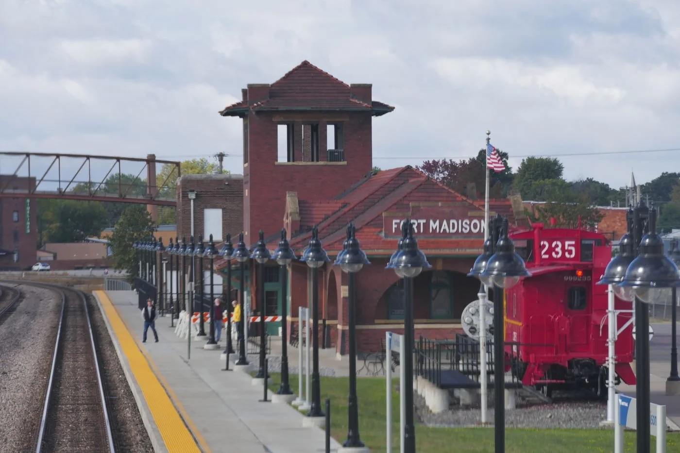
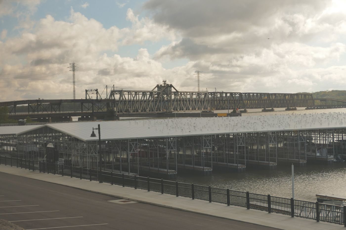


Chicago here we come.

Elemental Chicago
How do you describe Chicago? And I do mean, how do you describe Chicago? Terroir is going to have a crack at it now, but we’d like to know how you saw this complex city. I’m sure many of you have been there.

How does the woman with her buggy (sorry, stroller) think of Chicago, or the guy on the bike? Here (below) is how many tourists see it.


As we explored, we (or one of us, anyway) began to think of this city in terms of fire, water and air – three of the four classical Greek elements used to explain the complexity of the world. The fourth element – earth – is of course underpinning the whole thing, but to us in Chicago, the four elements which appeared to best explain the city are fire, water, air and, underpinning the whole thing, railways.

Amazingly, we managed to arrive in Chicago by train, using Amtrak’s Southwest Chief service from Los Angeles (we got on at Albuquerque).
Locomotive 158 (right) is a big beast but still struggled with some of the steeper gradients.
Amtrak LA to Chicago is a historic line but with a modern service: if you have time to spare and don’t mind sleeping in some pretty luxurious recliner seats, then it’s cheaper than flying. Sleeper accommodation is pricey but includes all meals, free scenery and use of the observation car. Worth every penny.
Excited by the idea of arriving in Grand Central Station, that legendary piece of Chicago history and architecture, we hoped for a memorable initiation into the ‘Windy City’. Not so. ‘Legibility’ was poor. How do we get out of this damned rabbit warren? We stumbled into the recently renovated Great Hall and nearly missed it due to a bizarre installation blocking our way and rendering that amazing centre piece, with its lines of wooden benches, all but invisible. Outside the ‘temporary main entrance’, on Clinton Street, the traffic roared past, annihilating any sense of a triumphant arrival. Heigh ho.


Above: left - the way in to Grand Central seemed simple, but the way out (right) was much trickier.
Below: we passed some lovely detailing - sometimes more than once. That stairway to heaven was very misleading.


We will return to railways in a later blog, but let us now turn to fire.
Everyone told us about Chicago’s architecture, so our first visit was to the much-hyped Chicago Architecture Center, located close to the Chicago River. Good location, wide range of tours, interesting displays, funky shop (box set of small wooden blocks to build your own park – so tempting), clean loos but - no café. We’d booked an architectural walking tour which was excellent but decided against the Center’s own river boat tour on grounds of cost, duration (long) and competition from other providers. We did, eventually, book a trip with the competition and had an excellent tour which better suited our pockets and timetable. Such is business.
We were told, as I’m sure many of you know, that fire was key to the development of modern Chicago.

Due to its Lake Michigan location, the area was always important. The indigenous population enjoyed the bounty of its rivers and forests and developed extensive trade routes, exploiting water transport, and good portage routes to drag boats from one waterway to another. The future site of Chicago City would be located at a particularly advantageous portage point.
Sadly most internet histories of Chicago start with the destruction or exploitation of this indignous culture, merely noting the legacy of mispronounced names (probably mangled by both French and then Anglophone speakers) and some modern roads and railways built on the routes of the original trails. We did, however, particularly enjoy this website (https://interactive.wbez.org/curiouscity/chicago-native-americans/) which provided a much longer perspective.
As the Europeans started to arrive on the continent, many traders and missionaries passed through this area, but Chicago’s first permanent settler is usually cited as Jean-Baptiste-Point Du Sable who is reported to have set up a thriving trading post towards the end of the 18th century (although he seems to have moved away by 1800). Fort Dearborn was established soon after, was destroyed in the (US/British) war of 1812 but reconstructed in 1816.

Illinois became a state in 1818 and Chicago was incorporated as a (very small) town in 1833. Then somebody thought of constructing a canal between Lake Michigan and the Illinois River, and boom, Chicago was on the map! The town became a city in 1837; the population had multiplied 12 fold in just four years.
Right: ‘Urbs in Horto’ - a fascinating and revealing glimpse of Chicago history
So, back to fire and architecture. Inevitably, the Chicago building boom made great use of timber, presumably still a readily available and local resource. Just as in the London of 1666, so in the Chicago of 1871, when a fire did break out, there was very little to stop it. Exacerbating circumstances in Chicago are said to include drought, exhausted fire fighters who had been working the night before (yes, there had already been other fires), a steady south west wind, a collapse of water pumping apparatus and mis-directed fire equipment. Apparently over 17,000 buildings were destroyed in an area of nearly four square miles, leaving nearly 100,000 people homeless and damage valued at $200 million dollars. And an enormous area of prime building land.

Above: an arresting image from the Chicago Architecture Center. The caption reads ‘Surviving Structures offered lessons on wooden, ballon frame builldings’
As with London, so Chicago rebuilt. We were told that, at first the rebuild was in wood but this quick, if perhaps short-sighted, method of construction was rapidly overtaken by the opportunities offered by new designs, new and more fire proof materials, new building heights for better financial return and, one presumes, a better resourced fire-fighting operation.

Above: the Chicago Architectural Center’s summary of Chicago’s, post fire, architectural residetial development
As in London, some stunning new architecture was created (Christopher Wren was particularly busy, of course) and, as with London, land values were such that many blocks have been developed and re-developed on numerous occasions.
Some might regard St Paul’s Cathedral as the phoenix rising from the ashes of the Fire of London. In Chicago, two hundred years’ later, it is probably fair to say that the phoenix’s legacy is still architectural. But with hugely different technologies, economics, and social structures, the ashes of Chicago have stimulated a secular, residential and commercial response, creating buildings of great height and great density and of spectacular designs. Visually powerful indeed, but the only inhabitants of Chicago that we met, live way out of town in the suburbs!


The Glory of the Garden
Creating an RHS Show Garden
Kipling’s allegorical poem of England as a glorious garden was set in a time when
‘…a garden that is full of stately views,
Of borders, beds and shrubberies and lawns and avenues,’
was created and maintained by
‘…the gardeners, the men and 'prentice boys
Told off to do as they are bid and do it without noise’
From The Glory of the Garden by Rudyard Kipling
Today, most of us tend our gardens unaided, but reap significant benefits from the therapeutic nature of working with plants and creating an open air environment which relaxes and stimulates in equal measure.
Many of us also enjoy visiting flower shows to admire, and be inspired by the glorious gardens created by skilled designers and knowledgeable plants men and women. How do they do it?
So welcome Sarah ‘Rosegrows’ Collings for a story of what it is really like to create a show garden.

Sarah writes:
In January 2023, I had been studying Landscape Architecture for about four months. I was on a conversion course because I wanted to change careers, but so far everything we had done at university was theoretical: we made designs, but we would never build them. So I was pretty interested when I saw the chance to design and build a show garden at the prestigious RHS Flower Show Tatton Park. The theme was “sensory Long Borders”.
In spring, I heard that I’d been accepted. I was so excited, but I quickly learned that exhibiting at an RHS Show is quite the undertaking. Did I find sponsorship first, order the plants, or sow seeds? How would I build the thing? The more information we got from the RHS the more things I realised I had to do.
About a month before the show, a close friend of mine said to me, “I’m enjoying your increasingly manic [Instagram] posts about Tatton Park.” Her comment didn’t worry me, but it made me feel ‘seen’. Preparing for the flower show was manic. It was daunting, it was frightening and at times I was completely overwhelmed. I am really proud of the garden and I learned so much - about the RHS, about plants, about myself.
As I reflect on that experience, here are some of the lessons I am most grateful for.
Lesson 1 - Be humble and be persistent
Preparing for the show is not like normal gardening, which I consider relaxing. A show garden requires skills in project management, horticulture and design but, for me, the biggest challenge was the mental barrier: I just didn’t think I would be able to do it.
It’s a humbling experience to wake up in the morning, feel sure you are unable to do something, and then spend the next eight or nine hours diligently working on it anyway. Reasoning with myself that “everything will be fine” just didn’t work. I just had to accept that maybe it would be a complete disaster, but nevertheless, I was going to keep doing it anyway.
Lesson 2 - Judge success on your own terms
One of my biggest fears was that I would “fail” and it would all go wrong. So before the show, I took some time to reflect on why I was doing this thing in the first place.
I wanted to take a design all the way from an initial idea to completion.
I was trying to learn as much as possible, particularly about plants.
I wanted to meet people, network, raise my profile and progress my career as a new designer. I hoped this would give me a competitive edge when applying for future work.
And, of course, I wanted people who came to the show to like my garden and learn something about plants.

I loved my garden, but the feedback from the RHS judges and mentors suggested that they didn’t like it. The judges gave it a bronze medal, and said it was unclear, too ambitious and complicated. I felt disappointed. Did “only” getting bronze mean I hadn’t done well?
Returning to my own goals assured me that wasn’t the case. Actually, getting critiqued from the judges meant I could learn a lot, which is exactly what I wanted.
In addition, while the judges didn’t connect to the concept, other people did. I got to speak to loads of visitors about the garden and share it on social media.
Lesson three: what kind of designer are you?
Months before the show, my personal tutor at university asked me what kind of Landscape Architect I wanted to be. This would have been a great opportunity to pitch myself as, say, a future leader, but I couldn't answer. I didn't feel like I even knew the options. However, it was such a good question that I've been thinking about it ever since.

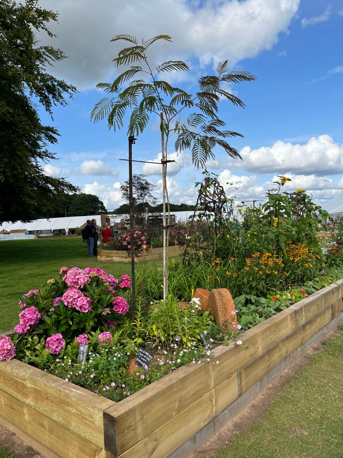
Tatton gave me the beginning of an answer. When I finished the garden, I could see a lot of myself in it. Most show gardens are built by professionals, but I loved working with my friends and family (image left). It was rewarding to bring people into the event who had never been before.
I was also proud that I produced so little waste: all the structures in my garden were made from recycled metal (see images below)…


… I grew my plants in peat free soil and, thanks to sponsorship, donated the plants and tools to the Gatis community garden. https://www.gatiscommunityspace.co.uk/our-history/
My design aimed to create the garden of a botanist who wanted to observe how plants used their senses to react to external triggers. This building process reminded me a lot of my experiences doing drama as a teenager and working in set design. Having worked in education, it’s not surprising that I chose an educational theme (if you’ve got people’s attention you might as well teach them something, right!?)
I wonder if it’s possible to work out what kind of designer you are without actively designing? It reminds me of a Picasso quote: “Inspiration exists, but it has to find you working.” When the RHS judges marked me down because my design was too ambitious, I had to take it as a compliment. As a designer, I want to be ambitious, as well as dramatic, engaging, sustainable, and inclusive.
Final thoughts

I gained so much practical experience from working with suppliers, growing my own plants and meeting other designers. One of my key goals was to further my design career. I exceeded my expectations when the border was featured on Gardeners World and on international news sites. A brilliant highlight!
Left: Sarah with Frances Tophill, filming for BBC Garders’ World
https://www.bbc.co.uk/iplayer/episode/m001nxvf/gardeners-world-2023-episode-17 Sarah’s garden features at 20.56 minutes in.
Creating a show garden - even a small one - is prohibitively expensive and support from the RHS is limited. I wouldn’t have been able to personally afford the project, but I managed to secure sponsorship from the University of Sheffield, the Yorkshire Gardens Trust and Burgon and Ball. I hope sharing my lessons shows that, yes, this is a challenging project, especially for a new designer, but it is not impossible.
I am now preparing for my final year on my Landscape Architecture course and will be spending the first half of that year studying abroad. I hope these lessons stand me in good stead for the inevitable challenges ahead! You can follow my progress on Instagram or on my blog https://sarahrosegrows.substack.com/

Pastizzu
We recently went on a holiday entilted ‘The splendours of Corsica’.

Here’s one of them.
Le pastizzu is a dessert, a sort of meeting between an English bread and butter pudding and the French crème caramel. Corsican restaurants don’t always excel in the dessert department so, when we were offered this, we ordered it, ate it and asked for the recipe. They printed it off the internet for us and were delighted with our interest! Here is the link https://cuisine.journaldesfemmes.fr/recette/1017831-le-pastizzu-le-dessert-corse-a-base-de-pain-rassis. There are plenty of other pastizzu recipes on the net but they all have one thing in common: they look nothing like the version we produced, see above!!
So here is a rough translation of the recipe which we made, with some hints based on our own experiences.
Le Pastizzu: the Corsican dessert based on stale bread
If stale French bread could generate renewable energy, the French would be 100% carbon free tomorrow. They are way ahead of the rest of us anyway because of their reliance on nuclear electricity generation, but what I meant was that stale bread is a very common by-product of the Francophone kitchen, so this slightly unappetising title may be a sort of culinary recycling advertisement. Even so, I’m glad the Brits don’t refer to one of our classic traditions as ‘bread and butter pudding made with stale bread’.
Ingredients:
350 ml of milk
A vanilla pod
50 g butter
4 eggs
200 g crème fraîche
Zest of 1 lemon
150 g of stale French bread, sliced
100 g sugar
For the caramel:
120g sugar
10 ml water (note: the recipe we were given - see link above - asks for 10 g of water but others suggest 10 mls of the stuff. We strongly recommend the latter!)
Method
Please note that this is not a direct translation of the recipe we were given but our adaptation to suit the sort of equipment found in a British kitchen with a few extra instructions reflecting our own experiences.
1 Gently heat the milk, crème fraîche, vanilla pod, butter and lemon zest until it comes to the boil. Turn off the heat and leave to infuse for 3 to 4 minutes. Strain the mix into a cake or flan tin and add the bread in a layer. Make sure the cake tin doesn’t have a loose bottom as it will probably leak all over your kitchen surfaces.
2 Meanwhile make the caramel by heating the sugar and water until it becomes a lovely amber colour. Allow to cool.
3 Blanch the eggs with the sugar: we presume this means beat the eggs and sugar over a gentle heat for two to three minutes until pale and foamy. Pour over the bread mix. We would then suggest leaving the dish for a while to allow the egg mix to soak into the bread.
4 Re-heat the carmel until it is liquid again and pour over the bread and egg mix.
5 Place the cake/flan tin in a bain Marie/baking dish full of hot water and bake in an oven at 180 degrees for 55 minutes until golden brown.
Enjoy!

Ashby dans la Forêt
If you know Ashby de la Zouch, then you probably won’t need to scrutinise the rest of this blog post. I’m betting, however, that at least some of you may never have visited this Leicestershire town. As it happens, we hadn’t either, but we did have reason to be in neighbouring south Derbyshire around 6pm of a Friday evening and, thanks to a certain chain of hotels offering a decent rate, we elected to stay the night in nearby Ashby de la Zouch. We were glad we did.
It turns out that Ashby dl Z seems to exemplify everything you ever learnt in history and geography lessons (and quite a few other subjects as well). Obviously Terroir enjoyed history and geography, but even if you didn’t, there is something very comforting in experiencing a real life example of the sort of things which teachers tried to instil in us from the age of four-and-a-bit to those teenage years when we were forced to specialise and may have parted company with history or geography, or indeed both.
Ask the internet for a history of Ashby de la Zouch and you tend to be tipped straight into Medieval England largely because of Ashby’s Castle (now part of the English Heritage portfolio) and partly because most people want to know why it is ‘de la Zouch’. We’ll come back to that when we’ve taken a look at what was around before the Norman Conquest.
School, legend, Shakespeare and the film industry taught us that the English midlands were once largely enormous forests: Sherwood Forest, Charnwood Forest, Needwood Forest, the Forest of Arden and so on. Terroir isn’t arguing with this but would point out that the legal term Forest as in say, a royal hunting forest, didn’t necessarily mean the areas was totally covered in trees. I suspect that there were plenty of clearings in this wooded area where people lived, farmed and mined useful materials, as well as hunted.
Aschebie, as it was known in pre Norman times, was probably typical of this type of landscape. It is recorded in the Domesday book of 1086 as having 21 households ‘putting it in the largest 40% of settlements recorded’ (https://opendomesday.org/place/SK3616/ashby-de-la-zouch/). Thank goodness for websites like these - we couldn’t make head nor tale of the Domesday survey when we were school kids but now access and interpretation is so much easier.
In modern times, this woodland heritage is beautifully referenced by the glorious ‘floorscape’ which was designed and constructed in Ashby just prior to Covid. Sadly, its nearby companion piece, ‘The Heart of the Forest’ struck us as less photogenic.


Enter the Normans in 1066: junior school history lessons were big on Norman castles - there were lots of them and they were, and still are, major features in the English landscape.

According to English Heritage, Ashby Castle started out as ‘just’ a manor house and formed part of the estate of the Earls of Leicester who ‘granted it to a family of Breton descent with the name ‘le Zouch’ (meaning ‘a stock’ or ‘stem’) in return for military service’ (https://www.english-heritage.org.uk/visit/places/ashby-de-la-zouch-castle/history/). So now you know.
After the de la Zouchs, the manor was granted in 1462 to William, Lord Hastings, a wealthy and powerful man who cracked on with constructing the castle from the 1470s. However, we don’t think that Lord Hastings featured in junior school history lessons.


While we are in the middle ages, did you have those lessons on medieval agriculture? All that stuff about lords of the manor, villeins and strip farming? Leicestershire was always quoted as having very visible remnants of the ridge and furrow landscape created by the open field system. Here is how the Ashby Museum describes the sort of landscapes which developed around this feudal world.


The 19th century poet John Clare mourned the loss of these vast, medieval open fields as the Enclosure Acts enabled landowners to divi up the fields and commons into smaller units delineated by quick thorn hedges. In the late 20th century, we mourned the loss of so many miles of these hedgerows, grubbed up to allow landowners to farm this same land with ever larger machinery.
It seems that the Ashby parish church – St Helen’s - was technically medieval, as Lord Hastings started its construction, but it was reworked around 1670, 1829 and again in 1878-80. It is splendid inside and out and is Grade I listed, despite all that restructuring.


Two features, in particular, struck Terroir. At first inspection, the list of incumbents (image below left) appeared pretty standard until we spotted that not only were the vicars listed but also their patrons, ie the Lords of the Manor in whose gift the living lay. Not until 2015 did the patron become the established church itself, in the person of the Bishop of Leicester.
The finger pillory (below right) is mentioned in every website devoted to St Helen’s history, and rightly so. School taught us about pillories for the neck and stocks for the legs but no-one ever mentioned a finger pillory.


There are plenty of other churches in Ashby today and their denominations and history are a great example of all the politico-religious shenanigans which you may or may not have studied but will certainly have heard about.
Obviously St Helen’s incumbents were caught in the revolving catholic/protestant door initiated by Henry VIII in the 16th century.

During the Civil War in the 17th century, Ashby Castle was held for the King and became a geographically significant garrison town and the subject of an uncomfortably long siege. Royalist Commander Henry Hastings was finally forced to surrender in 1646, much to the ‘great relief to the surrounding towns and villages’ (https://en.wikipedia.org/wiki/Ashby-de-la-Zouch).

Take one look at Ashby’s ‘townscape’ and you will know immediately that it is that quintessential English urban phenomenon, a market town. Market Street is the main north/south highway and is lined with magnificent timber frame buildings, or Georgian and Victorian brick properties, punctuated only occasionally with an unsympathetic 20th century intrusion. Ashby is heaving with listed buildings.


Even today, Ashby is well supplied with that essential adjunct to any market place - the inn or tavern. During the 17th century, however, there were more than 40 ale houses in the town, an abundance which caused the Puritan community much concern over unruly drunken behaviour, but also evidenced the continuing religious diversity of the English community.


In our brief visit, we saw little physical evidence of the industrial revolution, but the countryside around was pocked with mining enterprises, supplying coal, limestone and other minerals to industry throughout the Midlands. The Ashby canal – aiming to link the Trent to the Coventry Canal – never quite made it to Ashby itself and transport was supplemented by a horse drawn tramway. The 19th century brought the railway boom, with the Midland Railway finally arriving the 1870s, carrying coal and, increasingly, passengers. Passenger services stopped in 1964 but the neo classical, grade II* listed station still remains.


As an aside to the industrial and transport geography of the 19th century, Ashby also had aspirations to become a spa town, using water from a local spring, transported by canal and later railway. A large bathing complex, theatre, race course and assembly rooms were built but, after some initial success, the town failed to compete with more fashionable spa towns.
Our reminiscences of childhood geography lessons would not be complete, however, without returning to where we started, in the forests of Robin Hood and Shakespeare. The great midland forests are returning under the guise of ‘The National Forest’. Planting started in the 1990s, to extend and blend new woodland with the remnants of the old forests:
‘The National Forest is right in the heart of the country, embracing 200 square miles of the Midlands. It spans across parts of Derbyshire, Leicestershire and Staffordshire and aims to link the two ancient Forests of Charnwood and Needwood. With a history of coal mining and heavy industry, the landscape is now that of rolling farmland, ancient forests and new planted woodlands. Its main towns and villages include Burton upon Trent (famous for its brewing), Coalville and Swadlincote (formerly associated with the clay and coal mining industries) and the historic town of Ashby-de-la-Zouch.’ https://www.nationalforest.org/about/what-is-the-national-forest
So it looks as though Ashby de la Zouch will once again become Ashby dans la Forêt. Bonne chance.


August
August - the time when those of us not involved in education, in any way, stay at home.
Well mostly.

Normally we would be busy on the allotment but this year has not been so great. Plenty of gooseberries and red currants in early summer (although no black currants this year), and the rhubarb keeps on giving, of course.
But much of the vegetables are inside something else. If we depended on the plot for our sustenance, we would now be on a diet of potatoes and dandelion salad.
So where else have we been?


London - for the Natural History Museum (above left), and the Proms (detail of the Albert Memorial, above centre), followed by London by night (above right).


Some garden visiting: micro moth on mint flowers (above left, in Surrey), greenhouse carnivores in Kent (above centre) and, also in Kent, some Sicilian ceramic flower pot heads, with heuchera hair (above right).


Horsham in West Sussex, looking very summery at the top of the this post, with lunch in the Horsham Museum (above centre and left).


Osterley Park: its address is almost as historic as the house and garden - Jersey Road, Isleworth, Middlesex, TW7 4RB, aka West London. The Park is enormous and still in agricultural production, sandwiched between Southall and Brentford.


A town house and two cathedrals: Coventry of course.


And back to London: St James’ Palace (above left) for supper with a friend (in a modest Thai restaurant around the corner) and two glimpses of Shakespeare’s Globe theatre, dwarfed by its massive, Tate Modern, neighbour (above centre) and inside the tiny-theatre-with-big-ideas (above right).
But thank goodness August is over - others’ vegetable gardens are cropping well, and we can finally come off the potato diet.
See you soon.
Free and Easy
A friend once remarked that ‘blackberries should be free but not easy’, an approach to foraging with which I concurred completely.
As many readers have probably noticed, however, the blackberry harvest this year has been early, plentiful and easy to reach. I suppose we must take our climate change pleasures where we can, but it still leaves a bemused sensation of cheating when the blackberries are both free and easy.
With reports of generous blackberry pickings flooding in, Terroir set off with numerous re-usable plastic boxes but minus the usual necessary walking stick and heavy duty gardening gloves: a walk in the park – only better!
The sound track to our expedition was the key to the landscape through which we were walking. Squawking geese provided the overture and were joined by the occasional mewing buzzard for the first movement. As we progressed, we started to hear the rumble of quarry machinery and, eventually, the sounds of a motorway. The counterpoint was provided by the huffing of dogs and the calls of their owners, and the rattle of a bicycle chain.
The brambles in the massive hedgerows either side of the track leant towards us, offering an easy to reach, takeaway banquet, of berries, ranging from small, hard, green fruits, through swelling, red adolescents to the black bounty of the final offering. Even here we soon learned the difference between the young adults (black but bashful) and the larger, shiny, and totally luscious mature fruit.


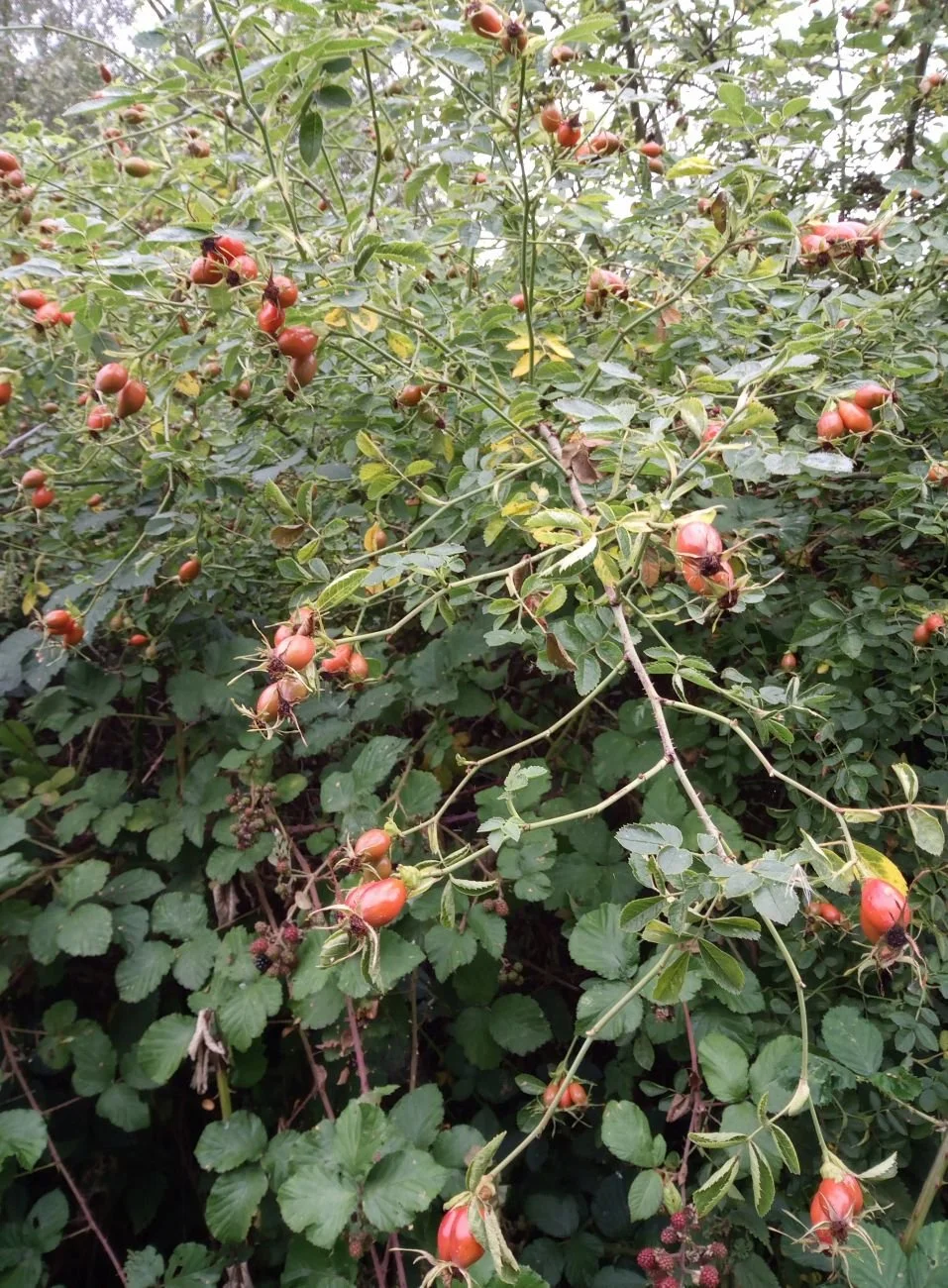
Many other hedgerow shrubs were also shouting their wares. The wild roses and hawthorns (below left and centre) were covered in hips and haws. The guelder rose was beginning to look like a Christmas tree (below right). Only the blackthorn was reluctant to offer sloes.


So, where were we? We’ve given you plenty of audio and visual clues. The observant and regular reader will probably have guessed - correctly - that we were in the county of Surrey. Surrey geology is dominated by the North Downs (chalk) and the Greensand Ridge, separated by parallel strips of Gault and Wealden Clay. There are two motorways in Surrey – the east/west M25, and the north/south M23 at the eastern end of the county. But Surrey boasts six National Cycle Network routes, plenty of lakes which are home to flocks of geese (and broody swans), and several active sand and clay quarries.
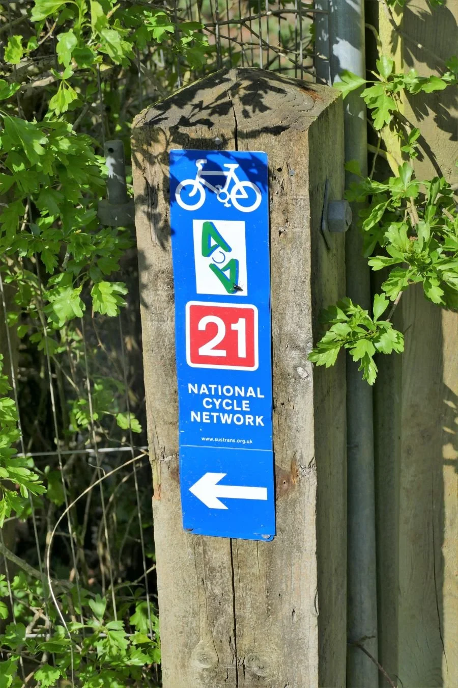
Give up? This particular blackberry heaven was located on the Greensand, to the south of the M25, and immediately to the west of the M23. National Cycle Route 21 passes through on its way to and from Eastbourne and Greenwich. The key to this area, however, is the valuable sand resource which is the basis for a large active quarry and several wetlands based on former workings.

We were, in fact, walking around Spynes Mere, part of the Surrey Wildlife Trust’s Nutfield Marshes Nature Reserve (https://www.surreywildlifetrust.org/nature-reserves/nutfield-marshes-moors-spynes-mere). The giveaway clue is probably the network of sandy tracks, lined with those outstandingly broad and high hedgerows, which would be very unusual in an active agricultural landscape.


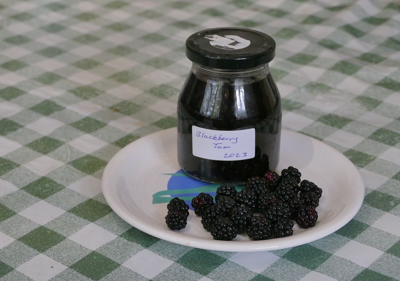
Our Spynes Mere blackberry jam is delicious and, as you can see, the Route 21 blackberry cordial has been particularly successful…. Happy foraging.

Plant Idents
When one of us was a student, Friday mornings were always a tense time. A 10 o’clock start, admittedly, but the 20 milk bottles arrayed on the long bench at the end of the laboratory struck fear into the heart. It was plant identification time and each bottle contained a twig or stem of some tree, shrub, climber or herbaceous plant. Correct identification of more than 50% was joyous - but rare.
The world of work necessitated a rapid honing of native trees and shrub recognition. Battered British floras attested to constant work on wild flowers, peaking in spring and early summer when the previous year’s knowledge had seeped into the sediment traps of winter. A grasp of ornamental horticulture (ie garden flowers) came and went according to level of garden visiting (and plant labels!) but recognition skills fluctuated alarmingly over the years.
But, of course, these days, the tech savvy generation are using plant identification apps to check out plants they can’t recognise. The results can be helpful, hilarious, misleading or downright frustrating.

Recently, three of us went on a couple of garden visits on the Kent/Surrey borders. We started at Titsey Place, near Oxted in Surrey (images right and below).


The youngest member of the group (under 40) noticed an older member (well over 40) using a phone app (so smug) to identify a plant the name of which had been obliterated by anno domini (so embarrassing). Very soon another couple of apps had been up loaded and we started comparing notes.
Results were unexpected as illustrated by the three images below. Consistency was impressive (all three apps identified all three trees as Fagus sylvatica) but all had insufficient nuances/resources in their data bases to explain why the three beech trees could look so different.


So we hatched a cunning (if very unscientific) plan, to test out various apps and see what they were capable – or incapable – of doing. Thanks to the magnificent National Garden Scheme (https://ngs.org.uk/find-a-garden/) we selected another garden to visit the following day and then settled down to define a short list of plant identification apps to test.
We discarded any app which wasn’t free and any app which put too many barriers between the user and the plant to be identified, such as asking for too much personal information. Any app which wasn’t simple to use was also scrapped. We also looked for apps which majored on ornamental horticulture rather than, say, British wildflowers. We ended up with a short list of three:
Candide – which one of us had already uploaded for free as a result of a visit to the Newt garden in Somerset; has a tendancy to crash; needs extremely clear photos with good light and few distractions such as neighbouring foliage; tells you when it can’t identify the plant you have just photographed
Flora Incognita – highly rated and very easy to use; suggests additional or alternative photographs of the plant in question and a % confidence rating on suggested identity
Plantnet – again, well rated and easy to use, offers no suggestions for alternative photos and is less confident in its results
We only looked at basic plant identity uses and didn’t assess the other aspects of the apps eg gardening tips.
Yes – we said it was very unscientific, but please enjoy some of the results.
We’ll start with a couple of easy ones.


What we thought: tobacco plant What we thought: oxeye daisy
Candide: Necotiana alata/Sweet tobacco Candide: Leucanthemum vulgare/oxeye daisy
Flora Incognita: ditto Flora incognita: ditto
Plantnet: ditto Plantnet: L. maximum/max chrisanthemum


What we thought: didn’t know; we now know it’s a Spider flower! What we thought: Crocosmia
Candide: Cleome (spider flower) Helen Campbell Candide: Crocosmia auria
Flora Incognita: Cleome guaranitica Flora incognita: ditto
Plantnet: Cleome hassleriana Plantnet: ditto


What we thought: Robinia pseudoacacia (there’s a label) Lace Lady That we thought: A fir (Abies sp)
Candide: No idea Candide: Erica (blame the photographer)
Flora Incognita: Robinia pseudoacacia (not bad) Flora incognita: Korean Fir
Plantnet: No idea Plantnet: ditto


What we thought: Sedum What we thought: not sure
Candide: Hylotelephium telephium/orpine aka S. telephium Candide: Chestnut leaved Rodgersia
Flora Incognita: ditto Flora incognita: Spirea/Japonica/Rubus/don’t know
Plantnet: ditto/but using the English name Butterfly Plantnet: Rodgersia
It was a delightful couple of afternoons. Both visits provided varied horticultural pleasures, seats for weary legs and much appreciated tea and cakes. Both gardens also gave the apps a good run for their money.
Our conclusions? All three apps were helpful, particularly for retrieving plant names buried deep in the heads of the over 40s. But don’t take them at face value. They can only work as well as the light/camera/operator can capture an image. Check the results again and again. Unlike books, apps do well in the rain, of course, and can be easily updated, but a flat phone battery can bring the botanical adventure to a grinding halt. Anyone got a charger?

DLR
A journey on the Docklands Light Railway
Leaving from Tower Gateway Station
Now there’s a misnomer.
In 1294, the Abbey of the Minoresses of St. Clare without Aldgate was founded, and gave a version of its name to the street which runs southwards from the church of St Botolph without Aldgate, passed the more recent Aldgate Bus Station, passed the end of St Clare Street (guess what/who that was named after) and on to the north east corner of the Tower of London. Google maps mentions that St Botolphs’ Church was the burial place of Tudor rebels and you can see that the church must have been very handy for deceased prisoners. The road was, and is, called Minories, a name which puzzled a member of Team Terroir very much, when a small child.
In 1840, a station was opened towards the southern end of Minories and was called - Minories (none of this Tower Gateway stuff). The station was the western terminus of the Commercial Company which quickly changed its name to the London and Blackwall Railway Company whose railway was built to serve the docks when ‘London docks’ meant ships and trade and empire. The station closed in 1853 but the railway infrastructure was retained, and was used as a goods yard until 1951.
In 1987, the station and railway was reborn as the western terminus of the Docklands Light Railway, when ‘London docklands’ meant money, tower blocks and a different sort of trade. The station was called ‘Tower Gateway’, a name which nowadays puzzles a member of Team Terroir as an adult, as the platforms are a good 10 minutes’ walk from both the Tower of London and Tower Bridge.
What follows is a brief tale of two railways: the Commercial/London and Blackwall railway, and its latest incarnation, the DLR.

Enough! Let’s get on board and enjoy a ride on the DLR. We are going east and the next stop is:
Shadwell
Not to be confused with Shadwell Overground Station. The first station was opened in 1841 as plain Shadwell Station, on the Commercial/London and Blackwall railway line to the docks. Even more confusingly in 1900, this station was re-named Shadwell and St George-in-the-East, to distinguish it from the second Shadwell station which was built later, and eventually became the London Overground Station. By the way, the church of St George in the East was also known as the Church in the Ruins, during the blitz of WWII.
The DLR station was built a short walk to the east of the Overground station and opened in 1987. Confused? Believe me, it’s going to get worse.
Change here for:
a view of the brick railway viaduct and the fascinating, myriad of uses, to which railway arches can be put.
Cable Street, famous for the eponymous Battle when Shadwell turned out en masse to block the march of Mosley’s fascists in 1936.
St Georges Town Hall, Grade II listed, built around 1860 and now a registrar office.
Views from the train:
a wonderful range of 20th century low rise residential building styles, earlier churches and later mosques.
Limehouse
Not to be confused with the original, 1840, Limehouse station (built, of course, by the Commercial/London and Blackwall Railway), which closed in 1926 and was located one mile to the east of the current DLR station.
or
Stepney station (also Commercial/London and Blackwall Railway) built and opened in 1840; renamed Stepney East in 1923; converted to DLR use in 1987 and changed its name to - Limehouse.
Change here for:
Limehouse Basin, formerly known as the Regent’s Canal Dock, and used for transhipping goods from seafaring ships to canal boats
St Anne’s Limehouse


Views from the train:
ie between this station and the next
leisure/house boats in Limehouse basin, a mix of narrow boats, broader beam barges and much larger motor yachts, able to escape to the Thames and beyond
low to mid rise housing including modern ‘docklands’ style residential development, part warehouse conversions, part attempts at stylish modern new builds
accumulator tower for hydrostatic operation of docks machinery (images below) and …


… St Anne’s Church, Limehouse (full view left but also peaking out between youngsters like the accumulator tower and a block of flats). St Anne’s was designed by Hawksmoor and built in the late 1720s. Listed Grade I, the church also sits close to the Grade II listed Limehouse Town Hall and Limehouse Library.
Westferry

Not to be confused by the fact that there is no place nearby called Westferry, and no former London and Blackwall Railway station here either. The DLR had already used the name Limehouse for the station to the west, which in turn had obliterated the other possibile name of Stepney or Stepney East.
In Terroir’s view, Isle of Dogs North might have been a logical name, but no one seems to have felt that was appropriate. It does appear, however, that Westferry station was named after the nearby Westferry Road, which did at least go to a passenger ferry, albeit located at the southern tip of the Isle of Dogs, some two miles away.
Change here for:
the start of Poplar High Street
A2161 West India Dock Road
many remnants of industrial archaeology and docks-related architecture


Views from the train:
roads, highways, streets
Dockmasters House (former Excise House) listed grade II
a huge willow
a slew of Boris Bikes
A2161 West India Dock Road …


… the swerve when the DLR leaves the old London and Blackwall Line and heads south on a new section of railway line towards West India Dock, Canary Wharf and the Isle of Dogs (below left)


The DLR, unlike most buses and larger trains, provides a wonderful roller coaster experience, especially if you are sitting at the front.
West India Quay
Not to be confused with the 1840 West India Docks station on the Commercial/London and Blackwall Railway. The Docks station was demolished in the early 1930s and the DLR railway line runs through the site on a new viaduct. The DLR West India Quay station, itself, is located approximately half a mile to the south east on that new bit of railway line described above.
Change here for:
London Docklands Museum – highly recommended although you may need a strong constitution for the - excellent - exhibition on the lives led by enslaved and indentured people in the Caribbean and elsewhere in the Empire; building listed Grade I (image below centre)
the Ledger Building - former West India Docks ledger store (image below left)
Dock Master’s House (former Excise House) listed grade II
West India North Dock
the northern side of the mighty Canary Wharf Complex (image below right)


Views from the train:
Serious high rise Docklands conversion
Canary Wharf

Not to be confused with Canary Wharf Elizabeth Line (on an island in the North Dock) or Canary Wharf Jubilee Line (next to Jubilee Park and the Middle Dock).
Change here for:
finance and commercial hub, retail therapy, entertainment and everything else that Canary Wharf stands for - until the ‘working at home’ trend makes the offices financially untenable…
Views from the train:
a tunnel
the docks
the buildings
Heron Quays
Not to be confused with anything as important as big brother Canary Wharf. Heron Quays is a new build and was originally an open air station when first built. It was reconstructed at the beginning of the century to fit inside a new high rise development above it. Well, you would, wouldn’t you?
Change here for:
the southern side of the Canary Wharf extravaganza.
Views from the train:
pretty much as for Canary Wharf
another swerve as the DLR line heads back towards the original 19th century railway and arrives at:
South Quay Station
Not to be confused with the original 1987 South Quay DLR station. Its location, close to a tight right angle bend, limited the platform length so, sometime in the Noughties, the station was relocated about 400m to the east, to a straight stretch of track which accommodated longer platforms. The switch-over was made in October 2009.
The straight stretch of track was actually contained between two right angle dog-legs as the DLR line veered wildly back to head eastward and link up with the original Blackwall and London Railway Company, who had built a branch line called the Millwall Extension Railway from Poplar, straight down the Isle of Dogs.
Change here for:
West India Docks south and Millwall Dock and everything Millwall needs from Monday to Sunday (except maybe custard powder and boot polish). Football comes later.
Views from the train:
the Isle of Dogs; much is new but there are still low rise vestiges of the old Island community.
Crossharbour Station
Not to be confused with Millwall Docks Station (1871 – 1926) a fraction to the north of the current DLR station. Yes, we are back on the Blackwall and London Railway Isle of Dogs branch line.
The new DLR station opened in 1987 and was named after the bridge which had carries the road across Millwall inner dock. In 1994, the station was renamed Crossharbour and London Arena, in honour of the new, 15,000 seater indoor arena and exhibition space, located nearby. In 2006 the arena building was demolished and replaced with housing. The DLR station was renamed – Crossharbour!
Change here for:
Millwall inner dock and its 1990 Dutch-style double-leaf bascule bridge.
Asda
lots of residential development, low, medium and, occasionally, high
Views from the train:
Asda
lots of housing
the north End of MudChute Park
Mudchute Station
Not to be confused with oh dear – it’s a long story. The Millwall Extension Railway didn’t bother with a station here but the DLR opened a high-level station in 1989, to be called Millwall Park. But, well, you know Millwall fans - a team with a tough reputation. Wikipedia reports that the local population was also worried that visiting fans, not realising that Millwall had moved south of the river at the beginning of the (20th) century, might come to Millwall Park by mistake. So the station was called Mudchute instead. Why? After the mud shoot/chute located here, to take the spoil and silt from the excavation of Millwall Dock. Wait, I’ve not finished.
The DLR used to terminate at the next station (Island Gardens), located at the southern end of the Isle of Dogs. But the DLR was extended under the Thames to Lewisham, and Mudchute station had to be significantly lowered from its elevated position to the bottom of a shallow cutting close to the entrance of the new tunnel.
Change here for:
Mudchute Park and Farm
Various bits of archeology (you might enjoy https://islandhistory.wordpress.com/2019/05/11/the-chimneys-of-the-isle-of-dogs/)

Views from the train:
Mudchute Park and Farm
1950s incinerator chimney (image right)
tower blocks
Island Gardens
Not to be confused with the North Greenwich & Cubitt Town Station, aka North Greenwich station, which was the terminus of the Millwall Extension Railway. The station opened in 1872 (closing to passengers in 1926) and connected with the aforementioned ferry service to Greenwich proper, ie the south side of the river. The ferry was later replaced by the Greenwich Foot Tunnel.
Not to be confused with the North Greenwich station on the Jubilee line, which is also located south of the river.
Built on the north end of the original North Greenwich station site, the Island Gardens station was another elevated station, located to the west of the Park, and was also the terminus of the DLR when it opened in 1987. When the DLR extended under the Thames to Lewisham in the 1990s, a new station was built underground, close to the tunnel mouth, and a block of flats constructed on the old station site.
Change here for:
Island Gardens (Victorian Park, opened in 1895 with views across the river to Greenwich Park, the Old Royal Naval College, the National Maritime Museum, the Cutty Sark and Trinity Hospital)
Millwall Park
Waterman’s Arms
Greenwich Foot Tunnel
Our journey didn’t end here, as we took the train through the tunnel, and on to Greenwich, Deptford and finally to Lewisham. But Greenwich and beyond is ‘south of the river’ and therefore, a foreign country. This is a ‘north of the river’ story, concentrating on London’s east end, and the docklands, old and new. We may well, however, return to the Greenwich to Lewisham section, and perhaps other DLR routes, another time.
As a ‘light railway’ the DLR always seems to Terroir like a cross between a ‘Puffing Billy’ town tourist train and a bus. I suspect tourists actually see it as a very confusing form of transport which doesn’t go anywhere that they believe might interest them. No doubt those working or living in Docklands still find it useful: it can carry more passengers than a bus and runs much more frequently. But for longer distances, it’s beginning to feel old and bumpy, and lacks the comfort and speed of the rival Jubilee and Elizabeth Lines.
But locals do love it. The views are, actually, very good, the line has some almost thrilling switch back and roller coaster sections and, best of all, you can sit up front and drive. Want to keep the kids happy during the school holidays? Take them on the DLR and hustle for those front seats. Bad luck if a train Captain is occupying one of them, but then you do get to see all those wonderful buttons and knobs.


Boots, Boats, Buses and Trains
A Tale of Two Parks
We hear a lot about integrated public transport these days. In Britain, much of this is aspirational rather than on-the-ground creational. The Foundation for Integrated Transport describes it as a human right and it is also – obviously, I hope – a big player in climate change issues, safety and improvements to local and national environments. It also requires political commitment, bigger budgets and, probably the hardest measure of all, a break-up of our love affair with the car.
Fossicking about on line, it is obvious that the big players, such as the World Economic Forum (https://www.weforum.org/agenda/2022/12/top-10-cities-with-best-public-transport/) seem to concentrate on city transport, suggesting that the best examples are mostly in Europe: Zurich, Stockholm, Helsinki, Oslo, Paris, Berlin and London take seven out of the top 10 places in the Forum’s world ranking. Other rankings mention places like Copenhagen and Edinburgh, but you get the basic idea.
Integrated rural transport, however, needs a wholly different approach (crudely, rural transport involves bigger areas and smaller populations). My research may be inadequate, but it seems that, despite a nod to Germany for some interesting new schemes, Switzerland gets most of the accolades.
So what brought on this polemic? A trip to the Lake District – the Switzerland of England!
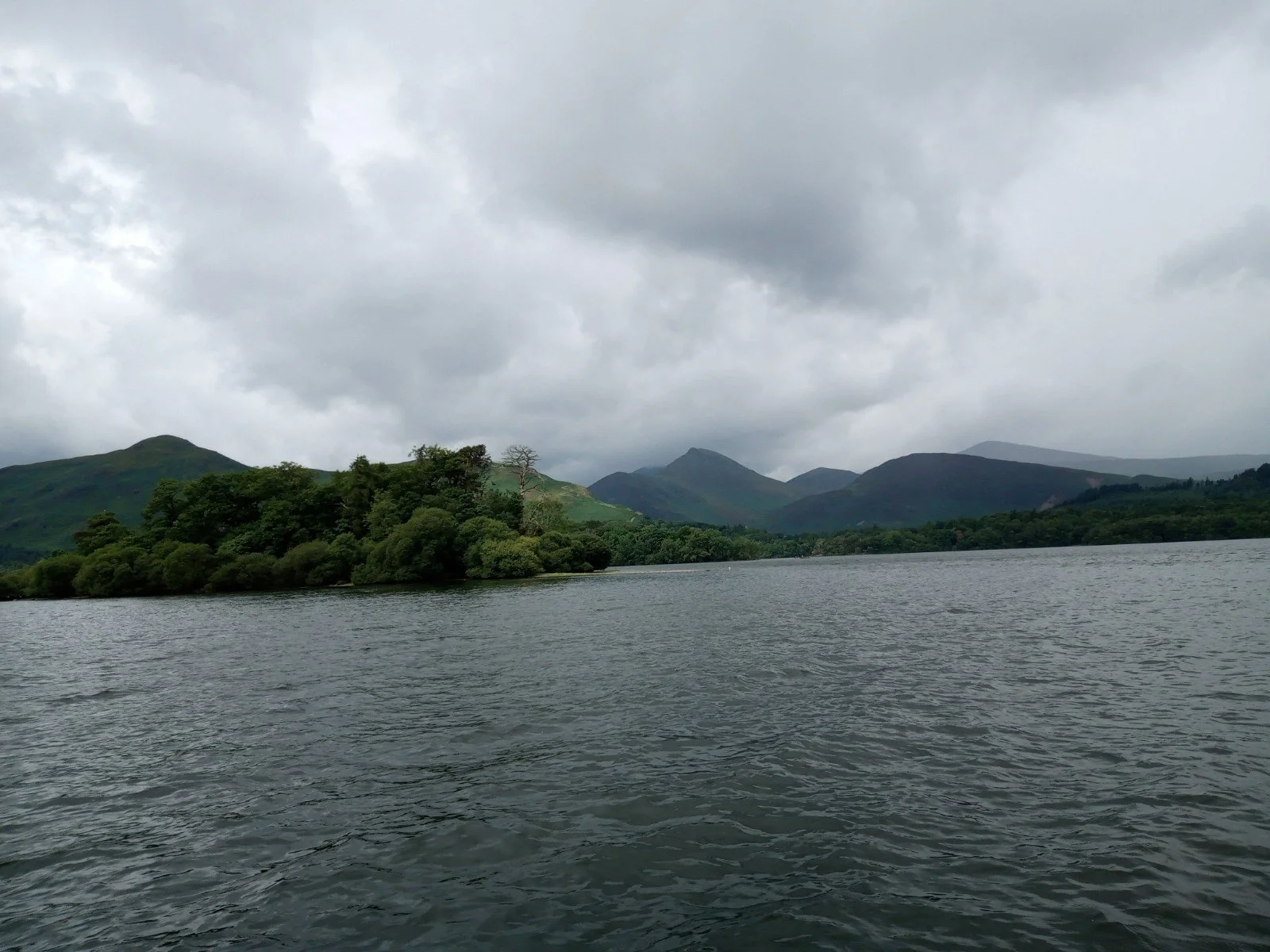


Travel to the North Lakes by train, with a friend who knows how to read a bus timetable, and you are in for a pleasant surprise. There is a regular bus from Penrith station to the centre of Keswick (right), a town situated deep in the Lake District National Park and a gentle stroll from Derwent Water.
The bus leaves Penrith about 50 minutes after the London train arrives, but this inconvenience may just be a cunning ruse to ensure increased use of Penrith cafes for a refreshing cuppa or lunch, or to allow time for you to claim your delay repay from Avanti, when the train runs late. If you are coming from Glasgow, the connection is in the order of a mere 20 minutes, allowing less wriggle room. But, as there are also long distance buses to Keswick from Newcastle and Carlisle, this competition may suggest that it is higher priority to connect with train services from the north, than from the south.
As it happened, our London train was on time but our lunch was so enjoyable that we missed the first bus and had time for coffee before catching the bus an hour later.
Once in Keswick, there are buses to a number of locations, including Borrowdale and Buttermere, Windermere, Ambleside, Grasmere and Thirlmere. Some are double-deckers and provide stunning views but even the single deck buses give you a far better prospect than you would get from a car. Apart from scenery, these buses also provide access to lowland and upland walks, to stately and humble homes and gardens, to excellent cafes and, of course, to the Grasmere Gingerbread Shop. It was delightful to be car-free.
Below: the stately Grade II* (both house and garden) Rydal Hall (left) and formal garden (right) designed by Thomas Mawson


Above: the ‘humble’ Grade I listed Dove Cottage (the Wordworths’ Grasmere home); the cottage and garden (left) and the modern museum building (right).
To be honest, access to Scafell Pike (England’s highest peak) is tricky by public transport, so no chance of ticking off this one on our recent trip. But, of course, Switzerland solves this access issue with the Tramway du Mont Blanc (not to the actual top)!
Cars and uplands are a tricky mix. Issues of parking and summer traffic jams can ruin any mountain experience. The Lake District was one of the first areas to tackle the problem, in the 1970s, when traffic made the Langdales virtually impassable, with serious consequences for emergency vehicle access. In Snowdonia, now known as Eryri, and Wales’ oldest National Park, this problem became headline news during the Covid epidemic, when cars were towed away from narrow roads and tracks to ensure emergency vehicles could get through.
In the Lake District, and in Snowdonia, a new form of public transport was established to enable visitors to leave their cars in car parks or even at home. In the Lake District, the Mountain Goat bus service commenced in 1972, using 12 seater minibuses which could ‘access all areas’. It was not without controversy, however, but the Goat service grew rapidly, as did the number of visitors with cars and the potential market. Locals also added to the problem, with increased car ownership among residents, but also benefitted from the expanding route network.
Today Mountain Goat company run a sizeable tourism operation, and Terroir suspects that they have even given up their public service bus routes to Stagecoach, who currently run the other Lake District routes. Accessibility is also improved by the current English flat fare of £2 a trip or, for the more mature, the use of an English bus pass.
Boats are also a facet of Lake District transport thanks to the 16 large lakes which complement the mountains in the scenery department. Only one - Bassenthwaite – is actually called a lake, but I suppose that naming the area the ‘Water District’ might not have the same cachet as the ‘Lake District’. One of our expeditions involved a boat trip partway down Derwent Water, a pleasant hike to a handy bus stop and a very long wait for the Buttermere bus. No doubt if we had downloaded the App, we would have realised that the late running was due to a closed road, but a return trip through Seatoller, past the Honister Slate Mine (which, of course Terroir found fascinating) and down to Buttermere (the lake not the village) was well worth the effort.


Above left: the bus stop shows a slightly dated ‘flag’, maybe from a time when homing sparrows were used to carry bus timetable updates (© G Harding), but (right) the Derwent Water launch, is bang up to date.
Although made famous during Covid, the Snowdonia/Eryri car problem was developing around the same time as that in the Lake District. Snowdonia’s answer to the Moutain Goat was the Sherpa’r Wyddfa, a delightful mix of Nepalese and Welsh, which translates as the Snowdon person from the east, although I’m happy to settle for the Snowdon Sherpa. As with the Lake District, the service started in the 1970s and provided a network of routes which complemented a more traditional bus service.


The problems were basically the same and the two parks are very similar, not necessarily in terms of landscape, but in size and popularity. The Lake District is just 186 sq km bigger than Snowdonia, but Snowdon itself, at 1,085 m, caps Scafell Pyke by just over 100 m. But in Wales, things are done differently. Transport for Wales was established in 2016 to ‘change the way Wales travels’, with a specific remit to encourage both active and sustainable travel. There is a chance that integrated transport may actually mean something here, with a mix of Sherpa’r Wyddfa, TrawsCymru bus services and funding available for improvements.

And, although boats don’t feature much in the Snowdonia transport mix, one should not forget the importance of big and little trains in the Welsh landscape. ‘Big trains’ (images below) serve the National Park well, via the North Wales Coast Line (Crewe to Holyhead), the Conwy Valley Line, which runs through the park to Blaenau Ffestiniog, and the Cambrian Line (Shrewsbury to Pwllheli). Snowdon itself, of course, has its very own mountain railway and the heritage and ‘little’ trains of the Welsh Highland Line (right) and Ffestiniog Railway, compete more than adequately with the Lake District’s monopoly on boats and large water bodies.


I would suggest, however that if Eryri/Snowdonia has the edge on integrated and sustainable transport, the award for best cake and cafes must go to the Lake District.


All Welsh images © TerroirNorth/T Thompson/R Thompson

Bloom in June
No Mow May is not always a universal favourite.
Terroir south has many neighbours with knee-deep, shaggy, floriferous and colourful vegetation, where once was neat lawn. But others see this land- or garden-scape as long, unkempt and weedy. They bemoan the loss of the great British lawn: green, stripy, easy on the eye, wonderful to sit on and relatively free of fauna which bite or sting. Which side of the garden fence are you on?


But there’s the thing. There is no need for any fencing in this debate. In any garden, public park, common or road verge, there is room for both types of grassland, and for a great deal more in between. It need not be a cultural debate between, on the one hand, the traditional British lawn, parkland or sports pitch (dare we say it, symptomatic of control, status, high maintenance and (deservedly) great pride in horticultural skill) and, on the other hand, the contemporary, species rich, climate change aware, low input, meadow. Historically, both have been with us for centuries, although we would venture to say that the economically valuable hay meadow has probably been around longer than the manicured lawn, or the extensive grass-scape of the English Landscape Park.
Probably the least understood aspect of this debate is maintenance and long term management. Not cutting the grass in spring is a huge attraction which encourages many to start on the road of No Mow May. But the slogan implies that it is OK to start mowing again in June. This is a shame as many meadow-loving flowers bloom in June, July, or August or … . Why restrict ourselves to the flowery beauty of spring alone? Need somewhere to sip that glass of Prosecco or read a book? Cut yourself a sitting space and access path and revel in the summer blooms while you sip and scrutinise your screen. Watch the activities of a whole host of other creatures which also benefit from that ‘relaxed’ attitude to mowing. Know that you are contributing to a healthier planet. Know that varied garden habitats are as crucial to biodiversity as they are in a nature reserve.


But it is also true to say that mowing a short grass lawn is a lot less effort that cutting back something that has been growing unmolested since late winter. Ideally, wildflower meadows need anything between one and three cuts a year, depending on how you want it to develop. In theory, Terroir’s meadows get cut in August/September and possibly again in February, but they are very forgiving if the cuts are late or, occasionally, non-existent. But if you want a bloomin’ meadow, rather than scrubby glades, then at least an annual cut is fairly essential. Holly and oak are particularly invasive in le jardin de Terroir.
So it’s a balance: a quick-ish cut every week or so for that green lawn, or a major hay harvest in late summer. Don’t forget to leave the hay in situ for two or three days, to allow all the seeds to drop back into the sward to enhance next year’s display. Finally, remove the hay to stop it enriching your meadow. Grass loves rich pickings in the soil department so if you want your flowers to get a root-hold, then keep the meadow on a low fertility diet. What to do with the hay? Find someone with guinea pigs or rabbits!
What follows is a tale of three meadows. Two were intentional, but were created in different ways. One is a more rural, recovery area.
Meadow 1 – Terroir’s Mini Meadow

Terroir’s first meadow was created over 20 years ago and although it kept the guinea pigs in hay for many months each year, in other ways it has been somewhat disappointing. We removed the topsoil over the majority of the area and sowed what, at the time, was felt to be a reliable wildflower seed mix. Germination was poor and we probably broadcast the seed too thickly.
As you can see (above right) grasses now dominate, so only the most invasive herbaceous plants can get a foothold – common sorrel (Rumex acetosa) and ribwort plantain (Plantago lanceolate) do well, as do a small selection of garden escapes including a purple cranesbill, lungwort (Pulmonaria, probably officinalis) and lady’s mantle (Alchemilla). Bugle (Ajuga reptans) and ox-eye daisy (Chrysanthemum leucanthemum) come and go, and this year some ragwort (Senecio jacobaea) has established, but as yet without Cinnabar moth caterpillars to strip it bare. Past highlights have included a hub of ground nesting bees – quite a shock at harvest time and left severely alone once discovered.


In springtime, however, primroses throng a bank under an apple tree and fritillary bulbs, planted around the tree’s trunk, have finally come good with stunning displays before the grasses get too overpowering.


Bizarrely, a persistent specimen of ling (Calluna Vulgaris) clings on from an earlier planting, and colour coordinated Betony (Betonica officinalis) has now colonised this area and spreads each year (both left). The first outliers of the latter have finally reached the main meadow, No. 2.
So Meadow 1 looks fabulous in spring, is good on biomass, but is somewhat underwhelming on biodiversity. Probably time for a change in management.
Meadow 2 – Terroir’s ‘lawn’ conversion
Meadow 2 is only a few year’s old. There was never a classic English lawn here; more a patch of grass which, once no longer required for football and cricket practice, was mown irregularly to maintain some sort of short sward of grass (and moss) for sitting out when the weather allowed. As it is not immediately adjacent to the house, there was no great demand for tables and chairs, Pimms and picnics in this location.
We started the meadow creation by leaving an unmown margin. This was quickly taken over by primroses and bluebells, loving the shady edges on three sides.


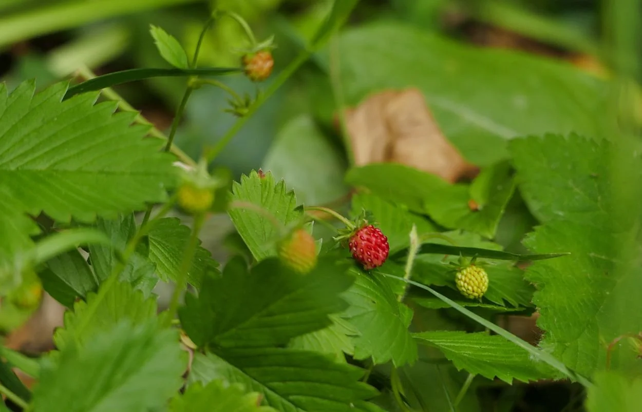

Three years ago, we stopped mowing altogether, apart from the creation of some necessary pathways from house to corner seat and from compost heap to a couple of small fruit trees. These routes vary year on year.
The results have been spectacular. The overture is an abundance of massed primroses around the edges, followed by a fanfare of bluebells and an aria of fresh spring green from the grasses. Sidling though the stems is the pale pink of lady’s smock or cuckoo flower, (Cardamine pratensis), then the pert stars of lesser stitchwort (Stellaria gramniea). Soon the plantains begin to provide texture and height as their spear-like flowers raise their heads above the grass parapet. Terroir loves a mixed metaphor.
If you had mowed on the first of June, however, you would have missed so much: the massed displays of ox-eye daisy, the purples of betony and self-heal (Prunella vulgaris), assorted red and white clovers, the yellows of ragwort, nipple-wort (Lantana communis) and cat’s-ear (Hypochoeris radicata), and the delicate white of a young umbellifer, probably wild carrot (Daucus carota).


By now the plaintains are on the march, swaying in the wind like drunken Cossacks or guardsmen, who have exchanged their spears for a slimline version of their traditional headgear of wolf or bearskins.


A new and rather experimental extension to the meadow was seeded last autumn, at the bottom of a slope. This shady area was largely seeded with a woodland/shade mix but the sunny spots received an eclectic mix of all the little packets and bags of assorted ‘wild’ flower seeds which came from everyone’s Christmas stockings over the last two years. The results to date have been a gaudy display of red and yellow: chamomiles, poppies, marigolds and what appears to be scarlet flax (Linum rubrum) (below left).


But it’s not just about gardens. Here is a dispatch from a rural area just north of Wrexham (a place which no longer needs any explanation as to its whereabouts…).
Meadow 3 – ‘just a field’
David writes: 2021/22 saw us with a tenant whose horses were in for somewhat random and, at times, inappropriate periods. The first autumn, they were in for several very wet weeks. As they were both shod, the field soon looked like a WW1 battlefield. Then, when the weather dried for a spell, they were taken off for several more weeks so the lumpiness set solid. However, thank goodness for earthworms etc and my amble today (22nd June) was reasonably smooth.
Late last year the horses were sold and we decided it would be good to let the field have a rest for a couple of years. The motivation for today’s walk was to see if some orchids had survived the equine depredation. They had indeed, though I got the feeling they would have preferred a little less grass. They still seem fairly widespread though and, with the denseness of the grasses, impossible to see except at close quarters.


There are a good variety of grasses and I always think the umbellifers (below left) look like patches of mist amongst the taller grasses.
There was a fair amount of yellow rattle about too (below right). Not much yellow left but plenty of rattle. I gather its hemi-parasitism is useful for weakening the grasses and thus encouraging more flowering plants to grow.


I think the element of my amble that you might have enjoyed the most though was the sheer number of, mostly, Meadow browns. Great crowds of them rising up with every few steps I took. A couple might have been Gatekeepers as there seemed to be a little more orange but that might just have been my eyes and the angle of the sun. I've never seen such a host of butterflies. There were lots of other little flying people but they were bees and, maybe, small moths.
My final pause came as I reached our back hedge gate. I wonder if the old holly berry saw is still valid because, if so, we may have a bad winter ahead.
Thank you David. Terroir suspects, unromantically, that the early mass of holly berries is due to the weather we have just had, rather than what we might expect in the autumn/winter! But your ’just a field’ report is very timely and very cheering.

Postcards from Sicily
It was the size of a grapefruit!
Just as bumps and lumps tend to be described in terms of fruit, so the proportions of geographical areas always seem to be compared with the size of Wales. For some reason, Sicily was bigger than Terroir expected, so we did a few of the obvious comparisons. Sicily just out ranks Sardinia in extent but is three times the size of Corsica. Compared to Wales? Sicily is 20% bigger. Who knew?
Just as Terroir has found it impossible to categorise Wales in a couple of blogs, so limiting ourselves to a few meagre words on a sodden Sicily is also very difficult. Regarding the adjective ‘sodden’, please see our previous post for details of recent Italian rainfall. And again, as per our last post, we are once more sending you a small selection of postcards. We will, however, preface the Sicilian ones with a curtsey to Mount Etna, Sicily’s iconic volcano.

Mount Etna, featured at the top of this post, can be a mighty smoking goddess or utterly hidden under an invisibility cloak of cloud. We were amused, therefore, by an interpretation board which included the rather esoteric comment illustrated right. The references to “between hell and paradise” and “a difficult challenge for the writers” struck home after our personal experiences, whilst standing on Etna’s volcanic slopes, of snow, torrential rain and no views! Admire the Valle del Bove? Huh.

Greetings from the Parco Florence Trevelyan, aka the English Garden, Taormina
Taormina, as many of you will know, is a popular ‘chic resort town’ [Lonely Planet’s description] which clings to the eastern coast of Sicily, providing wonderful views of both the Ionian sea and, in good weather, of Mount Etna. When the tourist bustle becomes too much, a quiet stroll around a spectacularly sited public park can bring welcome relief.
The eponymous Florence Trevelyan seems to be a slightly shadowy Victorian lady who may have needed to escape her native Northumberland after a dalliance with the Prince of Wales, later Edward VII. Arriving in Taormina in the 1880s, she created a number of gardens, and married a local doctor.
The Parco FT is a delight even when it’s raining but is spectacular when the sun comes out after a shower. The planting is a mixture of tropical and Mediterranean species including some fine specimens of olive, pine and cypress, underpinned with a variety of shrubs and hedges, herbaceous plants, tranquil open spaces and Victorian follies (the latter inaccessible and hard to photograph). A mix of local lava stone and brick creates whimsical structures and handsome surfaces although the latter can get a tad slippery in the wet.


Florence appears to have been a member of the Northumberland Trevelyan family (think BBC reporter Laura Trevelyan) who, records now reveal, were 19th century plantation owners in the Caribbean. Unsurprisingly, these holdings contributed greatly to Trevelyan fortunes and earlier this year the family apologised to the people of Granada and are, apparently, establishing a community fund for economic development on the island. It is doubtful whether this Victorian aspect of family life prompted Florence’s escape to Sicily but we would suggest that her life and garden design skills are worthy of further research.

Life in Ruins
We mentioned the association between archaeology and wildlife in our previous blog (the postcard from Pompeii). It is perhaps rather unoriginal of us to feature this again, but for once, the ruins, the weather, and the wildlife were all co-operating to create a very memorable Sicilian experience.
The Parco Archaeologic della Neapolis, in Siracusa, is stuffed with interest. We will spare you details of the Latomia del Pardiso (a historic space with catacombs and traces of classical prisoners of war, located in a gigantic former limestone quarry, below left) and will pause only briefly at one of the two amphitheatres which also occupy the site. The Teatro Greco (below right) is transformed each year into a modern theatrical space for classical Greek theatre productions and the infrastructure of modern technology robbed the space of any ancient atmosphere.


Further on however, is the Anfiteatro Romano, pictured on the ‘post card’ above, which creates a very different ambience, one of historical drama (literally and metaphorically), visual pleasure and wildlife interest.


Sicilian Souvenirs
Sicilian ceramics are striking, colourful and bold. The tradition is said to be very old, probably imported from North Africa, perhaps around 10,000 BCE. Various websites describe the process of drying followed by low temperature baking/firing, to create earthenware which is then painted with tin oxide colours to create a majolica style ceramic. The motifs are clearly influenced by the Sicilian landscape and culture; these days, we presume, that ‘culture’ also requires a huge increase in ceramic production to meet the demands of the modern tourist economy.


A remarkable variety of ceramic heads (right) are on sale everywhere and, in Terroir’s view, are an unappealing part of the offer; we just couldn’t live with one or two of these staring at us. One website suggested they portray the heads of two illicit lovers; when the girl discovers that her night time visitor already has a wife and children, she decapitates the boyfriend and uses his head as a flowerpot. At least this form of recycling shows an admirable imagination and love of plants, but it’s still a ‘no’ as a souvenir purchase.
Terroir is susceptible to shopping for ceramics, however, so while in Palermo, we made our way to an establishment which had been recommended to us. Talk about a kid in a sweet shop. The photos below demonstarte the vibrancy and celebration of design and decoration. Below left, you can see a variety of creamic blue pine cones, another motif which is typical of Sicily both in terms of ceramics and landscape.


The recommendation to visit this shop was a good one. We were talked through the origins of many of the designs and shown pictures of much earlier interpretations of the two patterns we chose. Below (top row) shows a traditional pomegranate design (from the 16th century) with the modern plate on the right and, in the lower row, an even older fish representation from the 12th century. Again, the modern plate is on the right.


We are pleased to report that both dishes arrived home undamaged.

Postcards from Italy
The key to Italy this spring was Climate Change. Climate Change in the form of water. You may have read about it on-line, seen it on television, heard about it on the radio. Some of you may still be enjoying your news stories in print, through the medium of daily papers or magazines. However you choose to take your news, in Italy this spring, it was taken with water. In some areas, the equivalent of over half the annual rainfall descended in just two days. Flooding and mud slides caused catastrophic damage, thousands were forced to leave their homes and at least 13 people died. The Irish Times of 23rd May, put it succinctly: “They [the floods] are a warning too for other Europeans that potentially catastrophic climate change induced by human action is here to stay on the continent.”(https://www.irishtimes.com/opinion/editorials/2023/05/23/the-irish-times-view-on-the-aftermath-of-the-italian-floods-a-warning-for-europe/). Will we never heed these warnings?
Terroir visited la bella Italia last month, although we were well south of the worst hit areas in the centre of the country. Thankful as we were to miss the flooding, being rained on everyday does drive home the climate change message. The picture at the top of this post was one of the best views we managed from Mount Vesuvius: a quick click of the camera as the clouds parted for just a few seconds.
But there were some more photographic friendly moments, so we are sending you four picture postcards from Southern Italy.

Greetings from the National Railway Museum of Pietrarsa.
Located between Naples and Portici, this museum is pretty much the perfect place to spend a wet morning and a damp lunch time.
The buildings represent the pinnacle of railway locomotive engineering ambition of the Bourbon King Ferdinand II, King of the two Sicilies. Aiming to promote home grown Italian industry and technology, the new railway works commenced in 1842 and became the Swindon of Italy, employing 1,100 workers by the middle of the 19th century (https://en.wikipedia.org/wiki/National_Railway_Museum_of_Pietrarsa). 5 pavilions dedicated to engineering lie on the very edge of the Bay of Naples. We’ll take a look outside when it stops raining.
Inside the ‘Cathedral Pavilion’ (below centre) lies a collection of steam powered beauties, all painted black and all polished to perfection. And, apparently, all constructed prior to 1930. Where’s the newer stuff? Apparently there isn’t much as the, by now unified, Italy started on electrification much earlier than Britain. We assumed this was due to less coal and oil but significant early hydroelectric generation.


We’re hungry and it’s stopped raining. The walk to the café (housed in a different pavilion) is full of surprises, not least the scenic location and the presence of a ‘botanic garden’. Something for everyone, including architecture, horticulture, coastal engineering and coffee.
Coudn’t read the plant labels as treading on the grass is forbidden.


Welcome to Pompeii in the spring
How often do you see an internationally famous archaeological site smothered in wildflowers? Visiting in May obviously ups your chances but we did wonder if the visual feast we encountered would scare the life out of some British archaeologists. Spring time fields of ‘Tuscan’ poppies (they probably came originally from North Africa) are a feature of the Italian landscape and we assume that Pompeii’s contribution is also the Tuscan variety. To Terroir, however, poppies suggest regularly disturbed ground so, yes, this spectacular display did leave an archeologically worrying after taste.
We were also travelling without an Italian flora (why, oh why?) so help, please, in identifying the crevice loving ‘snapdragon’ (below left and centre): garden escape? Sicilian snapdragon? Comments in the box below or by email please.
Oh, and bottom right, that’s a Wall butterfly, on a wall.


Impossible to sum up Pompeii in a few words, but brick loving Terroir revelled in some of the construction and design details, and the wall art was unbelievably impressive. And the gardens, and the amphitheatre, and the town planning and the occasional glimpse of Vesuvius’ foothills (right), once the early morning rain had stopped.


Views of Vesuvius - the Vanishing Volcano

The nearest active volcano to, say, London is probably Öraefajökull in Iceland. But the second nearest appears to be Vesuvius, the monster which made Pompeii and Herculaneum famous. It is scarily easy for Brits to get close up and personal with a smoking volcanic mass.
Image left: this is what it looks like on a good day.
As it happened, we also visited Etna but it rained so hard when we got there that we had to retreat. Etna’s snowline had advanced downhill between our arrival and our departure. It was the 16th of May.
Back on Vesuvius, the famous Bay of Naples view was totally obscured.


But we could see the track under our feet and could follow the gradation of vegetation colonising the lava slopes. No doubt the colour of the lava, elevation, aspect and degree of shelter make a difference, but a pattern is clearly defined. In the most inhospitable areas the lichens and mosses start off the process of plant colonisation and soil making.


Next come the tough, clump forming, herbaceous invaders, where the substrate is less vertiginous and the lava is more like gravel than bare rock. Here are docks, artemisia/wormwood, red valerian and chamomile (botanists - do correct me if I’m wrong!)


Finally as the pioneer species begin to create more recognisable ‘soil’ the plants begin to coalesce and become more varied, until shrubs such as broom can get a toe hold and a scrub and young woodland habitat starts to form.


Further down the slopes, where you would expect woodland, something else has been going on. Wildfires have always been a presence but it seems their number and impact (world wide) has been increasing, probably due to human impact (intentionally or unintentionally), exacerbated by climate change. A big fire affected these slopes of Vesuvious in the last few years. The ground flora and broom has grown back under the woody skeletons but other shrubs and trees are taking longer to establish.


Not the Boat Train but the Train Boat!
Remember when trains went on boats? One of Team Terroir can remember travelling on the ‘Night Ferry’, an iconic train which ran from London Victoria to Dover, then by ferry to Dunkirk and finally on to Paris Gare du Nord. The service was axed in 1980, but other European train ferries continued to function. Today, only two remain in Europe, a freight line from Germany to Sweden and a passenger train from the toe of Italy to Messina in Sicily.

It’s a captivating experience: a combination of the excitement at using a piece of working heritage with all the fun of playing with a giant model train set.


Here Be Dragons II
In their previous Dragon post, Terroir North Wales considered symbols of Welsh-ness and debunked a few myths about daffodils, mountains and coal mines. The Welsh dragon, symbol of strength and courage was, however, shown to be a consistent symbol of Welsh identity. So let’s take a closer look.
Welsh dragons populate all parts of the Principality, in a multitude of locations and venues and in all shapes and sizes. Some are traditional, some fierce, some apparently friendly, some are caricatures or abstract and some are just plainly and intentionally comical.

For example the Welsh Government logo (image right) is a traditional dragon whereas the erstwhile Countryside for Wales (now part of Natural Resources Wales) (below left) used a much more abstract version and the National Botanic Garden (below right) uses a vertical interpretation (with a fern frond sprouting out of its back).


So what is the background to this mythical beast in Welsh culture?

As an emblem, the red Dragon of Wales has reputedly been used since the reign of Cadwaladr, the seventh century King of Gwynedd (you will recall that we met him earlier whilst on the subject of leeks). Leaders of the ancient Celtic Britons are often referred to as dragons (including the eponymous Owain Glyndwr, left).
Of course, there are many versions of the legends and stories relating to the adoption of the dragon as a symbol of Wales but the over-arching theme is that our trusty Welsh dragon was basically one of the ‘good guys’ favouring the Welsh, and so it was logical to adopt it as an icon of power, strength and Welsh-ness.
Image © Hefin Owen https://www.flickr.com/photos/47515486@N05/50587033677/
In the Mabinogion, for example, (the first written collection of ancient Welsh tales and folklore), the Welsh dragon appears in a story of the brothers Lludd and Llefelys. Our dragon is battling with an invading white dragon (English of course) at Dinas Emrys, an area that we now know as Beddgelert in north west Wales. Gwytheyrn, a fifth century King of the Britons, tries to build a fortress here (it’s a long story), but a little lad named Emrys, popularly thought to be the juvenile Merlin of Arthurian fame and fortuitously present at the time (maybe on holiday from the eighth century version of Hogwarts), advises him to dig up the squabbling dragons which are below the proposed fortress site. Gwytheyrn does the digging and is able to witness the red dragon defeat the white dragon, which is summarily despatched back whence it came. Presumably it skulked off with the dragon version of its tail between its legs, no doubt intent on wreaking havoc in some part of England instead.
Now dragons are found everywhere. Apart from on the ubiquitous buses, shops and road signs, dragons have appeared in a multitude of other places. A train which shuttled between Rhyl and Llandudno for many years was known as the Red Dragon and proudly displayed a headboard to confirm its identity (see previous post) .

There were the council officials tasked with creating a name for the new bridge which spans the harbour at Rhyl (image left). And what did they come up with? Dragon Bridge (Pont y Ddraig).
Image © Richard Hoare

There are Dragon Roads in many places, including Holyhead and Llanelli and Coed y Ddraig (Dragon Wood) near Tregaron. A massive stone edged dragon was constructed on the side of the main road entering Wales at Deeside though that has since disappeared into a mass of overgrown vegetation. But it was the thought that counted even though it was constructed facing the wrong way. Generally the Welsh dragon should always face to the left. This one faced to the right. Maybe that’s why it was abandoned so soon after being constructed!
Welsh War memorials also feature the courageous dragon. The Memorial Park in Ypres has a large dragon (below left) as its focal point, standing proudly on a Celtic style cromlech, in memory of Welsh soldiers and members of Welsh regiments who lost their lives in World War One. At Mametz Wood (nrthern France), David Petersen’s sculpture (below right) stands on a stone plinth, clutching barbed wire, in memory of the 38th (Welsh) Division during the first Battle of the Somme.

Image left: © Llywelyn2000 https://commons.wikimedia.org/wiki/File:Red_Dragon_of_Wales_at_the_Welsh_Memorial_Park_Ieper_%28Ypres%29_Parc_Coffa%27r_Cymry,_Gwlad_Belg_31.jpg
Image right: © The First World War poetry Digital Archive, University of Oxford

And, on a completely different level, there is all the dragon-embossed merchandise found in every souvenir shop the length and breadth of the country; cuddly toys, ceramics, key rings, fridge magnets, pens, rulers, and a whole variety of tacky gifts.
© https://www.flickr.com/photos/worldofoddy/
In modern times there remain good and bad dragons. The classic baddie to end all baddies must be the dreaded Smaug from Tolkien’s The Hobbit. This really was a nasty specimen given to mass destruction on an unparalleled scale.
At the other end of the dragon spectrum is the lovable Idris and his family (partner Olwen, and their adorable children Blodwen and Gaian) who feature in the delightful stories of Ivor the Engine. Whilst primarily a series of children’s books, Ivor and his friends have a massive adult fan club. Ivor, his driver Jones the Steam and the stationmaster Dai Station, all reside at the fictitious Merioneth and Llantisilly Rail Traction Company which, as the books point out, is located in the top left hand corner of Wales.

Thanks to Messrs Postgate and Firmin
Briefly, Idris hatched from an egg placed in Ivor’s firebox and later resides in an extinct volcano on Smoke Mountain. The books follow Idris’s adventures as well as those of Ivor, Jones, Dai and a whole host of other wonderful characters. Now these really are the sort of dragons that we would all love to have living in our multifuel stoves or centrally heated sheds.

But surely dragons are fictitious, like unicorns, the Loch Ness Monster, the Abominable Snowman or Bigfoot? Or are they? If you’ve ever ventured into a woodland at dusk and heard a vixen’s eerie call, the bark of a roe deer or muntjac or, indeed, the grunts and creaks of two old trees rubbing together in the wind, then you will know how easy it is to be spooked by these things, and how your imagination can carry you away into another world of strange creatures.


Dead and broken trees, branches and stumps can also assume remarkably convincing shapes of dragons or other mythical beasts. Up in the mountains of Snowdonia (now officially known as Eryri by the way) the wind and the cloud and maybe the failing light can deceive your logic with a host of strange noises and movement. Suddenly a rock can assume the form of a dragon and the swirling mist and low cloud can exacerbate that impression. But, of course dragons don’t really exist …. or do they?


Footnote:
Medieval mapmakers supposedly inscribed the phrase ‘Here be Dragons’ on maps showing unknown regions of the world. What does that say about Wales?
All images © T Thompson unless otherwise stated.

Here Be Dragons
Part 1
A little while ago, two members of the Terroir North Wales team had cause to travel regularly from the Vale of Clwyd in the north of Wales to near Llandeilo in the south. Those familiar with the geography of Wales will instantly recognise that this was going to be a slow and circuitous journey whichever route the Terroir team chose. The eastern route generally passes through lower lying and more undulating country whilst the western passes largely through more mountainous terrain.
We had to invent something to pass the time. Perhaps a simple game of I Spy might have worked, but M for mountain, F for field, S for sheep, DSW for dry stone wall and TJ for Traffic Jam (and yes, we do occasionally have those in Wales), would get very repetitious. Coloured cars was a bit too infantile and railway bridges disappointing; guaranteed never to exceed low single figures.

So what do you think we settled on? Well, dragons of course. Considering that most people consider dragons to be a figment of imagination, their images are omnipresent throughout Wales. No, not great scary fire breathing reptiles, lurking behind boulders or under river bridges, but red, Welsh dragon images in all their forms.
Image right: straight on for Wales and non scary dragons, left to England for scary Daleks and a variety of transport options.
And goodness, how very many forms there were: pictures and caricatures on buses, taxis, shopfronts, delivery vans, road signs and so on.
So many in fact that the game later evolved into categories – acceptable/valid images such as found on, say, Dragon Taxis, Dragon Auto Parts or patriotically flown Welsh flags (see top of this post), and unacceptable/inane dragon images, found on something having no real Welsh connection or relevance, eg some shopfronts, some buses and quite a lot of lorries. Of course this latter classification in itself caused debate, with points being awarded or lost depending on whether the opponent agreed or disagreed with the dragon spotter. Needless to say it created a fun activity to lessen the tedium of such a long and regular round trip.
Up to you to decide which category the following imges fall into.


The above are pretty easy to judge on the ‘valid or ‘inane’ decision, but why does the CCGC/CCW dragon (above centre) face the ‘wrong’ way?

Who decides which language should come first?


Welsh transport - old and new-ish.


Welsh groceries.
This led us to a discussion along the lines of ‘what would you get if a Welsh person asked a group of English people what they think typifies Wales, in one or two words (we are assuming that the English people have never, or rarely, visited the Principality)?
What would our blog readers suggest? We guessed that some of the more likely responses (in no particular order of course) would include mountains, coal mines, daffodils, leeks, rugby, unpronounceable place names (ok that’s three words) and, yes, dragons. So let’s have a look at these a bit more closely.
Mountains – yes plenty of those but contrary to popular belief, Wales has substantial areas of low lying land, especially in the east and parts of the south and south west. For example most of Pembrokeshire is very low lying and so is Anglesey of course.


Coal Mines – probably one of the most common myths is that Wales has or had wall to wall coal mines, interspersed with happy miners singing their socks off in every valley. Of course the mining areas were largely confined to the valleys of south and south east Wales and to a lesser extent in the north east around Wrexham and Deeside.
Image above: the Rhondda Valley’s Glamorgan Colliery c 1920 © Terroir
In between those two areas there were positively no coal mines (though incidentally tiny coal mines did once exist, for a very brief period, in Pembrokeshire and on Anglesey).
Little trace remains today; the mines are all closed and the tips removed or regraded. The rows of terraced houses and the odd preserved headgear are all that reminds us of this industry.


Above: images of South Wales mining taken at the Blaenavon Big Pit National Coal Museum. ‘National’ means ‘Wales’ in this context. Note the red dragon flying proudly from the preserved pit head gear (above left). Images © Terroir

Daffodils – here with Welsh Border Collie - are found everywhere but are not specifically Welsh, of course. The wild daffodils in the Lake District which so enthused Wordsworth are not to be found in Wales in such abundance, although they do occur in small numbers in many places.
The daffodil seems to be a relatively late addition to Welsh symbolism and the precise reason for its adoption remains unclear. Maybe its Welsh name Cenhinen bedr (Peter’s leek) may have some bearing in so far as it has, to some extent, superseded the leek as an emblem of Wales. And, of course, it is somewhat easier to wear as a buttonhole, and considerably less pungent than the leek. Also the fact that by St David’s Day (1st March) there should be plenty of daffodils in flower, makes it easier to gather for the many events that take place on that day.

Leeks – legend claims that Cadwaladr, a seventh century king of Gwynedd, ordered his men to fasten a leek onto their armour to help to identify them in battle. The tradition of the leek as a symbol of Welsh-ness has persisted, albeit in modern times in less combative activities. But, it remains rather odoriferous and is now very much subservient to the daffodil.

Rugby – is very much a south Wales sport and garners relatively little participation or interest north thereof. So hardly an all embracing emblem of Wales.

Place Names – with a little bit of effort and a basic understanding of the Welsh alphabet (which has only a few differences from the English one) it is usually quite easy to correctly pronounce place names and, in almost all cases they are pronounced phonetically making it even simpler.

Longest village name in UK (and probably Europe). Usually referred to as LlanfairPG for obvious reasons.
Place names tend to be strongly descriptive, based on history and/or topography, thus making it easier to understand their meaning.
Note from the only all-English member of Team Terroir: from the English perspective, I wish to challlenge the above. Depending on how you define a ‘letter’, the Welsh alphabet has 29 options of which, arguably, only 19 are in common with the English alphabet. As an English speaker not resident in Wales or the borders, and schooled in Latin, French and German, I can assure you that it is hard work to learn Welsh phonetics, alphabet and place names, however logical that pronounciation may be! Also, If you have never learnt any Welsh, having place names which are descriptive is no help whatsoever! Assistance is not always constructive: if I was to pronounce Llanfair PG as suggested by the transliteration given on the sign above I would be banned from crossing the border for ever more. Oh and the pronounciation differs between north and south…
Terroir North Wales continues: a Welsh person in England could be forgiven [really?] for struggling with English place names, as they often are not phonetic, or are pronounced differently to how they read, or include silent letters. [Do the Welsh forgive the English for mis-pronounciation of Welsh place names?] By way of example, how about Happisburgh in Norfolk (pronounced Hazeburgh), Cholmondeley (Chumley), Horsted Keynes (Horsted Kanes) but Milton Keynes is – well – Milton Keynes, Kirkby is Kirby and Norwich is Norich. I rest my case! [But not even the English can pronounce these. Well, most of us can manage Norich].
Dragons – and finally we reach that most Welsh of all Welsh symbols immortalised for ever on the Welsh flag as a spectacular and rather fearsome looking bright red creature (in Welsh – y Ddraig Goch), rampant on a white and green background. Never mind boring stripes and coloured bands found on most country’s flags - this is a serious and instantly recognisable national banner and one of only three in the world to incorporate a dragon (and in case you ask - the others are Bhutan and Malta). It is found everywhere as a symbol of Welsh patriotism and will be seen fluttering from public buildings, private houses and gardens – in fact anywhere it can be displayed – with an exponential increase in use when a major Welsh event is taking place in the locality (such as an Eisteddfod).
We’ll look more closely at the Welsh Dragon in the next post, but we leave you now with a Welsh and English take on the Dragon myth.


All images © T Thompson unless otherwise stated.

Still Tumbling In

In 1919, the church of All Saints (the last remnant of the Suffolk coastal city of Dunwich), finally fell into the sea. Dunwich probably started as a Roman fort, became a Saxon settlement and, by 1086, was one of the ten largest towns or cities in England, despite having already lost a significant acreage to coastal erosion (http://www.dunwich.org.uk/history/). Major storms continued to eat away at the coast line such that, by 1602, the city was reduced to around a quarter of its former size. Storms in 1740 flattened what was left, leaving only the church to survive into the 20th century.
Image right: Dunwich Beach in June 2009 © ADE46 (link at end of blog post)
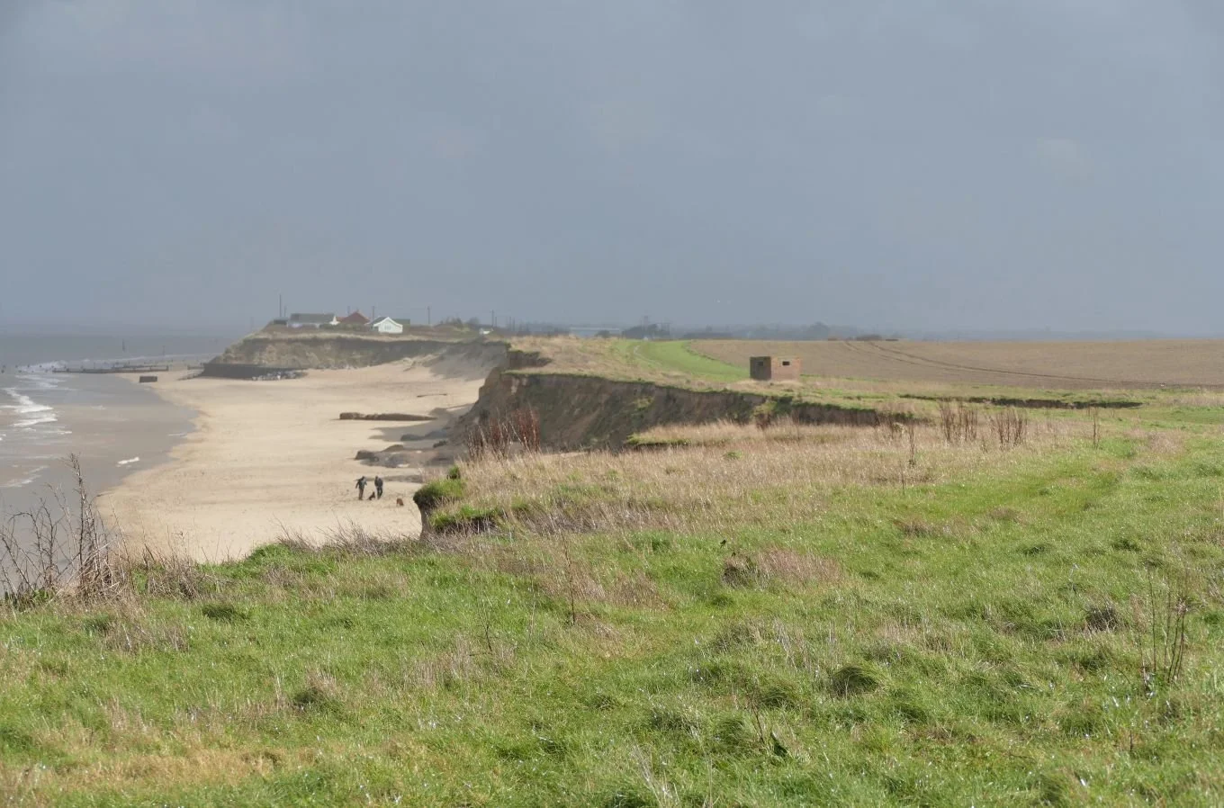
Further north on the East Anglian coast lies the star of our previous post: the village of Happisburgh (pronounced Hazeborough, of course). Around 50 miles up the coast from the lost city of Dunwich (pronounced Dunnidge), Happisburgh is described as the ‘Village Falling into the Sea’. Coastal erosion is, once again, the culprit. The present tense is still applicable to Happisbugh, but for how much longer will this be the case?
Image right: Happisburgh beach backed by those crumbling cliffs
Happisburgh, it seems, was never of the size or substance of Dunwich. But appearances can be deceptive, and human activity left its mark on the area long, long before the Romans ever eyeballed its Suffolk neighbour as a site for a coastal fort. It’s hard to get your head around the archaeological and geological history of the area, but it seems to go something like this:
It’s the early Pleistocene – maybe 2 million years ago and the ‘Ancestral’ River Thames probably rises in or around Wales and flows to the sea in the Happisburgh area. The Solent, the Seine and the Somme all seem to be in fairly familiar positions but, shock horror, the British land mass is part of the European continent, joined at the hip from, say Portsmouth to north Suffolk.
It’s getting chilly. Ice ages are rolling in. Ice diverts the Thames southwards (think Vale of St Albans, Richmond, Walthamstow and finally all points east). Pesky glaciers dump glacial till in the Happisburgh area. Fast forward to maybe 800,000 years ago and human-like figures are roaming East Anglia, dropping axes and who knows what other bits and bobs. We’ll come back to that later.
Forward again, into historical times. That soft East Anglian geology is now on the coast of an enlarged North Sea. Britain has become the British Isles. The shoreline is littered with crumbling cliffs, and coastal erosion becomes a physical reality. Communities build or farm close to the coastline and, whoa, suddenly, coastal erosion has become, not just a physical phenomenon, but a social, economic, political and frightening ‘thing’.
So where does that leave Happisburgh now? It leaves the village, where it has been for centuries: erratically and irregularly ‘Tumbling in’ to the sea. The village website (http://happisburgh.org.uk/history/sea/coastal-erosion/) provides sobering evidence. The neighbouring parish of Whimpwell had vanished completely by 1183. 19th century evidence for Happisburgh records a newly drilled field of wheat disappearing overnight (1845); Whites’ 1854 Directory suggests a coastline retreat of 250 yards in the previous 70 years; a set of farm buildings goes over the edge in 1855. The epic storm of 1953 caused unimaginable damage with 7 fatalities and horror stories such as “A bungalow … which at teatime on Saturday stood 15 feet from the cliff, was hanging over the cliff edge on Sunday morning”. There is more and it is uncomfortable reading.

The map evidence is equally dramatic. The image, left, shows Happisburgh in 1885. Note the square of roads which used to link the Coastguard Station, the Hill Hotel and the village centre before turning south and then east to complete the circuit and link with the coast road to the Low Lighthouse (located at the bottom right of the image). The north east corner of the road square has already gone over the cliff edge and the lighthouse, now also at risk from erosion, is recorded as having been closed in 1883.

In the 1930s, a ribbon development of cliff top dwellings has been constructed, despite the fact that the north east corner of our square of village roads has tumbled even further into the sea.

A mere twenty years later, some of these houses have aleady gone (the writing no longer on the wall, but on the beach?) but the coast road still appears to be functioning.
Map images all © and reproduced with the permission of the National Library of Scotland https://maps.nls.uk/index.html
Today, all the houses as well as the coast road have gone and a more westerly track which has replaced the road is already close to succumbing to the same fate. The process is clearly illustrated by the following images of active coatal erosion, all taken in March 2023.


Attempting to secure or protect the coast is costly and/or short term. ‘Hard’ reinforcements, such as groynes, energy absorbing rock barriers or concrete defences merely move the problem further up or down the coast, and require constant and expensive maintenance. Soft solutions such as ‘sandscaping’ or ‘nourishing’ the beach with sand have been tried, for instance on the coast between the Bacton Gas Terminal and Walcott, a few miles north of Happisburgh. Fuel security has obviously been the key to this scheme but Terroir suspects the works are too recent to provide significant results or reassurances. https://www.north-norfolk.gov.uk/sandscaping#:~:text=The%20Sandscaping%20scheme%20is%20based%20on%20a%20Dutch,erosion%20and%20flood%20protection%20to%20Bacton%20and%20Walcott
Hard defences have been constructed on Happisburgh Beach. Groynes were built in the 1950s. Part of a wooden beach revetment to the south of the village was washed away in 1990; the subsequent rate of erosion is said to have increased.


On the cliff top to the south of the Low Lighthouse site there is another row of homes or holiday cottages, some of which still survive. On the beach below is a stretch of concrete and rock armour, begun in 2002, presumably to buy time to allow for appropriate planning before ‘managed realignment’ allows the inevitable to happen.


But island Britain cannot afford to defend any more than a tiny proportion of its eroding coastline. In the past, the economic value which could be attributed to the works was probably more important than the emotional or financial needs of residents about to lose their homes. Today, managed realignment, coastal adaptation, improving coastal resilience are catch phrases of the moment, but if your house is perched perilously close to a rapidly moving cliff edge, this may not be much comfort. Also there is no single approved process for compensating for the loss of private property or land caused by coastal erosion in England. Schemes of compensation appear to be very variable in terms of approach, scope and financial aid.
Coincidentally, a BBC Radio 4 episode of ‘Costing the Earth’ was broadcast on April 18th, soon after Terroir’s visit to Happisburgh. Entitled ‘Losing our History’ (you can listen to it on BBC Sounds) the broadcast looked at the impact of coastal erosion in three very different parts of the world – Ghana, Bangladesh and – yes – Happisburgh. Specifically, the programme asks if we all need to prepare for the emotional impact of climate change, and calls for the inclusion of the community and of local skills and knowledge in planning the managed retreat process. Well done to ‘Costing the Earth’ for championing these aspects of managing coastal erosion and to the BBC website, which has some exceptionally moving eye witness accounts of the Happisburgh experience.
https://www.bbc.co.uk/news/uk-england-norfolk-63822899

But Terroir wishes to end this blog on a more cheerful note by looking at something positive which can result from coastal erosion. Remember those lost pick axes and wandering figures who were strolling about during the Pleistocene? Coastal erosion can undermine houses, fields and livelihoods, but it can also reveal surfaces which may have been buried beneath glacial deposits for thousands of years.
In 2000, a dog walker (that may be apocryphal) found a flint axe head in muddy sediments under the sands of Happisburgh beach. There seems to have been some debate on its age: 100,000 years old? 200,000 years old?
But this was just the warm up act. In May 2013 the Happisburgh Footprints were revealed: hominid prints embedded in newly uncovered sediment, and partially covered by beach sand. Lying below the high tide mark, tidal erosion could reveal but also destroy, but thankfully they were photographed and recorded before the prints were washed away - in less than two weeks. The footprints revealed a family group of perhaps five people, walking upstream on the mudflats of the Ancestral Thames estuary.
The following year, the footprints had been dated to perhaps a massive 800,000 years ago, making then the earliest known human type footprints to be found outside of Africa. The axe head has since been re-dated to a similar period.


Wikipedia (https://en.wikipedia.org/wiki/Happisburgh_footprints) suggests coastal erosion has been revealing new material at Happisburgh since at least the 1820s and knowledge of the environment of this early family seems to be increasing all the time. Sometimes coastal erosion gives, as well as takes away.
Ade46 link: https://www.flickr.com/photos/ade46/3642316814/in/photolist-6xRPTL-6xME9V-coPuSU-fejf1H-z5QhAV-59LQ7F-T6TRjW-WeBRzK-iVorx-2nQBKMV-59LTRF-YgW5o-2tXhZg-YgWGS-2tXhYK-2tXhYx-xdYdxM-4avYrS-2nRqSuc-54NSgE-4arKeR-6xRMXC-Ee7J9-fh4kwv-tgwewo-2tXhZK-fh4krD-fdBDkL-2bA5goF-2bA5feg-fdBC6L-2bA5gY8-2bA5gG6-gWEy2i-2on7LSs-9d8Gxx-2nRxqTv-4arvAV-2bA5fJ4-4arTNt-2mhan11-4avzoE-2bA5fYx-4fUVai-zqWDnj-4arHwP-4aw3js-54NSwE-oJhhHs-26nq5xm

Tumbling-In
Welcome to the land of linguistic challenges, crumbling coastlines and flinty facades. Yes, we are in North Norfolk where village names such as Cley-next-the-Sea, Happisburgh, Hunstanton, or Stiffkey are not what they seem.

‘Happisburg’ (pronounced ‘Haseboro’ or ‘Haseborough’ depending on your spelling preference), lies on – and in – the sea, about 14 miles south of Cromer (pronounced Cromer). First impressions reveal a distinctive vernacular architecture, based on a surprising variety of local materials. Let’s take a stroll.
To start with, it’s not just one material or style or shape which makes the village so easy on the eye: colour, texture and pattern all play a signifcant part in the Happisburgh village-scape. A palette of warm orange-reds and flecked greys is complemented with textures, forms, design and details created by the building materials themselves and how they’re put together. Two materials are key: clay and flint.
Anyone from southern England will be familiar with flint as a building material but Norfolk takes it to another level. Combined with the county’s remarkable range of orange, smoky red and buff bricks - mottled or plain, new or weathered - the results are at once striking, heart-warming and distinctive. Every building is an individual and yet all are of a kind, created from local resources through the agency of craftsmen who fashioned the materials and constructed the buildings.


Flint can provide a satisfying and unifying theme, but brick, in particular, lends itself to creativity. Use of different bonds, or different colours to create wall patterns, or different bricks for specific purposes (eg red brick for chimneys) gives individuality which is often lacking in more modern constructions. ‘Tumbling-in’ brickwork, which was probably used for practical construction purposes, becomes more of an art form in Happisburgh.
Below left: detail from Happisburgh Manor (of which more later) with bricks ‘tumbling-in’ from either side above the window Below right: tumbling-in on gable end


Clay is also used for roofs. In Norfolk, plain tiles are often replaced by the larger, curved pantiles, and glazed pantiles are a county speciality (below right).
Roofs also bring in a third vernacular material - thatch made from Norfolk reed.


But even in rural North Norfolk, there is no avoiding the ubiquitous Welsh slate (below left) or, indeed, that staple of British agriculture, the corrugated iron roof.


Unsurprisingly, a number of buildings in and around Happisburgh are listed by Historic England, but only one manages to pull off Grade I status. This, of course, is the Church of St Mary, perched on a knoll above the village. The first church on the site was probably of late 11th century Norman construction, but the current classic - so typical of Norfolk with its tall but sturdy tower and substantial nave, aisles and chancel - was constructed in the 15C, restored in the 19th and again in the 20th century, following damage during WWII. https://historicengland.org.uk/listing/the-list/list-entry/1169843?section=official-list-entry

Even to the casual observer the building is obviously of flint construction although Historic England does mention the use of some brick. However, that casual observer would need to lift their eyes unto the heavans to note that most of the roof is actually, yes, slate, although the chancel is, apparently, roofed with lead.


The tower is thought to have been an important landmark for mariners but the need for something more visible at night became pressing and the lighthouse – illustrated at the top of this post - was constructed in 1790.

Sadly, neither church nor lighthouse tower was able to prevent the loss of HMS Invincible in 1801. Invincible was on her way to join Nelson in what was to become the Battle of Copenhagen when she hit the treacherous sand banks off Happisburg and went down the following morning with serious loss of life. This stone (right) on the seaward side of the church yard, marks the mass grave of 119 members of the crew.
Had we been invited, our visit to Happisburgh’s newest piece of heritage would have been approached through a gateway in a fine, curving flint wall, past a magnificent, Grade II listed red brick and thatch stable block and on into the grounds of Happisburgh Manor. As befits our humble origins, and thanks to England’s excellent system of public rights of way, we took an alternative route via a public footpath which provided us with fine views of this extraordinary example of very early 20th century design.

The house design is credited to Arts and Craft architect Detmar Blow (although other(s) may have been involved), is based on an unusual butterfly or X-plan, and uses Norfolk vernacular materials throughout; apparently only the window glass came from outside the county. The client was Albemarle Cator, one of Blow’s many aristocratic clients.
Blow, the Manor House and its Grade II Registered Park all deserve blogs in their own right, but for now, we hope you can enjoy a few images of this remarkable building. The words affixed to the two gables visible from the footpath, read ‘Stella’ and ‘Maris’.


Our next post will explore a much more literal take on ‘Tumbling-in’.

Naval Gazing
What do you expect from a heritage museum landscape? Beautiful gardens and architecture? Symbols of power and wealth? Apologies for former lifestyles? Sculpture and fine art? Industrial or transport heritage?
You may be rather nonplussed, therefore, when you pass through the gateway of the Portsmouth Historic Dockyard.

Arrive by train and, yes, you do get an eyeful of anticipatory delight. (right)
Walking to the entrance (below) also raises expectations. Here is power and money in spades - well, bricks.


But once you are through these gates and past the now inevitable and, in this case, un-prepossessing bag search facility, you are confronted – perhaps affronted – by a wide, windswept and uncompromising open space. No wonder Terroir took refuge in the Porter’s Garden, just visible to our right and sheltering behind that massive dockyard wall.

Here is classic and comfortable heritage restoration. An 18th century garden, both planted and paved over for three centuries. The present design was created as part of the Renaissance of Portsmouth Harbour Millennium Scheme. ‘Flower beds follow the principles of 18th century design’ with medicinal herbs ‘linking the garden to Mary Rose and HMS Victory’. This is just what we want and expect to see.

Here is respite, shelter, beauty, form and colour. Here also are the emblems of power, wealth, protection, sovereignty and social hierarchies.
The Porter’s job was actually to secure the dockyard from theft (and perhaps espionage?), to mark working hours by ringing a bell, and to close the gate against late comers. As the link between town and dockyard, porters must have been grateful for any garden down-time they could get.


But we must not linger longer in this small oasis of comfort; we must pass back into the windswept spaces. In contrast to the garden, this entrance area seems stark, exposed and unwelcoming; over large, over hard (such an assortment of levels and surfaces) and under interpreted. Why is it here? What was it used for: a parade ground? An unloading area? Was there a building here which has been demolished? We could forgive much if we were told its history, what purpose it served and why it is here.


A few items of interest are dotted around this area. The view of the aircraft carrier, HMS Queen Elizabeth, is an accidental bonus, highly visible just beyond the Historic Dockyard fence. More permanent, internal dockyard residents include Vice Admiral Benbow (left) who looks saddened and bemused by his environment, or Admiral Nelson (right) who just looks cross.


The Dockyard website doesn’t help either. It’s opening page majors on car parking and our search for a digital map or plan of the museum was a futile exercise.

But here is the ultimate, if heavily disguised, apology. It stands near the dockyard entrance and we just didn’t get it… until we had walked a good five minutes via a circuitous access route to reach the Mary Rose herself. Yep, another extraordinary selection of surfaces and fences with not a hint of interesting interpretation or helpful signs like ‘you’re nearly there’.

At least we had a good, if ironic, giggle about this sign when we got there.
This little tableau (right) made us laugh too.
When you do arrive, and have moved through the standard gift shop area, you soon realise that the Mary Rose Museum is a completely different kettle of fish. The technological innovations required to both conserve the ship, and make it accessible to the public, are mind-blowing. The research into the stories behind the rescued artefacts is gripping. And it’s hard to hurry your first visit; we ran out of time and stamina after three galleries but were able to return the next day to complete the tour.
The ‘expererience’ starts with a little scene setting. You’ll meet Henry VIII again. You’ll go on board a virtual Mary Rose. No spoilers about that experience, but they do mention, before-hand, that the floor doesn’t move and you won’t get shot.


Finally, you are released into the chamber of wonders. Galleries reveal extraordinary stories of Tudor life, based on analysis of surviving evidence of life on board, of the crew’s personal belongings, even of some DNA.


Between galleries, you take a walk through the darkened, below-decks world of a virtual version of the ship. Between these imagined glimpses of life on board, you can turn aside to view to the reality of the actual wreck. It can be an intense, evocative, and shocking experiece. It can be hard work but we suggest it’s worth the effort.


Emerging into what is now clearly an underwhelming gift shop, you take your post Mary Rose exhaustion to the cafe for a restorative cuppa and an attempt to process it all.
Despite our initial disorientation in those windswept expanses, we did have a grand day out. We had bought the ‘access all areas for a year’ ticket and went back the next day to experience the Mary Rose galleries which we hadn’t had the time or energy for on the previous day. We will go back yet again, to visit HMS Victory (below left) and HMS Warrior (below right) when both are more accessible (assuming we can remember where we put the tickets).


We’ll also take you for a spin around the drier bits of Old Portsmouth, sometime soon.